- Shafter, California
Infobox Settlement
official_name = Shafter, California
settlement_type =City 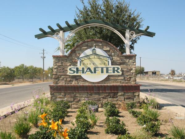
imagesize =
image_caption =
image_

mapsize = 250x200px
map_caption = Location in Kern County and the state ofCalifornia
mapsize1 =
map_caption1 =
subdivision_type = Country
subdivision_type1 = State
subdivision_type2 = County
subdivision_name =United States
subdivision_name1 =California
subdivision_name2 = Kern
government_type =
leader_title = Mayor
leader_name =
leader_title1 = Senate
leader_name1 =Dean Florez (D)
leader_title2 = Assembly
leader_name2 =Nicole Parra (D)
leader_title3 = U. S. Congress
leader_name3 =Jim Costa (D)
established_date =
area_magnitude =
area_total_km2 = 46.6
area_total_sq_mi = 18
area_land_km2 = 46.6
area_land_sq_mi = 18
area_water_km2 = 0
area_water_sq_mi = 0
elevation_ft = 348
elevation_m = 106
population_as_of = 2000
population_footnotes =
population_total = 12736
population_metro =
population_density_km2 = 273.3
population_density_sq_mi = 707.6
timezone = PST
utc_offset = -8
latd = 35 |latm = 29 |lats = 45 |latNS = N
longd = 119 |longm = 14 |longs = 52 |longEW = W
timezone_DST = PDT
utc_offset_DST = -7
postal_code_type =ZIP code
postal_code = 93263
area_code = 661
blank_name = FIPS code
blank_info = 06-71106
blank1_name = GNIS feature ID
blank1_info = 1661428
footnotes =
website = http://www.shafter.com/Shafter is a city in Kern County,
California ,United States . It is located about 18 miles northwest of Bakersfield, CA. The population was 12,736 at the 2000 census. Wired telephone numbers in Shafter follow the format (661) 746-xxxx and the ZIP Code is 93263.The city is located along State Route 43. Suburbs of Shafter include areas or communities named:
* Myrick's Corner
* North Shafter
* Smith's Corner
* Thomas LaneHistory
The city of Shafter began as a loading dock along the
Santa Fe Railroad right-of-way. The community was named for General William Rufus Shafter who commanded US Forces inCuba during theSpanish-American War . Property was sold beginning in 1914 and the city incorporated in 1938.Also of historical note, Shafter is home to Minter Field, which began operations in June 1941 and saw heavy use during World War II. Approximately 7,000 troops were stationed at the airstrip which hosted up to 600 prisoners of war as well. Today it is publicly owned and administered by the Minter Field Airport District and serves as an industrial center and airport for crop dusters and private aircraft. The Minter Field Museum is maintained on location as well.
The Shafter Historical Society also maintains two other museums. The Green Hotel and the Shafter Depot Museum emphasize various aspects of the daily lives of Shafter residents in years past.
Economy
Much of Shafter's economy is comprised of agriculture and ag-related industry. Local crops include cotton, almonds, pistachios and alfalfa as well as some carrots, potatoes and other vegetables. Cotton and Potatoes have a special historical significance for the town of Shafter as leading industries in different periods of the town's development.
Aside from agriculture, Shafter is host to a variety of different industries and business. Elk Corporation Roofing company maintains a manufacturing plant in Shafter and Target maintains a 700 acre distribution center set upon 1.7 million square feet of concrete. [http://findarticles.com/p/articles/mi_m0FNP/is_20_40/ai_79803224] Shafter is also home to the International Trade and Transportation Center (ITTC), built to facilitate easier Central Valley access to ports in Long Beach and Los Angeles via the Burlington Northern Santa Fe railway. [http://www.shafter.com/index.asp?NID=21]
Education
Shafter is home to the Richland School District which oversees operation of four schools: Golden Oak Elementary School (K-5), Redwood Elementary School (K-5), Sequoia Elementary School (K-5) and Richland Junior High School. The district operates under the leadership of superintendent Dr. Ken Bergevin. Class sizes in grades K-3 average 20 students, grades 4-5 average 30 students and grade 7-8 average 30 students, but may have as many as 33. The district boast four libraries as well as a strong marching band program and other special programs for its students. As with many districts in the region, one of the biggest challenges facing the district is to meet state and national testing standards with large segments of migrant and English-learning populations among its student body. [http://www.richland.k12.ca.us/index.cfm?fuseaction=menu&menu_id=1]
Shafter is also home to Shafter High School, a member of the Kern High School District. Built by architects Edwin J. Symmes and Clarence Cullimore [http://www.kcmuseum.org/stories/storyReader$1213] in the late 1920s. Officially founded in 1928, Shafter High School has a history as old as the town itself. Today, it is administered by Principal John Davis. The school has undergone many recent renovations including the construction of a new cafeteria and new classroom space to meet the needs of a growing student body. The school is also home to the historical Fred L. Starrh Performing Arts Center, a large theater building with a fully functional Fly System.
Geography
According to the
United States Census Bureau , the city has a total area of 18.0square mile s (46.6km² ), all of it land.Demographics
As of the
census GR|2 of 2000, there were 12,736 people, 3,293 households, and 2,759 families residing in the city. Thepopulation density was 708.4 people per square mile (273.5/km²). There were 3,624 housing units at an average density of 201.6/sq mi (77.8/km²). The racial makeup of the city was 44.52% White, 1.60% Black or African American, 1.25% Native American, 0.31% Asian, 0.14% Pacific Islander, 48.36% from other races, and 3.82% from two or more races. 68.05% of the population were Hispanic or Latino of any race.There were 3,293 households out of which 52.6% had children under the age of 18 living with them, 61.7% were married couples living together, 15.3% had a female householder with no husband present, and 16.2% were non-families. 13.3% of all households were made up of individuals and 7.4% had someone living alone who was 65 years of age or older. The average household size was 3.67 and the average family size was 3.98.
In the city the population was spread out with 36.6% under the age of 18, 11.7% from 18 to 24, 28.5% from 25 to 44, 15.0% from 45 to 64, and 8.1% who were 65 years of age or older. The median age was 26 years. For every 100 females there were 104.3 males. For every 100 females age 18 and over, there were 106.0 males.
The median
income for a household in the city was $29,515, and the median income for a family was $31,457. Males had a median income of $31,605 versus $21,603 for females. Theper capita income for the city was $10,961. About 22.5% of families and 29.2% of the population were below thepoverty line , including 36.8% of those under age 18 and 11.0% of those age 65 or over.References
External links
* http://www.shafter.com/
* http://www.richland.k12.ca.us/index.cfm---
Wikimedia Foundation. 2010.