- Randsburg, California
Infobox Settlement
official_name = Randsburg, California
settlement_type = CDP
imagesize =
image_caption =
image_
imagesize =
image_caption =
image_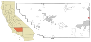
mapsize = 250x200px
map_caption = Location in Kern County and the state ofCalifornia
mapsize1 =
map_caption1 =
subdivision_type = Country
subdivision_type1 = State
subdivision_type2 = County
subdivision_name =United States
subdivision_name1 =California
subdivision_name2 = Kern
government_type =
leader_title = N/A
leader_name =
leader_title1 = Senate
leader_name1 =Roy Ashburn (R)
leader_title2 = Assembly
leader_name2 =Jean Fuller (R)
leader_title3 = U. S. Congress
leader_name3 = Kevin McCarthy (R)
established_date =
area_magnitude =
area_total_km2 = 5.1
area_total_sq_mi = 2
area_land_km2 = 5.1
area_land_sq_mi = 2
area_water_km2 = 0
area_water_sq_mi = 0
elevation_ft = 3504
elevation_m = 1068
population_as_of = 2000
population_footnotes =
population_total = 77
population_metro =
population_density_km2 = 15.1
population_density_sq_mi = 38.5
timezone = PST
utc_offset = -8
latd = 35 |latm = 22 |lats = 3 |latNS = N
longd = 117 |longm = 39 |longs = 15 |longEW = W
timezone_DST = PDT
utc_offset_DST = -7
postal_code_type =ZIP code
postal_code = 93554
area_code = 760
blank_name = FIPS code
blank_info = 06-59668
blank1_name = GNIS feature ID
blank1_info = 1661284
footnotes =
website = s and the occasional staged
gunfight.] Randsburg is acensus-designated place (CDP) in Kern County,California ,United States . The population was 77 at the 2000 census.Geography
Randsburg is located at coor dms|35|22|3|N|117|39|15|W|city (35.367588, -117.654189)GR|1. It is on the west side of
U.S. Route 395 between Kramer Junction to the south and Ridgecrest to the north. Randsburg is in the Rand Mountains, and is separated by a ridge from the neighboring community of Johannesburg.According to the
United States Census Bureau , the CDP has a total area of 2.0square mile s (5.1km² ), all of it land.Demographics
As of the
census GR|2 of 2000, there were 77 people, 49 households, and 22 families residing in the CDP. Thepopulation density was 39.1 people per square mile (15.1/km²). There were 109 housing units at an average density of 55.4/sq mi (21.4/km²). The racial makeup of the CDP was 85.71% White, 5.19% Native American, 3.90% from other races, and 5.19% from two or more races. 5.19% of the population were Hispanic or Latino of any race.There were 49 households out of which 4.1% had children under the age of 18 living with them, 42.9% were married couples living together, and 53.1% were non-families. 49.0% of all households were made up of individuals and 24.5% had someone living alone who was 65 years of age or older. The average household size was 1.57 and the average family size was 2.09.
In the CDP the population was spread out with 3.9% under the age of 18, 2.6% from 18 to 24, 15.6% from 25 to 44, 48.1% from 45 to 64, and 29.9% who were 65 years of age or older. The median age was 57 years. For every 100 females there were 92.5 males. For every 100 females age 18 and over, there were 94.7 males.
The median income for a household in the CDP was $48,000, and the median income for a family was $49,875. Males had a median income of $53,750 versus $21,250 for females. The
per capita income for the CDP was $23,602. None of the population and none of the families were below thepoverty line .References
External links
Wikimedia Foundation. 2010.