- Wasco, California
-
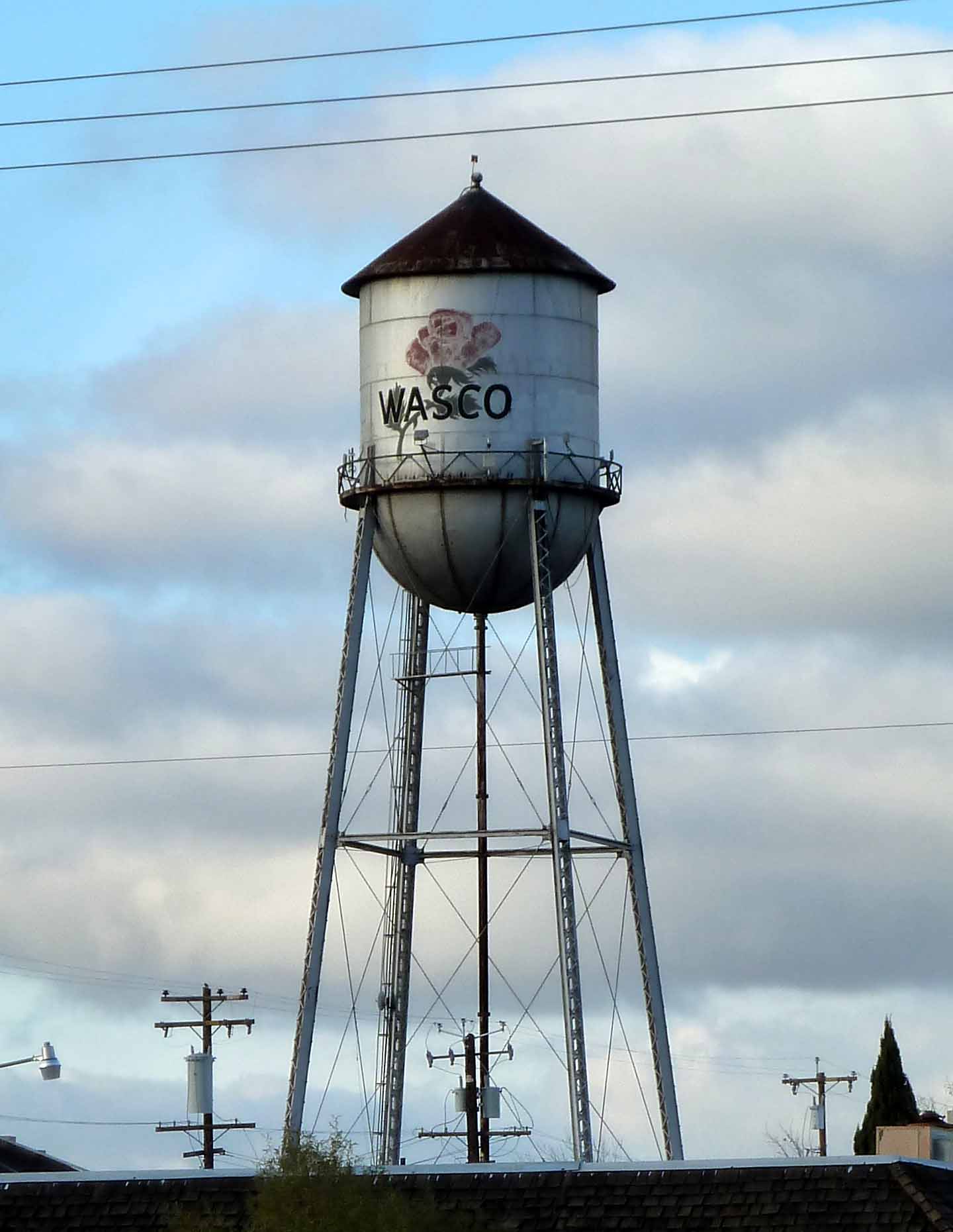
City of Wasco — City — Water tower in Wasco Location in Kern County and the state of California
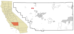
Coordinates: 35°35′39″N 119°20′27″W / 35.59417°N 119.34083°WCoordinates: 35°35′39″N 119°20′27″W / 35.59417°N 119.34083°W Country  United States
State  California
County Kern Government – Senate Dean Florez (D) – Assembly Danny Gilmore (R) – U. S. Congress Jim Costa (D) Area[1] – Total 9.426 sq mi (24.413 km2) – Land 9.426 sq mi (24.413 km2) – Water 0 sq mi (0 km2) 0% Elevation[2] 328 ft (100 m) Population (2010) – Total 25,545 – Density 2,710.1/sq mi (1,046.4/km2) Time zone PST (UTC-8) – Summer (DST) PDT (UTC-7) ZIP code 93280 Area code(s) 661 FIPS code 06-83542 GNIS feature ID 1661652 Wasco (formerly, Dewey and Deweyville)[3] is a city in the San Joaquin Valley, in Kern County, California, United States. Wasco is located 24 miles (39 km) northwest of Bakersfield,[3] at an elevation of 328 feet (100 m).[2] The population was 25,545 at the 2010 census, up from 21,263 at the 2000 census.
Contents
People in group quarters
- 7,975 people in state prison
- 1,226 people in other types of correctional institutions
- 10 people in homes for the mentally ill
- 8 people in other noninstitutional group quarters
Geography
According to the United States Census Bureau, the city has a total area of 9.4 square miles (24 km2), all of it land. At the 2000 census, according to the United States Census Bureau, the city had a total area of 7.6 square miles (20 km2), all of it land. Wasco is located on the floor of the San Joaquin Valley, at the intersection of California State Routes 43, which runs north-south, and 46, which runs east-west.
Demographics
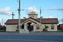 Train Station
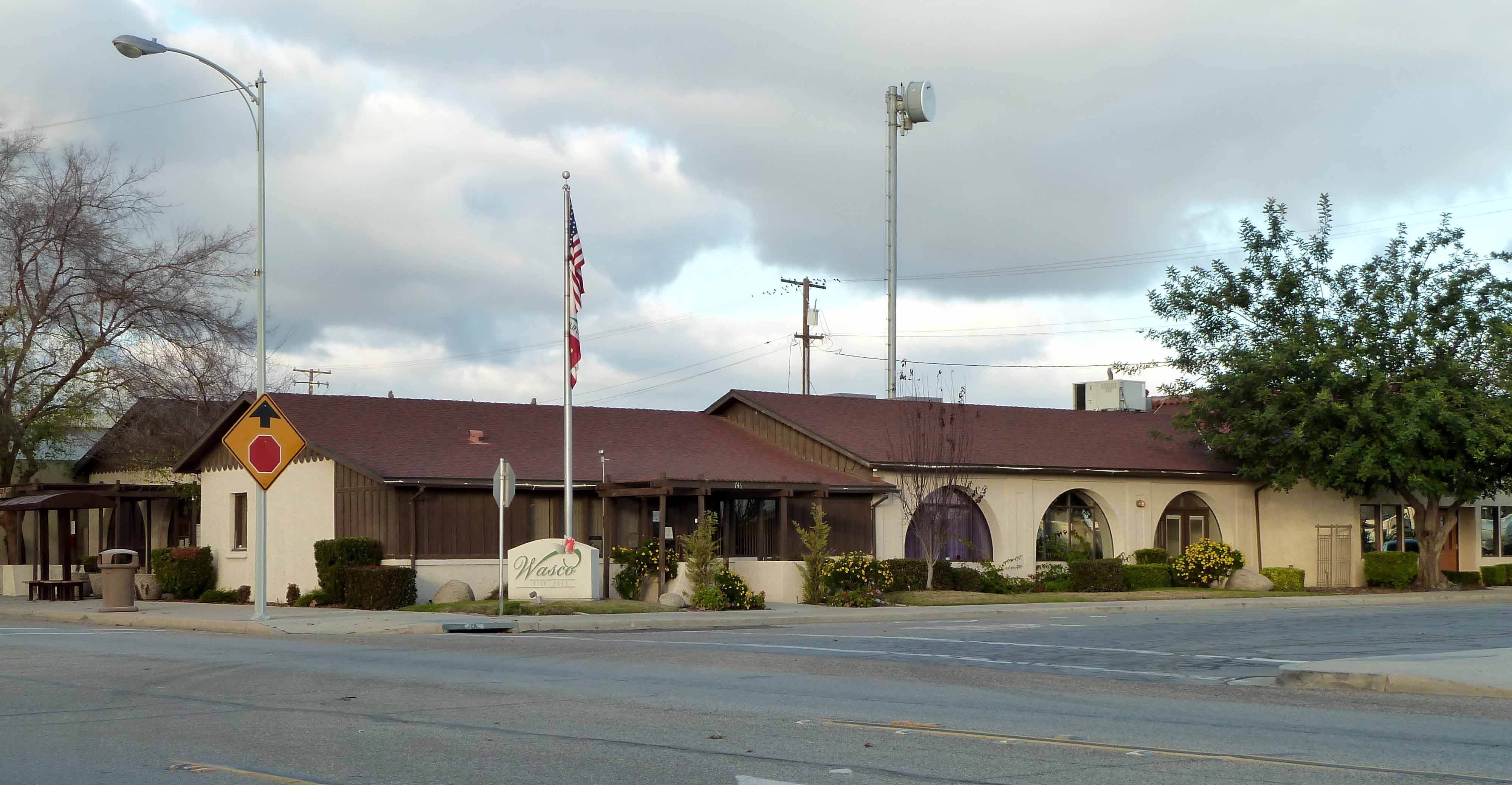
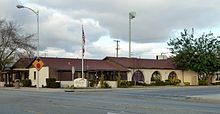 City Hall
2010
The 2010 United States Census[5] reported that Wasco had a population of 25,545. The population density was 2,710.1 people per square mile (1,046.4/km²). The racial makeup of Wasco was 12,579 (49.2%) White, 1,951 (7.6%) African American, 283 (1.1%) Native American, 180 (0.7%) Asian, 12 (0.0%) Pacific Islander, 9,714 (38.0%) from other races, and 826 (3.2%) from two or more races. Hispanic or Latino of any race were 19,585 persons (76.7%).
The Census reported that 19,825 people (77.6% of the population) lived in households, 10 (0%) lived in non-institutionalized group quarters, and 5,710 (22.4%) were institutionalized.
There were 5,131 households, out of which 3,143 (61.3%) had children under the age of 18 living in them, 2,894 (56.4%) were opposite-sex married couples living together, 992 (19.3%) had a female householder with no husband present, 484 (9.4%) had a male householder with no wife present. There were 478 (9.3%) unmarried opposite-sex partnerships, and 27 (0.5%) same-sex married couples or partnerships. 575 households (11.2%) were made up of individuals and 243 (4.7%) had someone living alone who was 65 years of age or older. The average household size was 3.86. There were 4,370 families (85.2% of all households); the average family size was 4.11.
The population was spread out with 7,351 people (28.8%) under the age of 18, 3,687 people (14.4%) aged 18 to 24, 8,621 people (33.7%) aged 25 to 44, 4,593 people (18.0%) aged 45 to 64, and 1,293 people (5.1%) who were 65 years of age or older. The median age was 28.3 years. For every 100 females there were 160.3 males. For every 100 females age 18 and over, there were 192.5 males.
There were 5,477 housing units at an average density of 581.1 per square mile (224.3/km²), of which 2,680 (52.2%) were owner-occupied, and 2,451 (47.8%) were occupied by renters. The homeowner vacancy rate was 5.1%; the rental vacancy rate was 4.0%. 10,486 people (41.0% of the population) lived in owner-occupied housing units and 9,339 people (36.6%) lived in rental housing units.
2000
As of the census[6] of 2000, there were 21,263 people, 3,971 households, and 3,403 families residing in the city. The population density was 2,795.7 people per square mile (1,078.8/km²). There were 4,256 housing units at an average density of 559.6 per square mile (215.9/km²). The racial makeup of the city was 34.64% White, 10.27% Black or African American, 1.02% Native American, 0.67% Asian, 0.15% Pacific Islander, 50.46% from other races, and 2.78% from two or more races. 66.72% of the population were Hispanic or Latino of any race.
There were 3,971 households out of which 55.1% had children under the age of 18 living with them, 62.3% were married couples living together, 16.8% had a female householder with no husband present, and 14.3% were non-families. 11.6% of all households were made up of individuals and 5.7% had someone living alone who was 65 years of age or older. The average household size was 3.79 and the average family size was 4.07.
In the city the population was spread out with 27.4% under the age of 18, 13.9% from 18 to 24, 39.4% from 25 to 44, 13.8% from 45 to 64, and 5.4% who were 65 years of age or older. The median age was 29 years. For every 100 females there were 183.5 males. For every 100 females age 18 and over, there were 230.6 males.
The median income for a household in the city was $28,997, and the median income for a family was $30,506. Males had a median income of $48,105 versus $18,697 for females. The per capita income for the city was $14,228. About 24.3% of families and 27.5% of the population were below the poverty line, including 35.3% of those under age 18 and 10.1% of those age 65 or over.
History
The name Dewey was in honor of Admiral George Dewey, a hero of the Spanish-American War.[3] The Deweyville post office opened in 1899, and changed its name to Wasco in 1900.[3]
The origin of the name Wasco is subject of two different theories: (1) That it was coined from Western American Sugar Company; and (2) that a resident from Wasco County, Oregon named it for that.[3]
Wasco is the site of the Fourth Home Extension Colony, founded in 1907 by the American Home Extension Association.[3]
Economy
One of Wasco's major economic activities is its agriculture, specifically the growing of roses. 55% of all roses grown in the United States are grown in or around Wasco.[1]
In addition to agriculture, oil and gas extraction is a significant part of the local economy. The large Semitropic Oil Field is along State Route 46 about 7 miles west of town. Formerly a gas field, the region now mainly produces oil. Vintage Production, an arm of Occidental Petroleum, is the primary operator as of 2010.
Public safety
The Kern County Sheriff's and Fire Departments now provides law enforcement and fire protection services to the City of Wasco. Emergency Medical Services are provided by a private company, Kern Ambulance, under a contract with the County. The Wasco State Prison is located approximately 1-mile (1.6 km) west of the city limits.
Notable locations
- Wasco State Prison
- Wasco High School Auditorium
Wasco in media
The classic film "North by Northwest", Directed by Alfred Hitchcock and starring Cary Grant, includes a scene where Grant's character flees a menacing airplane. This scene was filmed near Wasco.
The beginning of the film Son in Law is filmed during the graduation of Rebecca Warner played by Carla Gugino; the opening credits show the water tower and later in the movie the airport is shown to be the Wasco Airport.
Wasco is featured in the book Lucifer's Hammer written by Larry Niven, which is about the end of the world after a comet hits the earth. Wasco is underwater after catastrophic flood inundates the city and the San Joaquin Valley.
Radio stations
AM radio
- KERN (1180 AM; 50 kW; WASCO-GREENACRES, CA; Owner: AGM, INC.)
- KCHJ (1010 AM; 5 kW; DELANO, CA; Owner: ILLINOIS LOTUS CORP.)
- KNZR (1560 AM; 25 kW; BAKERSFIELD, CA; Owner: BUCKLEY BROADCASTING CORP. OF CALIF.)
- KMJ (580 AM; 50 kW; FRESNO, CA; Owner: INFINITY RADIO OPERATIONS INC.)
- KWRU (940 AM; 50 kW; FRESNO, CA)
- KGDP (660 AM; 50 kW; ORCUTT, CA; Owner: RADIO REPRESENTATIVES, INC.)
- KUZZ (550 AM; 5 kW; BAKERSFIELD, CA; Owner: OWENS ONE COMPANY)
- KGET (970 AM; 5 kW; BAKERSFIELD, CA; Owner: CLEVELAND RADIO LICENSES, LLC)
- KIRN (670 AM; 35 kW; SIMI VALLEY, CA; Owner: LOTUS OXNARD CORP.)
- KSPN (710 AM; 50 kW; LOS ANGELES, CA; Owner: KABC-AM RADIO, INC.)
- KAFY (1100 AM; 4 kW; BAKERSFIELD, CA; Owner: KAFY, INC.)
- KLAC (570 AM; 50 kW; LOS ANGELES, CA; Owner: AMFM RADIO LICENSES, L.L.C.)
- KMAP (1050 AM; 10 kW; FRAZIER PARK, CA; Owner: KMAP, INC.)
FM radio
- KIWI (102.9 FM; MCFARLAND, CA; Owner: ILLINOIS LOTUS CORP.)
- K266AH (101.1 FM; BENA, CA; Owner: CALVARY CHAPEL OF TWIN FALLS, INC.)
- KTQX (90.1 FM; BAKERSFIELD, CA; Owner: RADIO BILINGUE, INC.)
- KGZO (90.9 FM; SHAFTER, CA; Owner: THE ASSOCIATION FOR COMMUNITY EDUCATION, INC.)
- K293AG (106.5 FM; TAFT, CA; Owner: CENTRO CRISTIANO DE FE, INC.)
- KZPO (103.3 FM; LINDSAY, CA; Owner: LINDSAY BROADCASTING)
- KSMJ (97.7 FM; SHAFTER, CA; Owner: BUCKLEY BROADCASTING CORPORATION OF CALIFORNIA)
- KKBB (99.3 FM; BAKERSFIELD, CA; Owner: BUCKLEY COMMUNICATIONS, INC.)
- KMQA (100.5 FM; EAST PORTERVILLE, CA; Owner: MOON BROADCASTING PORTERVILLE L.L.C.)
- KMYX-FM (92.5 FM; ARVIN, CA; Owner: FARMWORKER EDUC. RADIO NETWORK, INC.)
- KDUV (88.9 FM; VISALIA, CA; Owner: COMMUNITY EDUCATIONAL B/CASTNG, INC.)
- KJUG-FM (106.7 FM; TULARE, CA; Owner: WESTCOAST BROADCASTING, INC.)
- K220EY (91.9 FM; PORTERVILLE, CA; Owner: FAMILY STATIONS, INC.)
- KUFW (90.5 FM; WOODLAKE, CA; Owner: NATIONAL FARM WORKERS SERVICE CENTER)
- KDFO-FM (98.5 FM; DELANO, CA; Owner: CLEAR CHANNEL BROADCASTING LICENSES, INC.)
- KKDJ (105.3 FM; DELANO, CA; Owner: CLEAR CHANNEL BROADCASTING LICENSES, INC.)
- KRFR (104.3 FM; SHAFTER, CA; Owner: AMERICAN GENERAL MEDIA OF TEXAS, INC)
- KAXL (88.3 FM; GREENACRES, CA; Owner: SKYRIDE UNLIMITED, INCORPORATED)
- KFRB (91.3 FM; BAKERSFIELD, CA; Owner: FAMILY STATIONS, INC.)
- KUZZ-FM (107.9 FM; BAKERSFIELD, CA; Owner: OWENS ONE COMPANY, INC)
See also
- M.V. Hartranft, land developer in Wasco
References
- ^ U.S. Census
- ^ a b U.S. Geological Survey Geographic Names Information System: Wasco, California
- ^ a b c d e f Durham, David L. (1998). California's Geographic Names: A Gazetteer of Historic and Modern Names of the State. Quill Driver Books. ISBN 9781884995149.
- ^ "City-data - People in group quarters / Wasco - California". analyzed data from numerous sources. http://www.city-data.com/city/Wasco-California.html. Retrieved 2009-03-17.
- ^ All data are derived from the United States Census Bureau reports from the 2010 United States Census, and are accessible on-line here. The data on unmarried partnerships and same-sex married couples are from the Census report DEC_10_SF1_PCT15. All other housing and population data are from Census report DEC_10_DP_DPDP1. Both reports are viewable online or downloadable in a zip file containing a comma-delimited data file. The area data, from which densities are calculated, are available on-line here. Percentage totals may not add to 100% due to rounding. The Census Bureau defines families as a household containing one or more people related to the householder by birth, opposite-sex marriage, or adoption. People living in group quarters are tabulated by the Census Bureau as neither owners nor renters. For further details, see the text files accompanying the data files containing the Census reports mentioned above.
- ^ "American FactFinder". United States Census Bureau. http://factfinder.census.gov. Retrieved 2008-01-31.
- ^ "City-data - Wasco - Radio Stations". analyzed data from numerous sources. http://www.city-data.com/city/Wasco-California.html. Retrieved 2009-03-17.
External links
Municipalities and communities of Kern County, California Cities Arvin | Bakersfield | California City | Delano | Maricopa | McFarland | Ridgecrest | Shafter | Taft | Tehachapi | Wasco
CDPs Bear Valley Springs | Bodfish | Boron | Buttonwillow | Cherokee Strip | China Lake Acres | Derby Acres | Dustin Acres | Edmundson Acres | Edwards Air Force Base | Fellows | Ford City | Frazier Park | Fuller Acres | Golden Hills | Greenacres | Greenfield | Inyokern | Johannesburg | Keene | Kernville | Lake Isabella | Lake of the Woods | Lamont | Lebec | Lost Hills | McKittrick | Mettler | Mexican Colony | Mojave | Mountain Mesa | North Edwards | Oildale | Onyx | Pine Mountain Club | Randsburg | Rosamond | Rosedale | Smith Corner | South Taft | Squirrel Mountain Valley | Stallion Springs | Taft Heights | Tupman | Valley Acres | Weedpatch | Weldon | Wofford Heights
Unincorporated
communitiesActis | Aerial Acres | Alameda | Algoso | Alta Sierra | Annette | Ansel | Armistead | Baker | Bannister | Bealville | Bena | Bissell | Blackwells Corner | Bowerbank | Bradys | Brown | Burton Mill | Cable | Calders Corner | Calico | Caliente | Cameron | Camp Owens | Canebrake | Cantil | Cawelo | Ceneda | Chaffee | China Lake | Cinco | Claraville | Conner | Crome | Desert Lake | Di Giorgio | Dow | East Bakersfield | Edison | Edwards | El Rita | Elmo | Famoso | Fig Orchard | Five Points | Fleta | Fruitvale | Glennville | Goler Heights | Gosford | Grapevine | Gulf | Gypsite | Halfway House | Harpertown | Harts Place | Havilah | Hazelton | Hights Corner | Hollis | Ilmon | Indian Wells | Jasmin | Jastro | Kayandee | Kecks Corner | Kern Lake | Kernell | Keyesville | Kilowatt | Lackey Place | Lakeview | Landco | Lerdo | Lokern | Lonsmith | Loraine | Magunden | Maltha | Manolith | Marcel | Mayfair | Meridian | Midoil | Millersville | Millux | Minter Village | Miracle Hot Springs | Missouri Triangle | Mitchells Corner | Monolith | Moreland Mill | Myricks Corner | Neufeld | North Belridge | North Shafter | Oil City | Oil Junction | Old Garlock | Old River | Old Town | Palmo | Panama | Patch | Pentland | Pettit Place | Pinon Pines Estates | Pond | Prospero | Pumpkin Center | Quality | Rancho Seco | Rand | Reward | Ribier | Ricardo | Rich | Rio Bravo | Riverkern | Rowen | Saco | Sageland | Saltdale | San Emidio | Sanborn | Sand Canyon | Searles | Seguro | Semitropic | Shirley Meadows | Silt | Slater | South Lake | Spellacy | Spicer City | Stevens | Summit | Thomas Lane | Twin Lakes | Twin Oaks | Una | Venola | Vinland | Walker Basin | Wallace Center | Walong | Wheeler Ridge | Wible Orchard | Willow Springs | Woodford | Woody | Zentner
Former
settlements18 Mile House | Allard | Amalie | Artwell | Asphalto | Barnes Settlement | Benita | Big Blue Mill | Borel | Burkeville | Cabernet | Cambio | Canebrake | Canfield | Chanz | Clarkson | Code | Craft | Cuttens | Desert Spring | Domino | Eaires | Eric | Fluhr | Fram | Gamba | Garlock | Girard | Glenburn | Gold Town | Greenwich | Gyle | Indian Springs | Inmans | Isabella | Joe Walker Town | Joyfull | Kern River Slough | Kernvale | Kernville | Kyan | La Rose | Langdon | Lavers' Crossing | Leliter | Leonards | Levee | Levee Spur | Little Dixie | Martendale | Midway | Miramonte | Monterio | Moseman | Muroc | Nadeau | Neil | Neuralia | Nome | North Muroc | Olig | Packwood | Page | Paloma | Parsons | Petersburg | Petro | Pine | Piute | Proctor | Progress | Pylema | Quartzburg | Redrock | Reefer City | Reservoir | Rio Bravo | Riverview | Rock Springs | Rogersville | Sage | San Miguel de los Noches | Sand Cut | Scovern Hot Springs | Sedwell | Shady Rest | Shale | Shamrock | Smyrna | Solon | Sorrell's | Strader | Strand | Sullivan | Summers | Sunset | Teagle | Tehichipa | Tejon | Terese | Terese Siding | Toolwass | Trescape | Treves | Una Siding | Unadilla | Vaccaro | Vaughn | Vernette | Warren (Fellows) | Warren (Mojave) | Water Station | West Baker | Winter Garden
Categories:- Cities in Kern County, California
- Incorporated cities and towns in California
- Populated places in California with Hispanic majority populations
- Populated places established in 1899


Wikimedia Foundation. 2010.