- Rosamond, California
Infobox Settlement
official_name = Rosamond, California
settlement_type = CDP
imagesize =
image_caption =
image_
imagesize =
image_caption =
image_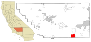
mapsize = 250x200px
map_caption = Location in Kern County and the state ofCalifornia
mapsize1 =
map_caption1 =
subdivision_type = Country
subdivision_type1 = State
subdivision_type2 = County
subdivision_name =United States
subdivision_name1 =California
subdivision_name2 = Kern
government_type =
leader_title = N/A
leader_name =
leader_title1 = Senate
leader_name1 =Roy Ashburn (R)
leader_title2 = Assembly
leader_name2 =Bill Maze (R)
leader_title3 = U. S. Congress
leader_name3 = Kevin McCarthy (R)
established_date =
area_magnitude =
area_total_km2 = 135.6
area_total_sq_mi = 52.3
area_land_km2 = 135.3
area_land_sq_mi = 52.2
area_water_km2 = 0.3
area_water_sq_mi = 0.1
elevation_ft = 2343
elevation_m = 714
population_as_of = 2000
population_footnotes =
population_total = 14349
population_metro =
population_density_km2 = 105.8
population_density_sq_mi = 274.4
timezone = PST
utc_offset = -8
latd = 34 |latm = 51 |lats = 57 |latNS = N
longd = 118 |longm = 12 |longs = 25 |longEW = W
timezone_DST = PDT
utc_offset_DST = -7
postal_code_type =ZIP code
postal_code = 93560
area_code = 661
blank_name = FIPS code
blank_info = 06-62826
blank1_name = GNIS feature ID
blank1_info = 1661329
footnotes =
website =Rosamond is a
census-designated place (CDP) in Kern County,California , USA, convert|20|mi|km North of Palmdale, in theAntelope Valley , the westernmost desert valley of theMojave Desert . According to 2000United States census data, the town population was 14,349.The Postal Service shows portions of Rosamond as having the names Tropico Village, named after a mine, and Willow Springs.
Rosamond Skypark, Federal Aviation Administration identifier L00 (with two zeroes), is located at coor dms|34|52|15|N|118|12|32|W and features a paved convert|3600|ft|m|sing=on runway.
Wired telephone numbers in Rosamond follow the format (661) 256-xxxx and the entire city is included in ZIP Code 93560.
History
Rosamond was originally established in 1877 as a townsite which was owned by the
Southern Pacific Railroad and was named 'Rosamond' after the daughter of one of therailroad officials. The first local industries were mining andcattle . During the 1890s,gold was discovered andMiners quickly travelled to the area and populated it in order to strike it rich; however, the industry waned for many years, yet later had some success with a small boom during the 1930s. In 1933 Muroc Army Air Field was established, which has since been renamedEdwards Air Force Base in honor of fallen test pilot Glenn Edwards.Geography
Rosamond is situated in the west central area of the expansive
Antelope Valley , which comprises the westernmost valley of theMojave Desert . Because the elevation is in the range of 2000 to convert|3000|ft|m above sea level, the area, like the other parts of the Mojave Desert region, is alternatively referred to as "the High Desert". Some cities and communities within the trading area of Rosamond include Lancaster, Palmdale, Lake Los Angeles, Quartz Hill, Ridgecrest, and Santa Clarita. Residents of these desert cities and unincorporated communities shareSierra Highway , Angeles Forest Highway, Angeles Crest Highway (State Route 2), and theAntelope Valley Freeway (State Route 14) for commutes to the San Fernando Valley and Los Angeles Basin in order to get to work.Willow Springs lies west of central Rosamond and was a watering hole for stagecoach travelers for generations. Due to the water now not available at the surface as it once was, the age-old springs are but a memory. Today
Willow Springs Raceway is nearby, which hosts a variety of motor racing events - and attracting people from all over Southern California and beyond.Rosamond is located at coor dms|34|51|57|N|118|12|25|W|city (34.865786, -118.206856)GR|1.
According to the
United States Census Bureau , the CDP has a total area of 52.3 square miles (135.6 km²), of which, 52.2 square miles (135.3 km²) of it is land and 0.1 square miles (0.3 km²) of it (0.19%) is water.Demographics
As of the
census GR|2 of 2000, there were 14,349 people, 4,988 households, and 3,626 families residing in the CDP. Thepopulation density was 274.7 people per square mile (106.1/km²). There were 5,597 housing units at an average density of 107.2/sq mi (41.4/km²). The racial makeup of the CDP was 72.01% White, 6.62% Black or African American, 1.32% Native American, 3.01% Asian, 0.23% Pacific Islander, 11.65% from other races, and 5.16% from two or more races. 25.67% of the population were Hispanic or Latino of any race.There were 4,988 households out of which 41.2% had children under the age of 18 living with them, 54.7% were married couples living together, 12.5% had a female householder with no husband present, and 27.3% were non-families. 21.9% of all households were made up of individuals and 6.2% had someone living alone who was 65 years of age or older. The average household size was 2.88 and the average family size was 3.38.
In the CDP the population was spread out with 32.9% under the age of 18, 7.9% from 18 to 24, 32.0% from 25 to 44, 19.3% from 45 to 64, and 7.9% who were 65 years of age or older. The median age was 33 years. For every 100 females there were 102.4 males. For every 100 females age 18 and over, there were 101.5 males.
The median income for a household in the CDP was $42,307, and the median income for a family was $46,918. Males had a median income of $42,484 versus $26,745 for females. The
per capita income for the CDP was $17,440. About 11.6% of families and 14.1% of the population were below thepoverty line , including 19.2% of those under age 18 and 12.0% of those age 65 or over.Education
There are five schools in Rosamond:
Hamilton Elementary School ,Rosamond Elementary School ,west Park Elementary School ,Tropico Middle School , andRosamond High School .References
External links
Wikimedia Foundation. 2010.