- Frazier Park, California
Infobox Settlement
official_name = Frazier Park, California
settlement_type = CDP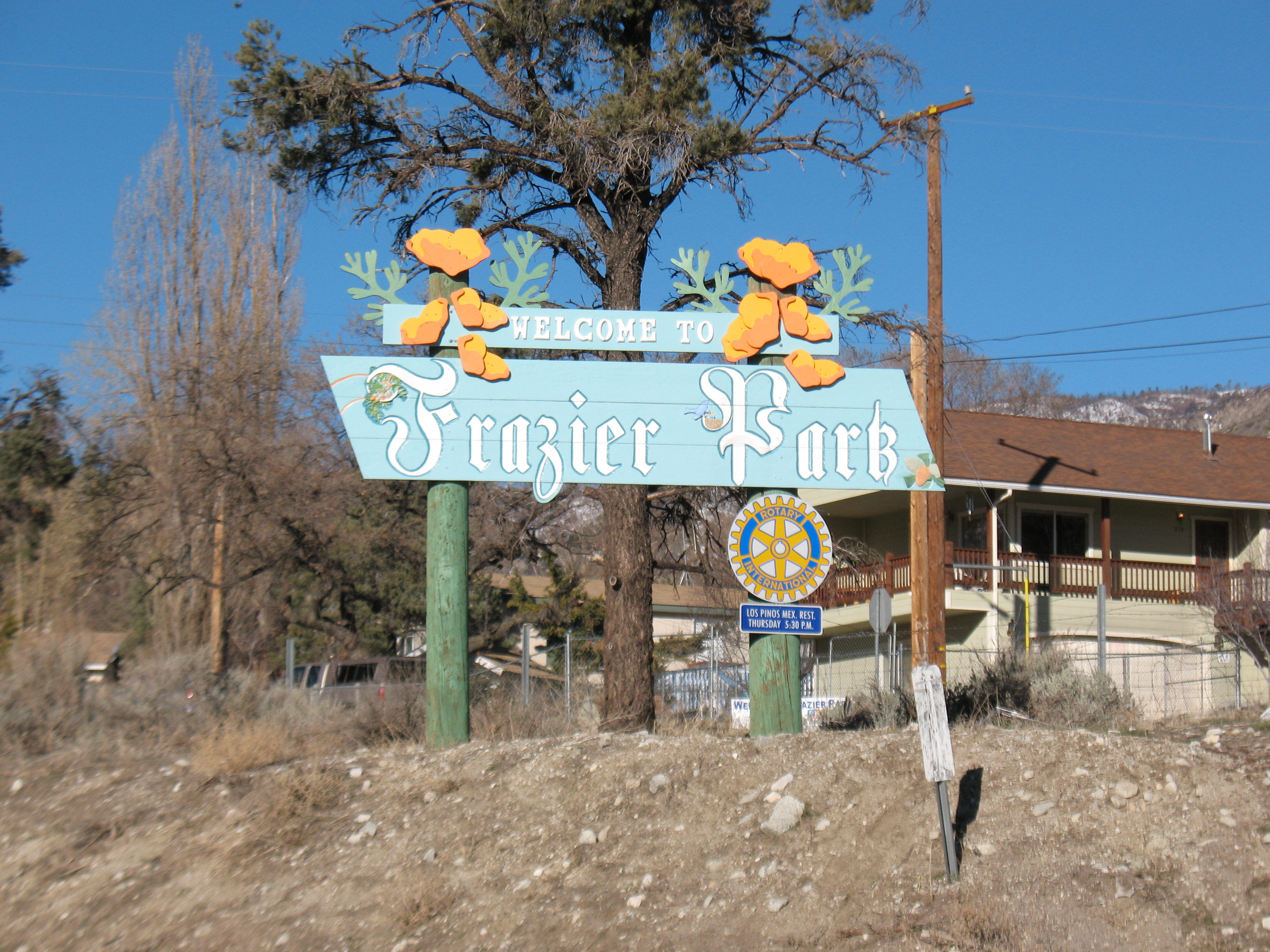
imagesize =
image_caption = Entrance to Frazier Park
image_
mapsize = 250x200px
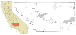
map_caption = Location in Kern County and the state ofCalifornia 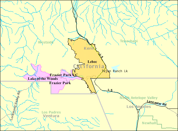
mapsize1 =
map_caption1 = Pink area is Frazier Park and nearby Lake of the Woods, both of them in zip code 93225. Click for a larger image.
subdivision_type = Country
subdivision_type1 = State
subdivision_type2 = County
subdivision_name =United States
subdivision_name1 =California
subdivision_name2 = Kern
government_type =
leader_title = N/A
leader_name =
leader_title1 = Senate
leader_name1 =Roy Ashburn (R)
leader_title2 = Assembly
leader_name2 =Jean Fuller (R)
leader_title3 = U. S. Congress
leader_name3 = Kevin McCarthy (R)
established_date =
area_magnitude =
area_total_km2 = 12.6
area_total_sq_mi = 4.9
area_land_km2 = 12.6
area_land_sq_mi = 4.9
area_water_km2 = 0
area_water_sq_mi = 0
elevation_ft = 4639
elevation_m = 1414
population_as_of = 2000
population_footnotes =
population_total = 2348
population_metro =
population_density_km2 = 186.3
population_density_sq_mi = 479.2
timezone = PST
utc_offset = -8
latd = 34 |latm = 49 |lats = 20 |latNS = N
longd = 118 |longm = 56 |longs = 54 |longEW = W
timezone_DST = PDT
utc_offset_DST = -7
postal_code_type =ZIP code s
postal_code = 93222, 93225
area_code = 661
blank_name = FIPS code
blank_info = 06-25534
blank1_name = GNIS feature ID
blank1_info = 1656523
footnotes =
website =Frazier Park is an
unincorporated area in Kern County,California . It is one of theMountain Communities of the Tejon Pass . The population was 2,348 at the 2000 census.History
The
settlement was named by pioneer Harry McBain for nearbyFrazier Mountain in 1925.Geography
Frazier Park is at coor dms|34|49|20|N|118|56|54|W|city (34.822242, -118.948251)GR|1 within Cuddy Canyon inside
Los Padres National Forest . Its elevation is convert|4767|ft|m|abbr=on. Frazier Park is within theLos Padres National Forest .Other nearby communities are Lake of the Woods (3.6 miles), Lebec (4.6 miles), Pine Mountain Club (14.5 miles), and Mettler (16.7 miles).
Santa Clarita, California . is the nearest large city.According to the
United States Census Bureau , Frazier Park has an area of 4.9 square miles (12.6 km²).Mt. Pinos, the highest peak in the area at convert|8831|ft|m|abbr=on, is a popular
Southern California location forcross-country skiing ,mountain biking , hiking, back-country snowboarding, star-gazing, and other recreation. This peak, and other 6,000 to convert|8000|ft|m|abbr=on mountains in the area, receive the most natural snowfall in Southern California. Fact|date=September 2008 The San Andreas earthquake fault runs through the region, turning southeast on the west side ofInterstate 5 , just southwest of the Frazier Park exit in what is known as the Big Bend of the San Andreas. Immediately to the east, the Garlock fault lies under theTejon Ranch and the Castac/Kashtiq Lake.Population
"Source for this information was [http://factfinder.census.gov/servlet/SAFFFacts?_event=Search&geo_id=&_geoContext=&_street=&_county=Frazier+Park&_cityTown=Frazier+Park&_state=04000US06&_zip=&_lang=en&_sse=on&pctxt=fph&pgsl=010&show_2003_tab=&redirect=Y|U.S. Census Bureau, American FactFinder.] See the census map in the box above."
A total of 2,348 people lived in Frazier Park in 2000, of which 2,055 (87 percent) were white. Other residents included 34 American Indians or Alaska natives, 19 Asians, and 14 blacks. There were 292 Hispanics or Latinos of any race.
The median age for Frazier Park residents was 38 years compared with 35 for the nation as a whole.
Frazier Park also had slightly more veterans than its share — 293, or 17 percent, compared to 13 percent around the country.
It had a significantly higher percentage of disabled people than the rest of the nation — 36 percent against 19 percent.
In contrast with the country at large, where 64 percent of the adults were working, Frazier Park had just 48 percent employed. Those who were working had to travel some 42 minutes to their jobs, compared to 25 minutes for most Americans.
Frazier Park households had a lower median income than the nation as a whole — $46,857, compared to $50,046.
There were 291 people (or 12 percent) below the
poverty level in Frazier Park in 2000. That is the same proportion as the country as a whole.Almost a quarter of Frazier Park's 1,203 housing units (23 percent) were vacant when the census was taken in March 2000 — much higher than the national rate of 9 percent. This may be explained by the fact that many Frazier Park properties are second or seasonal homes. Fact|date=October 2008 Property owners lived in about seven of every 10 occupied units, renters in the other three — just about the same as in the rest of the nation.
chools
* Frazier Park Elementary School. The grade levels range from Kindergarten through third grade.
* El Tejon Middle School (Lebec). Established in 1876, the school has a broad history. The grade levels range from fourth to eighth grade.
* Frazier Mountain High School. Established in 1995. The grade levels range from 9 to 12.
Photos
References
http://www.geocities.com/nrthrd2000/nrthofFrazier.jpg
ources
*Bailey, Richard C., "Kern County Place Names", (Bakersfield, California: Merchant's Printing and Lithography Co., 1967).
*US Geological Survey 7.5-minute quadrangle, "Frazier Mountain, California" (1995).
*United States Postal Service web site, 2006.http://www.city-data.com/city/Frazier-Park-California.htmlhttp://www.city-data.com/cpic/ufiles253.jpghttp://web.archive.org/web/20040109090155/http://cspangler.com/images/photos/rainbow_mountain.jpgExternal links
http://www.MountainEnterprise.com (local newspaper)
http://www.shopoutdoors.com/activities.html (Frazier Park Visitors Center)
http://www.shopoutdoors.com (Local website, area information, recreational info.)
http://www.co.kern.ca.us (Information about Kern County, Calif.)
http://www.shopoutdoors.com/FOGnews.html (Local Online NewsLetter)
Wikimedia Foundation. 2010.