- Garlock, California
-
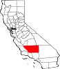
Garlock — Unincorporated community — Location in California
 Garlock
Coordinates: 35°24′09″N 117°47′24″W / 35.4025°N 117.79°WCoordinates: 35°24′09″N 117°47′24″W / 35.4025°N 117.79°W Country United States State California County Kern County Elevation[1] 2,169 ft (661 m) Reference #: 671 Garlock (formerly, Eugeneville)[2] is an unincorporated community in Kern County, California.[1] It is located 6.25 miles (10 km) east-southeast of Saltdale,[2] at an elevation of 2169 feet (661 m).[1]
A post office operated at Garlock from 1896 to 1904 and from 1923 to 1926.[2]
Garlock is a ghost town that was known as El Paso City or Cow Wells interchangeably. The little town provided water for cattlemen and freighters wishing to avoid the potentially treacherous washes in Red Rock Canyon. Some gold had been found in the canyons of the El Paso Mountains, enough to warrant an arrastre being built in 1887. In 1893 a nugget was brought in worth $1,900 from Goler Canyon and so the rush began. In 1894 Eugene Garlock of Tehachapi moved in an eight stamp mill. Miners would talk of going down to "the Garlock mill," "down to the Garlock," and finally just "Garlock."
California Historical Landmark #671.
References
External links
See also
Municipalities and communities of Kern County, California Cities Arvin | Bakersfield | California City | Delano | Maricopa | McFarland | Ridgecrest | Shafter | Taft | Tehachapi | Wasco
CDPs Bear Valley Springs | Bodfish | Boron | Buttonwillow | Cherokee Strip | China Lake Acres | Derby Acres | Dustin Acres | Edmundson Acres | Edwards Air Force Base | Fellows | Ford City | Frazier Park | Fuller Acres | Golden Hills | Greenacres | Greenfield | Inyokern | Johannesburg | Keene | Kernville | Lake Isabella | Lake of the Woods | Lamont | Lebec | Lost Hills | McKittrick | Mettler | Mexican Colony | Mojave | Mountain Mesa | North Edwards | Oildale | Onyx | Pine Mountain Club | Randsburg | Rosamond | Rosedale | Smith Corner | South Taft | Squirrel Mountain Valley | Stallion Springs | Taft Heights | Tupman | Valley Acres | Weedpatch | Weldon | Wofford Heights
Unincorporated
communitiesActis | Aerial Acres | Alameda | Algoso | Alta Sierra | Annette | Ansel | Armistead | Baker | Bannister | Bealville | Bena | Bissell | Blackwells Corner | Bowerbank | Bradys | Brown | Burton Mill | Cable | Calders Corner | Calico | Caliente | Cameron | Camp Owens | Canebrake | Cantil | Cawelo | Ceneda | Chaffee | China Lake | Cinco | Claraville | Conner | Crome | Desert Lake | Di Giorgio | Dow | East Bakersfield | Edison | Edwards | El Rita | Elmo | Famoso | Fig Orchard | Five Points | Fleta | Fruitvale | Glennville | Goler Heights | Gosford | Grapevine | Gulf | Gypsite | Halfway House | Harpertown | Harts Place | Havilah | Hazelton | Hights Corner | Hollis | Ilmon | Indian Wells | Jasmin | Jastro | Kayandee | Kecks Corner | Kern Lake | Kernell | Keyesville | Kilowatt | Lackey Place | Lakeview | Landco | Lerdo | Lokern | Lonsmith | Loraine | Magunden | Maltha | Manolith | Marcel | Mayfair | Meridian | Midoil | Millersville | Millux | Minter Village | Miracle Hot Springs | Missouri Triangle | Mitchells Corner | Monolith | Moreland Mill | Myricks Corner | Neufeld | North Belridge | North Shafter | Oil City | Oil Junction | Old Garlock | Old River | Old Town | Palmo | Panama | Patch | Pentland | Pettit Place | Pinon Pines Estates | Pond | Prospero | Pumpkin Center | Quality | Rancho Seco | Rand | Reward | Ribier | Ricardo | Rich | Rio Bravo | Riverkern | Rowen | Saco | Sageland | Saltdale | San Emidio | Sanborn | Sand Canyon | Searles | Seguro | Semitropic | Shirley Meadows | Silt | Slater | South Lake | Spellacy | Spicer City | Stevens | Summit | Thomas Lane | Twin Lakes | Twin Oaks | Una | Venola | Vinland | Walker Basin | Wallace Center | Walong | Wheeler Ridge | Wible Orchard | Willow Springs | Woodford | Woody | Zentner
Former
settlements18 Mile House | Allard | Amalie | Artwell | Asphalto | Barnes Settlement | Benita | Big Blue Mill | Borel | Burkeville | Cabernet | Cambio | Canebrake | Canfield | Chanz | Clarkson | Code | Craft | Cuttens | Desert Spring | Domino | Eaires | Eric | Fluhr | Fram | Gamba | Garlock | Girard | Glenburn | Gold Town | Greenwich | Gyle | Indian Springs | Inmans | Isabella | Joe Walker Town | Joyfull | Kern River Slough | Kernvale | Kernville | Kyan | La Rose | Langdon | Lavers' Crossing | Leliter | Leonards | Levee | Levee Spur | Little Dixie | Martendale | Midway | Miramonte | Monterio | Moseman | Muroc | Nadeau | Neil | Neuralia | Nome | North Muroc | Olig | Packwood | Page | Paloma | Parsons | Petersburg | Petro | Pine | Piute | Proctor | Progress | Pylema | Quartzburg | Redrock | Reefer City | Reservoir | Rio Bravo | Riverview | Rock Springs | Rogersville | Sage | San Miguel de los Noches | Sand Cut | Scovern Hot Springs | Sedwell | Shady Rest | Shale | Shamrock | Smyrna | Solon | Sorrell's | Strader | Strand | Sullivan | Summers | Sunset | Teagle | Tehichipa | Tejon | Terese | Terese Siding | Toolwass | Trescape | Treves | Una Siding | Unadilla | Vaccaro | Vaughn | Vernette | Warren (Fellows) | Warren (Mojave) | Water Station | West Baker | Winter Garden
Categories:- History of Kern County, California
- Former settlements in Kern County, California
- Mining communities in California
- Unincorporated communities in California
- California Historical Landmarks
- Ghost towns in California
- Populated places in the Mojave Desert
- Kern County, California geography stubs
- California ghost town stubs


Wikimedia Foundation. 2010.