- Charleston, Missouri
-
Charleston, Missouri — City — Location of Charleston, Missouri U.S. Census Map
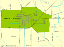
Coordinates: 36°55′17″N 89°20′47″W / 36.92139°N 89.34639°WCoordinates: 36°55′17″N 89°20′47″W / 36.92139°N 89.34639°W Country United States State Missouri County Mississippi Area – Total 4.7 sq mi (12.1 km2) – Land 4.7 sq mi (12.1 km2) – Water 0.0 sq mi (0.0 km2) Elevation 322 ft (98 m) Population (2000) – Total 4,732 – Density 1,011.8/sq mi (390.7/km2) Time zone Central (CST) (UTC-6) – Summer (DST) CDT (UTC-5) ZIP code 63834 Area code(s) 573 FIPS code 29-13366[1] GNIS feature ID 0715743[2] Charleston is a city in Mississippi County, Missouri, United States. The population was 4,732 at the 2000 census. It is the county seat of Mississippi County[3] and it is a home to a local correctional facility.
Contents
History
Charleston is the biggest town on the Missouri side near the confluence of the Mississippi River and Ohio River at Bird's Point, Missouri (11 miles east on U.S. Route 60). Its history has been tied to traffic on the rivers.
Settlement initially occurred on the north side in what in 1805 was called Matthews Prairie.
In 1837 Joseph Moore laid out the community after buying 22.5 acres (91,000 m2) for $337.[4] According to town lore Moore promised to name the town for his brother Charles if he helped. At various times it was called St. Charles Prairie and Carlos Prairie before ultimately being named Charleston.
In 1845 it was selected the county seat.
On September 1, 1861, Confederate General M. Jeff Thompson robbed the Union Bank of Charleston. Thompson, who handed the cashier a note, gave the cashier an hour to get approval from superiors to give him keys to the vault. After receiving the money he left a receipt for $57,000 and discovered later that only $56,000 was in the bags.[5]
The city was the epicenter of the October 31, 1895 6.6 earthquake on the New Madrid Seismic Zone. The quake damaged virtually all buildings in Charleston, creating sand volcanoes, cracked a pier on the Cairo Rail Bridge and toppled chimneys in St. Louis, Missouri, Memphis, Tennessee, Gadsden, Alabama and Evansville, Indiana. The fate of specific buildings may also be traced by Sanborn Maps of the town produced during this period.[6] The quake is the biggest quake since the 1812 New Madrid earthquake, which at 8.3 was the biggest recorded quake in the Contiguous United States.[7] One of the most visible signs of the quake is Henson Lake south of Charleston, which was greatly expanded by the quake.
In 1901 the county courthouse was built. It was designed by J.B. Legg, who designed numerous buildings throughout Missouri including the Gasconade County, Missouri and St. Charles County, Missouri courthouses. On February 10, 1997, the courthouse was damaged by fire and was subsequently torn down. A new courthouse has since been constructed in the place of the former.
Athletics
Charleston High School has won 10 state boys basketball state championships the most recent of which in 2007.
Geography
According to the United States Census Bureau, Charleston has a total area of 4.7 square miles (12 km2), all land.
Demographics
As of the census[1] of 2000, there were 4,732 people, 1,834 households, and 1,228 families residing in the city. The population density was 1,011.8 people per square mile (390.4/km²). There were 1,957 housing units at an average density of 418.5 per square mile (161.5/km²). The racial makeup of the city was 53.11% White, 45.60% African American, 0.04% Native American, 0.27% Asian, 0.02% Pacific Islander (U.S. Census), 0.15% from other races, and 0.80% from two or more races. Hispanic or Latino of any race were 1.10% of the population.
There were 1,834 households out of which 32.9% had children under the age of 18 living with them, 39.0% were married couples living together, 24.8% had a female householder with no husband present, and 33.0% were non-families. 30.6% of all households were made up of individuals and 16.0% had someone living alone who was 65 years of age or older. The average household size was 2.50 and the average family size was 3.13.
In the city the population was spread out with 30.2% under the age of 18, 8.5% from 18 to 24, 24.6% from 25 to 44, 20.8% from 45 to 64, and 16.0% who were 65 years of age or older. The median age was 35 years. For every 100 females there were 82.6 males. For every 100 females age 18 and over, there were 74.7 males.
The median income for a household in the city was $21,812, and the median income for a family was $28,178. Males had a median income of $25,908 versus $17,292 for females. The per capita income for the city was $12,876. About 21.2% of families and 26.0% of the population were below the poverty line, including 41.3% of those under age 18 and 16.8% of those age 65 or over.
Trivia
Significant portions of the 1962 film The Intruder (directed by Roger Corman and starring William Shatner) were filmed in Charleston.
Notable people
- Charlie Babb, former Miami Dolphin
- Ricky Frazier, former basketball player
- Betty Cooper Hearnes, Missouri politician
- Warren E. Hearnes, former Missouri Governor
- Matt Whiteside, baseball player
- John E. Scott, former state senate president pro tem
References
- ^ a b "American FactFinder". United States Census Bureau. http://factfinder.census.gov. Retrieved 2008-01-31.
- ^ "US Board on Geographic Names". United States Geological Survey. 2007-10-25. http://geonames.usgs.gov. Retrieved 2008-01-31.
- ^ "Find a County". National Association of Counties. http://www.naco.org/Counties/Pages/FindACounty.aspx. Retrieved 2011-06-07.
- ^ http://www.charlestonmo.net/history.asp
- ^ M. Jeff Thompson: Missouri's swamp fox of the Confederacy By Doris Land Mueller
- ^ Sanborn Maps for Missouri: Charleston, from the University of Missouri Digital Library. Accessed 2011-03-14.
- ^ Historic Earthquakes: Near Charleston, Mississippi County, Missouri - usgs.gov - Retrieved August 27, 2009
External links
Municipalities and communities of Mississippi County, Missouri Cities Anniston | Bertrand | Charleston | East Prairie | Miner‡ | Wyatt

Villages Unincorporated
communitiesFootnotes ‡This populated place also has portions in an adjacent county or counties
Categories:- Cities in Mississippi County, Missouri
- County seats in Missouri
- Populated places established in 1837


Wikimedia Foundation. 2010.