- Clayton, Missouri
-
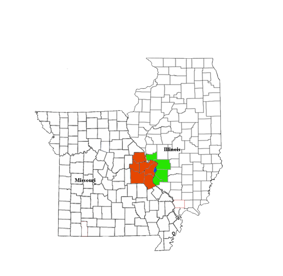
Clayton, Missouri — City — Location in Missouri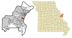 U.S. Census Map
Coordinates: 38°38′43″N 90°19′55″W / 38.64528°N 90.33194°WCoordinates: 38°38′43″N 90°19′55″W / 38.64528°N 90.33194°W Country United States State Missouri County St. Louis Settled 1877 Incorporated 1913 Government - Type Mayor-council city - Mayor Linda Goldstein Area - Total 2.5 sq mi (6.4 km2) - Land 2.5 sq mi (6.4 km2) - Water 0.0 sq mi (0.0 km2) Elevation 568 ft (173 m) Population (2010) - Total 15,939 - Density 6,450.3/sq mi (2,490.5/km2) Time zone Central (UTC-6) - Summer (DST) Central (UTC-5) ZIP code 63105 Area code(s) 314 FIPS code 29-14572[1] GNIS feature ID 0755896[2] Website http://www.claytonmo.gov/ Clayton is an inner-ring suburb of St. Louis and the county seat of St. Louis County, Missouri. The population was 15,939 at the 2010 census.[3] The city was organized in 1877 and is named after Ralph Clayton, who donated the land for the courthouse.
Contents
Geography
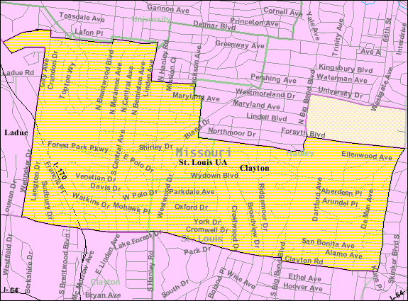
According to the United States Census Bureau, the city has a total area of 2.5 square miles (6.5 km2), all of it land.
Cityscape
The architecture of central Clayton reflects its economic activity and eras of growth. An impressive collection of mid-century Modernist low and high rise structures contrast with earlier mansions, stores and flats.
Demographics
Historical populations Year Pop. ±% 2000 12,825 — 2010 15,939 +24.3% In the St. Louis region, Clayton is well known for housing a wealthy and educated young professional, often dual-income population.
As of the census[1] of 2000, there were 12,825 people, 5,370 households, and 2,797 families residing in the city. The population density was 5,164.4 people per square mile (1,996.7/km²). There were 5,852 housing units at an average density of 2,356.5 per square mile (911.1/km²). The racial makeup of the city was 84.94% White, 7.77% Black or African American, 0.12% Native American, 5.62% Asian, 0.03% Pacific Islander, 0.29% from other races, and 1.22% from two or more races. Hispanic or Latino of any race were 1.49% of the population.
There were 5,370 households out of which 25.9% had children under the age of 18 living with them, 43.4% were married couples living together, 6.7% had a female householder with no husband present, and 47.9% were non-families. 40.4% of all households were made up of individuals and 11.8% had someone living alone who was 65 years of age or older. The average household size was 2.09 and the average family size was 2.90.
In the city the population was spread out with 20.1% under the age of 18, 10.7% from 18 to 24, 32.3% from 25 to 44, 22.6% from 45 to 64, and 14.3% who were 65 years of age or older. The median age was 37 years. For every 100 females there were 100.5 males. For every 100 females age 18 and over, there were 98.0 males.
The median income for a household in the city was $64,184, and the median income for a family was $107,346. Males had a median income of $64,737 versus $42,757 for females. The per capita income for the city was $48,055. About 5.0% of families and 7.7% of the population were below the poverty line, including 9.5% of those under age 18 and 3.2% of those age 65 or over.
Economy
Brown Shoe Company (owner of Famous Footwear and Shoes.com),[4] Enterprise Rent-a-Car,[5] Olin Corporation,[6] and Straub's Markets are headquartered in Clayton.[7][8]
Neighborhoods
The city's neighborhoods include Claverach Park, Clayton Gardens, Clayshire, DeMun, Davis Place, Hillcrest, Moorlands, Old Town, Downtown Clayton, Polo, Wydown Forest, Wydown Terrace, Forsyth and Washington University.
Culture
Clayton is a thriving cultural center. The downtown business district has many art galleries, boutiques and fine restaurants, and European-style outdoor cafes.[9] The city hosts major cultural and culinary events such as the St. Louis Art Fair and the Taste of Clayton food festival.[10]
Transportation
Public transportation
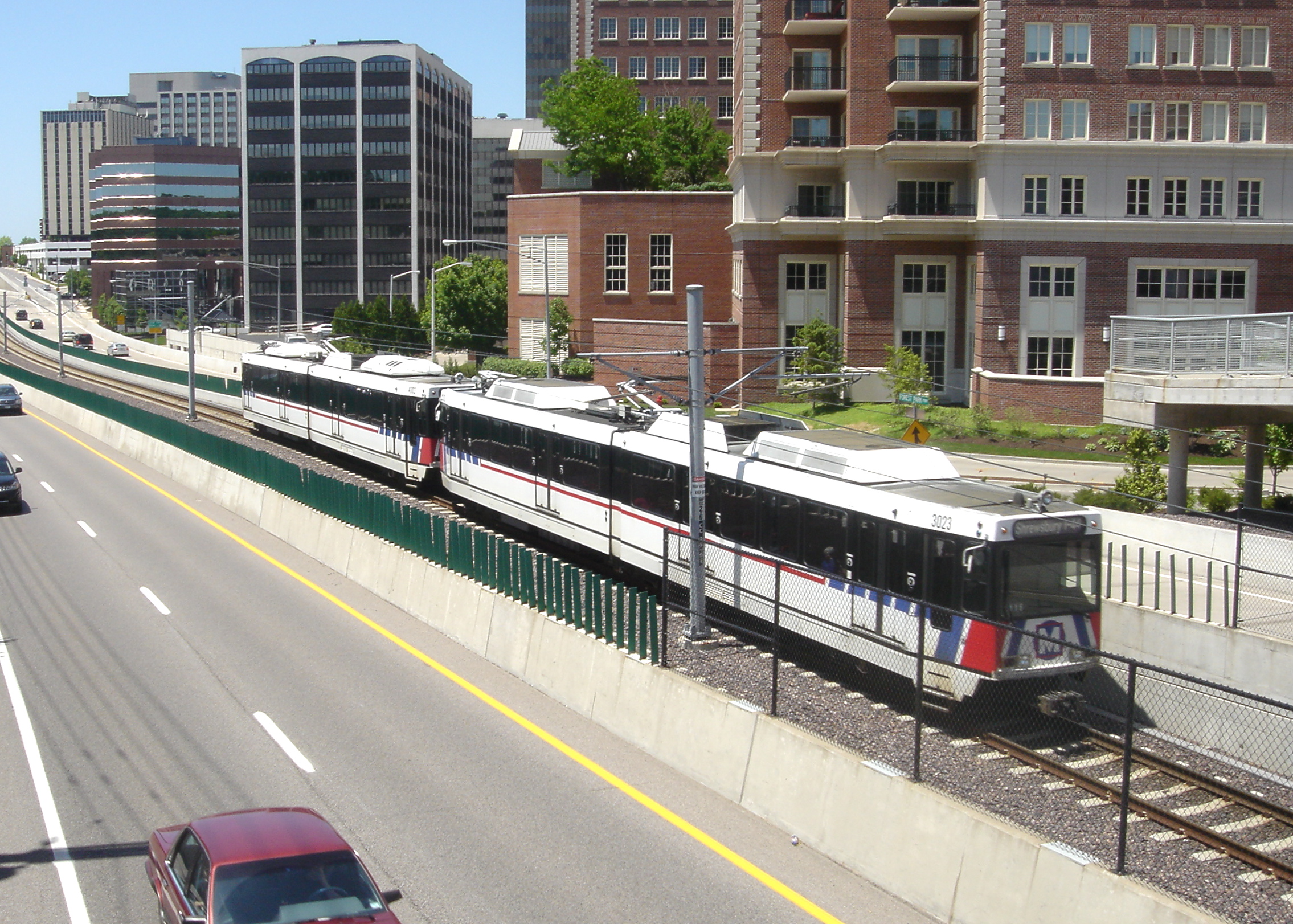
 A Blue Line MetroLink train bound for Shrewsbury-Lansdowne I-44 station passes by downtown Clayton. The train is travelling within the median of Forest Park Parkway.
Clayton is served by the Metrolink light rail system. The city has two stations along the Blue Line: Clayton, and Forsyth. Metro also operates bus services in Clayton.
Major roads and highways
Major roads and highways in Clayton include Interstate 170, Brentwood Boulevard, Hanley Road, and Forest Park Parkway.[11] Old Bonhomme (renamed Forsythe Boulevard when it changes from North-South to East-West direction) in North Clayton is an ancient Native American trail. Wydown Boulevard in Clayton was called one of the nation's most dignified streets in the AIA Architecture Guide to St. Louis.
Transit centers
- Clayton Transit Center
Education
Universities
Washington University in St. Louis is partially located in Clayton.[8][12] The city is also home to Fontbonne University and Concordia Seminary of the Lutheran Church–Missouri Synod.
Primary and secondary schools
The School District of Clayton operates public schools. There are three public elementary schools in Clayton, each feeding into the middle and high schools. There is Glenridge Elementary School, located in the Moorlands neighborhood, Captain Elementary School in the DeMun neighborhood near Concordia Seminary, and Meramec Elementary School in Davis Place. All three of these schools feed into Wydown Middle School, located on Wydown Boulevard, across from Washington University. This, in turn, feeds into Clayton High School, which is located next to Shaw Park, near downtown Clayton. Several of Clayton's elementary schools have been closed and/or repurposed. Gay School is now the Clayton Family Center, Maryland School is the Clayton Early Childhood Center, DeMun School burned in a fire and was replaced by Ralph M. Captain Elementary, and in the wake of the Brown v. Board of Education case abolishing segregated schools, Crispus Attucks School was closed and demolished (an office building was constructed on its former grounds in downtown Clayton).[13]
Public libraries
St. Louis County Library operates the Mid-County Branch in Clayton.[8][14]
References
- ^ a b "American FactFinder". United States Census Bureau. http://factfinder.census.gov. Retrieved 2008-01-31.
- ^ "US Board on Geographic Names". United States Geological Survey. 2007-10-25. http://geonames.usgs.gov. Retrieved 2008-01-31.
- ^ "Race, Hispanic or Latino, Age, and Housing Occupancy: 2010 Census Redistricting Data (Public Law 94-171) Summary File (QT-PL), Clayton city, Missouri". U.S. Census Bureau, American FactFinder 2. http://factfinder2.census.gov. Retrieved October 19, 2011.
- ^ "We're Brown Shoe." Brown Shoe Company. Retrieved on January 23, 2010.
- ^ "Frequently Asked Questions." Enterprise Rent-a-Car. Retrieved on June 14, 2009.
- ^ Van Der Werf, Martin. "Isle of Capri will move HQ to Creve Coeur." St. Louis Post-Dispatch. January 28, 2006. Third Edition, Business A31. Retrieved on August 19, 2009.
- ^ "Employment Opportunities." Straub's Markets. Retrieved on July 12, 2010.
- ^ a b c "Clayton city, Missouri." U.S. Census Bureau. Retrieved on June 13, 2009.
- ^ Saint Louis - Clayton Business District
- ^ St. Louis Art Galleries - Clayton Business District
- ^ http://www.ci.clayton.mo.us/FileSystem/Page99/00%20FINAL%202007%20citywide.pdf Retrieved on November 12, 2009
- ^ "Danforth Campus Map." Washington University in St. Louis. Retrieved on June 13, 2009.
- ^ http://www.claytonhistorysociety.org/schools.html
- ^ "Mid-County Branch." St. Louis County Library. Retrieved on August 18, 2009.
External links
Greater St. Louis Illinois · Missouri · United States of America Topics 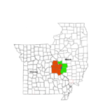
Central city Largest cities
(over 20,000 in 2000)Affton CDP · Alton · Ballwin · Belleville · Chesterfield · Collinsville · East St. Louis · Edwardsville · Ferguson · Florissant · Granite City · Hazelwood · Kirkwood · Maryland Heights · Mehlville CDP · Oakville CDP · O'Fallon, Illinois · O'Fallon, Missouri · Saint Charles · St. Peters · Spanish Lake CDP · University City · Webster Groves · WildwoodLargest towns
and villages
(over 10,000 in 2000)Arnold · Bellefontaine Neighbors · Berkeley · Bridgeton · Cahokia · Clayton · Concord CDP · Crestwood · Creve Coeur · Fairview Heights · Farmington · Festus · Glen Carbon · Godfrey · Jennings · Lake St. Louis · Lemay CDP · Manchester · Overland · St. Ann · Swansea · Town and Country · Washington · Wentzville · Wood RiverMissouri Counties Franklin · Jefferson · Lincoln · St. Charles · Saint Francois · St. Louis City · St. Louis County · Warren · WashingtonIllinois Counties Subregions County seats in Missouri Albany • Alton • Ava • Benton • Bethany • Bloomfield • Bolivar • Boonville • Bowling Green • Buffalo • Butler • California • Camdenton • Carrollton • Carthage • Caruthersville • Cassville • Centerville • Charleston • Chillicothe • Clayton • Clinton • Columbia • Doniphan • Edina • Eminence • Farmington • Fayette • Forsyth • Fredericktown • Fulton • Gainesville • Galena • Gallatin • Grant City • Greenfield • Greenville • Harrisonville • Hartville • Hermann • Hermitage • Hillsboro • Houston • Huntsville • Independence • Ironton • Jackson • Jefferson City • Kahoka • Kennett • Keytesville • Kingston • Kirksville • Lamar • Lancaster • Lebanon • Lexington • Liberty • Linn • Linneus • Macon • Marble Hill • Marshall • Marshfield • Maryville • Maysville • Memphis • Mexico • Milan • Montgomery City • Monticello • Mount Vernon • Neosho • Nevada • New London • New Madrid • Oregon • Osceola • Ozark • Palmyra • Paris • Perryville • Pineville • Platte City • Plattsburg • Poplar Bluff • Potosi • Princeton • Richmond • Rock Port • Rolla • Saint Charles • Saint Joseph • Salem • Savannah • Sedalia • Shelbyville • Springfield • Ste. Genevieve • Steelville • Stockton • Trenton • Troy • Tuscumbia • Union • Unionville • Van Buren • Versailles • Vienna • Warrensburg • Warrenton • Warsaw • Waynesville • West PlainsCategories:- Cities in St. Louis County, Missouri
- County seats in Missouri


Wikimedia Foundation. 2010.