- Ava, Missouri
Infobox Settlement
official_name = Ava, Missouri
settlement_type =City
nickname =
motto =
imagesize =
image_caption =
image_
imagesize =
image_caption =
image_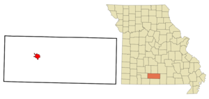
mapsize = 250x200px
map_caption = Location of Ava, Missouri
mapsize1 =
map_caption1 =subdivision_type = Country
subdivision_name =United States
subdivision_type1 = State
subdivision_name1 =Missouri
subdivision_type2 = County
subdivision_name2 = Douglas
government_footnotes =
government_type =
leader_title =
leader_name =
leader_title1 =
leader_name1 =
established_title =
established_date =unit_pref = Imperial
area_footnotes =area_magnitude =
area_total_km2 = 8.0
area_land_km2 = 8.0
area_water_km2 = 0.0
area_total_sq_mi = 3.1
area_land_sq_mi = 3.1
area_water_sq_mi = 0.0population_as_of = 2000
population_footnotes =
population_total = 3021
population_density_km2 = 375.7
population_density_sq_mi = 973.0timezone = Central (CST)
utc_offset = -6
timezone_DST = CDT
utc_offset_DST = -5
elevation_footnotes =
elevation_m = 391
elevation_ft = 1283
latd = 36 |latm = 57 |lats = 19 |latNS = N
longd = 92 |longm = 39 |longs = 47 |longEW = Wpostal_code_type =
ZIP code
postal_code = 65608
area_code = 417
blank_name = FIPS code
blank_info = 29-02674GR|2
blank1_name = GNIS feature ID
blank1_info = 0735491GR|3
website =
footnotes =Ava is a city in Douglas County,
Missouri ,United States . The population was 3,021 at the 2000 census. It is thecounty seat of Douglas CountyGR|6. The city was founded in1871 and is named after the city of "Ava" in theBible .cite web |url=http://www.epodunk.com/cgi-bin/genInfo.php?locIndex=20091 |title=Ava, Missouri City Profile|publisher=ePodunk |accessdate=2008-01-10] Ava is the only incorporated city in Douglas County.Geography
Ava is located at coor dms|36|57|19|N|92|39|47|W|city (36.955176, -92.663114)GR|1. According to the
United States Census Bureau , the city has a total area of 3.1square mile s (8.0km² ), all of it land.Demographics
As of the
census GR|2 of 2000, there were 3,021 people, 1,350 households, and 764 families residing in the city. Thepopulation density was 973.0 people per square mile (376.3/km²). There were 1,493 housing units at an average density of 480.9/sq mi (186.0/km²). The racial makeup of the city was 96.79% White, 0.13% African American, 0.66% Native American, 0.43% Asian, 0.03% Pacific Islander, 0.26% from other races, and 1.69% from two or more races. Hispanic or Latino of any race were 1.36% of the population.There were 1,350 households out of which 27.3% had children under the age of 18 living with them, 43.0% were married couples living together, 10.5% had a female householder with no husband present, and 43.4% were non-families. 39.3% of all households were made up of individuals and 23.3% had someone living alone who was 65 years of age or older. The average household size was 2.21 and the average family size was 2.96.
In the city the population was spread out with 25.4% under the age of 18, 8.3% from 18 to 24, 24.0% from 25 to 44, 19.3% from 45 to 64, and 23.0% who were 65 years of age or older. The median age was 38 years. For every 100 females there were 79.2 males. For every 100 females age 18 and over, there were 73.1 males.
The median income for a household in the city was $22,331, and the median income for a family was $28,228. Males had a median income of $25,865 versus $16,324 for females. The
per capita income for the city was $13,307. About 16.0% of families and 21.7% of the population were below thepoverty line , including 27.3% of those under age 18 and 25.8% of those age 65 or over.References
External links
* [http://www.avamissouri.org/ City of Ava website]
*Mapit-US-cityscale|36.955176|-92.663114
Wikimedia Foundation. 2010.