- Marshfield, Missouri
-
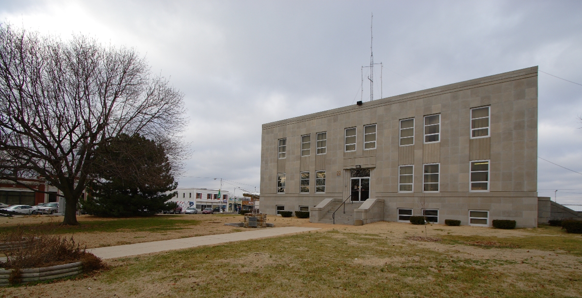
Marshfield, Missouri — City — Webster County Courthouse Location of Marshfield, Missouri
Coordinates: 37°20′23″N 92°54′26″W / 37.33972°N 92.90722°WCoordinates: 37°20′23″N 92°54′26″W / 37.33972°N 92.90722°W Country United States State Missouri County Webster Area - Total 4.8 sq mi (12.5 km2) - Land 4.8 sq mi (12.5 km2) - Water 0.0 sq mi (0.0 km2) Elevation 1,493 ft (455 m) Population (2010) - Total 7,250 - Density 1,497.9/sq mi (578.4/km2) Time zone Central (CST) (UTC-6) - Summer (DST) CDT (UTC-5) ZIP code 65706 Area code(s) 417 FIPS code 29-46388[1] GNIS feature ID 0721909[2] Marshfield is a city in Webster County, Missouri, United States. The population was 7,250 at the 2010 census, a 26.7% increase since the 2000 population of 5,720. It is the county seat [3] and part of the Springfield, Missouri Metropolitan Statistical Area.
Contents
History
Marshfield was settled in 1830. On May 28, 1856, the court instructed Wright Holland to lay out the County seat on a square in the southeast corner of the acres apportioned. The survey of the town was commenced June 21, 1856. The post-office was established also in 1856, with Allan F. Goss as postmaster. (--State of Missouri, 1889, pp. 252–259.) [7][[
Early growth was described as "very slow" until the opening of the railroad in 1870. It had 1 church, about 20 stores, 1 furniture factory and 2 wagon shops. (--Gazetteer of Missouri, Campbell, p. 643; Mr. T. Ballard Watters.)[7]
On April 18, 1880, a tornado measuring F4 on the Fujita scale struck Marshfield. Its damage path was 800 yards (730 m) wide and 64 miles (103 km) long. The tornado killed 99 people and injured 100, and it is said that 10% of Marshfield's residents were killed and all but 15 of its buildings were destroyed.
Hosmer Dairy Farm Historic District, also known as Walnut Springs Farm, is on the National Register of Historic Places. It is currently a popular place for wedding ceremonies.
In 1948, President Harry S Truman visited the city. On July 4, 1991, President George H W and Barbara Bush visited the annual Fourth of July parade. The town boasts the oldest Fourth of July celebration west of the Mississippi River and in the state of Missouri, which is the reason the First Family chose Marshfield as a campaign stop on the nation's birthday.
In 2006, the city made the national news as it welcomed the largest gathering of Presidential relatives in the history of the nation. The historic gathering occurred for the announcement ceremony of the National First Families Library and Museum, which is located on the city square.
Marshfield is the sister city of Marshfield, Massachusetts and is a Tree City USA. The city is also home to the Webster County Museum and the Missouri Walk of Fame, which is Missouri's version of the Hollywood Walk of Fame. The walk honors famous Missourians and stars are unveiled during the annual "Cherry Blossom Festival."
Features
Marshfield has one public high school, Marshfield High School and one Christian school. Marshfield also has a Wal-Mart Supercenter.
Geography
Marshfield is located at 37°20′23″N 92°54′26″W / 37.33972°N 92.90722°W (37.339599, -92.907230)[4]. According to the United States Census Bureau, the city has a total area of 4.8 square miles (12.5 km²), all land.
Demographics
As of the census[1] of 2010, there were 7,250 people residing in the city. The population density was 1497.9 people per square mile (456.3/km²). As of 2000, there were 2,417 housing units at an average density of 499.8 per square mile (192.8/km²). The racial makeup of the city was 97.80% White, 0.19% African American, 0.42% Native American, 0.30% Asian, 0.12% from other races, and 1.17% from two or more races. Hispanic or Latino of any race were 1.75% of the population.
There were 2,256 households out of which 34.7% had children under the age of 18 living with them, 53.2% were married couples living together, 11.4% had a female householder with no husband present, and 32.0% were non-families. 28.7% of all households were made up of individuals and 16.0% had someone living alone who was 65 years of age or older. The average household size was 2.44 and the average family size was 3.00.
In the city the population was spread out with 27.1% under the age of 18, 9.4% from 18 to 24, 27.2% from 25 to 44, 18.2% from 45 to 64, and 18.1% who were 65 years of age or older. The median age was 35 years. For every 100 females there were 85.0 males. For every 100 females age 18 and over, there were 79.3 males.
The median income for a household in the city was $27,753, and the median income for a family was $36,090. Males had a median income of $27,813 versus $20,752 for females. The per capita income for the city was $14,855. About 5.5% of families and 11.6% of the population were below the poverty line, including 10.2% of those under age 18 and 12.2% of those age 65 or over.
Notable residents
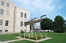 A 1/4 scale model of the Hubble Space Telescope located at the courthouse in Marshfield.
- Joe Haymes, Swing Era orchestra leader, was born in Marshfield in 1907.
- Edwin Hubble. The stretch of Interstate 44 through Marshfield is named the Edwin Hubble Highway.
- Mike Cunningham, current Missouri State Representative, grew up and lived in Marshfield.
- Dan Clemens, current Republican member of the Missouri State Senate, grew up and currently lives in Marshfield.
- Darren King, current member of the band Mute Math, grew up in Marshfield.
References
- ^ a b "American FactFinder". United States Census Bureau. http://factfinder.census.gov. Retrieved 2008-01-31.
- ^ "US Board on Geographic Names". United States Geological Survey. 2007-10-25. http://geonames.usgs.gov. Retrieved 2008-01-31.
- ^ "Find a County". National Association of Counties. http://www.naco.org/Counties/Pages/FindACounty.aspx. Retrieved 2011-06-07.
- ^ "US Gazetteer files: 2010, 2000, and 1990". United States Census Bureau. 2011-02-12. http://www.census.gov/geo/www/gazetteer/gazette.html. Retrieved 2011-04-23.
External links
- A Directory of Towns, Villages, and Hamlets, Past and Present of Webster County, Missouri
- Historic maps of Marshfield in the Sanborn Maps of Missouri Collection at the University of Missouri
- Marshfield Mail newspaper
Municipalities and communities of Webster County, Missouri County seat: Marshfield Cities Fordland | Marshfield | Niangua | Rogersville‡ | Seymour

Village Townships East Benton | East Dallas | Finley | Grant | Hazelwood | High Prairie | Jackson | Niangua | Ozark | Union | Washington | West Benton | West Dallas
Unincorporated
communitiesFootnotes ‡This populated place also has portions in an adjacent county or counties
Categories:- Populated places established in 1830
- Cities in Webster County, Missouri
- Communities on U.S. Route 66
- County seats in Missouri
- Springfield, Missouri metropolitan area


Wikimedia Foundation. 2010.