- Perryville, Missouri
Infobox Settlement
official_name = Perryville, Missouri
settlement_type =City
nickname =
motto =
imagesize =
image_caption =
image_
imagesize =
image_caption =
image_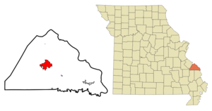
mapsize = 250x200px
map_caption = Location of Perryville, Missouri
mapsize1 =
map_caption1 =subdivision_type = Country
subdivision_name =United States
subdivision_type1 = State
subdivision_name1 =Missouri
subdivision_type2 = County
subdivision_name2 = Perry
government_footnotes =
government_type =
leader_title =
leader_name =
leader_title1 =
leader_name1 =
established_title =
established_date =unit_pref = Imperial
area_footnotes =area_magnitude =
area_total_km2 = 20.0
area_land_km2 = 19.7
area_water_km2 = 0.4
area_total_sq_mi = 7.7
area_land_sq_mi = 7.6
area_water_sq_mi = 0.2population_as_of = 2000
population_footnotes =
population_total = 7667
population_density_km2 = 390.1
population_density_sq_mi = 1010.3timezone = Central (CST)
utc_offset = -6
timezone_DST = CDT
utc_offset_DST = -5
elevation_footnotes =
elevation_m = 177
elevation_ft = 581
latd = 37 |latm = 43 |lats = 34 |latNS = N
longd = 89 |longm = 52 |longs = 18 |longEW = Wpostal_code_type =
ZIP code s
postal_code = 63775, 63776, 63783
area_code = 573
blank_name = FIPS code
blank_info = 29-57116GR|2
blank1_name = GNIS feature ID
blank1_info = 0724239GR|3
website =
footnotes = Perryville has a Mayfest once a yearPerryville is a
city in Perry County,Missouri ,United States . The population was 7,667 at the 2000 census. It is thecounty seat of Perry CountyGR|6.Governance
Perryville has a Mayor/City Council form of government. The
city council consists of six aldermen, two from each of three wards. Both the mayor and the aldermen are elected for a term of two years.History
No one knows why Perryville was chosen as the location for the county seat of Perry County government, but on August 7, 1821, Bernard Layton deeded 51 acres to the commissioners in exchange for one town lot. Fifty-three of the 99 town lots were sold for $1,486.25, which was used to build the first courthouse. The one existing today is actually the third such structure. It was built in 1904 at a cost of $30,000.
There were two early stores in Perryville. The first, a log structure, was built by Ferdinand Rozier, Sr. on the north side of the square. The second, built by Levi Block, was a two-story building. The upper story served as the first town hall for the small settlement.
Perryville was first incorporated in 1837, but records show the incorporation was allowed to lapse. In the early 1800s, Henry Burns built a home on South Spring Street. Later, William P. Faherty bought the house, which is now a museum operated by the Perry County Historical Society.
As both merchandisers and consumers grew in sophistication, so did the types of establishments in the County. Built in 1843, the Hoose Hotel, often called the "white house", was a prominent structure in early commercial days. The Hoose Hotel was located at the site presently occupied by Eagle Bank and Trust Co. and The Total Package and served as a hotel, a brewery and an auction block.
In 1856, the town was again incorporated and by 1874 it had its first fire engine. Fourth Class City status was attained in 1879 and the following year Charles A. Weber was elected its first mayor. With the building of the Perryville, Chester and Ste. Genevieve Railroad, prosperity came.
Largely because of its role as the seat of county government and because of its central location, Perryville began to develop as the major commercial and service center in Perry County. The population jumped from 897 in 1890 to 1275 in 1900. In 1893 the telephone arrived. The first horseless carriage, deemed a "locomobile" by The Perry County Republican newspaper, was reported in Perryville in 1903. The first power plant was built in 1913 to provide Perryville with electric lights. This building is currently being renovated by the Perry Art Alliance.
In 1923 the Chamber of Commerce was formed, and Perryville launched its first industrial development offensive by raising $100,000 to build an industrial building in the hope of persuading International Shoe Company in St. Louis to open a Perryville plant. The venture was successful and the opening of the International plant spurred a cycle of growth which included the paving of city streets and a host of new businesses and city services.
In 1940 a second International production facility, known as the Kiefner Branch, opened in Perryville. However, in 1964 an economic downturn forced the closing of International's original Magnolia branch plant.
The loss of 250 jobs in the Magnolia plant closing only served to heighten the community's enthusiasm to move toward a more diverse industrial base. The ingenuity and dedication of the Chamber of Commerce, Perryville Development Corporation, and city officials led to the development of the Perryville Industrial Park and the establishment of an Enterprise Zone. The City of Perryville hired its first City Administrator in 1976. The Perry County Industrial Development Authority was established in 1983 and our first Economic Development Director was hired.
The goal of diversification in the City's industrial base has been extremely successful. Tenants in the Perryville Industrial Park include TG Missouri Corporation, T-N-T Plastics, Wilkes Integrated Packaging, Falcon Foam, Industrial Foam Products, Perry County Sheltered Workshop and Missouri Corrugated Box.
Among other important contemporary manufacturers in the Perryville area are Gilster-Mary Lee Corporation, with five Perry County facilities, which processes and globally markets a wide variety of grain-based food products; Sabreliner Corporation, a company which provides maintenance and overhauling for both military and business jet aircraft engines; BBL Buildings and Components Ltd. and Stark Truss, Inc. both of whom manufacture building trusses for commercial and residential construction; and a French wine barrel manufacturer, Seguin Moreau, that mills barrel staves and heads from Perry County's white oak forests to supply its cooperage in Napa, California. The cooperage uses the wood it gets from Perry County to produce superb quality American oak wine barrels for the international wine industry.
Geography
Perryville is located at coor dms|37|43|34|N|89|52|18|W|city (37.726123, -89.871564)GR|1.
According to the
United States Census Bureau , the city has a total area of 7.7square mile s (20.0km² ), of which, 7.6 square miles (19.7 km²) of it is land and 0.2 square miles (0.4 km²) of it iswater . The total area is 1.94% water.Demographics
As of the
census GR|2 of 2000, there were 7,667 people, 3,031 households, and 1,991 families residing in the city. Thepopulation density was 1,010.3 people per square mile (390.0/km²). There were 3,284 housing units at an average density of 432.7/sq mi (167.1/km²). The racial makeup of the city was 97.47% White, 0.25% African American, 0.17% Native American, 1.32% Asian, 0.01% Pacific Islander, 0.16% from other races, and 0.63% from two or more races. Hispanic or Latino of any race were 0.70% of the population.There were 3,031 households out of which 31.7% had children under the age of 18 living with them, 51.4% were married couples living together, 11.2% had a female householder with no husband present, and 34.3% were non-families. 30.4% of all households were made up of individuals and 15.6% had someone living alone who was 65 years of age or older. The average household size was 2.41 and the average family size was 3.00.
In the city the population was spread out with 24.6% under the age of 18, 9.2% from 18 to 24, 28.2% from 25 to 44, 18.5% from 45 to 64, and 19.5% who were 65 years of age or older. The median age was 37 years. For every 100 females there were 89.7 males. For every 100 females age 18 and over, there were 86.9 males.
The median income for a household in the city was $33,934, and the median income for a family was $43,072. Males had a median income of $27,115 versus $19,736 for females. The
per capita income for the city was $16,630. About 5.9% of families and 11.0% of the population were below thepoverty line , including 10.6% of those under age 18 and 15.9% of those age 65 or over.References
External links
* [http://www.perryvillemo.com/city/ Official website]
Wikimedia Foundation. 2010.