- Gallatin, Missouri
Infobox Settlement
official_name = Gallatin, Missouri
settlement_type =City
nickname =
motto =
imagesize =
image_caption =
image_
imagesize =
image_caption =
image_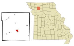
mapsize = 250x200px
map_caption = Location of Gallatin, Missouri
mapsize1 =
map_caption1 =subdivision_type = Country
subdivision_name =United States
subdivision_type1 = State
subdivision_name1 =Missouri
subdivision_type2 = County
subdivision_name2 = Daviess
government_footnotes =
government_type =
leader_title =
leader_name =
leader_title1 =
leader_name1 =
established_title =
established_date =unit_pref = Imperial
area_footnotes =area_magnitude =
area_total_km2 = 7.3
area_land_km2 = 7.2
area_water_km2 = 0.0
area_total_sq_mi = 2.8
area_land_sq_mi = 2.8
area_water_sq_mi = 0.0population_as_of = 2000
population_footnotes =
population_total = 1789
population_density_km2 = 247.1
population_density_sq_mi = 640.1timezone = Central (CST)
utc_offset = -6
timezone_DST = CDT
utc_offset_DST = -5
elevation_footnotes =
elevation_m = 281
elevation_ft = 922
latd = 39 |latm = 54 |lats = 43 |latNS = N
longd = 93 |longm = 57 |longs = 43 |longEW = Wpostal_code_type =
ZIP code
postal_code = 64640
area_code = 660
blank_name = FIPS code
blank_info = 29-26308GR|2
blank1_name = GNIS feature ID
blank1_info = 0766157GR|3
website =
footnotes =Gallatin is a city in Daviess County,
Missouri ,United States . The population was 1,789 at the 2000 census. It is thecounty seat of Daviess CountyGR|6.History
The Daviess County Rotary Jail and Sheriff's Residence, the A.T. Ray Home and the Daviess County Courthouse are on the National Register of Historic Places.
Geography
Gallatin is located at coor dms|39|54|43|N|93|57|43|W|city (39.912073, -93.961930)GR|1. According to the
United States Census Bureau , the city has a total area of 2.8square mile s (7.3km² ), of which, 2.8 square miles (7.3 km²) of it is land and 0.36% is water.Demographics
As of the
census GR|2 of 2000, there were 1,789 people, 771 households, and 477 families residing in the city. Thepopulation density was 640.1 people per square mile (246.7/km²). There were 905 housing units at an average density of 323.8/sq mi (124.8/km²). The racial makeup of the city was 99.27% White, 0.06% African American, 0.22% Native American, 0.06% from other races, and 0.39% from two or more races. Hispanic or Latino of any race were 0.39% of the population.There were 771 households out of which 31.0% had children under the age of 18 living with them, 49.5% were married couples living together, 9.9% had a female householder with no husband present, and 38.1% were non-families. 35.5% of all households were made up of individuals and 20.2% had someone living alone who was 65 years of age or older. The average household size was 2.25 and the average family size was 2.92.
In the city the population was spread out with 25.8% under the age of 18, 7.2% from 18 to 24, 24.0% from 25 to 44, 20.7% from 45 to 64, and 22.3% who were 65 years of age or older. The median age was 40 years. For every 100 females there were 83.3 males. For every 100 females age 18 and over, there were 76.5 males.
The median income for a household in the city was $29,234, and the median income for a family was $40,398. Males had a median income of $26,974 versus $18,929 for females. The
per capita income for the city was $17,092. About 12.8% of families and 14.3% of the population were below thepoverty line , including 18.4% of those under age 18 and 14.1% of those age 65 or over.Notable residents
*
Joshua Willis Alexander - US Secretary of Commerce, 1919-1921, under PresidentWoodrow Wilson
*Conrad Burns - Senator from Montana
*Alexander Monroe Dockery -Missouri Governor
*William Thornton Kemper, Sr. - Patriarch of the Missouri Kemper financial family
*Johnny Ringo - outlaw who briefly lived in the town
*Walter Page - Jazz bassistReferences
External links
Wikimedia Foundation. 2010.