- Clayton, Oklahoma
-
Clayton, Oklahoma — Town — Location of Clayton, Oklahoma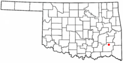
Coordinates: 34°35′16″N 95°21′25″W / 34.58778°N 95.35694°WCoordinates: 34°35′16″N 95°21′25″W / 34.58778°N 95.35694°W Country United States State Oklahoma County Pushmataha Area - Total 1.7 sq mi (4.4 km2) - Land 1.7 sq mi (4.4 km2) - Water 0.0 sq mi (0.0 km2) Elevation 607 ft (185 m) Population (2000) - Total 719 - Density 424.0/sq mi (163.7/km2) Time zone Central (CST) (UTC-6) - Summer (DST) CDT (UTC-5) ZIP code 74536 Area code(s) 539/918 FIPS code 40-14900[1] GNIS feature ID 1091403[2] Clayton is a town in Pushmataha County, Oklahoma, United States. The population was 719 at the 2000 census.
Contents
History
Clayton was formerly known as Dexter. A United States Post Office was established at Dexter, Indian Territory on March 31, 1894. It was named for Dexter Chapman, early-day resident.
Dexter was located in Wade County, Choctaw Nation.
The official name of the post office name changed to Clayton, Indian Territory on April 5, 1907. Its name is thought to come from Clayton, Missouri.[3] It is also possible the town renamed itself after the popular William H.H. Clayton, judge of the U.S. Court for the Central District of Indian Territory. Judge Clayton was prominent in the role to gain Oklahoma’s statehood.
Clayton is the largest town or community in northern Pushmataha County. It is the region’s largest trading center due to its relative distance from the county seat of Antlers, Oklahoma—36 miles.
Flagpole Mountain retains a fire tower. Built of metal and several stories tall, it was once part of a network of towers, all manned, from which a fire watch was maintained. It is the only tower remaining in Pushmataha County, although it is no longer operational. Views from the tower are stunning, offering a panorama stretching for many miles in any direction.
Clayton, as regional trading center, remains economically healthy, with a locally based economy. It is currently home to a public school, several churches, and numerous businesses and homes.
During recent years the Clayton High School Auditorium (Oklahoma) has become recognized as an architecturally and historically significant building, and has been added to the National Register of Historic Places. The building was found to be a very unusual example of Works Progress Administration architecture—one of only two known single-use auditoriums constructed by the WPA.
More information on the history of Clayton may be found in the Pushmataha County Historical Society.
Geography
Clayton is located at 34°35′16″N 95°21′25″W / 34.58778°N 95.35694°W (34.587698, -95.357077)[4]. According to the United States Census Bureau, the town has a total area of 1.7 square miles (4.4 km2), of which, 1.7 square miles (4.4 km2) of it is land and 0.58% is water.
Using the Public Land Survey System in use in Oklahoma the community is located in T6-1N-R19E.
Clayton, located in the picturesque Kiamichi River valley, is framed on its west by Flagpole Mountain (1,562 ft.) and to its east by unnamed mountains topping 1,600 feet in elevation. Within a few miles of Clayton is scenic McKinley Rocks, a collection of massive boulders strewn across a mountain top. South of Clayton is Clayton Lake State Park—which is surrounded by a pine tree forest—and northwest of town is Sardis Lake (Oklahoma), a U.S. Army Corps of Engineers dam which impounds the water of Jack’s Fork Creek. The Pushmataha Wildlife Refuge is also nearby, featuring scenic views from its mountain summit.
Demographics
As of the census[1] of 2000, there were 719 people, 335 households, and 191 families residing in the town. The population density was 424.0 people per square mile (163.3/km²). There were 404 housing units at an average density of 238.3 per square mile (91.8/km²). The racial makeup of the town was 74.41% White, 19.33% Native American, and 6.26% from two or more races. Hispanic or Latino of any race were 0.70% of the population.
There were 335 households out of which 28.4% had children under the age of 18 living with them, 41.8% were married couples living together, 12.8% had a female householder with no husband present, and 42.7% were non-families. 40.0% of all households were made up of individuals and 22.7% had someone living alone who was 65 years of age or older. The average household size was 2.15 and the average family size was 2.88.
In the town the population was spread out with 25.3% under the age of 18, 7.9% from 18 to 24, 23.8% from 25 to 44, 22.9% from 45 to 64, and 20.0% who were 65 years of age or older. The median age was 38 years. For every 100 females there were 83.0 males. For every 100 females age 18 and over, there were 77.8 males.
The median income for a household in the town was $13,516, and the median income for a family was $23,269. Males had a median income of $23,750 versus $15,556 for females. The per capita income for the town was $11,530. Below the poverty line were 38.8% of people, 31.3% of families, 49.4% of those under 18 and 37.0% of those over 64.
References
- ^ a b "American FactFinder". United States Census Bureau. http://factfinder.census.gov. Retrieved 2008-01-31.
- ^ "US Board on Geographic Names". United States Geological Survey. 2007-10-25. http://geonames.usgs.gov. Retrieved 2008-01-31.
- ^ George H. Shirk, Oklahoma Place Names, pp. 48 & 63; Post Office Site Location Reports, Record Group 28, National Archives
- ^ "US Gazetteer files: 2010, 2000, and 1990". United States Census Bureau. 2011-02-12. http://www.census.gov/geo/www/gazetteer/gazette.html. Retrieved 2011-04-23.
External links
Municipalities and communities of Pushmataha County, Oklahoma City 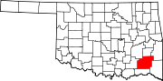
Towns Unincorporated
communitiesGhost towns Abbott | Cohn | Crum Creek | Dunbar | Eubanks | Gee | Honobia‡ | Johns | Kiamichi | Lyceum | Nolia | Rodney | Sardis | Wilson | Zoraya
Footnotes ‡This populated place also has portions in an adjacent county or counties
Categories:- Populated places in Pushmataha County, Oklahoma
- Towns in Oklahoma


Wikimedia Foundation. 2010.