- Olivette, Missouri
-
Olivette, Missouri — City — Location of Olivette, Missouri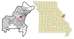
Coordinates: 38°40′23″N 90°22′38″W / 38.67306°N 90.37722°WCoordinates: 38°40′23″N 90°22′38″W / 38.67306°N 90.37722°W Country United States State Missouri County St. Louis Area – Total 2.8 sq mi (7.2 km2) – Land 2.8 sq mi (7.2 km2) – Water 0.0 sq mi (0.0 km2) Elevation 663 ft (202 m) Population (2010) – Total 7,737 – Density 2,783.2/sq mi (1,074.6/km2) Time zone Central (CST) (UTC-6) – Summer (DST) CDT (UTC-5) FIPS code 29-54650[1] GNIS feature ID 0756479[2] Olivette is an inner-ring suburb of St. Louis, located in St. Louis County, Missouri, United States. The population was 7,737 at the 2010 census.[3]
Contents
History
Olivette was settled in the mid-19th century as a small farming community along an old Indian trail originally called the Bonhomme Road (now known as Old Bonhomme, which meets and essentially turns into Olive Boulevard). Olive Road is a ridge road and at one time served as a de facto boundary for housing segregation in outer St. Louis.
Olivette was incorporated in 1930 by combining the communities of Central, Tower Hill, Olive, and Stratmann. It was once called Central due to its centralized location along the Central Plank Road (again, now called Olive Boulevard). In fact, Price Road and Olive Boulevard intersect at the exact midpoint between the Port of St. Louis on the Mississippi River and Howell's Landing on the Missouri River. Central became the best stop for wagons to restock on their journey between the two stops. Olivette is home to the first brick schoolhouse in St. Louis County at the corner of Price and Old Bonhomme. For the past 150 years, a schoolhouse has occupied this corner. Logos High School sits here now. Olivette is one of the communities in the county that still maintains its own municipal fire department as well as police department.
Geography
Olivette is located at 38°40′23″N 90°22′38″W / 38.67306°N 90.37722°W (38.672951, -90.377328)[4]. According to the United States Census Bureau, the city has a total area of 2.8 square miles (7.3 km2), all of it land.
Key roads through Olivette include Missouri Route 340 (Olive Boulevard), Price Road, Dielman Road, Old Bonhomme Road, and Interstate 170.
Olivette's neighbors include Overland and unincorporated St. Louis County to the north, Creve Coeur to the west, Ladue to the south, and University City to the east.
Demographics
Historical populations Year Pop. ±% 2000 7,438 — 2010 7,737 +4.0% As of the census[1] of 2000, there were 7,438 people, 3,096 households, and 2,173 families residing in the city. The population density was 2,667.5 people per square mile (1,029.3/km²). There were 3,231 housing units at an average density of 1,158.7 per square mile (447.1/km²). The racial makeup of the city was 70.38% White, 21.90% African American, 0.08% Native American, 5.00% Asian, 0.01% Pacific Islander, 0.75% from other races, and 1.87% from two or more races. Hispanic or Latino of any race were 1.57% of the population.
There were 3,096 households out of which 31.5% had children under the age of 18 living with them, 54.2% were married couples living together, 12.7% had a female householder with no husband present, and 29.8% were non-families. 25.8% of all households were made up of individuals and 10.4% had someone living alone who was 65 years of age or older. The average household size was 2.40 and the average family size was 2.91.
In the city the population was spread out with 23.8% under the age of 18, 5.8% from 18 to 24, 25.4% from 25 to 44, 27.7% from 45 to 64, and 17.3% who were 65 years of age or older. The median age was 42 years. For every 100 females there were 89.0 males. For every 100 females age 18 and over, there were 84.5 males.
The median income for a household in the city was $57,669, and the median income for a family was $67,569. Males had a median income of $49,853 versus $35,278 for females. The per capita income for the city was $32,379. About 3.6% of families and 4.3% of the population were below the poverty line, including 3.8% of those under age 18 and 0.7% of those age 65 or over.
Education
The public Ladue School District serves all of Olivette. Old Bonhomme Elementary School is located within the city limits. Private schools located within the city include Logos High School, Epstein Hebrew Academy, and Immanuel Lutheran School (Olivette).
Hilltop Elementary school (erected in 1962) closed down and replaced with homes.
Famous residents
- Jim Bakken, former football Cardinals player
- Lou Brock, former St. Louis Cardinals baseball outfielder
- Jim Hart, former football Cardinals player
- Ken Holtzman, former Major League Baseball pitcher
- Jay Randolph, current St. Louis Cardinals broadcaster
- Johnny Roland, former football Cardinals player
References
- ^ a b "American FactFinder". United States Census Bureau. http://factfinder.census.gov. Retrieved 2008-01-31.
- ^ "US Board on Geographic Names". United States Geological Survey. 2007-10-25. http://geonames.usgs.gov. Retrieved 2008-01-31.
- ^ "Race, Hispanic or Latino, Age, and Housing Occupancy: 2010 Census Redistricting Data (Public Law 94-171) Summary File (QT-PL), Olivette city, Missouri". U.S. Census Bureau, American FactFinder 2. http://factfinder2.census.gov. Retrieved October 24, 2011.
- ^ "US Gazetteer files: 2010, 2000, and 1990". United States Census Bureau. 2011-02-12. http://www.census.gov/geo/www/gazetteer/gazette.html. Retrieved 2011-04-23.
Categories:- Cities in St. Louis County, Missouri


Wikimedia Foundation. 2010.