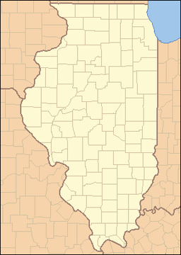
- Donnellson, Illinois
-
Donnellson Village Country United States State Illinois County Bond Elevation 620 ft (189 m) Coordinates 39°1′52″N 89°28′27″W / 39.03111°N 89.47417°W Area 0.2 sq mi (1 km2) - land 0.2 sq mi (1 km2) Population 243 (2000) Density 1,021.2 / sq mi (394 / km2) Timezone CST (UTC-6) - summer (DST) CDT (UTC-5) Postal code 62019 Area code 217 Wikimedia Commons: Donnellson, Illinois Donnellson is a village in Montgomery and Bond Counties, Illinois, United States. The population was 243 at the 2000 census.
Contents
History
Donnellson was originally known as Bear Creek, and the name was changed to Donnellson in 1851.[1] It was incorporated as a village in 1897.
Geography
Donnellson is located at 39°01′52″N 89°28′27″W / 39.031159°N 89.474037°W.[2]
According to the United States Census Bureau, the village has a total area of 0.2 square miles (0.52 km2), all of it land.
Demographics
As of the census[3] of 2000, there were 243 people, 93 households, and 63 families residing in the village. The population density was 1,021.2 people per square mile (390.9/km²). There were 100 housing units at an average density of 420.3 per square mile (160.9/km²). The racial makeup of the village was 97.94% White, 0.41% African American, 0.41% Native American, and 1.23% from two or more races.
There were 93 households out of which 36.6% had children under the age of 18 living with them, 53.8% were married couples living together, 11.8% had a female householder with no husband present, and 31.2% were non-families. 25.8% of all households were made up of individuals and 14.0% had someone living alone who was 65 years of age or older. The average household size was 2.61 and the average family size was 3.23.
In the village the population was spread out with 30.9% under the age of 18, 10.3% from 18 to 24, 26.7% from 25 to 44, 18.5% from 45 to 64, and 13.6% who were 65 years of age or older. The median age was 34 years. For every 100 females there were 104.2 males. For every 100 females age 18 and over, there were 97.6 males.
The median income for a household in the village was $28,365, and the median income for a family was $27,917. Males had a median income of $36,875 versus $22,500 for females. The per capita income for the village was $13,665. About 7.6% of families and 13.4% of the population were below the poverty line, including 29.5% of those under the age of eighteen and 5.4% of those sixty five or over.
References
- ^ Allan H. Keith, Historical Stories: About Greenville and Bond County, IL. Consulted on August 15, 2007.
- ^ "US Gazetteer files: 2010, 2000, and 1990". United States Census Bureau. 2011-02-12. http://www.census.gov/geo/www/gazetteer/gazette.html. Retrieved 2011-04-23.
- ^ "American FactFinder". United States Census Bureau. http://factfinder.census.gov. Retrieved 2008-01-31.
External links
- Donnellson Illinois, Historical Society of Montgomery County Illinois
Municipalities and communities of Bond County, Illinois City Villages Donnellson‡ | Keyesport‡ | Mulberry Grove | Old Ripley | Panama‡ | Pierron‡ | Pocahontas | Smithboro | Sorento
Townships Burgess | Central | Lagrange | Mills | Mulberry Grove | Old Ripley | Pleasant Mound | Shoal Creek | Tamalco
Unincorporated
communitiesAyers | Beaver Creek | Bunje | Dudleyville | Durley | Gilmore | Hamburg | Hookdale | Keyesport Landing | Paisley Corners | Pleasant Mound | Reno | Stubblefield | Tamalco | Woburn
Ghost town Elm Point
Footnotes ‡This populated place also has portions in an adjacent county or counties
Municipalities and communities of Montgomery County, Illinois Cities Coffeen | Hillsboro | Litchfield | Nokomis | Witt
Villages Butler | Coalton | Donnellson‡ | Farmersville | Fillmore | Harvel‡ | Irving | Ohlman | Panama‡ | Raymond | Schram City | Taylor Springs | Waggoner | Walshville | Wenonah
Townships Audubon | Bois D'Arc | Butler Grove | East Fork | Fillmore | Grisham | Harvel | Hillsboro | Irving | Nokomis | North Litchfield | Pitman | Raymond | Rountree | South Fillmore | South Litchfield | Walshville | Witt | Zanesville
Unincorporated
communitiesChapman | Kortcamp | Van Burensburg | Zenobia‡
Footnotes ‡This populated place also has portions in an adjacent county or counties
Categories:- Populated places in Bond County, Illinois
- Villages in Illinois
- Populated places in Montgomery County, Illinois
Wikimedia Foundation. 2010.

