- Lake Vermilion
-
Lake Vermilion 
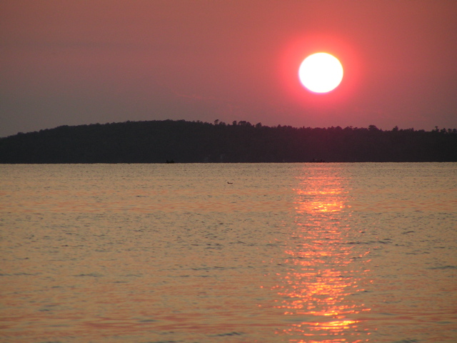
At sunset Location St. Louis County, Minnesota, USA Coordinates 47°51′28.47″N 92°17′58.60″W / 47.8579083°N 92.299611°WCoordinates: 47°51′28.47″N 92°17′58.60″W / 47.8579083°N 92.299611°W Primary outflows Vermilion River Basin countries United States Max. length 10.4 mi (16.7 km) Max. width 24 mi (39 km) Surface area 39,271 acres (158.9 km2) Max. depth 76 ft (23 m) Shore length1 313 mi (504 km) Surface elevation 1,358 ft (414 m) Islands 365 Settlements Tower, Cook 1 Shore length is not a well-defined measure. Lake Vermilion is a freshwater lake in northeastern Minnesota, United States. The Ojibwe originally called the lake Onamuni, which means "Lake of the Sunset Glow".[1] French fur traders translated this to the Latin word Vermilion, which is a red pigment. Lake Vermilion is located between the towns of Tower on the east and Cook on the west, in the heart of Minnesota's Arrowhead Region and at the northern fringe of the Mesabi Iron Range. The Vermilion Range was an area known for mining during the late 19th century and early-to-mid-20th century, and the Soudan Mine operated just at the eastern edge of the lake. One of the early mining families, the Pequerzinya family, has been in the area continuously since the "gold rush" of 1865-66. Mai Pequerzinya lives in the area and finds time for ice fishing during the long winter.
The lake contains black crappie, bluegill, brown bullhead, largemouth bass, muskellunge, northern pike, pumpkinseed, rock bass, smallmouth bass, tullibee (cisco), walleye, white sucker, and yellow perch.[2] Lake Vermilion is known for its walleye and muskie fishing. In the spring of 2005, Lake Vermilion was host to the annual Minnesota Governor’s Fishing Opener Weekend. Some fish consumption guideline restrictions have been placed on the lake's bluegill, cisco, crappie, northern pike, walleye, and white sucker due to mercury contamination.[2]
The lake attracts visitors from all parts of Minnesota and the Midwestern United States, who lodge at the lake's numerous resorts and hotels. Tourists are drawn by Lake Vermilion's reputation as a fishing destination, as well as its setting in the northern Minnesota wilderness. The lake is surrounded by parts of the Superior National Forest and the Boundary Waters Canoe Area Wilderness (BWCAW).
The Minnesota DNR rates Lake Vermilion as the fifth largest lake by surface area within Minnesota borders. The surface area of Lake Vermilion is 39,271 acres (158.9 km2) and has a maximum depth of 76 feet (23 m).[2]
In 2007, Governor Tim Pawlenty announced the state was negotiating the purchase from U.S. Steel of a large area of land on the eastern shore of the lake for a proposed new Minnesota state park. The sale of the land at a cost of $18m was finalized in June 2010.[3]
The claim that "in the 1940s, the National Geographic Society declared Lake Vermilion one of the top ten most scenic lakes in the United States"[3] has been rebutted by a representative of the National Geographic Society who wrote:
There are no references in our files indicating that National Geographic magazine has said Lake Vermilion is one of the worlds [sic] most beautiful lakes. We are asked from time to time whether the National Geographic Society has ever rated lakes and sunsets as to beauty or towns as to climate. It has not generally been our policy to do so, since personal opinion plays so large a part in determining such things.[4]References
- ^ "History of Lake Vermilion". http://lakevermilionresorts.com/info/history.
- ^ a b c "Lake information report: Minnesota DNR". MN DNR. MN DNR. 2009-05-03. http://www.dnr.state.mn.us/lakefind/showreport.html?downum=69037800.
- ^ a b "Lake Vermilion state park land deal finalized". http://www.startribune.com/politics/95860639.html.
- ^ Crain, Julie (17 May 2007). Re: A Question from the Reference Desk at Cumberland Public Library. email.
External links
Categories:- Lakes of Minnesota
- Geography of St. Louis County, Minnesota
- Visitor attractions in St. Louis County, Minnesota
Wikimedia Foundation. 2010.