- National Register of Historic Places listings in Sheboygan County, Wisconsin
-
Buildings, sites, structures, districts, and objects in Sheboygan County listed on the National Register of Historic Places
-
- This National Park Service list is complete through NPS recent listings posted November 10, 2011.[1]
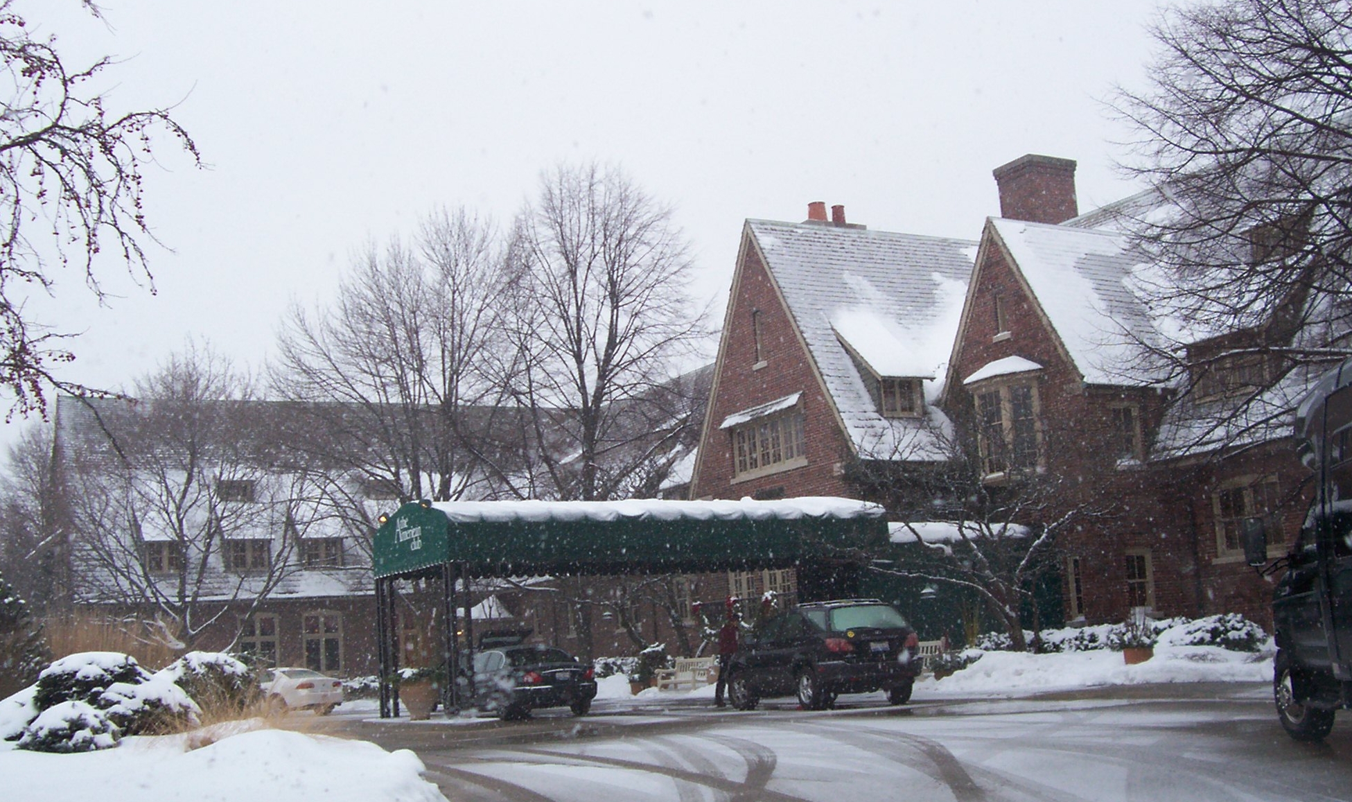
[2] Landmark name [3] Image Date listed Location City or town Summary 1 American Club 
May 22, 1978 High St.
43°44′23″N 87°46′51″W / 43.739722°N 87.780833°WKohler 2 John Balzer Wagon Works Complex 
December 23, 1993 818-820, 820A Pennsylvania Ave.
43°45′00″N 87°42′48″W / 43.75°N 87.713333°WSheboygan 3 Thomas M. and Bridget Blackstock House 
March 17, 1995 507 Washington Ct.
43°45′13″N 87°42′29″W / 43.753611°N 87.708056°WSheboygan 4 Byron (schooner) Shipwreck 
May 20, 2009 Address restricted Oostburg 5 Cole Historic District 
December 1, 1988 501 and 517 Monroe St. and 504, 508, and 516-518 Water St.
43°43′43″N 87°48′32″W / 43.728611°N 87.808889°WSheboygan Falls 6 Downtown Churches Historic District March 1, 2010 Generally bounded by Erie Ave., N. 6th St., Ontario Ave., and N. 7th St.
43°45′21″N 87°42′37″W / 43.755806°N 87.710392°WSheboygan 7 Downtown Historic District 
December 27, 1984 Roughly bounded by Broadway, Monroe, Pine, and Buffalo Sts., and the Sheboygan River
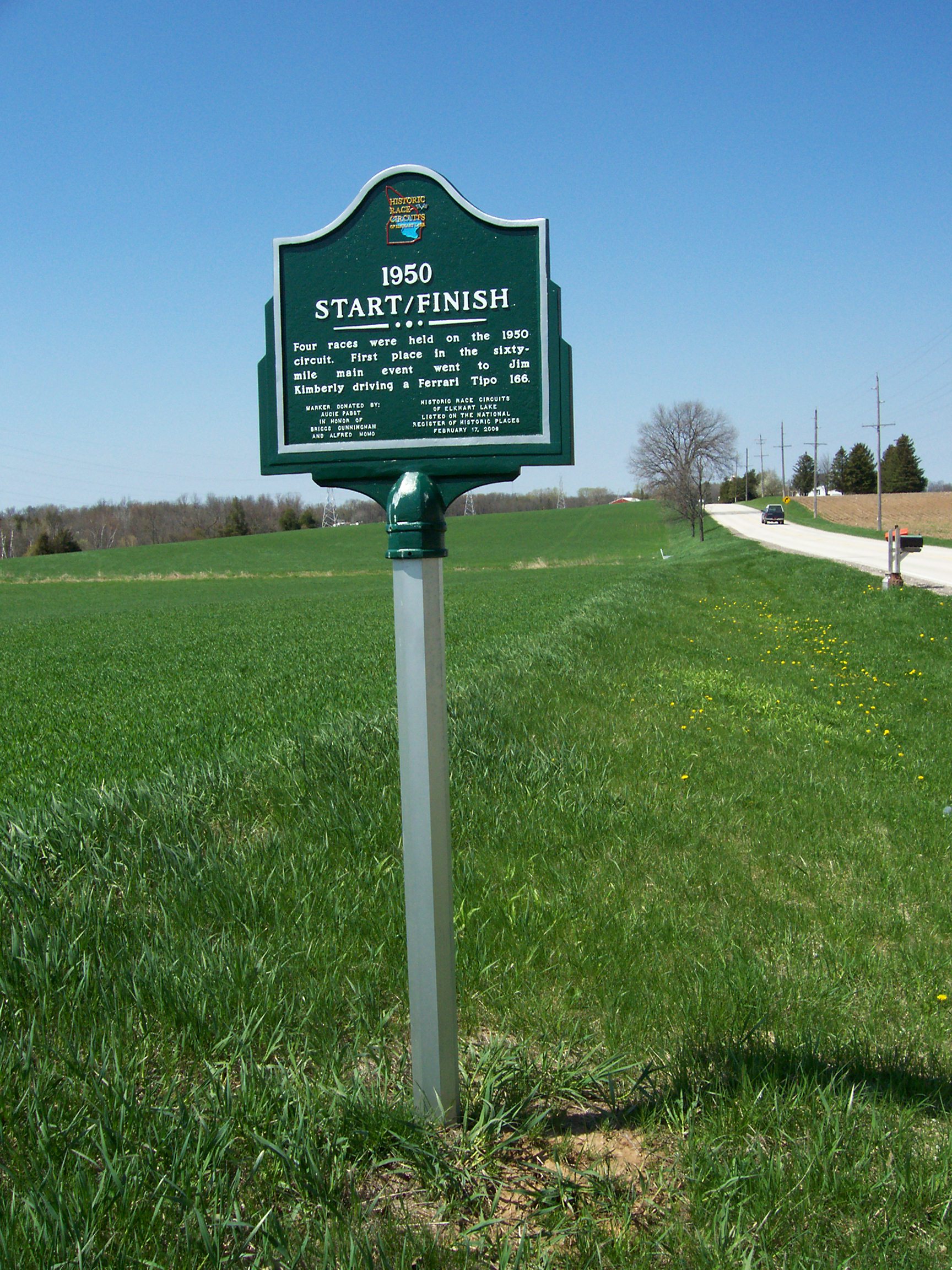
43°43′41″N 87°48′43″W / 43.728056°N 87.811944°WSheboygan Falls 8 Elkhart Lake Road Race Circuits 
February 17, 2006 Cty Hwys, J, P, JP, A, and Lake St.
43°49′40″N 88°01′45″W / 43.827778°N 88.029167°WElkhart Lake 9 Henry Store Foeste Building 
September 1, 1995 522 S. Eighth St.
43°44′57″N 87°42′47″W / 43.749167°N 87.713056°WSheboygan 10 Franklin Feed Mill 
April 11, 1985 Franklin Rd.
43°50′07″N 87°54′09″W / 43.835278°N 87.9025°WFranklin 11 Friendship House 
July 10, 1974 721 Ontario Ave.
43°45′18″N 87°42′42″W / 43.755°N 87.711667°WSheboygan 12 Garton Toy Company 
May 11, 2000 746, 810, 830 N. Water St., 1104 Wisconsin Ave.
43°45′12″N 87°43′08″W / 43.753333°N 87.718889°WSheboygan 13 Glenbeulah Mill/Grist Mill 
December 27, 1984 Gardner St.
43°47′47″N 88°02′37″W / 43.796389°N 88.043611°WGlenbeulah 14 Gooseville Mill/Grist Mill 
December 27, 1984 Silver Creek-Cascade Rd.
43°35′16″N 88°01′14″W / 43.587778°N 88.020556°WAdell 15 HETTY TAYLOR (shipwreck) June 1, 2005 Lake Michigan, 7 mi. SE of Sheboygan R.
43°41′00″N 87°39′17″W / 43.683333°N 87.654722°WSheboygan See [1] 16 Hotel Laack 
December 2, 1985 52 Stafford St.
43°44′50″N 87°58′39″W / 43.747222°N 87.9775°WPlymouth 17 Henry H. Huson House and Water Tower 
November 28, 1980 405 Collins St.
43°44′44″N 87°58′34″W / 43.745556°N 87.976111°WPlymouth 18 Henry and Charles Imig Block 
July 9, 1998 625-629 N. Eighth St.
43°45′11″N 87°42′45″W / 43.753056°N 87.7125°WSheboygan 19 Jung Carriage Factory 
July 10, 1974 829-835 Pennsylvania Ave.
43°44′59″N 87°42′52″W / 43.749722°N 87.714444°WSheboygan 20 Jung Shoe Manufacturing Company Factory 
January 22, 1992 620 S. Eighth St.
43°44′53″N 87°42′47″W / 43.748056°N 87.713056°WSheboygan 21 Kletzien Mound Group (47-SB-61) July 23, 1981 Address Restricted Sheboygan 22 Kohler Company Factory Complex 
April 6, 2001 444 Highland Dr.
43°44′28″N 87°46′34″W / 43.741111°N 87.776111°WKohler Complex of the Kohler Company 23 John Michael Kohler House 
November 30, 1982 608 New York Ave.
43°45′08″N 87°42′35″W / 43.752222°N 87.709722°WSheboygan 24 Mission House Historic District 
December 20, 1984 County Trunk M
43°50′31″N 87°52′44″W / 43.841944°N 87.878889°WHerman Now known as Lakeland College 25 Onion River Flouring Mill/Grist Mill December 27, 1984 Hwy 57
43°40′32″N 87°56′28″W / 43.675556°N 87.941111°WWaldo 26 Plymouth Post Office 
October 24, 2000 302 E. Main St.
43°44′57″N 87°58′37″W / 43.749167°N 87.976944°WPlymouth 27 Riverbend December 4, 1980 Lower Falls Rd.
43°43′42″N 87°47′21″W / 43.728333°N 87.789167°WKohler 28 Charles Robinson House December 20, 1984 Center St., Old Wade House State Park
43°46′34″N 88°05′10″W / 43.776111°N 88.086111°WGreenbush 29 Robinson-Herrling Sawmill 
December 27, 1984 Old Wade House State Park
43°46′42″N 88°05′08″W / 43.778333°N 88.085556°WGreenbush 30 Henry and Henriette Roth House April 29, 1993 822 Niagara Ave.
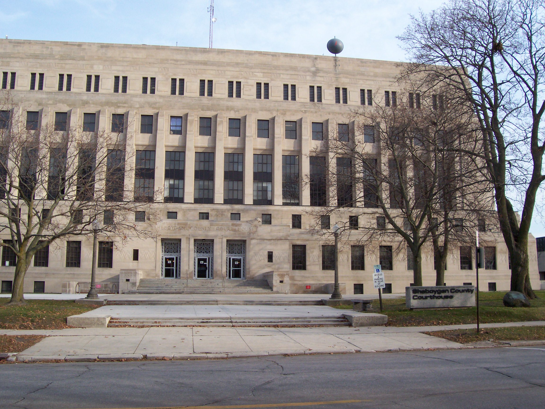
43°45′16″N 87°42′49″W / 43.754444°N 87.713611°WSheboygan 31 Sheboygan County Courthouse 
March 12, 1982 615 N. 6th St.
43°45′04″N 87°42′31″W / 43.751111°N 87.708611°WSheboygan 32 Sheboygan Post Office 
October 24, 2000 522 N. Ninth St.
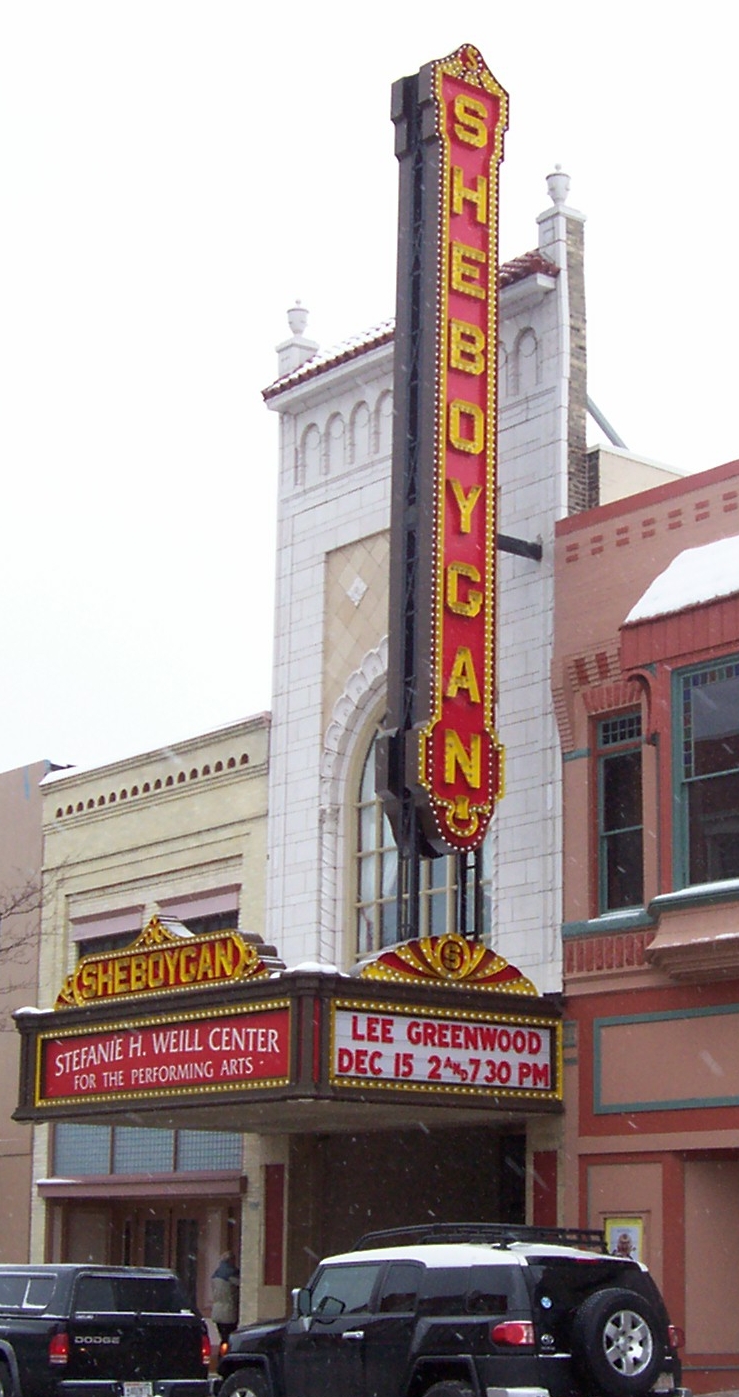
43°45′02″N 87°42′54″W / 43.750556°N 87.715°WSheboygan 33 Sheboygan Theater 
December 22, 1999 826 N. Eighth St.
43°45′14″N 87°42′47″W / 43.753889°N 87.713056°WSheboygan Stefanie H. Weill Center for the Performing Arts 34 St. Patrick's Roman Catholic Church 
September 8, 1983 WI 1
43°37′00″N 87°55′49″W / 43.616667°N 87.930278°WAdell 35 David Taylor House January 2, 1976 3110 Erie Ave.
43°45′10″N 87°44′52″W / 43.752778°N 87.747778°WSheboygan 36 Third Ward School 
September 3, 1981 1208 S. 8th St.
43°44′30″N 87°42′46″W / 43.741667°N 87.712778°WSheboygan 37 I. C. Thomas Drug Store 
July 10, 1974 632 N. 8th St.
43°45′06″N 87°42′47″W / 43.751667°N 87.713056°WSheboygan 38 Villa Laun January 28, 1982 402 Lake Side Park Dr.
43°49′27″N 88°01′50″W / 43.824167°N 88.030556°WElkhart Lake 39 Villa Von Baumbach November 30, 1982 754 Elkhart Lake Dr.
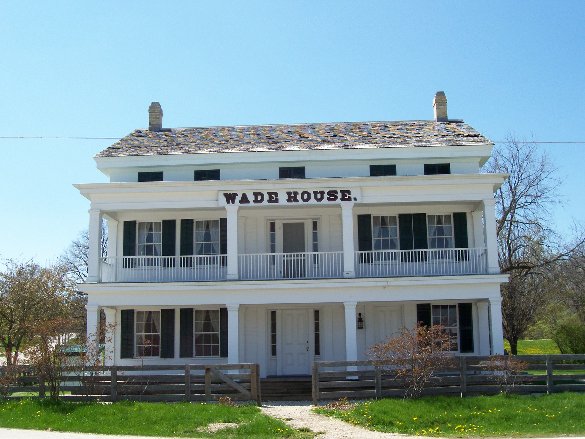
43°49′48″N 88°01′36″W / 43.83°N 88.026667°WElkhart Lake 40 Sylvanus Wade House 
October 26, 1971 At jct. of WI 23 and Kettle Maraine Dr. in Old Wade House State Park
43°46′36″N 88°05′06″W / 43.776667°N 88.085°WGreenbush 41 Windway July 28, 1988 CTH Y, N of CTH O
43°46′06″N 87°46′36″W / 43.768333°N 87.776667°WSheboygan 42 Wolff-Jung Company Shoe Factory 
January 30, 1992 531 S. Eighth St.
43°44′56″N 87°42′44″W / 43.748889°N 87.712222°WSheboygan See also
References
- ^ "National Register of Historic Places: Weekly List Actions". National Park Service, United States Department of the Interior. Retrieved on November 10, 2011.
- ^ Numbers represent an ordering by significant words. Various colorings, defined here, differentiate National Historic Landmark sites and National Register of Historic Places Districts from other NRHP buildings, structures, sites or objects.
- ^ "National Register Information System". National Register of Historic Places. National Park Service. . http://nrhp.focus.nps.gov/natreg/docs/All_Data.html.
U.S. National Register of Historic Places Topics Lists by states Alabama • Alaska • Arizona • Arkansas • California • Colorado • Connecticut • Delaware • Florida • Georgia • Hawaii • Idaho • Illinois • Indiana • Iowa • Kansas • Kentucky • Louisiana • Maine • Maryland • Massachusetts • Michigan • Minnesota • Mississippi • Missouri • Montana • Nebraska • Nevada • New Hampshire • New Jersey • New Mexico • New York • North Carolina • North Dakota • Ohio • Oklahoma • Oregon • Pennsylvania • Rhode Island • South Carolina • South Dakota • Tennessee • Texas • Utah • Vermont • Virginia • Washington • West Virginia • Wisconsin • WyomingLists by territories Lists by associated states Other Municipalities and communities of Sheboygan County, Wisconsin Cities 
Villages Adell | Cascade | Cedar Grove | Elkhart Lake | Glenbeulah | Howards Grove | Kohler | Oostburg | Random Lake | Waldo
Towns CDPs Gibbsville | Greenbush | Hingham
Unincorporated
communitiesBatavia | Dacada‡ | Franklin | German Corners | Gooseville | Haven | Johnsonville | St. Anna‡ | Silver Creek
Footnotes ‡This populated place also has portions in an adjacent county or counties
Categories:- Sheboygan County, Wisconsin
- Lists of historic places in Wisconsin
-


Wikimedia Foundation. 2010.