- Wood County, Wisconsin
-
Wood County, Wisconsin 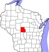
Location in the state of Wisconsin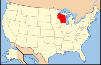
Wisconsin's location in the U.S.Founded 1856 Seat Wisconsin Rapids Largest city Marshfield Area
- Total
- Land
- Water
809 sq mi (2,095 km²)
793 sq mi (2,054 km²)
17 sq mi (44 km²), 2.06%Population
- (2000)
- Density
75,555
95/sq mi (32/km²)Website www.co.wood.wi.us Wood County is a county located in the U.S. state of Wisconsin. As of 2000, the population was 75,555. Its county seat is Wisconsin Rapids.[1] The United States Census Bureau's Wisconsin Rapids-Marshfield Micropolitan Statistical Area includes all of Wood County.
Contents
Geography
According to the U.S. Census Bureau, the county has a total area of 809 square miles (2,100 km2), of which 793 square miles (2,050 km2) is land and 17 square miles (44 km2) (2.06%) is water.
Major highways
 U.S. Highway 10
 Highway 13 (Wisconsin)
 Highway 34 (Wisconsin)
 Highway 54 (Wisconsin)
 Highway 73 (Wisconsin)
 Highway 80 (Wisconsin)
 Highway 97 (Wisconsin)
 Highway 173 (Wisconsin)
 Highway 186 (Wisconsin)
Adjacent counties
- Marathon County - north
- Portage County - east
- Adams County - southeast
- Juneau County - south
- Jackson County - southwest
- Clark County - northwest
Natural wildlife refuges
Demographics
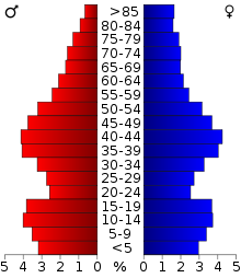 2000 Census Age Pyramid for Wood County.
Historical populations Census Pop. %± 1900 25,865 — 1910 30,583 18.2% 1920 34,643 13.3% 1930 37,865 9.3% 1940 44,465 17.4% 1950 50,500 13.6% 1960 59,105 17.0% 1970 65,362 10.6% 1980 72,799 11.4% 1990 73,605 1.1% 2000 75,555 2.6% 2010 74,749 −1.1% WI Counties 1900-1990 As of the census[2] of 2000, there were 75,555 people, 30,135 households, and 20,491 families residing in the county. The population density was 95 people per square mile (37/km²). There were 31,691 housing units at an average density of 40 per square mile (15/km²). The racial makeup of the county was 96.43% White, 0.27% Black or African American, 0.70% Native American, 1.61% Asian, 0.01% Pacific Islander, 0.30% from other races, and 0.69% from two or more races. 0.94% of the population were Hispanic or Latino of any race. 50.8% were of German, 8.5% Polish, 6.2% Norwegian, 5.2% American and 5.1% Irish ancestry according to Census 2000.
There were 30,135 households out of which 32.20% had children under the age of 18 living with them, 56.70% were married couples living together, 8.00% had a female householder with no husband present, and 32.00% were non-families. 27.20% of all households were made up of individuals and 11.40% had someone living alone who was 65 years of age or older. The average household size was 2.47 and the average family size was 3.01.
In the county the population was spread out with 25.70% under the age of 18, 7.70% from 18 to 24, 28.40% from 25 to 44, 22.90% from 45 to 64, and 15.30% who were 65 years of age or older. The median age was 38 years. For every 100 females there were 96.10 males. For every 100 females age 18 and over, there were 93.00 males.
Cities, villages, and towns
- Arpin
- Arpin (town)
- Auburndale (town)
- Auburndale
- Biron
- Cameron
- Cary
- Cranmoor
- Dexter
- Grand Rapids
- Hansen
- Hewitt
- Hiles
- Lincoln
- Marshfield
- Marshfield (town)
- Milladore
- Milladore (town)
- Nekoosa
- Pittsville
- Port Edwards (town)
- Port Edwards
- Remington
- Richfield
- Rock
- Rudolph (town)
- Rudolph
- Saratoga
- Seneca
- Sherry
- Sigel
- Vesper
- Wisconsin Rapids
- Wood
Census-designated places
- Babcock
- Lake Wazeecha
Unincorporated communities
- Bakerville
- Bethel
- Blenker
- Dexterville
- Eight Corners
- Kellner (partial)
- Lindsey
- Sherry
- Veedum
See also
References
- ^ "Find a County". National Association of Counties. http://www.naco.org/Counties/Pages/FindACounty.aspx. Retrieved 2011-06-07.
- ^ "American FactFinder". United States Census Bureau. http://factfinder.census.gov. Retrieved 2008-01-31.
External links
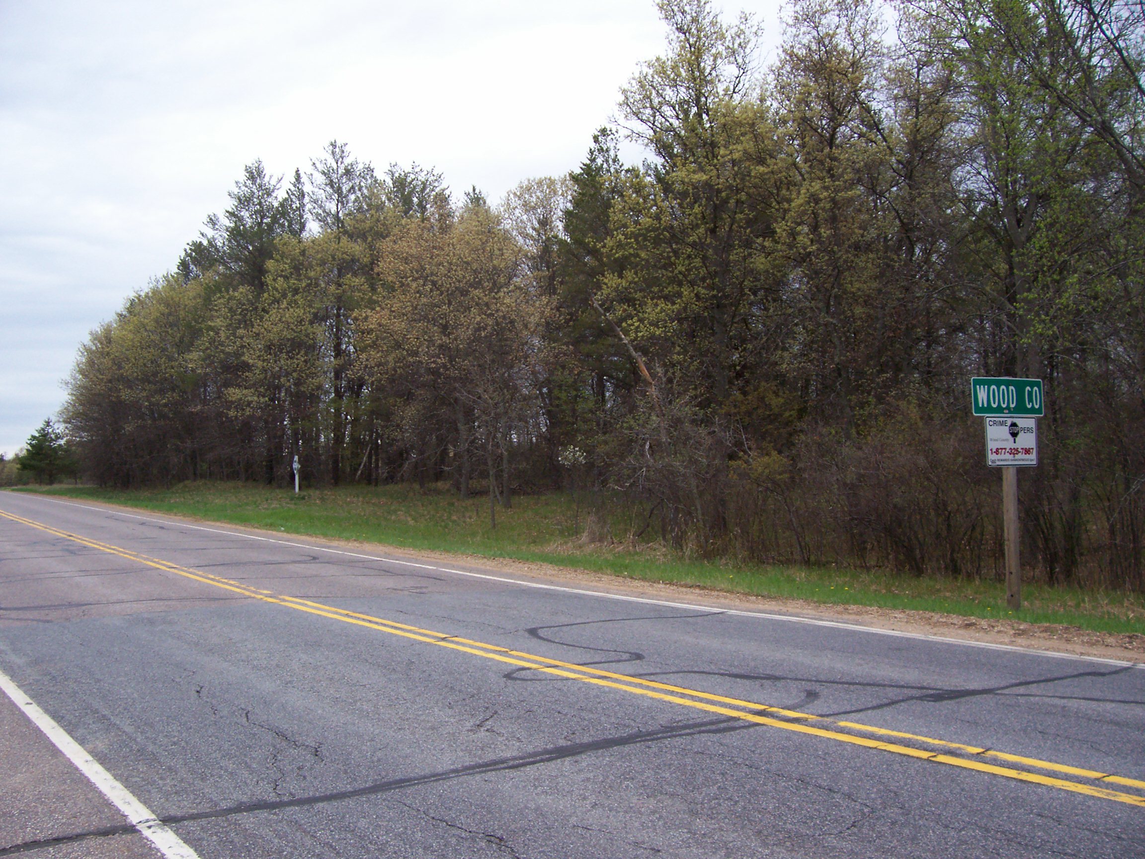
 County line sign along the Wisconsin River
Resources
Six foundation volumes that document and present the early history of Dane, Sauk, Wood, and Portage Counties. Titles include: Durrie, Daniel S. (Daniel Steele), 1819-1892 A History of Madison, the Capital of Wisconsin; Including the Four Lake Country (1874), A Standard History of Sauk County, Wisconsin: Volume I (1918), A Standard History of Sauk County, Wisconsin: Volume II (1918), Jones, George O. History of Wood County, Wisconsin (1923), Madison, Dane County and Surrounding Towns; Being a History and Guide to Places of Scenic Beauty and Historical Note ...(1877), and Rosholt, Malcolm Leviatt, 1907- Our County, our Story; Portage County, Wisconsin (1959).
A digital collection of books, pamphlets and photographs from Wisconsin Rapids, Wood County and central Wisconsin. Titles include: 100 years of pictorial & descriptive history of Wisconsin Rapids, Wisconsin by T. A. [Theodore Asa] Taylor (1939); History of Wood County, Wisconsin compiled by George O. Jones (1923); Grand Rapids : descriptive of Grand Rapids, Wood County, and the Wisconsin River by A. Decker (1907); Along the Wisconsin River : descriptive of the Wisconsin River Valley, its resources, industries and opportunities by A. Decker (1907); Art work of the Wisconsin River Valley (1901); Central Wisconsin's railroads : past and future by Ray Specht (1981); and Wood County place names by Robert S. Rudolph.

Clark County Marathon County 
Portage County  Wood County, Wisconsin

Jackson County Juneau County Adams County Wisconsin Rapids, Wisconsin Surrounding
communities(under 10,000) 
Counties Wood CountyMarshfield, WI Surrounding
communities(under 10,000) Counties Marathon | WoodMunicipalities and communities of Wood County, Wisconsin Cities 
Villages Arpin | Auburndale | Biron | Hewitt | Milladore‡ | Port Edwards | Rudolph | Vesper
Towns CDPs Babcock | Lake Wazeecha
Unincorporated
communitiesBakerville | Bethel | Blenker | Dexterville | Eight Corners | Kellner‡ | Lindsey | Sherry | Veedum
Footnotes ‡This populated place also has portions in an adjacent county or counties
Categories:- Wisconsin counties
- 1856 establishments in the United States
- Wood County, Wisconsin


Wikimedia Foundation. 2010.