- Clark County, Wisconsin
-
Clark County, Wisconsin 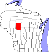
Location in the state of Wisconsin
Wisconsin's location in the U.S.Founded July 6, 1853 Named for William Clark, explorer who accompanied Meriwether Lewis on the Lewis and Clark Expedition Seat Neillsville Largest city Neillsville Area
- Total
- Land
- Water
1,219 sq mi (3,157 km²)
1,216 sq mi (3,148 km²)
3 sq mi (9 km²), 0.28%Population
- (2000)
- Density
33,557
28/sq mi (11/km²)Time zone Central: UTC-6/-5 Website www.co.clark.wi.us/ClarkCounty/ Clark County is a county located in the U.S. state of Wisconsin. As of 2000, the population was 33,557. Its county seat is Neillsville.[1]
Contents
Geography
According to the U.S. Census Bureau, the county has a total area of 1,219 square miles (3,157.2 km2), of which 1,216 square miles (3,149.4 km2) is land and 3 square miles (7.8 km2) (0.28%) is water.
Adjacent counties
- Taylor County – north
- Marathon County – east
- Wood County – southeast
- Jackson County – south
- Eau Claire County – west
- Chippewa County – northwest
Major highways
 U.S. Highway 12
 U.S. Highway 10
 Highway 29 (Wisconsin)
 Highway 73 (Wisconsin)
 Highway 13 (Wisconsin)
 Highway 95 (Wisconsin)
 Highway 98 (Wisconsin)
Demographics
 2000 Census Age Pyramid for Clark County.
Historical populations Census Pop. %± 1900 25,848 — 1910 30,074 16.3% 1920 35,120 16.8% 1930 34,165 −2.7% 1940 33,972 −0.6% 1950 32,459 −4.5% 1960 31,527 −2.9% 1970 30,361 −3.7% 1980 32,910 8.4% 1990 31,647 −3.8% 2000 33,557 6.0% 2010 34,690 3.4% WI Counties 1900-1990 As of the census[2] of 2000, there were 33,557 people, 12,047 households, and 8,673 families residing in the county. The population density was 28 people per square mile (11/km²). There were 13,531 housing units at an average density of 11 per square mile (4/km²). The racial makeup of the county was 98.05% White, 0.13% Black or African American, 0.48% Native American, 0.30% Asian, 0.01% Pacific Islander, 0.56% from other races, and 0.47% from two or more races. 1.20% of the population were Hispanic or Latino of any race. 54.0% were of German, 9.0% Polish, 6.2% Norwegian and 6.1% United States or American ancestry according to Census 2000. 6.62% reported speaking German, Pennsylvania German, or Dutch at home; an additional 1.34% speak Spanish.[1]
There were 12,047 households out of which 35.00% had children under the age of 18 living with them, 61.20% were married couples living together, 6.50% had a female householder with no husband present, and 28.00% were non-families. 23.80% of all households were made up of individuals and 12.60% had someone living alone who was 65 years of age or older. The average household size was 2.73 and the average family size was 3.27.
In the county, the population was spread out with 29.90% under the age of 18, 7.70% from 18 to 24, 26.20% from 25 to 44, 20.20% from 45 to 64, and 16.00% who were 65 years of age or older. The median age was 36 years. For every 100 females there were 100.50 males. For every 100 females age 18 and over, there were 98.70 males.
Cities, villages, and towns
Cities and villages
Cities - Abbotsford (partial)
- Colby (partial)
- Greenwood
- Loyal
- Neillsville
- Owen
- Thorp
- Stanley (partial)
Villages - Curtiss
- Dorchester (partial)
- Granton
- Unity (partial)
- Withee
Towns
- Hoard
- Levis
- Longwood
- Loyal
- Lynn
- Mayville
- Mead
- Mentor
- Pine Valley
- Reseburg
- Seif
Unincorporated communities
- Atwood
- Christie
- Chili
- Columbia
- Globe
- Hemlock
- Humbird
- Lombard
- Nevins
- Reseburg
- Riplinger
- Shortville
- Sidney
- Veefkind
- Willard
See also
References
- ^ "Find a County". National Association of Counties. http://www.naco.org/Counties/Pages/FindACounty.aspx. Retrieved 2011-06-07.
- ^ "American FactFinder". United States Census Bureau. http://factfinder.census.gov. Retrieved 2008-01-31.
External links

Chippewa County Taylor County Eau Claire County 
Marathon County  Clark County, Wisconsin

Jackson County Wood County Municipalities and communities of Clark County, Wisconsin Cities Abbotsford‡ | Colby‡ | Greenwood | Loyal | Neillsville | Owen | Stanley‡ | Thorp

Villages Curtiss | Dorchester‡ | Granton | Unity‡ | Withee
Towns Beaver | Butler | Colby | Dewhurst | Eaton | Foster | Fremont | Grant | Green Grove | Hendren | Hewett | Hixon | Hoard | Levis | Longwood | Loyal | Lynn | Mayville | Mead | Mentor | Pine Valley | Reseburg | Seif | Sherman | Sherwood | Thorp | Unity | Warner | Washburn | Weston | Withee | Worden | York
CDPs Chili | Humbird
Unincorporated
communitiesFootnotes ‡This populated place also has portions in an adjacent county or counties
Categories:- Wisconsin counties
- Clark County, Wisconsin
- 1853 establishments in the United States


Wikimedia Foundation. 2010.