- Dunn County, Wisconsin
-
This article is about the county in Wisconsin. For the county in North Dakota, see Dunn County, North Dakota.
Dunn County, Wisconsin 
Seal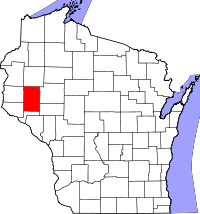
Location in the state of Wisconsin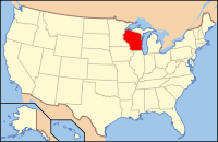
Wisconsin's location in the U.S.Founded February 3, 1854, separated from Chippewa Co.[1][2] Named for State Senator Charles Dunn Seat Menomonie Largest city Menomonie Area
- Total
- Land
- Water
864 sq mi (2,238 km²)
852 sq mi (2,207 km²)
12 sq mi (31 km²), 1.38%Population
- (2010)
- Density
43,587
47/sq mi (18/km²)Time zone Central: UTC-6/-5 Website www.co.dunn.wi.us/ Dunn County is a county in the U.S. state of Wisconsin. As of 2010, the population was 43,857. Its county seat is Menomonie.[3] The United States Census Bureau's Menomonie Micropolitan Statistical Area includes all of Dunn County. The Menomonie MSA, together with the Eau Claire Metropolitan Statistical Area to the east, forms the Census Bureau's Eau Claire-Menomonie Combined Statistical Area.
Contents
Geography
According to the U.S. Census Bureau, the county has a total area of 864 square miles (2,237.7 km2), of which 852 square miles (2,206.7 km2) is land and 12 square miles (31.1 km2) (1.38%) is water.
Adjacent counties
- Barron County - north
- Chippewa County - east
- Eau Claire County - southeast
- Pepin County - south
- Pierce County - southwest
- St. Croix County - west
- Polk County - northwest
Major highways
 Interstate 94
 U.S. Highway 12
 Highway 29 (Wisconsin)
 Highway 25 (Wisconsin)
 Highway 40 (Wisconsin)
 Highway 64 (Wisconsin)
 Highway 85 (Wisconsin)
 Highway 72 (Wisconsin)
 Highway 170 (Wisconsin)
 Highway 79 (Wisconsin)
Demographics
 2000 Census Age Pyramid for Dunn County.
Historical populations Census Pop. %± 1900 25,043 — 1910 25,260 0.9% 1920 26,970 6.8% 1930 27,037 0.2% 1940 27,375 1.3% 1950 27,341 −0.1% 1960 26,156 −4.3% 1970 29,154 11.5% 1980 34,314 17.7% 1990 35,909 4.6% 2000 39,858 11.0% 2010 43,857 10.0% WI Counties 1900-1990 As of the census[4] of 2000, there were 39,858 people, 14,337 households, and 9,261 families residing in the county. The population density was 47 people per square mile (18/km²). There were 15,277 housing units at an average density of 18 per square mile (7/km²). The racial makeup of the county was 96.08% White, 0.34% Black or African American, 0.27% Native American, 2.13% Asian, 0.01% Pacific Islander, 0.37% from other races, and 0.80% from two or more races. 0.84% of the population were Hispanic or Latino of any race. 39.3% were of German, 22.6% Norwegian and 5.1% Irish ancestry according to Census 2000. 95.7% spoke English, 1.6% Spanish and 1.5% Hmong as their first language.
There were 14,337 households out of which 31.40% had children under the age of 18 living with them, 54.10% were married couples living together, 6.90% had a female householder with no husband present, and 35.40% were non-families. 24.40% of all households were made up of individuals and 9.00% had someone living alone who was 65 years of age or older. The average household size was 2.57 and the average family size was 3.07.
In the county, the population was spread out with 23.30% under the age of 18, 19.80% from 18 to 24, 25.70% from 25 to 44, 19.80% from 45 to 64, and 11.20% who were 65 years of age or older. The median age was 31 years. For every 100 females there were 101.70 males. For every 100 females age 18 and over, there were 102.20 males.
Cities, villages, and towns
 Dunn County Government Center, Menomonie.
 Old farmhouse in Dunn County.
- Boyceville (village)
- Colfax (town)
- Colfax (village)
- Downing
- Dunn
- Eau Galle
- Elk Mound (town)
- Elk Mound
- Grant
- Hay River
- Knapp
- Lucas
- Menomonie (town)
- Menomonie
- New Haven
- Otter Creek
- Peru
- Red Cedar
- Ridgeland
- Rock Creek
- Sand Creek
- Sheridan
- Sherman
- Spring Brook
- Stanton
- Tainter
- Tiffany
- Weston
- Wheeler
- Wilson
Census-designated places
Unincorporated communities
- Caryville
- Cedar Falls
- Comfort
- Connorsville
- Downsville
- Dunnville[1]
- Eau Galle
- Falls City
- Graytown (partial)
- Hatchville (partial)
- Irvington
- Meridean
- Norton
- Red Cedar
- Rock Falls
- Rusk
- Sand Creek
- Weston
See also
References
- ^ Wisconsin Blue Book 1991-1992, p. 731; cited there as from "Wisconsin Historical Records, Origin and Legislative History of County Boundaries in Wisconsin, 1942."
- ^ When Counties Originated from rootsweb.com's Oconto County, Wisconsin webpage.
- ^ "Find a County". National Association of Counties. http://www.naco.org/Counties/Pages/FindACounty.aspx. Retrieved 2011-06-07.
- ^ "American FactFinder". United States Census Bureau. http://factfinder.census.gov. Retrieved 2008-01-31.
External links
- Dunn County, Wisconsin website
- Dunn County Historical Society
- Menomonie Visitors Guide
- Dunn County Visitors Guide
- Dunn County Restaurant Guide
- Dunn County Wisconsin Visitors Guide

Polk County Barron County St. Croix County 
Chippewa County  Dunn County, Wisconsin

Pierce County Pepin County Eau Claire County Menomonie, Wisconsin Surrounding
communities(under 10,000) 
Counties Dunn CountyMunicipalities and communities of Dunn County, Wisconsin City 
Villages Towns CDPs Unincorporated
communitiesCaryville | Cedar Falls | Comfort | Connorsville | Dunnville | Eau Galle | Falls City | Graytown‡ | Hatchville‡ | Irvington | Meridean | Norton | Red Cedar | Rock Falls | Rusk | Sand Creek | Weston
Footnote ‡This populated place also has portions in an adjacent county or counties
Categories:- Wisconsin counties
- Dunn County, Wisconsin
- 1854 establishments in the United States


Wikimedia Foundation. 2010.