- Oconto County, Wisconsin
-
Oconto County, Wisconsin 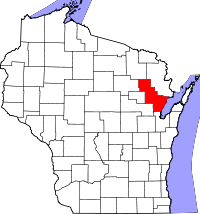
Location in the state of Wisconsin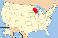
Wisconsin's location in the U.S.Founded information needed Seat Oconto Largest city Oconto Area
- Total
- Land
- Water
1,149 sq mi (2,976 km²)
998 sq mi (2,585 km²)
151 sq mi (391 km²), 13.15%Population
- (2000)
- Density
35,634
36/sq mi (14/km²)Time zone Central: UTC-6/-5 Website www.co.oconto.wi.us  Rural Oconto County in fall
Oconto County is a county in the U.S. state of Wisconsin. As of 2000, the population was 35,634. Its county seat is Oconto.[1]
Oconto County is part of the Green Bay Metropolitan Statistical Area. It was established in 1851.[2]
Contents
Geography
According to the U.S. Census Bureau, the county has a total area of 1,149 square miles (2,980 km2), of which 998 square miles (2,580 km2) is land and 151 square miles (390 km2) (13.15%) is water.
Adjacent counties
- Marinette County - northeast
- Brown County - south
- Shawano County - southwest
- Menominee County - west
- Langlade County - west
- Forest County - northwest
Major highways
 U.S. Highway 41
 U.S. Highway 141
 Highway 22 (Wisconsin)
 Highway 32 (Wisconsin)
 Highway 64 (Wisconsin)
National protected area
- Nicolet National Forest (part)
Demographics
 2000 Census Age Pyramid for Oconto County.
Historical populations Census Pop. %± 1900 20,874 — 1910 25,657 22.9% 1920 27,104 5.6% 1930 26,386 −2.6% 1940 27,075 2.6% 1950 26,238 −3.1% 1960 25,110 −4.3% 1970 25,553 1.8% 1980 28,947 13.3% 1990 30,226 4.4% 2000 35,634 17.9% 2010 37,660 5.7% WI Counties 1900-1990 
As of the census[3] of 2000, there were 35,634 people, 13,979 households, and 10,050 families residing in the county. The population density was 36 people per square mile (14/km²). There were 19,812 housing units at an average density of 20 per square mile (8/km²). The racial makeup of the county was 97.76% White, 0.13% Black or African American, 0.78% Native American, 0.20% Asian, 0.01% Pacific Islander, 0.24% from other races, and 0.88% from two or more races. 0.67% of the population were Hispanic or Latino of any race. 42.9% were of German, 11.8% Polish, 6.0% French and 5.6% American ancestry according to Census 2000.
There were 13,979 households out of which 32.20% had children under the age of 18 living with them, 60.70% were married couples living together, 6.90% had a female householder with no husband present, and 28.10% were non-families. 23.50% of all households were made up of individuals and 10.70% had someone living alone who was 65 years of age or older. The average household size was 2.52 and the average family size was 2.97.
In the county, the population was spread out with 25.70% under the age of 18, 6.40% from 18 to 24, 28.70% from 25 to 44, 24.00% from 45 to 64, and 15.10% who were 65 years of age or older. The median age was 39 years. For every 100 females there were 101.30 males. For every 100 females age 18 and over, there were 99.70 males.
Oconto County is perennially among the poorest counties in Wisconsin. Stagnant growth turned to negative growth in the early years of the 21st century as employers left the region. Oconto County had an unemployment rate of over 10% in 2004.[citation needed]
History
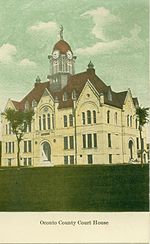 The Oconto County Court House, circa 1910
First visited by French explorers in the 17th century, Oconto County is among the oldest settlements in Wisconsin. Father Claude-Jean Allouez of the Roman Catholic Jesuit order said the first Mass in Oconto. Among the first settlers was Joseph Tourtilott, who explored much of the Oconto River watershed. Many of Tourtilott's descendants continue to reside in Oconto County, which has the highest percentage of residents with French ancestry in Wisconsin.[citation needed]
Cities, villages, and towns
Cities
Villages
Towns
- Abrams
- Bagley
- Brazeau
- Breed
- Chase
- Doty
- Gillett (town)
- How
- Lakewood
- Lena (town)
- Little River
- Little Suamico
- Maple Valley
- Morgan
- Mountain
- Oconto Falls (town)
- Oconto (town)
- Pensaukee
- Riverview
- Spruce
- Stiles
- Townsend
- Underhill
Unincorporated communities
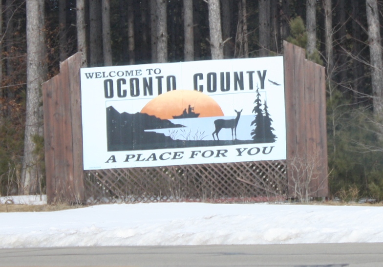
 Oconto County sign
- Abrams
- Breed
- County Line (partial)
- Hayes
- Klondike
- Krakow (partial)
- Lakewood
- Little Suamico
- Morgan
- Mountain
- Oak Orchard
- Pensaukee
- Sampson
- Sobieski
- Sobieski Corners
- Spruce
- Stiles
- Stiles Junction
- Townsend
- Underhill
See also
References
- ^ "Find a County". National Association of Counties. http://www.naco.org/Counties/Pages/FindACounty.aspx. Retrieved 2011-06-07.
- ^ Columbia-Lippincott Gazeteer, (New York:Columbia University Press, 1952) p. 1364
- ^ "American FactFinder". United States Census Bureau. http://factfinder.census.gov. Retrieved 2008-01-31.
External links

Forest County Marinette County Langlade County and Menominee County 
Green Bay  Oconto County, Wisconsin

Shawano County Brown County Municipalities and communities of Oconto County, Wisconsin Cities 
Villages Towns CDPs Unincorporated
communitiesBreed | County Line‡ | Hayes | Klondike | Little Suamico | Morgan | Oak Orchard | Pensaukee | Sampson | Sobieski Corners | Spruce | Stiles | Stiles Junction | Underhill
Footnotes ‡This populated place also has portions in an adjacent county or counties
Categories:- Wisconsin counties
- Oconto County, Wisconsin
- Green Bay metropolitan area
- 1851 establishments in the United States


Wikimedia Foundation. 2010.