- Door Peninsula
-
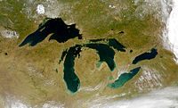
The Door Peninsula is a peninsula in eastern Wisconsin, separating the southern part of the Green Bay from Lake Michigan. The peninsula begins in northern Brown and Kewaunee counties and proceeds northeast to include all of Door County. It is the western portion of the Niagara Escarpment. Well known for its cherry and apple orchards, the Door Peninsula is a popular tourism destination. With the 1882 completion of the Sturgeon Bay Ship Canal, the northern half of the peninsula became an island.[1]
Limestone outcroppings of the Niagara Escarpment are visible on both shores of the peninsula, but are larger and more prominent on the Green Bay side as seen at the Bayshore Blufflands. Progressions of dunes have created much of the rest of the shoreline, especially on the easterly side. Flora along the shore provides clear evidence of plant succession. The middle of the peninsula is mostly flat, cultivated land. Beyond the northern tip of the peninsula are a succession of islands, the largest of which is Washington Island. The partially submerged ridge extends further north, becoming the Garden Peninsula in Upper Michigan.[2]
History
Archaeological evidence shows habitation of the peninsula and its islands by several different Native American groups. Two locations on the peninsula claim to be the landing site of French explorer Jean Nicolet in 1634, who was searching for a water route through North America to Asia: Horseshoe Island, which is part of Peninsula State Park, and Red Banks, which is about 7 miles north of what is now Green Bay.[3] Nicolet is remembered in Wisconsin lore for having mistaken the Ho-Chunk Indians for Asians and celebrating, believing he had reached the Far East. Nicolet had heard long before coming that the people living along these shores were called Winnebago ("the people from the stinking water") and, perhaps erroneously, "the People of the Sea". He concluded that this name meant they were from or living near the Pacific Ocean with its aromatic salt air and that they would be a direct link to the people of China, if not from China.[4]
The name of the peninsula and the county comes from the name of a route between Green Bay and Lake Michigan. Humans, whether Native Americans, early explorers, or American ship captains, have been well aware of the dangerous water passage that lies between the Door Peninsula and Washington Island, connecting the bay to the rest of Lake Michigan. This small strait is now littered with shipwrecks. It was named by the Native Americans and translated into French as Porte des Morts: in English, "Death's Door".
Notes
External links
- Door County tourism information from TravelWisconsin.com
- Door County Chamber of Commerce
Great Lakes of North America Main lakes 
Secondary lakes Waterways Detroit River • Erie Canal • French River • Great Lakes Waterway • Niagara River • Nipigon River • St. Clair River • Saint Lawrence River • Saint Lawrence Seaway • St. Marys River • Soo Locks • Straits of Mackinac • Trent–Severn Waterway • Welland CanalLists of islands Historic geology Lakeshores Related topics Basin • Bays of the Great Lakes • Great Lakes region • Georgian Bay • Great Lake ships • Isle Royale • Lake effect • Manitoulin Island • Megalopolis • Quebec City – Windsor Corridor • Settlements • Shipwrecks • Tall shipsCategories:- Peninsulas of Wisconsin
- Geography of Brown County, Wisconsin
- Geography of Door County, Wisconsin
- Geography of Kewaunee County, Wisconsin
- Niagara Escarpment
- Lake Michigan
Wikimedia Foundation. 2010.

