- Elk Mound, Wisconsin
Infobox Settlement
official_name = Elk Mound, Wisconsin
settlement_type =Town
nickname =
motto =
imagesize =
image_caption =
image_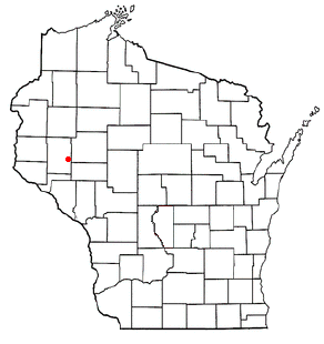
mapsize = 250px
map_caption = Location of Kewaunee, Wisconsin
mapsize1 =
map_caption1 =subdivision_type = Country
subdivision_name =United States
subdivision_type1 = State
subdivision_name1 =Wisconsin
subdivision_type2 = County
subdivision_name2 = Dunngovernment_footnotes =
government_type =
leader_title =
leader_name =
leader_title1 =
leader_name1 =
established_title =
established_date =unit_pref = Imperial
area_footnotes =area_magnitude =
area_total_km2 = 87.3
area_land_km2 = 87.3
area_water_km2 = 0.1
area_total_sq_mi = 33.7
area_land_sq_mi = 33.7
area_water_sq_mi = 0.0population_as_of = 2000
population_footnotes =
population_total = 1121
population_density_km2 = 12.8
population_density_sq_mi = 33.3timezone = Central (CST)
utc_offset = -6
timezone_DST = CDT
utc_offset_DST = -5
elevation_footnotes = GR|3
elevation_m = 310
elevation_ft = 1017
latd = 44 |latm = 54 |lats = 10 |latNS = N
longd = 91 |longm = 42 |longs = 29 |longEW = Wpostal_code_type =
postal_code =
area_code =
blank_name = FIPS code
blank_info = 55-23350GR|2
blank1_name = GNIS feature ID
blank1_info = 1583152GR|3
website =
footnotes =Elk Mound is a village in Dunn County,
Wisconsin ,United States . The population was 785 at the 2000 census. The village, named forElk Mound , is located within the Town of Elk Mound.Geography
Elk Mound is located at coor dms|44|52|23|N|91|41|23|W|city (44.873216, -91.689885)GR|1.
According to the
United States Census Bureau , the village has a total area of 2.3square mile s (5.9km² ).None of the area is covered with water.The village of Elk Mound is located in the Chippewa Valley, between the cities of Eau Claire, Menomonie, and Chippewa Falls.
Demographics
As of the
census GR|2 of 2000, there were 785 people, 300 households, and 225 families residing in the village. Thepopulation density was 345.3 people per square mile (133.5/km²). There were 311 housing units at an average density of 136.8/sq mi (52.9/km²). The racial makeup of the village was 96.18% White, 0.38% Native American, 2.17% Asian, and 1.27% from two or more races. 0.64% of the population wereHispanic orLatino of any race.There were 300 households out of which 41.3% had children under the age of 18 living with them, 54.0% were married couples living together, 16.3% had a female householder with no husband present, and 24.7% were non-families. 16.0% of all households were made up of individuals and 5.3% had someone living alone who was 65 years of age or older. The average household size was 2.62 and the average family size was 2.95.
In the village the population was spread out with 29.0% under the age of 18, 11.1% from 18 to 24, 33.1% from 25 to 44, 18.3% from 45 to 64, and 8.4% who were 65 years of age or older. The median age was 31 years. For every 100 females there were 90.5 males. For every 100 females age 18 and over, there were 96.8 males.
The median income for a household in the village was $36,513, and the median income for a family was $39,318. Males had a median income of $28,693 versus $21,780 for females. The
per capita income for the village was $16,156. About 5.6% of families and 6.4% of the population were below thepoverty line , including 9.5% of those under age 18 and none of those age 65 or over.Economy
Although farming has been the dominant occupation within the district, in recent years several small businesses have been established in the community. Industry, businesses and services are available in the neighboring cities. Many housing developments have been established both within and outside the village, and these developments continue to expand.
Education
The school district of Elk Mound is located within the village of Elk Mound. The district has an approximate enrollment of 928 students distributed between three schools. The elementary school houses preschool through 4th grade. The middle school houses 5th through 8th grades. The high school houses 9th-12th grades. Enrollment at the elementary has shown an upward trend, and district-wide enrollment has increased slightly over the past several years.
Churches
Elk Mound is the home of the Cornerstone Apostolic Church, pastored by Pastor Roy Clickner. Part of the UPC orginazation, It is a small community serving church with about 200 members. You can visit the church's website by going to:
*http://www.emcornerstone.comReferences
External links
* [http://www.elk-mound.org/ Village of Elk Mound]
* [http://www.elkmound.k12.wi.us/ Elk Mound School District]
*http://www.emcornerstone.com
Wikimedia Foundation. 2010.