- National Register of Historic Places listings in Wood County, Wisconsin
-
Buildings, sites, districts, and objects in Wood County listed on the National Register of Historic Places
-
- This National Park Service list is complete through NPS recent listings posted November 10, 2011.[1]
This document is intended to provide a comprehensive listing of entries in the National Register of Historic Places that are located in Wood County, Wisconsin. The locations of National Register properties, the latitude and longitude coordinates of which are included below, may be seen in a Google map.[2]
[3] Landmark name [4] Image Date listed Location City or town Summary 1 Central Wisconsin State Fair Round Barn 
March 21, 1997 Jct. of Vine Ave. and E. 17th St.
44°39′08″N 90°10′27″W / 44.652222°N 90.174167°WMarshfield The barn was built in 1916 to be the focal point of the fairground. 2 Columbia Park Band Shell September 3, 2008 201 W. Arnold St.
44°40′10″N 90°10′28″W / 44.669568°N 90.174408°WMarshfield 3 Elizabeth Daly House November 4, 1993 641 Baker St.
44°23′36″N 89°49′06″W / 44.393333°N 89.818333°WWisconsin Rapids 4 Marshfield Central Avenue Historic District 
November 4, 1993 Roughly, Central Ave. from Depot St. to Third St.
44°39′59″N 90°10′26″W / 44.666389°N 90.173889°WMarshfield Many old brick businesses built after the fire of 1887. JFK, Patsy Cline, and possibly John Dillinger stayed in the Charles Hotel.[5] 5 Marshfield Post Office 
October 24, 2000 202 S. Chestnut Ave.
44°39′59″N 90°10′35″W / 44.666389°N 90.176389°WMarshfield Example of classical revival architecture, built around 1930. 6 Marshfield Senior High School 
April 6, 2005 900 E. Fourth St.
44°39′38″N 90°09′55″W / 44.660556°N 90.165278°WMarshfield 1940 art deco building with observatory, designed by Eschweiler & Eschweiler. 7 Parkin Ice Cream Company 
January 8, 2009 108 W. 9th St.
44°39′35″N 90°10′44″W / 44.659628°N 90.179022°WMarshfield Former ice cream plant built in 1941. The Parkins were involved in the movement to create a national dairy marketing compact.[6][7] 8 Pleasant Hill Residential Historic District 
July 5, 2000 Roughly bounded by E. First St., Ash Ave., E. Fourth St., and S. Cedar Ave.
44°39′49″N 90°10′12″W / 44.663611°N 90.17°WMarshfield This residential district includes a variety of large old homes. Some were built by businessmen, within walking distance of their stores on Central Avenue.[5] 9 Willard D. Purdy Junior High and Vocational School 
September 8, 1992 110 W. Third St.
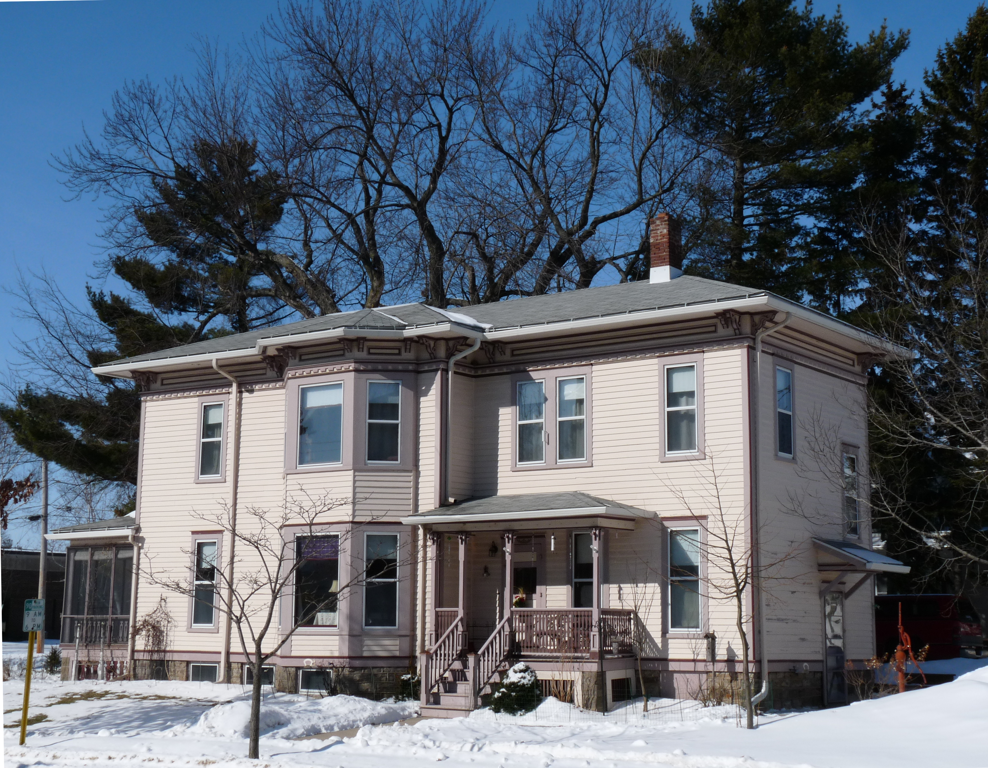
44°39′52″N 90°10′33″W / 44.664444°N 90.175833°WMarshfield 1919 building in collegiate gothic style, named for a WWI soldier from Marshfield who threw himself on a grenade to save his comrades.[8] 10 Hamilton and Catherine Roddis House 
July 5, 2002 1108 E. 4th St.
44°39′33″N 90°09′42″W / 44.659117°N 90.161767°WMarshfield This Dutch Colonial Revival style home was begun in 1915 by wood-products manufacturer and civic leader Roddis.[9] 11 Skunk Hill (Tah-qua-kik) Ceremonial Community 
July 5, 2002 Address Restricted Arpin Former Potawatomi village, with cemeteries and dance rings still visible. 12 Soo Line Steam Locomotive 2442 
May 13, 2009 circa 1800 S. Central Ave.
44°39′05″N 90°11′04″W / 44.651425°N 90.184461°WMarshfield Built in 1911, this steam locomotive hauled freight for the Wisconsin Central Railroad from 1911 to 1956.[10] 13 Gov. William H. Upham House December 12, 1976 212 W. 3rd St.
44°39′56″N 90°10′38″W / 44.665556°N 90.177222°WMarshfield 14 Upham House Historic District 
July 30, 2008 Generally bounded by W. 3rd St., S. Walnut Ave., W. 4th St., and S. Chestnut Ave.
44°39′58″N 90°10′40″W / 44.666089°N 90.177831°WMarshfield This district includes some of the oldest homes in Marshfield, built as early as 1880. Some survived the fire of 1887.[5] 15 Wahle-Laird House 
January 30, 1992 208 S. Cherry Ave.
44°39′50″N 90°10′14″W / 44.663889°N 90.170556°WMarshfield Childhood home of Melvin R. Laird, among others. Example of Colonial Revival style. 16 Wakeley's Tavern December 27, 1974 W end of Wakeley Rd.
44°17′58″N 89°53′27″W / 44.299444°N 89.890833°WNekoosa 17 Wakely Road Bridge April 5, 2001 Wakely Road over Wakely Creek
44°18′00″N 89°53′19″W / 44.3°N 89.888611°WSaratoga 18 Weinbrenner Shoe Factory 
August 27, 2008 305 W. 3rd St.
44°39′58″N 90°10′40″W / 44.666106°N 90.177886°WMarshfield Built in 1935 during Great Depression by the city and the WPA to draw jobs to town. As of 2010, still making boots! 19 West Fifth Street-West Sixth Street Historic District 
February 14, 2006 W. Fifth St. and W. Sixth St., generally bounded by Adams Ave. and Oak Ave.
44°39′56″N 90°11′13″W / 44.665556°N 90.186944°WMarshfield Homes built starting in 1900 in a wide variety of styles.[5][11] 20 West Park Street Historic District June 29, 2000 300-417 West Park St.
44°39′40″N 90°10′48″W / 44.661111°N 90.18°WMarshfield References
- ^ "National Register of Historic Places: Weekly List Actions". National Park Service, United States Department of the Interior. Retrieved on November 10, 2011.
- ^ The latitude and longitude information provided is primarily from the National Register Information System, and has been found to be fairly accurate for about 99% of listings. For 1%, the location info may be way off. We seek to correct the coordinate information wherever it is found to be erroneous. Please leave a note in the Discussion page for this article if you believe any specific location is incorrect.
- ^ Numbers represent an ordering by significant words. Various colorings, defined here, differentiate National Historic Landmark sites and National Register of Historic Places Districts from other NRHP buildings, structures, sites or objects.
- ^ "National Register Information System". National Register of Historic Places. National Park Service. . http://nrhp.focus.nps.gov/natreg/docs/All_Data.html.
- ^ a b c d "Marshfield Historic District Walking Tour Brochures", Marshfield Historic Preservation Committee, Marshfield Wisconsin. Retrieved on 2010-10-08.
- ^ "Historic Parkin Place", Blue Heron BrewPub, Marshfield Wisconsin. Retrieved on 2010-10-10.
- ^ "Parkin Place Historic Restoration", Tom Brown, architect, Stevens Point, Wisconsin. Retrieved on 2010-10-10.
- ^ "The 32nd 'Red Arrow' Veteran Association - Alsace Campaign". Retrieved on 2010-10-10.
- ^ "Roddis, Hamilton and Catherine, House", Wisconsin Historical Society. Retrieved on 2011-09-22.
- ^ "Summary of Soo Line Steam Locomotive 2442", Wisconsin Historical Society. Retrieved on 2010-10-10.
- ^ "Nomination of West Fifth Street-West Sixth Street Historic District to NRHP", Timothy Heggland, City of Marshfield, Marshfield Wisconsin. Retrieved on 2010-11-16.
Municipalities and communities of Wood County, Wisconsin County seat: Wisconsin Rapids Cities 
Villages Arpin | Auburndale | Biron | Hewitt | Milladore‡ | Port Edwards | Rudolph | Vesper
Towns CDPs Babcock | Lake Wazeecha
Unincorporated
communitiesBakerville | Bethel | Blenker | Dexterville | Eight Corners | Kellner‡ | Lindsey | Sherry | Veedum
Footnotes ‡This populated place also has portions in an adjacent county or counties
U.S. National Register of Historic Places Topics Lists by states Alabama • Alaska • Arizona • Arkansas • California • Colorado • Connecticut • Delaware • Florida • Georgia • Hawaii • Idaho • Illinois • Indiana • Iowa • Kansas • Kentucky • Louisiana • Maine • Maryland • Massachusetts • Michigan • Minnesota • Mississippi • Missouri • Montana • Nebraska • Nevada • New Hampshire • New Jersey • New Mexico • New York • North Carolina • North Dakota • Ohio • Oklahoma • Oregon • Pennsylvania • Rhode Island • South Carolina • South Dakota • Tennessee • Texas • Utah • Vermont • Virginia • Washington • West Virginia • Wisconsin • WyomingLists by territories Lists by associated states Other  Category:National Register of Historic Places •
  Portal:National Register of Historic PlacesCategories:
- Wood County, Wisconsin
- Lists of historic places in Wisconsin
-


Wikimedia Foundation. 2010.