There are 185 properties and districts listed on the National Register in the county, including 3 National Historic Landmarks.
| [3] |
Landmark name |
Image |
Date listed |
Location |
City or town |
Summary |
| 1 |
Adams-Crocker-Fish House |
|
01987-03-13March 13, 1987 |
449 Willow St.
41°42′07″N 70°23′22″W / 41.701944°N 70.389444°W / 41.701944; -70.389444 (Adams-Crocker-Fish House) |
Barnstable |
|
| 2 |
Ahearn House and Summer House |
|
01984-11-21November 21, 1984 |
Pamet Point Rd.
41°57′33″N 70°02′42″W / 41.959167°N 70.045°W / 41.959167; -70.045 (Ahearn House and Summer House) |
Wellfleet |
|
| 3 |
Josiah A. Ames House |
|
01987-09-18September 18, 1987 |
145 Bridge St.
41°37′20″N 70°23′46″W / 41.622222°N 70.396111°W / 41.622222; -70.396111 (Josiah A. Ames House) |
Barnstable |
|
| 4 |
Ancient Burying Ground |
|
01987-03-13March 13, 1987 |
Phinney's Ln.
41°39′17″N 70°20′38″W / 41.654722°N 70.343889°W / 41.654722; -70.343889 (Ancient Burying Ground) |
Barnstable |
|
| 5 |
Thomas Atwood House |
|
01976-07-30July 30, 1976 |
Northwest of Wellfleet on Boundbrook Island
41°57′21″N 70°03′58″W / 41.9557°N 70.0661°W / 41.9557; -70.0661 (Thomas Atwood House) |
Wellfleet |
|
| 6 |
Atwood-Higgins Historic District |
|
02010-07-28July 28, 2010 |
Bound Brook Island Rd.
41°57′12″N 70°03′26″W / 41.953333°N 70.057222°W / 41.953333; -70.057222 (Atwood-Higgins Historic District) |
Wellfleet |
|
| 7 |
Avant House |
|
01998-12-03December 3, 1998 |
MA 130 at Mill Pond
41°38′57″N 70°29′12″W / 41.649167°N 70.486667°W / 41.649167; -70.486667 (Avant House) |
Mashpee |
|
| 8 |
Benjamin Baker Jr. House |
|
01987-11-10November 10, 1987 |
1579 Hyannis Rd.
41°41′42″N 70°18′12″W / 41.695°N 70.303333°W / 41.695; -70.303333 (Benjamin Baker Jr. House) |
Barnstable |
|
| 9 |
Capt. Seth Baker Jr. House |
|
01987-09-18September 18, 1987 |
35 Main St.
41°39′22″N 70°16′22″W / 41.656111°N 70.272778°W / 41.656111; -70.272778 (Capt. Seth Baker Jr. House) |
Barnstable |
|
| 10 |
Nathaniel Baker House |
|
01987-03-13March 13, 1987 |
1606 Hyannis Rd.
41°41′45″N 70°18′08″W / 41.695833°N 70.302222°W / 41.695833; -70.302222 (Nathaniel Baker House) |
Barnstable |
|
| 11 |
Barnstable County Courthouse |
|
01981-06-11June 11, 1981 |
Main St.
41°42′05″N 70°18′17″W / 41.701389°N 70.304722°W / 41.701389; -70.304722 (Barnstable County Courthouse) |
Barnstable |
|
| 12 |
Baxter Mill |
|
01981-08-27August 27, 1981 |
MA 28
41°39′38″N 70°15′42″W / 41.660556°N 70.261667°W / 41.660556; -70.261667 (Baxter Mill) |
West Yarmouth |
|
| 13 |
Capt. Rodney J. Baxter House |
|
01987-03-13March 13, 1987 |
South and Pearl Sts.
41°39′00″N 70°17′06″W / 41.65°N 70.285°W / 41.65; -70.285 (Capt. Rodney J. Baxter House) |
Barnstable |
|
| 14 |
Capt. Sylvester Baxter House |
|
01987-03-13March 13, 1987 |
156 Main St.
41°39′19″N 70°16′39″W / 41.655278°N 70.2775°W / 41.655278; -70.2775 (Capt. Sylvester Baxter House) |
Barnstable |
|
| 15 |
Charles L. Baxter House |
|
01987-03-13March 13, 1987 |
77 Main St.
41°38′08″N 70°27′02″W / 41.635556°N 70.450556°W / 41.635556; -70.450556 (Charles L. Baxter House) |
Barnstable |
|
| 16 |
Shubael Baxter House |
|
01987-09-18September 18, 1987 |
9 E. Bay Rd.
41°37′39″N 70°22′49″W / 41.6275°N 70.380278°W / 41.6275; -70.380278 (Shubael Baxter House) |
Barnstable |
|
| 17 |
The Beacon |
|
01987-06-15June 15, 1987 |
Nauset Beach
41°50′42″N 69°57′06″W / 41.845°N 69.951667°W / 41.845; -69.951667 (The Beacon) |
Eastham |
|
| 18 |
Capt. Allen H. Bearse House |
|
01987-03-13March 13, 1987 |
48 Camp St.
41°39′25″N 70°16′33″W / 41.656944°N 70.275833°W / 41.656944; -70.275833 (Capt. Allen H. Bearse House) |
Barnstable |
|
| 19 |
Capt. Oliver Bearse House |
|
01987-03-13March 13, 1987 |
31 Pearl St.
41°39′03″N 70°17′07″W / 41.650833°N 70.285278°W / 41.650833; -70.285278 (Capt. Oliver Bearse House) |
Barnstable |
|
| 20 |
Captain James Berry House |
|
01986-09-26September 26, 1986 |
37 Main St.
41°40′09″N 70°07′08″W / 41.669167°N 70.118889°W / 41.669167; -70.118889 (Captain James Berry House) |
Harwich |
|
| 21 |
Blish-Garret House |
|
01987-03-13March 13, 1987 |
350 Plum St.
41°41′41″N 70°21′21″W / 41.694722°N 70.355833°W / 41.694722; -70.355833 (Blish-Garret House) |
Barnstable |
|
| 22 |
Louis Brandeis House |
|
01972-11-28November 28, 1972 |
Neck Lane, off Cedar St., 8 miles southwest of Stage Harbor Rd. intersection
41°40′23″N 69°59′00″W / 41.673056°N 69.983333°W / 41.673056; -69.983333 (Louis Brandeis House) |
Chatham |
Home of Justice Louis Brandeis |
| 23 |
Thomas Bray Farm |
|
01988-09-15September 15, 1988 |
280 Weir Rd.
41°42′04″N 70°12′29″W / 41.701111°N 70.208056°W / 41.701111; -70.208056 (Thomas Bray Farm) |
Yarmouth |
|
| 24 |
Brewster Old King's Highway Historic District |
|
01996-02-23February 23, 1996 |
Roughly MA 6A from east of Paines Creek Rd. to Bittersweet Dr. and parts of Briar and Lower Rds.
41°45′31″N 70°05′13″W / 41.758611°N 70.086944°W / 41.758611; -70.086944 (Brewster Old King's Highway Historic District) |
Brewster |
|
| 25 |
Brick Block |
|
01979-04-13April 13, 1979 |
Main St. and Chatham Bars Rd.
41°40′46″N 69°57′24″W / 41.679444°N 69.956667°W / 41.679444; -69.956667 (Brick Block) |
Chatham |
|
| 26 |
Bridge Road Cemetery |
|
01999-05-27May 27, 1999 |
Bridge Rd.
41°49′33″N 69°58′53″W / 41.825833°N 69.981389°W / 41.825833; -69.981389 (Bridge Road Cemetery) |
Eastham |
|
| 27 |
George I. Briggs House |
|
01981-09-10September 10, 1981 |
Sandwich Rd.
41°44′31″N 70°35′51″W / 41.741944°N 70.5975°W / 41.741944; -70.5975 (George I. Briggs House) |
Bourne |
1830s Greek Revival house; blacksmith on property shod Grover Cleveland's horses in 1880s. |
| 28 |
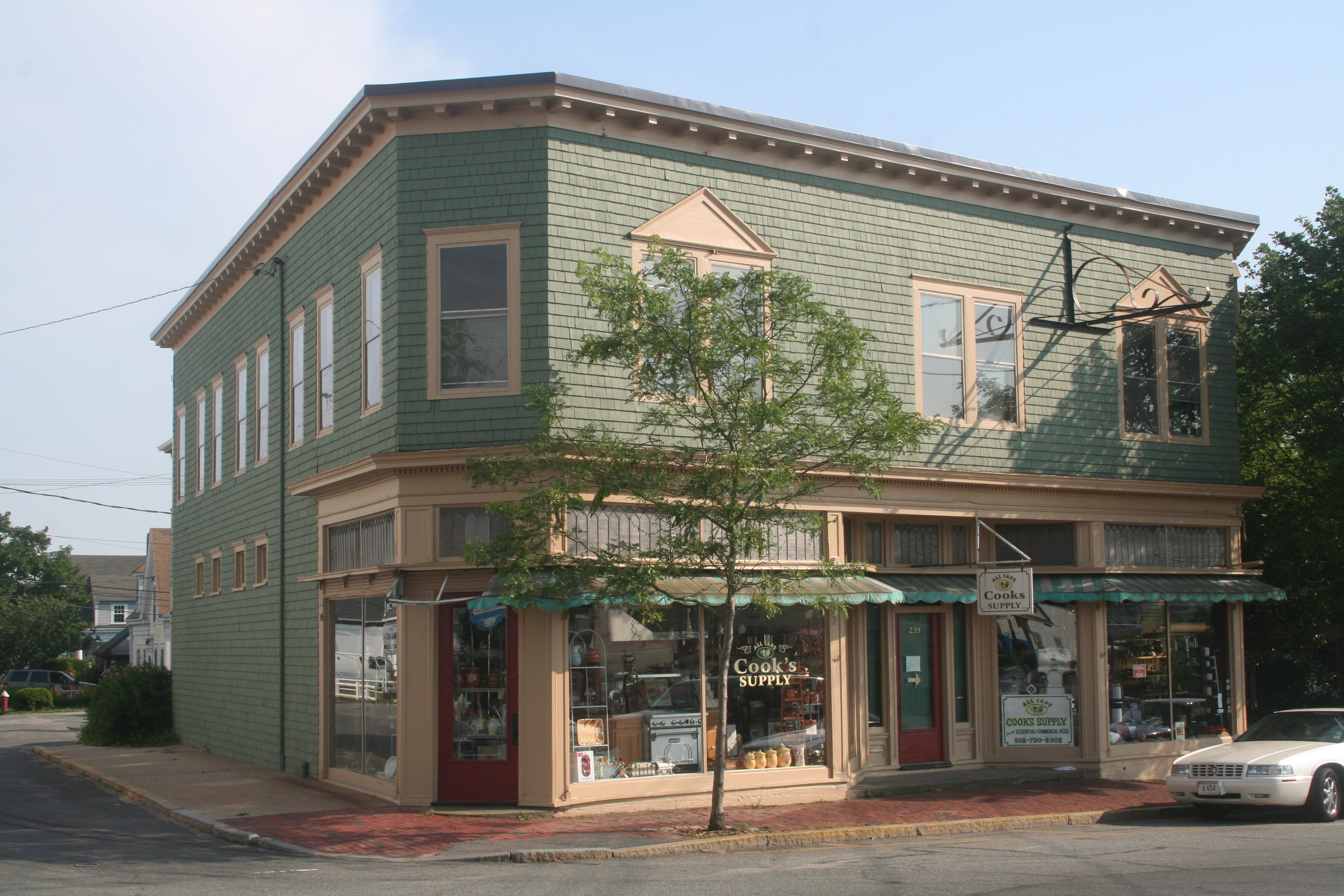
Building at 237-239 Main Street |
|
01987-03-13March 13, 1987 |
237-239 Main St.
41°39′16″N 70°16′49″W / 41.654444°N 70.280278°W / 41.654444; -70.280278 (Building at 237-239 Main Street) |
Barnstable |
|
| 29 |
Building at 600 Main Street |
|
01987-03-13March 13, 1987 |
600 Main St.
41°38′56″N 70°17′28″W / 41.648889°N 70.291111°W / 41.648889; -70.291111 (Building at 600 Main Street) |
Barnstable |
|
| 30 |
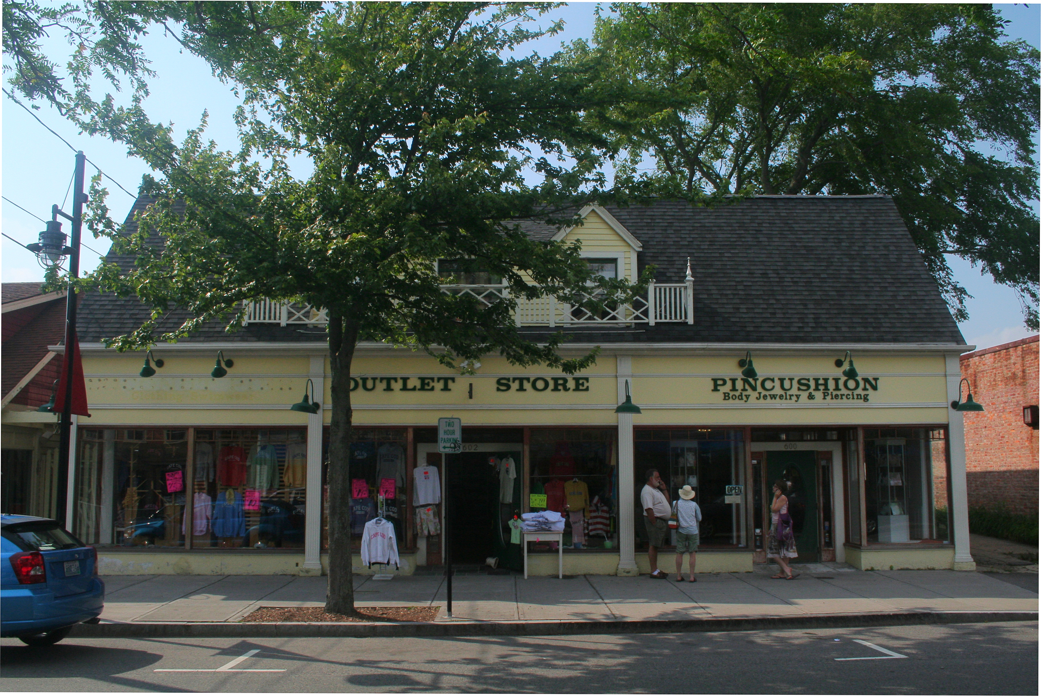
Building at 606 Main Street |
|
01987-03-13March 13, 1987 |
606 Main St.
41°38′56″N 70°17′28″W / 41.648889°N 70.291111°W / 41.648889; -70.291111 (Building at 606 Main Street) |
Barnstable |
|
| 31 |
Building at 614 Main Street |
|
01987-03-13March 13, 1987 |
614 Main St.
41°38′56″N 70°17′28″W / 41.648889°N 70.291111°W / 41.648889; -70.291111 (Building at 614 Main Street) |
Barnstable |
|
| 32 |
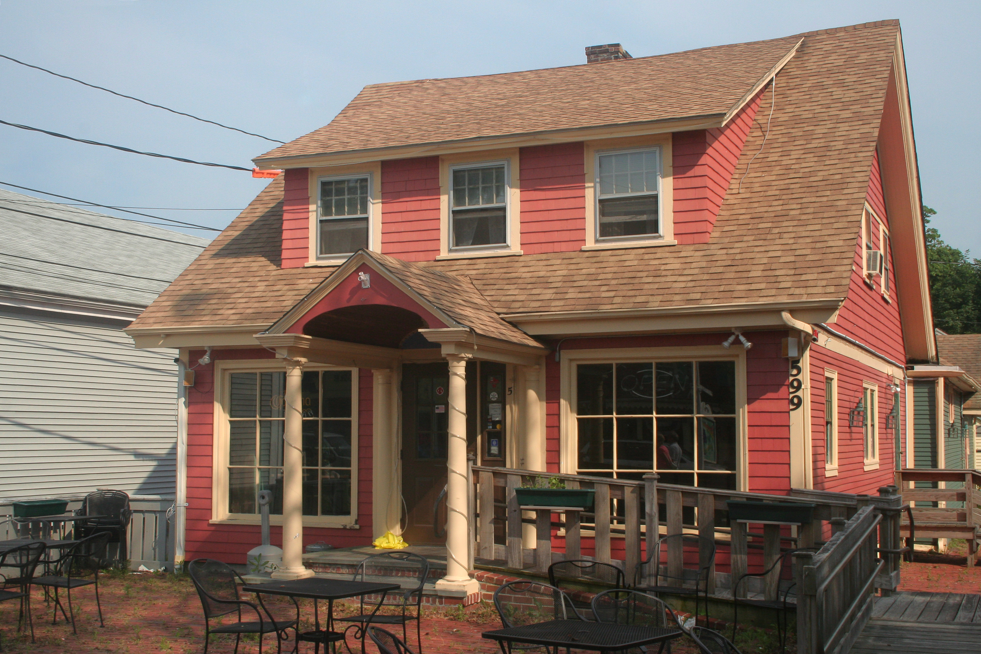
Collen C. Campbell House |
|
01987-03-13March 13, 1987 |
599 Main St.
41°38′55″N 70°17′27″W / 41.648611°N 70.290833°W / 41.648611; -70.290833 (Collen C. Campbell House) |
Barnstable |
|
| 33 |
Canary-Hartnett House |
|
01987-03-13March 13, 1987 |
113 Winter St.
41°39′10″N 70°17′14″W / 41.652778°N 70.287222°W / 41.652778; -70.287222 (Canary-Hartnett House) |
Barnstable |
|
| 34 |
Center Methodist Church |
|
01975-10-31October 31, 1975 |
356 Commercial St.
42°03′13″N 70°11′06″W / 42.053611°N 70.185°W / 42.053611; -70.185 (Center Methodist Church) |
Provincetown |
|
| 35 |
Centerville Historic District |
|
01987-11-10November 10, 1987 |
Main St.
41°38′56″N 70°20′53″W / 41.648889°N 70.348056°W / 41.648889; -70.348056 (Centerville Historic District) |
Barnstable |
|
| 36 |
Central Fire Station |
|
01998-02-26February 26, 1998 |
399 Main St.
41°33′06″N 70°36′28″W / 41.551667°N 70.607778°W / 41.551667; -70.607778 (Central Fire Station) |
Falmouth |
|
| 37 |
Lemuel B. Chase House |
|
01987-03-13March 13, 1987 |
340 Scudder Ave.
41°38′21″N 70°18′14″W / 41.639167°N 70.303889°W / 41.639167; -70.303889 (Lemuel B. Chase House) |
Barnstable |
|
| 38 |
Chatham Light Station |
|
01987-06-15June 15, 1987 |
Main St.
41°40′17″N 69°57′01″W / 41.671389°N 69.950278°W / 41.671389; -69.950278 (Chatham Light Station) |
Chatham |
|
| 39 |
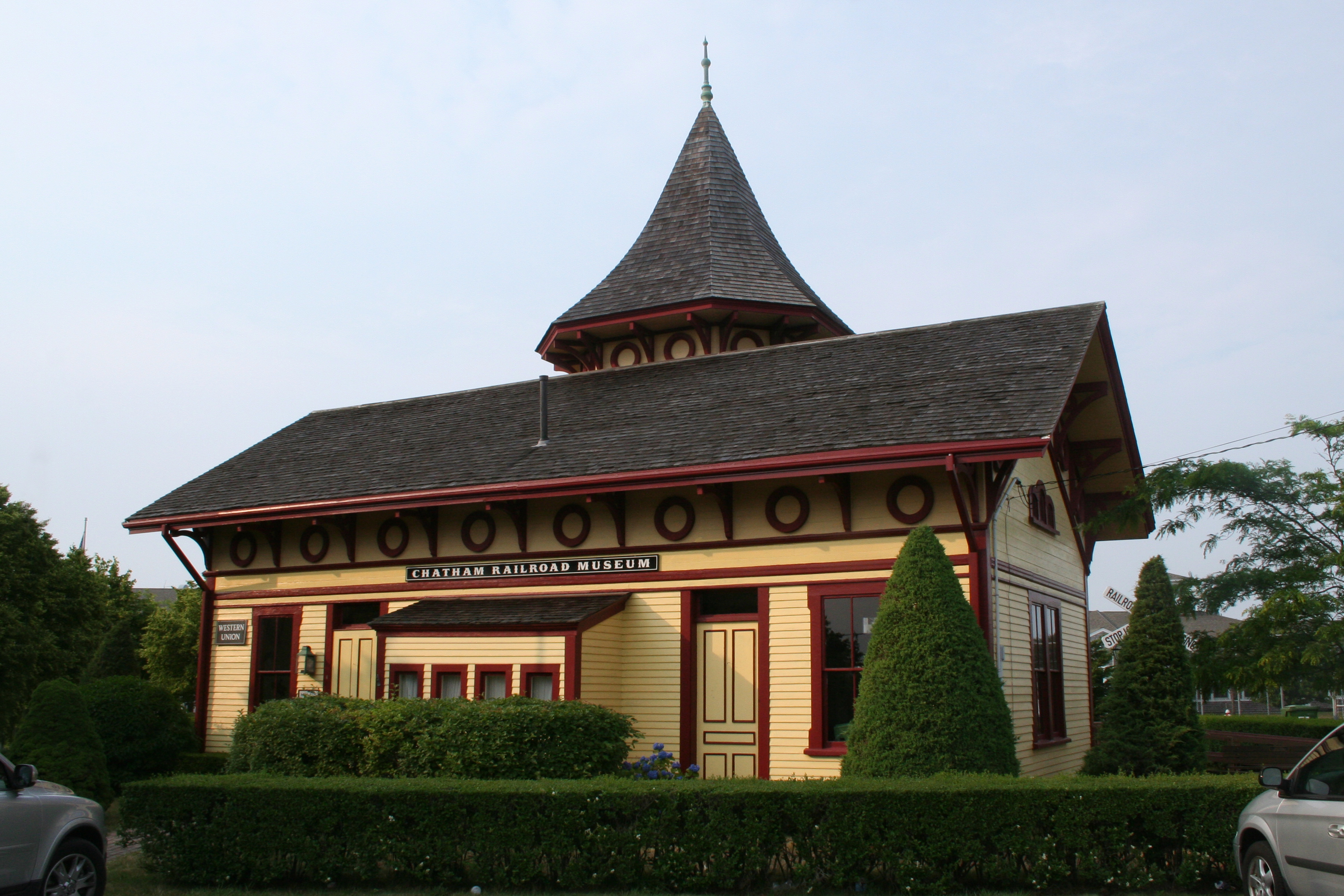
Chatham Railroad Depot |
|
01978-11-27November 27, 1978 |
153 Depot Rd.
41°41′08″N 69°57′44″W / 41.685556°N 69.962222°W / 41.685556; -69.962222 (Chatham Railroad Depot) |
Chatham |
|
| 40 |
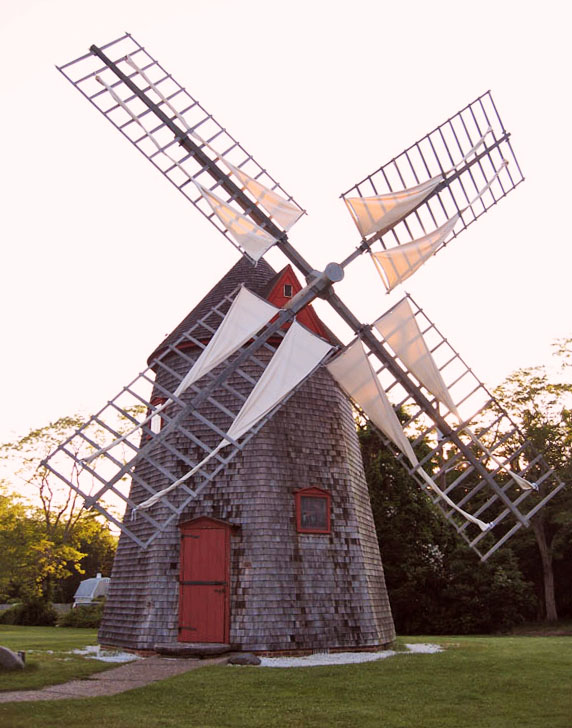
Chatham Windmill |
|
01978-11-30November 30, 1978 |
Chase Park, Shattuck Pl.
41°40′34″N 69°57′33″W / 41.676111°N 69.959167°W / 41.676111; -69.959167 (Chatham Windmill) |
Chatham |
|
| 41 |
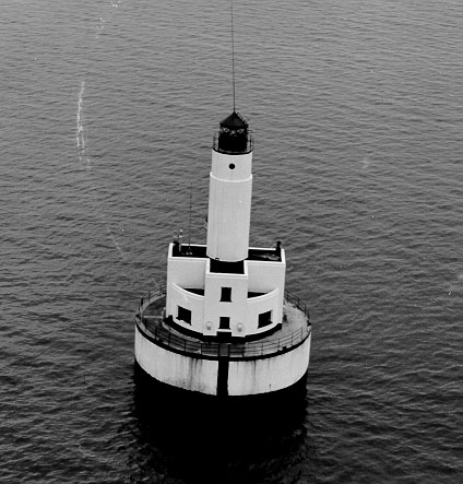
Cleveland Ledge Light Station |
|
01987-06-15June 15, 1987 |
Cape Cod Canal
41°37′49″N 70°41′55″W / 41.630278°N 70.698611°W / 41.630278; -70.698611 (Cleveland Ledge Light Station) |
Falmouth |
|
| 42 |
Coast Guard Motor Lifeboat CG 36500 |
|
02005-05-27May 27, 2005 |
Berthed at Rock Harbor
41°47′58″N 70°00′32″W / 41.799444°N 70.008889°W / 41.799444; -70.008889 (Coast Guard Motor Lifeboat CG 36500) |
Orleans |
|
| 43 |
Col. Charles Codman Estate |
|
01987-03-13March 13, 1987 |
43 Ocean View Ave.
41°36′39″N 70°26′00″W / 41.610833°N 70.433333°W / 41.610833; -70.433333 (Col. Charles Codman Estate) |
Barnstable |
|
| 44 |
Collins Cottages Historic District |
|
01999-05-20May 20, 1999 |
150 MA 6
41°47′58″N 69°58′55″W / 41.799444°N 69.981944°W / 41.799444; -69.981944 (Collins Cottages Historic District) |
Eastham |
|
| 45 |
Cotuit Historic District |
|
01987-11-10November 10, 1987 |
Main St., Lowell and Ocean View Aves. bounded by Osterville Harbor, Nantucket Sound, and Popponessett Bay
41°36′57″N 70°26′14″W / 41.615833°N 70.437222°W / 41.615833; -70.437222 (Cotuit Historic District) |
Barnstable |
|
| 46 |
Cove Burying Ground |
|
01999-05-12May 12, 1999 |
Junction of MA 6 and Pine Woods Rd.
41°48′40″N 69°58′17″W / 41.811111°N 69.971389°W / 41.811111; -69.971389 (Cove Burying Ground) |
Eastham |
|
| 47 |
Craigville Historic District |
|
01987-11-10November 10, 1987 |
Centerville Harbor, Nantucket Sound, Red Lily Pond, and Lake Elizabeth
41°38′29″N 70°19′58″W / 41.641389°N 70.332778°W / 41.641389; -70.332778 (Craigville Historic District) |
Barnstable |
|
| 48 |
Benomi and Barnabas Crocker House |
|
01987-03-13March 13, 1987 |
325 Willow St.
41°42′18″N 70°23′10″W / 41.705°N 70.386111°W / 41.705; -70.386111 (Benomi and Barnabas Crocker House) |
Barnstable |
|
| 49 |
Capt. Alexander Crocker House |
|
01987-03-13March 13, 1987 |
358 Sea St.
41°38′20″N 70°17′27″W / 41.638889°N 70.290833°W / 41.638889; -70.290833 (Capt. Alexander Crocker House) |
Barnstable |
|
| 50 |
Ebenezer Crocker Jr. House |
|
01987-11-10November 10, 1987 |
49 Putnam Ave.
41°37′17″N 70°26′03″W / 41.621389°N 70.434167°W / 41.621389; -70.434167 (Ebenezer Crocker Jr. House) |
Barnstable |
|
| 51 |
Lot Crocker House |
|
01987-03-13March 13, 1987 |
284 Gosnold St.
41°38′19″N 70°17′27″W / 41.638611°N 70.290833°W / 41.638611; -70.290833 (Lot Crocker House) |
Barnstable |
|
| 52 |
Daniel Crosby House |
|
01987-09-18September 18, 1987 |
18 Bay St.
41°37′44″N 70°23′18″W / 41.628889°N 70.388333°W / 41.628889; -70.388333 (Daniel Crosby House) |
Barnstable |
|
| 53 |
Crowell-Bourne Farm |
|
01980-04-23April 23, 1980 |
W. Falmouth Highway
41°37′04″N 70°37′34″W / 41.617778°N 70.626111°W / 41.617778; -70.626111 (Crowell-Bourne Farm) |
West Falmouth |
|
| 54 |
Crowell-Smith House |
|
01987-03-13March 13, 1987 |
33 Pine St.
41°38′57″N 70°17′19″W / 41.649167°N 70.288611°W / 41.649167; -70.288611 (Crowell-Smith House) |
Barnstable |
|
| 55 |
Dennis Village Cemetery |
|
02005-06-08June 8, 2005 |
MA 6A and Old Bass River Rd.
41°44′11″N 70°11′33″W / 41.736389°N 70.1925°W / 41.736389; -70.1925 (Dennis Village Cemetery) |
Dennis |
|
| 56 |
Josiah Dennis House |
|
01974-02-15February 15, 1974 |
Nobscusset Rd. at Whig St.
41°44′25″N 70°11′58″W / 41.740278°N 70.199444°W / 41.740278; -70.199444 (Josiah Dennis House) |
Dennis |
|
| 57 |
Dillingham House |
|
01976-04-30April 30, 1976 |
West of Brewster off MA 6A
41°44′57″N 70°07′31″W / 41.749167°N 70.125278°W / 41.749167; -70.125278 (Dillingham House) |
Brewster |
|
| 58 |
Eastham Center Historic District |
|
01999-05-12May 12, 1999 |
Depot, Mill, and Samoset Rds., and U.S. Route 6
41°49′40″N 69°58′24″W / 41.827778°N 69.973333°W / 41.827778; -69.973333 (Eastham Center Historic District) |
Eastham |
|
| 59 |
Eldredge Public Library |
|
01992-04-28April 28, 1992 |
564 Main St.
41°40′52″N 69°57′32″W / 41.681111°N 69.958889°W / 41.681111; -69.958889 (Eldredge Public Library) |
Chatham |
|
| 60 |
Falmouth Pumping Station |
|
01998-02-26February 26, 1998 |
Pumping Station Rd.
41°34′15″N 70°36′57″W / 41.570833°N 70.615833°W / 41.570833; -70.615833 (Falmouth Pumping Station) |
Falmouth |
|
| 61 |
Falmouth Village Green Historic District |
|
01996-03-27March 27, 1996 |
Roughly along Locust, Main, N. Main and Hewins Sts. and Palmer Ave., including also the Old Town Cemetery
41°33′06″N 70°37′22″W / 41.551667°N 70.622778°W / 41.551667; -70.622778 (Falmouth Village Green Historic District) |
Falmouth |
|
| 62 |
First Universalist Church |
|
01972-02-23February 23, 1972 |
236 Commercial St.
42°03′03″N 70°11′17″W / 42.050833°N 70.188056°W / 42.050833; -70.188056 (First Universalist Church) |
Provincetown |
|
| 63 |
Forestdale School |
|
01997-06-06June 6, 1997 |
87 Falmouth-Sandwich Rd.
41°41′15″N 70°30′16″W / 41.6875°N 70.504444°W / 41.6875; -70.504444 (Forestdale School) |
Sandwich |
|
| 64 |
Fort Hill Rural Historic District |
|
02001-04-05April 5, 2001 |
Fort Hill Rd, Cape Cod National Seashore
41°49′10″N 69°57′56″W / 41.819444°N 69.965556°W / 41.819444; -69.965556 (Fort Hill Rural Historic District) |
Eastham |
|
| 65 |
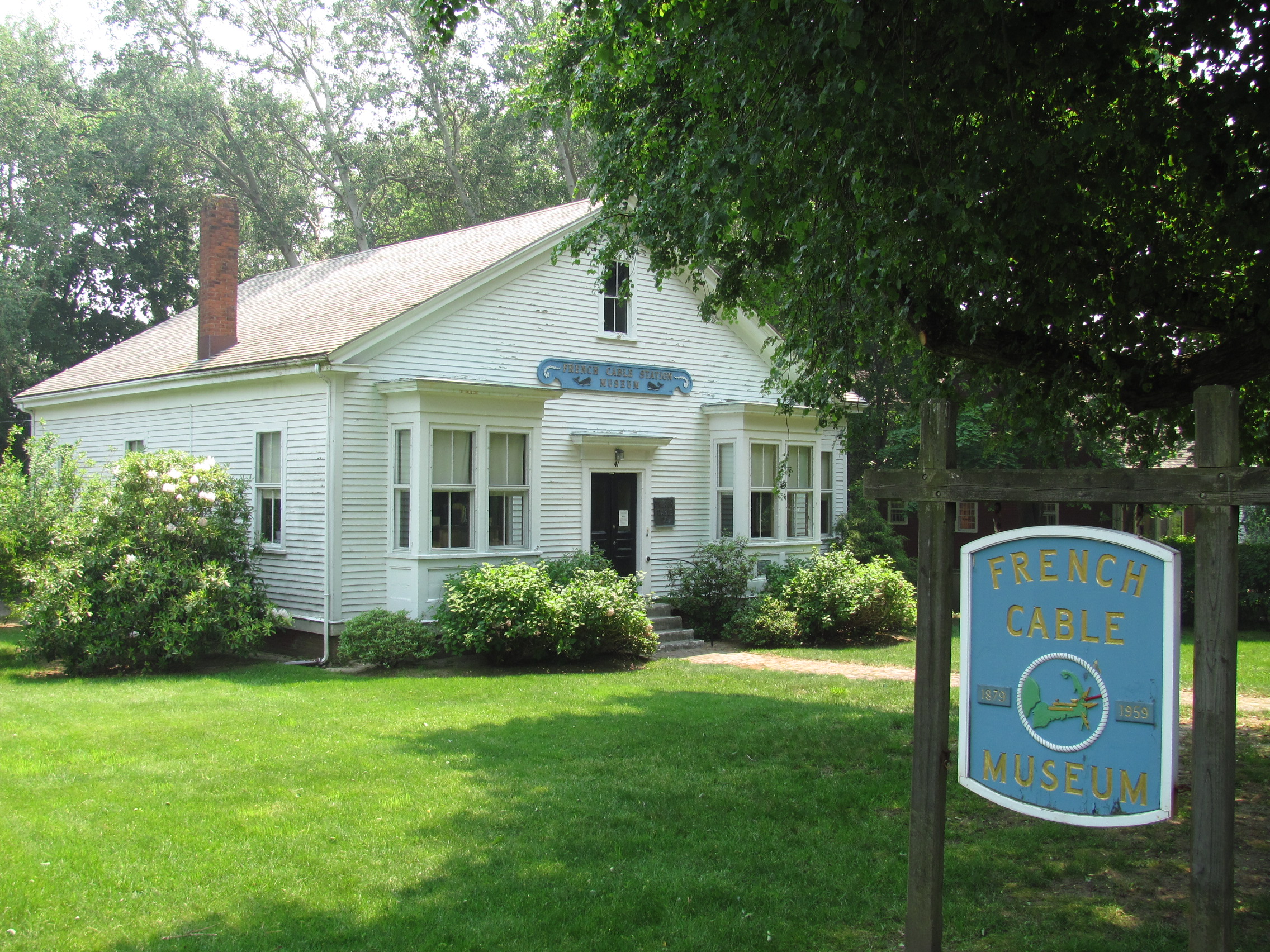
French Cable Hut |
|
01976-04-22April 22, 1976 |
East of North Eastham at the junction of Cable Rd. and Ocean View Dr.
41°51′34″N 69°57′07″W / 41.859444°N 69.951944°W / 41.859444; -69.951944 (French Cable Hut) |
North Eastham |
|
| 66 |
French Cable Station |
|
01972-04-11April 11, 1972 |
Southeastern corner of Cove Rd. and MA 28
41°47′16″N 69°59′16″W / 41.787778°N 69.987778°W / 41.787778; -69.987778 (French Cable Station) |
Orleans |
|
| 67 |
Fuller House |
|
01987-03-13March 13, 1987 |
Parker Rd.
41°41′42″N 70°22′01″W / 41.695°N 70.366944°W / 41.695; -70.366944 (Fuller House) |
Barnstable |
|
| 68 |
Gifford Farm |
|
01987-03-13March 13, 1987 |
261 Cotuit Rd.
41°39′26″N 70°24′43″W / 41.657222°N 70.411944°W / 41.657222; -70.411944 (Gifford Farm) |
Barnstable |
|
| 69 |
Dr. Edward Francis Gleason House |
|
01987-09-18September 18, 1987 |
88 Lewis Bay Rd.
41°39′10″N 70°16′30″W / 41.652778°N 70.275°W / 41.652778; -70.275 (Dr. Edward Francis Gleason House) |
Barnstable |
|
| 70 |
Goodspeed House |
|
01987-03-13March 13, 1987 |
271 River Rd.
41°39′32″N 70°25′10″W / 41.658889°N 70.419444°W / 41.658889; -70.419444 (Goodspeed House) |
Barnstable |
|
| 71 |
Capt. Thomas Gray House |
|
01987-03-13March 13, 1987 |
14 Main St.
41°39′25″N 70°16′20″W / 41.656944°N 70.272222°W / 41.656944; -70.272222 (Capt. Thomas Gray House) |
Barnstable |
|
| 72 |
Half Way House |
|
01978-07-21July 21, 1978 |
Andrew Harding La.
41°40′27″N 69°56′52″W / 41.674167°N 69.947778°W / 41.674167; -69.947778 (Half Way House) |
Chatham |
|
| 73 |
Capt. William Hallett House |
|
01987-09-18September 18, 1987 |
570 Main St.
41°38′59″N 70°17′24″W / 41.649722°N 70.29°W / 41.649722; -70.29 (Capt. William Hallett House) |
Barnstable |
|
| 74 |
Seth Hallett House |
|
01987-09-18September 18, 1987 |
110 Main St.
41°39′22″N 70°16′32″W / 41.656111°N 70.275556°W / 41.656111; -70.275556 (Seth Hallett House) |
Barnstable |
|
| 75 |
Harlow Homestead |
|
01987-09-18September 18, 1987 |
391 Main St.
41°37′42″N 70°26′35″W / 41.628333°N 70.443056°W / 41.628333; -70.443056 (Harlow Homestead) |
Barnstable |
|
| 76 |
Harwich Historic District |
|
01975-02-24February 24, 1975 |
Irregular pattern on both sides of Main St., west to Forest St. and east to the junction of Rte. 39 and Chatham Rd.
41°41′09″N 70°04′16″W / 41.685833°N 70.071111°W / 41.685833; -70.071111 (Harwich Historic District) |
Harwich |
|
| 77 |
Gideon Hawley House |
|
01987-03-13March 13, 1987 |
4766 Falmouth Rd.
41°38′11″N 70°27′16″W / 41.636389°N 70.454444°W / 41.636389; -70.454444 (Gideon Hawley House) |
Barnstable |
|
| 78 |
Hawthorne Class Studio |
|
01978-07-21July 21, 1978 |
Off Miller Hill Rd.
42°03′27″N 70°10′58″W / 42.0575°N 70.182778°W / 42.0575; -70.182778 (Hawthorne Class Studio) |
Provincetown |
|
| 79 |
Jedediah Higgins House |
|
01984-11-21November 21, 1984 |
Higgins Hollow Rd.
42°00′35″N 70°03′06″W / 42.009722°N 70.051667°W / 42.009722; -70.051667 (Jedediah Higgins House) |
North Truro |
|
| 80 |
Highland House |
|
01975-06-05June 5, 1975 |
Off U.S. Route 6 on Cape Cod National Seashore
42°02′25″N 70°03′56″W / 42.040278°N 70.065556°W / 42.040278; -70.065556 (Highland House) |
Truro |
|
| 81 |
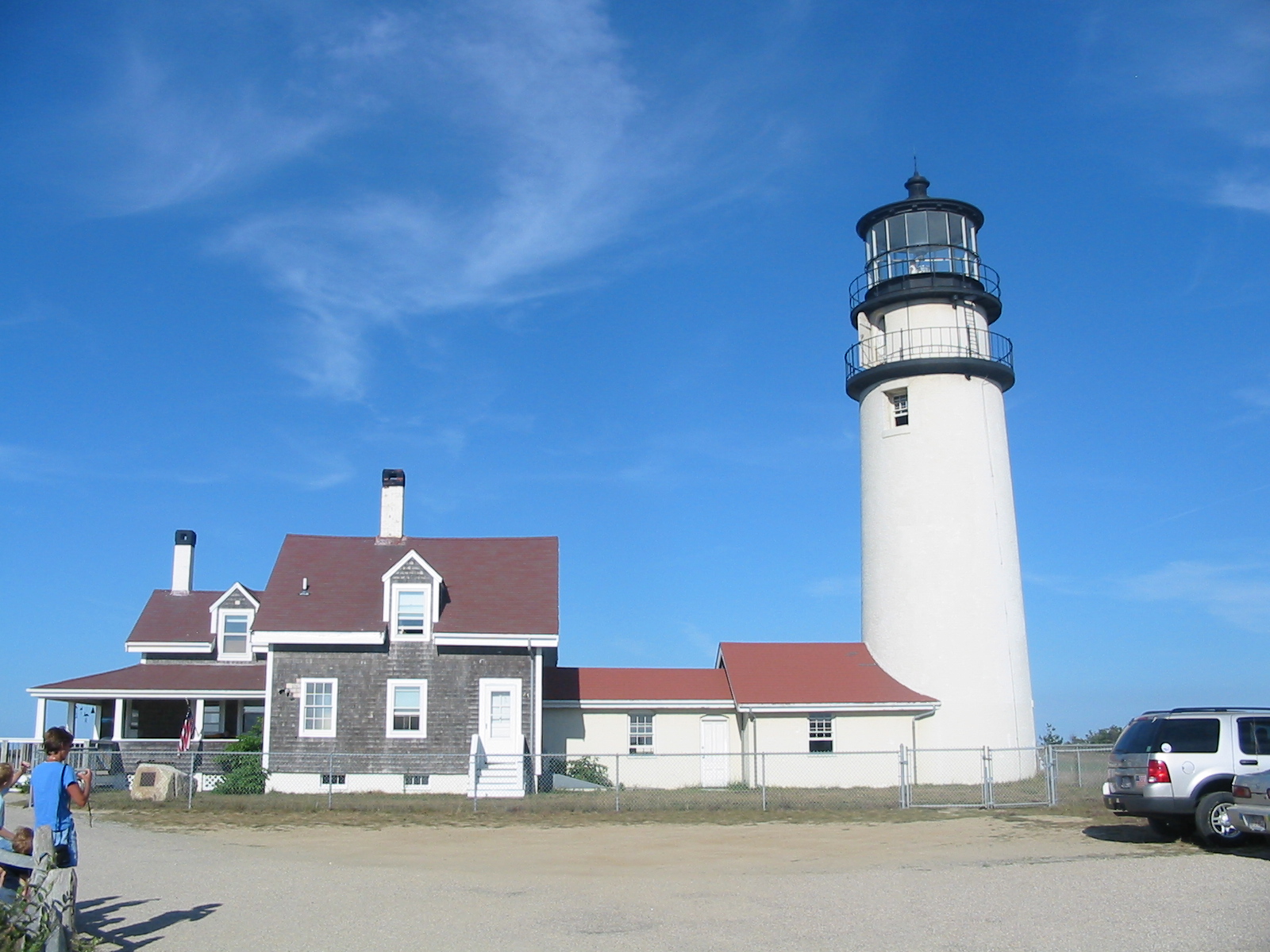
Highland Light Station |
|
01987-06-15June 15, 1987 |
Off U.S. Route 6
42°02′48″N 70°04′10″W / 42.046667°N 70.069444°W / 42.046667; -70.069444 (Highland Light Station) |
Truro |
|
| 82 |
Hinckley Homestead |
|
01987-09-18September 18, 1987 |
1740 S. County Rd.
41°38′57″N 70°23′52″W / 41.649167°N 70.397778°W / 41.649167; -70.397778 (Hinckley Homestead) |
Barnstable |
|
| 83 |
Hinckley's Corner Historic District |
|
01998-05-29May 29, 1998 |
0, 25, and 40 Way #112
41°55′02″N 70°00′14″W / 41.917222°N 70.003889°W / 41.917222; -70.003889 (Hinckley's Corner Historic District) |
Wellfleet |
|
| 84 |
Capt. Joseph Hinckley House |
|
01987-03-13March 13, 1987 |
142 Old Stage Rd.
41°39′14″N 70°21′02″W / 41.653889°N 70.350556°W / 41.653889; -70.350556 (Capt. Joseph Hinckley House) |
Barnstable |
|
| 85 |
Nymphus Hinckley House |
|
01987-03-13March 13, 1987 |
38 Bay St.
41°37′44″N 70°23′18″W / 41.628889°N 70.388333°W / 41.628889; -70.388333 (Nymphus Hinckley House) |
Barnstable |
|
| 86 |
S. Alexander Hinckley House |
|
01987-09-18September 18, 1987 |
151 Pine St.
41°38′48″N 70°17′13″W / 41.646667°N 70.286944°W / 41.646667; -70.286944 (S. Alexander Hinckley House) |
Barnstable |
|
| 87 |
Hyannis Port Historic District |
|
01987-11-10November 10, 1987 |
Roughly bounded by Massachusetts Ave. and Edgehill Rd., Hyannis Ave., Hyannis Harbor, and Scudder Ave.
41°37′52″N 70°17′55″W / 41.631111°N 70.298611°W / 41.631111; -70.298611 (Hyannis Port Historic District) |
Barnstable |
|
| 88 |
Hyannis Road Historic District |
|
01987-03-13March 13, 1987 |
Bounded by Old King's Highway, Bow Ln., Cape Cod Branch railroad tracks, and Hyannis Rd.
41°41′23″N 70°18′04″W / 41.689722°N 70.301111°W / 41.689722; -70.301111 (Hyannis Road Historic District) |
Barnstable |
|
| 89 |
Herman Isham House |
|
01987-03-13March 13, 1987 |
1322 Main St.
41°38′27″N 70°23′34″W / 41.640833°N 70.392778°W / 41.640833; -70.392778 (Herman Isham House) |
Barnstable |
|
| 90 |
John and Mary Waterman Jarves House |
|
02002-08-30August 30, 2002 |
3 Jarves St.
41°45′30″N 70°29′46″W / 41.758333°N 70.496111°W / 41.758333; -70.496111 (John and Mary Waterman Jarves House) |
Sandwich |
|
| 91 |
Jarvesville Historic District |
|
02010-09-23September 23, 2010 |
Roughly bounded by Liberty, Main, Jarves, and Church Sts., and the town landing
41°45′32″N 70°29′38″W / 41.758889°N 70.493889°W / 41.758889; -70.493889 (Jarvesville Historic District) |
Sandwich |
|
| 92 |
John Jenkins Homestead |
|
01987-03-13March 13, 1987 |
Church St.
41°41′41″N 70°22′12″W / 41.694722°N 70.37°W / 41.694722; -70.37 (John Jenkins Homestead) |
Barnstable |
|
| 93 |
Joseph Jenkins House |
|
01987-03-13March 13, 1987 |
310 Pine St.
41°41′29″N 70°22′15″W / 41.691389°N 70.370833°W / 41.691389; -70.370833 (Joseph Jenkins House) |
Barnstable |
|
| 94 |
Jenkins-Whelden Farmstead |
|
01987-03-13March 13, 1987 |
221 Pine St.
41°41′30″N 70°22′29″W / 41.691667°N 70.374722°W / 41.691667; -70.374722 (Jenkins-Whelden Farmstead) |
Barnstable |
|
| 95 |
Mercelia Evelyn Eldridge Kelley House |
|
02005-02-24February 24, 2005 |
2610 Main St.
41°40′44″N 70°01′35″W / 41.678889°N 70.026389°W / 41.678889; -70.026389 (Mercelia Evelyn Eldridge Kelley House) |
Chatham |
|
| 96 |
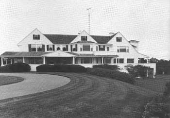
Kennedy Compound |
|
01972-11-28November 28, 1972 |
Irving and Marchant Aves.
41°37′49″N 70°18′12″W / 41.630278°N 70.303333°W / 41.630278; -70.303333 (Kennedy Compound) |
Hyannis Port |
Home of the Kennedy family |
| 97 |
Lawrence Academy |
|
01998-02-20February 20, 1998 |
20 Academy Ln.
41°33′09″N 70°36′57″W / 41.5525°N 70.615833°W / 41.5525; -70.615833 (Lawrence Academy) |
Falmouth |
|
| 98 |
Liberty Hall |
|
01987-03-13March 13, 1987 |
Main St.
41°39′15″N 70°24′46″W / 41.654167°N 70.412778°W / 41.654167; -70.412778 (Liberty Hall) |
Barnstable |
|
| 99 |
Lincoln House Club |
|
01987-03-13March 13, 1987 |
135 Bridge St.
41°37′19″N 70°23′47″W / 41.621944°N 70.396389°W / 41.621944; -70.396389 (Lincoln House Club) |
Barnstable |
|
| 100 |
Long Point Light Station |
|
01987-09-28September 28, 1987 |
Herring Cove Beach
42°01′53″N 70°10′01″W / 42.031389°N 70.166944°W / 42.031389; -70.166944 (Long Point Light Station) |
Provincetown |
|
| 101 |
Capt. George Lovell House |
|
01987-11-10November 10, 1987 |
8 E. Bay Rd.
41°37′40″N 70°22′46″W / 41.627778°N 70.379444°W / 41.627778; -70.379444 (Capt. George Lovell House) |
Barnstable |
|
| 102 |
Nehemiah Lovell House |
|
01987-09-18September 18, 1987 |
691 Main St.
41°37′38″N 70°22′51″W / 41.627222°N 70.380833°W / 41.627222; -70.380833 (Nehemiah Lovell House) |
Barnstable |
|
| 103 |
Marconi Wireless Station Site |
|
01975-05-02May 2, 1975 |
1 mile northeast of Cape Cod National Seashore
41°54′50″N 69°58′20″W / 41.913889°N 69.972222°W / 41.913889; -69.972222 (Marconi Wireless Station Site) |
South Wellfleet |
|
| 104 |
Marconi-RCA Wireless Receiving Station |
|
01994-08-30August 30, 1994 |
Junction of Old Comers Rd. and Orleans Rd.
41°42′12″N 69°58′47″W / 41.703333°N 69.979722°W / 41.703333; -69.979722 (Marconi-RCA Wireless Receiving Station) |
Chatham |
|
| 105 |
William Marston House |
|
01987-03-13March 13, 1987 |
71 Cotuit Rd.
41°39′08″N 70°24′53″W / 41.652222°N 70.414722°W / 41.652222; -70.414722 (William Marston House) |
Barnstable |
|
| 106 |
Marstons Mills Hearse House and Cemetery |
|
01987-03-13March 13, 1987 |
MA 149
41°39′43″N 70°24′31″W / 41.661944°N 70.408611°W / 41.661944; -70.408611 (Marstons Mills Hearse House and Cemetery) |
Barnstable |
|
| 107 |
Merrill Estate |
|
01987-09-18September 18, 1987 |
1874 S. County Rd.
41°39′06″N 70°24′11″W / 41.651667°N 70.403056°W / 41.651667; -70.403056 (Merrill Estate) |
Barnstable |
|
| 108 |
Methodist Church |
|
01987-03-13March 13, 1987 |
Main St.
41°39′14″N 70°24′43″W / 41.653889°N 70.411944°W / 41.653889; -70.411944 (Methodist Church) |
Barnstable |
|
| 109 |
Mill Way Historic District |
|
01987-11-10November 10, 1987 |
Mill Way Rd.
41°42′12″N 70°18′01″W / 41.703333°N 70.300278°W / 41.703333; -70.300278 (Mill Way Historic District) |
Barnstable |
|
| 110 |
Monomoy Point Lighthouse |
|
01979-11-01November 1, 1979 |
Monomoy Island
41°33′33″N 69°59′39″W / 41.559167°N 69.994167°W / 41.559167; -69.994167 (Monomoy Point Lighthouse) |
Chatham |
|
| 111 |
Municipal Group Historic District |
|
01987-11-10November 10, 1987 |
Roughly bounded by Main, Municipal Buildings, South, and Pearl Sts.
41°39′06″N 70°17′02″W / 41.651667°N 70.283889°W / 41.651667; -70.283889 (Municipal Group Historic District) |
Barnstable |
|
| 112 |
Nauset Archeological District |
|
01993-04-19April 19, 1993 |
Address Restricted
|
Eastham |
|
| 113 |
Nauset Beach Light |
|
01987-06-15June 15, 1987 |
Nauset Beach
41°51′15″N 69°57′06″W / 41.854167°N 69.951667°W / 41.854167; -69.951667 (Nauset Beach Light) |
Eastham |
|
| 114 |
John Newcomb House |
|
01988-09-15September 15, 1988 |
Address Restricted
|
Wellfleet |
|
| 115 |
Nickerson Mansion |
|
01986-02-20February 20, 1986 |
2871 Main St.
41°46′22″N 70°03′10″W / 41.772778°N 70.052778°W / 41.772778; -70.052778 (Nickerson Mansion) |
Brewster |
|
| 116 |
Nobska Point Light Station |
|
01987-06-15June 15, 1987 |
Nobska Rd.
41°30′59″N 70°39′27″W / 41.516389°N 70.6575°W / 41.516389; -70.6575 (Nobska Point Light Station) |
Falmouth |
|
| 117 |
North Falmouth Village Historic District |
|
01998-02-20February 20, 1998 |
85-408 Old Main Rd., and 6 Wild Harbor Rd.
41°38′47″N 70°37′02″W / 41.646389°N 70.617222°W / 41.646389; -70.617222 (North Falmouth Village Historic District) |
Falmouth |
|
| 118 |
Northside Historic District |
|
01987-11-24November 24, 1987 |
U.S. Route 6A between the Barnstable-Yarmouth town line and White Brock
41°42′10″N 70°14′45″W / 41.702778°N 70.245833°W / 41.702778; -70.245833 (Northside Historic District) |
Yarmouth |
|
| 119 |
Benjamin Nye Homestead |
|
01992-01-06January 6, 1992 |
85 Old County Rd.
41°43′43″N 70°25′55″W / 41.728611°N 70.431944°W / 41.728611; -70.431944 (Benjamin Nye Homestead) |
Sandwich |
|
| 120 |
Elnathan Nye House |
|
02002-06-27June 27, 2002 |
33 Old Main Rd.
41°38′08″N 70°37′11″W / 41.635556°N 70.619722°W / 41.635556; -70.619722 (Elnathan Nye House) |
Falmouth |
|
| 121 |
Old Harbor U.S. Life Saving Station |
|
01975-08-18August 18, 1975 |
Northeast of Chatham on Nauset Beach
41°41′52″N 69°55′46″W / 41.697778°N 69.929444°W / 41.697778; -69.929444 (Old Harbor U.S. Life Saving Station) |
Chatham |
|
| 122 |
Old Higgins Farm Windmill |
|
01975-06-10June 10, 1975 |
Off Old King's Highway
41°45′08″N 70°07′16″W / 41.752222°N 70.121111°W / 41.752222; -70.121111 (Old Higgins Farm Windmill) |
Brewster |
|
| 123 |
Old Indian Meeting House |
|
01998-12-03December 3, 1998 |
410 Meetinghouse Rd.
41°37′28″N 70°28′45″W / 41.624444°N 70.479167°W / 41.624444; -70.479167 (Old Indian Meeting House) |
Mashpee |
|
| 124 |
Old Jail |
|
01971-07-02July 2, 1971 |
U.S. Route 6A
41°42′00″N 70°17′56″W / 41.7°N 70.298889°W / 41.7; -70.298889 (Old Jail) |
Barnstable |
|
| 125 |
Old King's Highway Historic District |
|
01987-03-12March 12, 1987 |
Old King's Highway between the Sandwich town line on the west to the Yarmouth town line on the east
41°42′24″N 70°20′20″W / 41.706667°N 70.338889°W / 41.706667; -70.338889 (Old King's Highway Historic District) |
Barnstable |
|
| 126 |
Old Town Center Historic District |
|
02001-03-02March 2, 2001 |
Roughly along Locust Public Rd. and Salt Pond Rd.
41°50′18″N 69°58′37″W / 41.838333°N 69.976944°W / 41.838333; -69.976944 (Old Town Center Historic District) |
Eastham |
|
| 127 |
Old Village Historic District |
|
02001-12-17December 17, 2001 |
Roughly bounded by Main, Holway, Bridge Sts., Bearse's Ln., Chatham Harbor, Mill Pond, and Little Mill Pond
41°40′29″N 69°57′06″W / 41.674722°N 69.951667°W / 41.674722; -69.951667 (Old Village Historic District) |
Chatham |
|
| 128 |
Osterville Baptist Church |
|
01987-09-18September 18, 1987 |
Main St.
41°37′41″N 70°23′09″W / 41.628056°N 70.385833°W / 41.628056; -70.385833 (Osterville Baptist Church) |
Barnstable |
|
| 129 |
Paine Hollow Road South Historic District |
|
01998-05-20May 20, 1998 |
Roughly along Paine Hollow Rd., and Raywid Way
41°54′50″N 70°00′27″W / 41.913889°N 70.0075°W / 41.913889; -70.0075 (Paine Hollow Road South Historic District) |
Wellfleet |
|
| 130 |
PAUL PALMER (Shipwreck and Remains) |
|
02007-04-12April 12, 2007 |
Address Restricted
|
Provincetown |
|
| 131 |
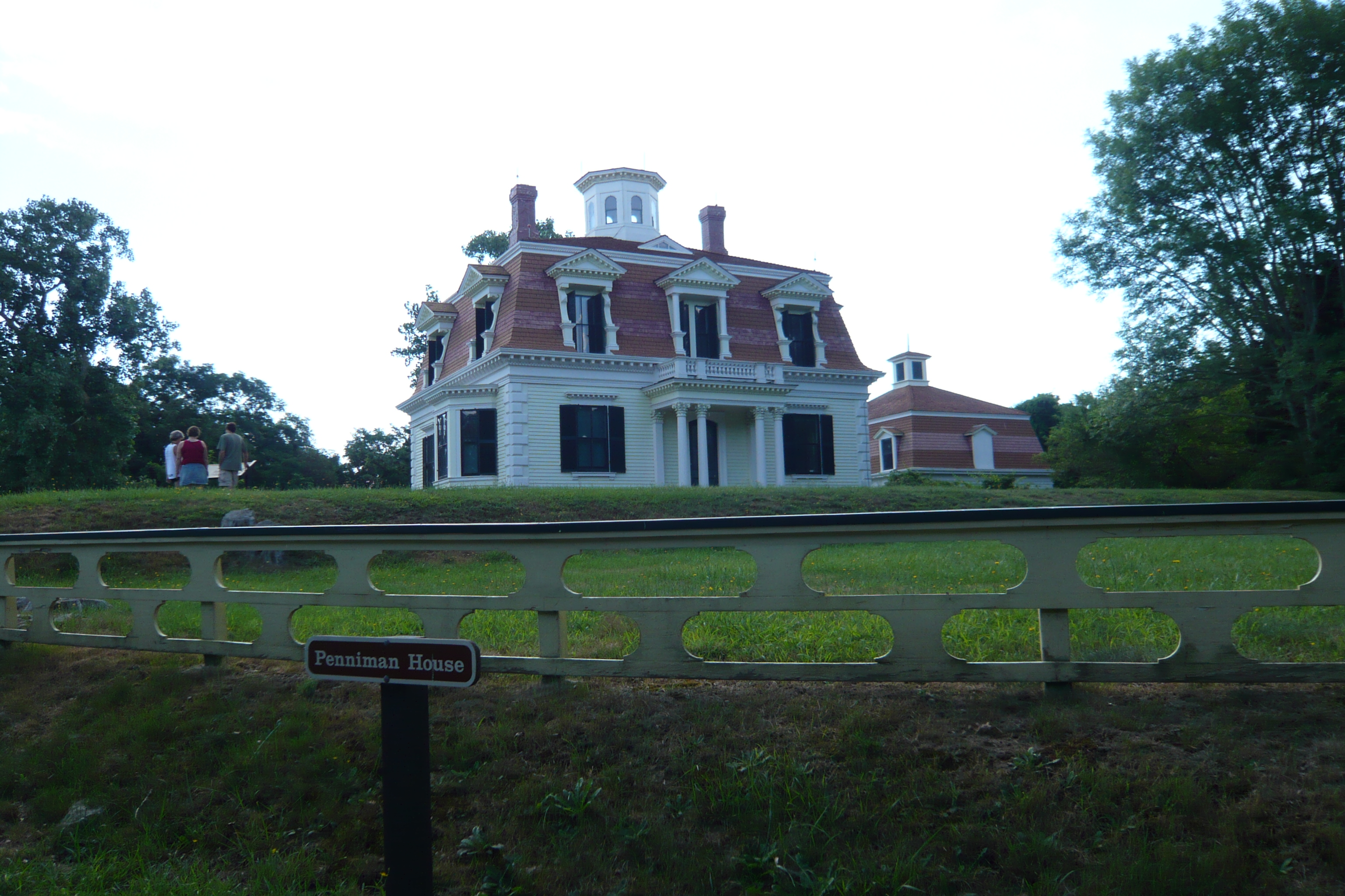
Edward Penniman House and Barn |
|
01976-05-28May 28, 1976 |
South of Eastham at Fort Hill and Governor Prence Rds.
41°49′06″N 69°57′56″W / 41.818472°N 69.965667°W / 41.818472; -69.965667 (Edward Penniman House and Barn) |
Eastham |
|
| 132 |
William and Jane Phinney House |
|
01987-03-13March 13, 1987 |
555 Phinney's Ln.
41°39′47″N 70°19′42″W / 41.663056°N 70.328333°W / 41.663056; -70.328333 (William and Jane Phinney House) |
Barnstable |
|
| 133 |
Pleasant-School Street Historic District |
|
01987-11-10November 10, 1987 |
Roughly bounded by Main, School, South, and Pleasant Sts.
41°39′12″N 70°16′42″W / 41.653333°N 70.278333°W / 41.653333; -70.278333 (Pleasant-School Street Historic District) |
Barnstable |
|
| 134 |
Pond Hill School |
|
01989-03-23March 23, 1989 |
U.S. Route 6
41°55′1.98″N 69°59′54.31″W / 41.9172167°N 69.9984194°W / 41.9172167; -69.9984194 (Pond Hill School)
|
Wellfleet |
|
| 135 |
Poor House and Methodist Cemetery |
|
01998-02-26February 26, 1998 |
744 Main St.
41°33′12″N 70°36′56″W / 41.553333°N 70.615556°W / 41.553333; -70.615556 (Poor House and Methodist Cemetery) |
Falmouth |
|
| 136 |
Port Royal House |
|
01982-04-15April 15, 1982 |
606 Main St.
41°40′56″N 69°57′36″W / 41.682222°N 69.96°W / 41.682222; -69.96 (Port Royal House) |
Chatham |
|
| 137 |
Provincetown Historic District |
|
01989-08-30August 30, 1989 |
Roughly bounded by U.S. Route 6, the western end of Commercial St., Provincetown Harbor, and the southeastern end of Commercial St.
42°03′02″N 70°11′13″W / 42.050556°N 70.186944°W / 42.050556; -70.186944 (Provincetown Historic District) |
Provincetown |
|
| 138 |
Provincetown Public Library |
|
01975-04-21April 21, 1975 |
330 Commercial St.
42°03′09″N 70°11′09″W / 42.0525°N 70.185833°W / 42.0525; -70.185833 (Provincetown Public Library) |
Provincetown |
|
| 139 |
Race Point Light Station |
|
01987-06-15June 15, 1987 |
Race Point Beach
42°03′40″N 70°14′33″W / 42.061111°N 70.2425°W / 42.061111; -70.2425 (Race Point Light Station) |
Provincetown |
|
| 140 |
Nelson Rhodehouse House |
|
01987-03-13March 13, 1987 |
131 Main St.
41°38′02″N 70°26′59″W / 41.633889°N 70.449722°W / 41.633889; -70.449722 (Nelson Rhodehouse House) |
Barnstable |
|
| 141 |
John Richardson House |
|
01987-09-18September 18, 1987 |
242 Phinney's Ln.
41°39′28″N 70°20′21″W / 41.657778°N 70.339167°W / 41.657778; -70.339167 (John Richardson House) |
Barnstable |
|
| 142 |
Joseph Robbins House |
|
01987-11-10November 10, 1987 |
12 Bay St.
41°37′44″N 70°23′18″W / 41.628889°N 70.388333°W / 41.628889; -70.388333 (Joseph Robbins House) |
Barnstable |
|
| 143 |
Round House |
|
01987-03-13March 13, 1987 |
971 W. Main St.
41°39′23″N 70°19′46″W / 41.656389°N 70.329444°W / 41.656389; -70.329444 (Round House) |
Barnstable |
|
| 144 |
Rowell House |
|
01988-09-01September 1, 1988 |
Gull Pond Rd.
41°57′20″N 70°00′47″W / 41.955556°N 70.013056°W / 41.955556; -70.013056 (Rowell House) |
Wellfleet |
|
| 145 |
Sampson's Folly-Josiah Sampson House |
|
01987-09-18September 18, 1987 |
40 Old King's Rd.
41°37′49″N 70°26′53″W / 41.630278°N 70.448056°W / 41.630278; -70.448056 (Sampson's Folly-Josiah Sampson House) |
Barnstable |
|
| 146 |
Sandy Neck Cultural Resources District |
|
01987-11-10November 10, 1987 |
Address Restricted
|
Barnstable |
|
| 147 |
Santuit Historic District |
|
01987-11-10November 10, 1987 |
MA 28
41°38′16″N 70°27′04″W / 41.637778°N 70.451111°W / 41.637778; -70.451111 (Santuit Historic District) |
Barnstable |
|
| 148 |
Santuit Post Office |
|
01987-11-10November 10, 1987 |
Main St.
41°38′06″N 70°27′01″W / 41.635°N 70.450278°W / 41.635; -70.450278 (Santuit Post Office) |
Barnstable |
|
| 149 |
Saunders-Paine House |
|
01998-05-20May 20, 1998 |
260 Paine Hollow Rd.
41°54′46″N 70°00′34″W / 41.912778°N 70.009444°W / 41.912778; -70.009444 (Saunders-Paine House) |
Wellfleet |
|
| 150 |
Sea Call Farm |
|
02008-06-12June 12, 2008 |
82 Tonset Rd.
41°47′12″N 69°58′45″W / 41.786783°N 69.979086°W / 41.786783; -69.979086 (Sea Call Farm) |
Orleans |
|
| 151 |
Jacob Sears Memorial Library |
|
02009-11-18November 18, 2009 |
23 Center St.
41°44′52″N 70°08′46″W / 41.7479°N 70.1462°W / 41.7479; -70.1462 (Jacob Sears Memorial Library) |
Dennis |
|
| 152 |
Matthias Smith House |
|
01987-03-13March 13, 1987 |
375 Cedar St.
41°42′23″N 70°23′36″W / 41.706389°N 70.393333°W / 41.706389; -70.393333 (Matthias Smith House) |
Barnstable |
|
| 153 |
Samuel Smith Tavern Site |
|
01977-11-11November 11, 1977 |
Address Restricted
|
Wellfleet |
|
| 154 |
South Harwich Methodist Church |
|
01986-08-21August 21, 1986 |
270 Chatham Rd.
41°40′40″N 70°02′49″W / 41.677778°N 70.046944°W / 41.677778; -70.046944 (South Harwich Methodist Church) |
Harwich |
|
| 155 |
South Yarmouth/Bass River Historic District |
|
01990-05-29May 29, 1990 |
Roughly Main St. from Pine to South St., River St. from Main to Bass River Parkway, and Willow St. from River to South St.
41°39′39″N 70°11′35″W / 41.660833°N 70.193056°W / 41.660833; -70.193056 (South Yarmouth/Bass River Historic District) |
Yarmouth |
|
| 156 |
Spring Hill Historic District |
|
02010-10-28October 28, 2010 |
Roughly bounded by Massachusetts Route 6A, Spring Hill Rd., and Discovery Hill Rd.
41°44′53″N 70°28′22″W / 41.748056°N 70.472778°W / 41.748056; -70.472778 (Spring Hill Historic District) |
Sandwich |
|
| 157 |
Stony Brook-Factory Village Historic District |
|
02000-06-15June 15, 2000 |
Stony Brook Rd.; Setucket Rd., Run Hill Rd.
41°44′37″N 70°06′43″W / 41.743611°N 70.111944°W / 41.743611; -70.111944 (Stony Brook-Factory Village Historic District) |
Brewster |
|
| 158 |
Taylor-Bray Farm |
|
01993-09-29September 29, 1993 |
Junction of Bray Farm Rd. N. and Nottingham Rd.
41°43′20″N 70°12′23″W / 41.722222°N 70.206389°W / 41.722222; -70.206389 (Taylor-Bray Farm) |
Yarmouth |
|
| 159 |
Teaticket School |
|
02002-02-22February 22, 2002 |
340 Teaticket Hwy, MA 28 at Sandwich Rd.
41°34′09″N 70°36′20″W / 41.569167°N 70.605556°W / 41.569167; -70.605556 (Teaticket School) |
Falmouth |
|
| 160 |
Three Sisters of Nauset (Twin Lights) |
|
01987-06-15June 15, 1987 |
Off Cable Rd.
41°50′42″N 69°57′36″W / 41.845°N 69.96°W / 41.845; -69.96 (Three Sisters of Nauset (Twin Lights)) |
Eastham |
|
| 161 |
Josiah Tobey House |
|
01994-12-09December 9, 1994 |
67 Oxbow Rd.
41°34′41″N 70°34′33″W / 41.578056°N 70.575833°W / 41.578056; -70.575833 (Josiah Tobey House) |
Falmouth |
|
| 162 |
Town Boundary Marker |
|
01987-09-18September 18, 1987 |
Race Ln. at Sandwich town line
41°41′11″N 70°26′12″W / 41.686389°N 70.436667°W / 41.686389; -70.436667 (Town Boundary Marker) |
Barnstable |
|
| 163 |
Town Hall Square Historic District |
|
01975-10-31October 31, 1975 |
Roughly bounded by Main, Grove, Water Sts., and Tupper Rd. from Beale Ave. to Massachusetts Route 6A
41°45′29″N 70°30′04″W / 41.758056°N 70.501111°W / 41.758056; -70.501111 (Town Hall Square Historic District) |
Sandwich |
Boundary increase (listed September 16, 2010): Roughly bounded by Massachusetts Route 6A, Morse Rd., Water St., Shawme Lake, Grove St., Main St., and Tupper Rd. |
| 164 |
Town Line Boundary Marker (Great Hill Road) |
|
01987-09-18September 18, 1987 |
Great Hill Rd.
41°43′19″N 70°24′04″W / 41.721944°N 70.401111°W / 41.721944; -70.401111 (Town Line Boundary Marker (Great Hill Road)) |
Barnstable |
|
| 165 |
Town Line Boundary Marker (410 High Street) |
|
01987-09-18September 18, 1987 |
410 High St.
41°43′19″N 70°24′04″W / 41.721944°N 70.401111°W / 41.721944; -70.401111 (Town Line Boundary Marker (410 High Street)) |
Barnstable |
|
| 166 |
Townsend House |
|
01998-05-20May 20, 1998 |
290 Paine Hollow Rd.
41°54′42″N 70°00′38″W / 41.911667°N 70.010556°W / 41.911667; -70.010556 (Townsend House) |
Wellfleet |
|
| 167 |
U.S. Customshouse |
|
01975-11-12November 12, 1975 |
Cobbs Hill, MA 6A
41°42′01″N 70°17′57″W / 41.700278°N 70.299167°W / 41.700278; -70.299167 (U.S. Customshouse) |
Barnstable |
|
| 168 |
Union Hall |
|
01997-05-23May 23, 1997 |
Town Hall Rd, east of MA 6
41°59′54″N 70°03′15″W / 41.998333°N 70.054167°W / 41.998333; -70.054167 (Union Hall) |
Truro |
|
| 169 |
Universalist Society Meetinghouse |
|
01999-02-25February 25, 1999 |
3 River Rd.
41°46′59″N 69°58′40″W / 41.783056°N 69.977778°W / 41.783056; -69.977778 (Universalist Society Meetinghouse) |
Orleans |
|
| 170 |
US Post Office-Provincetown Main |
|
01987-10-19October 19, 1987 |
217 Commercial St.
42°02′57″N 70°11′20″W / 42.049167°N 70.188889°W / 42.049167; -70.188889 (US Post Office-Provincetown Main) |
Provincetown |
|
| 171 |
Waquoit Historic District |
|
02004-02-26February 26, 2004 |
Portions of Main, Barrows, Carrige House, Collins, Martin, Moonakis, Takemmeh and Waquoit Landing, Parson, Studley, Whi
41°35′08″N 70°31′11″W / 41.585556°N 70.519722°W / 41.585556; -70.519722 (Waquoit Historic District) |
Falmouth |
|
| 172 |
Barzillai Weeks House |
|
01987-03-13March 13, 1987 |
313 High St.
41°43′15″N 70°23′59″W / 41.720833°N 70.399722°W / 41.720833; -70.399722 (Barzillai Weeks House) |
Barnstable |
|
| 173 |
Wellfleet Center Historic District |
|
01989-08-21August 21, 1989 |
Roughly bounded by Cross St., Holbrook Ave., Main, E. Main and School Sts., and Duck Creek
41°56′12″N 70°01′43″W / 41.936667°N 70.028611°W / 41.936667; -70.028611 (Wellfleet Center Historic District) |
Wellfleet |
|
| 174 |
West Barnstable Village-Meetinghouse Way Historic District |
|
01987-11-10November 10, 1987 |
Meetinghouse Way from County Rd. to Meetinghouse
41°42′10″N 70°22′45″W / 41.702778°N 70.379167°W / 41.702778; -70.379167 (West Barnstable Village-Meetinghouse Way Historic District) |
Barnstable |
|
| 175 |
West Dennis Graded School |
|
02000-08-24August 24, 2000 |
67 School St.
41°39′43″N 70°10′12″W / 41.661944°N 70.17°W / 41.661944; -70.17 (West Dennis Graded School) |
Dennis |
|
| 176 |
West Falmouth Village Historic District |
|
01998-04-02April 2, 1998 |
Roughly along N. Shore Rd., from the junction of MA 28A and MA 28, and Crocker Point
41°36′05″N 70°38′05″W / 41.601389°N 70.634722°W / 41.601389; -70.634722 (West Falmouth Village Historic District) |
Falmouth |
|
| 177 |
West Schoolhouse |
|
01975-04-24April 24, 1975 |
Nobscusset Road at Whig St.
41°44′20″N 70°11′59″W / 41.738889°N 70.199722°W / 41.738889; -70.199722 (West Schoolhouse) |
Dennis |
|
| 178 |
Josiah B. Whitman House |
|
01987-03-13March 13, 1987 |
210 Maple St.
41°42′31″N 70°23′21″W / 41.708611°N 70.389167°W / 41.708611; -70.389167 (Josiah B. Whitman House) |
Barnstable |
|
| 179 |
Wianno Club |
|
01979-03-02March 2, 1979 |
Seaview Ave.
41°36′58″N 70°22′17″W / 41.616111°N 70.371389°W / 41.616111; -70.371389 (Wianno Club) |
Osterville |
|
| 180 |
Wianno Historic District |
|
01987-11-10November 10, 1987 |
Roughly E. Bay Rd., Wianno and Sea View Aves. between Nantucket Sound and Crystal Lake
41°37′03″N 70°22′24″W / 41.6175°N 70.373333°W / 41.6175; -70.373333 (Wianno Historic District) |
Barnstable |
|
| 181 |
Wing Fort House |
|
01976-06-03June 3, 1976 |
Spring Hill Rd.
41°45′03″N 70°27′56″W / 41.750833°N 70.465556°W / 41.750833; -70.465556 (Wing Fort House) |
East Sandwich |
|
| 182 |
Wing's Neck Light |
|
01987-06-15June 15, 1987 |
Wing's Neck Rd.
41°40′56″N 70°39′37″W / 41.682222°N 70.660278°W / 41.682222; -70.660278 (Wing's Neck Light) |
Bourne |
|
| 183 |
Wood End Light Lookout Station |
|
01987-06-15June 15, 1987 |
Long Point
42°01′13″N 70°11′36″W / 42.020278°N 70.193333°W / 42.020278; -70.193333 (Wood End Light Lookout Station) |
Provincetown |
|
| 184 |
Woods Hole School |
|
01982-10-21October 21, 1982 |
24 School St.
41°31′29″N 70°40′10″W / 41.524722°N 70.669444°W / 41.524722; -70.669444 (Woods Hole School) |
Falmouth |
|
| 185 |
Yarmouth Camp Ground Historic District |
|
01990-08-28August 28, 1990 |
South of mid-Cape Highway (U.S. Route 6) and roughly bounded by County Ave., Willow St., Wood Rd., and Camp Ground Pond
41°40′59″N 70°15′44″W / 41.683056°N 70.262222°W / 41.683056; -70.262222 (Yarmouth Camp Ground Historic District) |
Barnstable and Yarmouth |
|
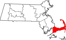 Location of Barnstable County in Massachusetts
 Category:National Register of Historic Places •
  Portal:National Register of Historic Places