There are 65 properties and districts listed on the National Register in the county excluding those in Springfield.
Latitude and longitude coordinates are provided for many National Register properties and districts; these locations may be seen together in a Google map.[1]
| [3] |
Landmark name[4] |
Image |
Date listed |
Location |
City or Town |
Summary |
| 1 |
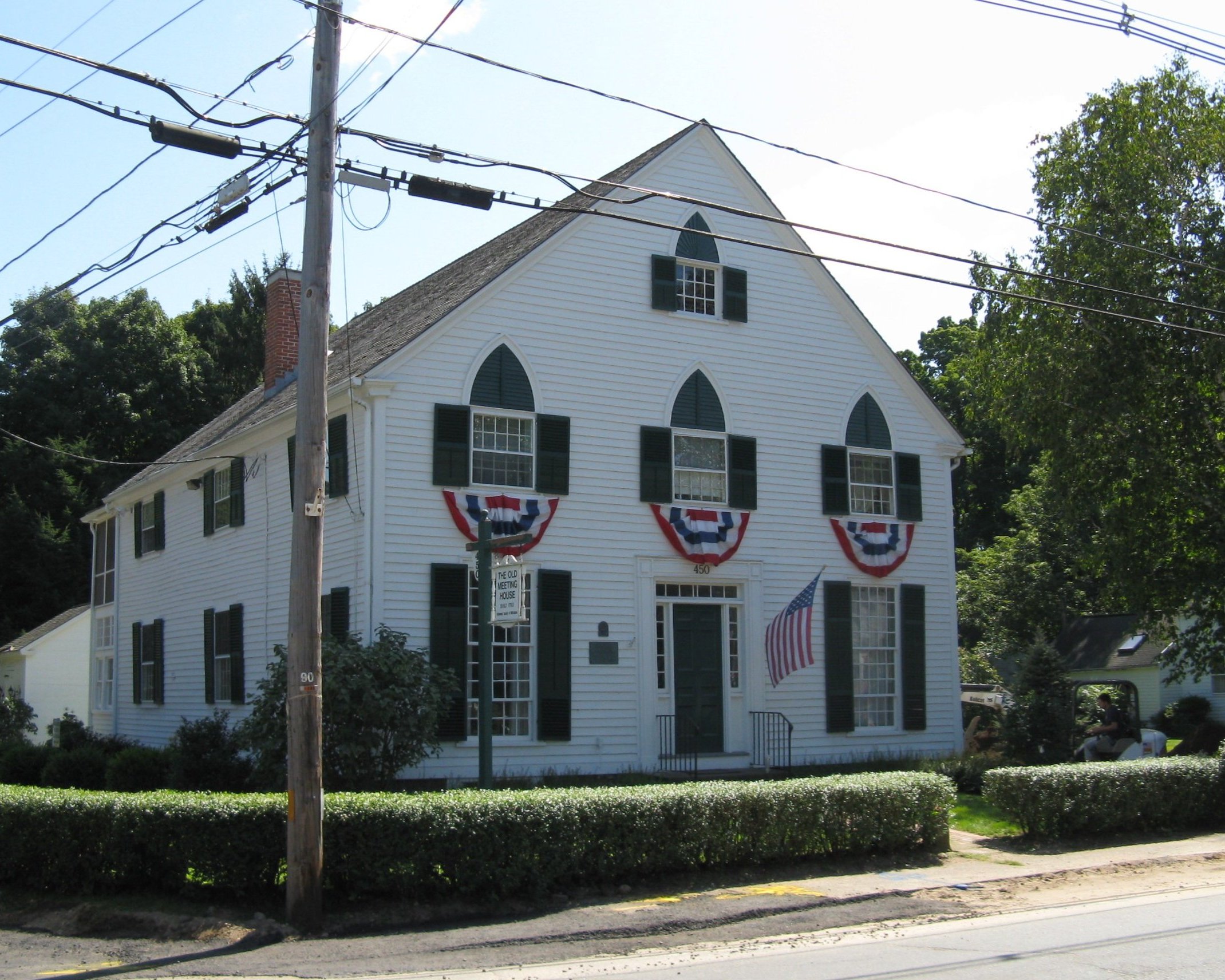
Academy Historic District |
 |
01979-04-20 April 20, 1979 |
Mountain Rd., Main and Faculty Sts.
42°7′29″N 72°25′56″W / 42.12472°N 72.43222°W / 42.12472; -72.43222 (Academy Historic District) |
Wilbraham |
|
| 2 |
Agawam Center Historic District |
 |
02001-06-21 June 21, 2001 |
24-196 Elm St.; 551-1008 Main St.
42°4′0″N 72°37′5″W / 42.066667°N 72.61806°W / 42.066667; -72.61806 (Agawam Center Historic District) |
Agawam |
|
| 3 |
Al's Diner |
|
02000-12-14 December 14, 2000 |
14 Yelle St.
42°11′30″N 72°35′58″W / 42.19167°N 72.59944°W / 42.19167; -72.59944 (Al's Diner) |
Chicopee |
|
| 4 |
Ames Manufacturing Company |
|
01983-06-23 June 23, 1983 |
5-7 Springfield St.
42°8′57″N 72°36′24″W / 42.14917°N 72.60667°W / 42.14917; -72.60667 (Ames Manufacturing Company) |
Chicopee |
|
| 5 |
Edward Bellamy House |
 |
01971-11-11 November 11, 1971 |
91-93 Church St.
42°9′21″N 72°35′4″W / 42.15583°N 72.58444°W / 42.15583; -72.58444 (Bellamy, Edward, House) |
Chicopee Falls |
|
| 6 |
Brimfield Center Historic District |
 |
02006-06-22 June 22, 2006 |
Main St., Brookfled, Wales, Sturbridge and Warren Rds.
42°7′29″N 72°18′32″W / 42.12472°N 72.30889°W / 42.12472; -72.30889 (Brimfield Center Historic District) |
Brimfield |
|
| 7 |
Thornton W. Burgess House |
|
01983-04-21 April 21, 1983 |
789 Main St.
42°3′48″N 72°24′24″W / 42.06333°N 72.40667°W / 42.06333; -72.40667 (Burgess, Thornton W., House) |
Hampden |
|
| 8 |
Elijah Burt House |
|
01976-04-26 April 26, 1976 |
201 Chestnut St.
42°3′15″N 72°30′54″W / 42.05417°N 72.515°W / 42.05417; -72.515 (Burt, Elijah, House) |
East Longmeadow |
|
| 9 |
Cabotville Common Historic District |
|
01999-05-28 May 28, 1999 |
School, Chestnut, Park and West Sts.
42°8′42″N 72°36′42″W / 42.145°N 72.61167°W / 42.145; -72.61167 (Cabotville Common Historic District) |
Chicopee |
|
| 10 |
Caledonia Building |
|
01979-07-03 July 3, 1979 |
185-193 High St.
42°12′27″N 72°36′27″W / 42.2075°N 72.6075°W / 42.2075; -72.6075 (Caledonia Building) |
Holyoke |
|
| 11 |
Carreau Block |
|
01998-08-06 August 6, 1998 |
640-642 Chicopee St.
42°11′5″N 72°36′41″W / 42.18472°N 72.61139°W / 42.18472; -72.61139 (Carreau Block) |
Chicopee |
|
| 12 |
Chester Center Historic District |
 |
01988-02-25 February 25, 1988 |
Skyline Trail at intersection of Bromley and Lyman Rds.
42°17′26″N 72°55′27″W / 42.29056°N 72.92417°W / 42.29056; -72.92417 (Chester Center Historic District) |
Chester |
|
| 13 |
Chester Factory Village Historic District |
|
01989-03-16 March 16, 1989 |
Roughly bounded by Middlefield Rd., River, Main, and Maple Sts., US 20, and Williams St.
42°16′52″N 72°58′54″W / 42.28111°N 72.98167°W / 42.28111; -72.98167 (Chester Factory Village Historic District) |
Chester |
|
| 14 |
City Hall |
 |
01974-07-30 July 30, 1974 |
Market Sq.
42°8′55″N 72°36′52″W / 42.14861°N 72.61444°W / 42.14861; -72.61444 (City Hall) |
Chicopee |
|
| 15 |
Josiah Day House |
 |
01975-04-16 April 16, 1975 |
70 Park St.
42°6′25″N 72°37′8″W / 42.10694°N 72.61889°W / 42.10694; -72.61889 (Day, Josiah, House) |
West Springfield |
|
| 16 |
Joseph Dewey House |
|
02001-07-27 July 27, 2001 |
87 S. Maple St.
42°6′42″N 72°45′49″W / 42.11167°N 72.76361°W / 42.11167; -72.76361 (Dewey, Joseph, House) |
Westfield |
|
| 17 |
Dwight Manufacturing Company Housing District |
|
01977-06-03 June 3, 1977 |
Front, Depot, Dwight, Exchange, Chestnut Sts.
42°8′48″N 72°36′44″W / 42.14667°N 72.61222°W / 42.14667; -72.61222 (Dwight Manufacturing Company Housing District) |
Chicopee |
|
| 18 |
First Congregational Church of Blandford |
|
01985-10-24 October 24, 1985 |
North St.
42°10′55″N 72°55′45″W / 42.18194°N 72.92917°W / 42.18194; -72.92917 (First Congregational Church of Blandford) |
Blandford |
|
| 19 |
First Congregational Church of East Longmeadow |
|
01978-01-03 January 3, 1978 |
7 Somers Rd.
42°3′51″N 72°30′46″W / 42.06417°N 72.51278°W / 42.06417; -72.51278 (First Congregational Church of East Longmeadow) |
East Longmeadow |
|
| 20 |
Friedrich Block |
|
02002-12-05 December 5, 2002 |
449-461 Main St.
42°11′52″N 72°36′36″W / 42.19778°N 72.61°W / 42.19778; -72.61 (Friedrich Block) |
Holyoke |
|
| 21 |
Granville Center Historic District |
 |
01991-11-05 November 5, 1991 |
Main Rd.
42°4′2″N 72°52′33″W / 42.06722°N 72.87583°W / 42.06722; -72.87583 (Granville Center Historic District) |
Granville |
|
| 22 |
Granville Village Historic District |
 |
01991-11-05 November 5, 1991 |
Roughly, area around the junction of Maple St. and Main and Granby Rds., including part of Water St.
42°3′54″N 72°51′49″W / 42.065°N 72.86361°W / 42.065; -72.86361 (Granville Village Historic District) |
Granville |
|
| 23 |
Hadley Falls Company Housing District |
|
01972-11-09 November 9, 1972 |
Center, N. Canal, Grover, and Lyman Sts.
42°12′30″N 72°35′0″W / 42.20833°N 72.583333°W / 42.20833; -72.583333 (Hadley Falls Company Housing District) |
Holyoke |
|
| 24 |
Holyoke Canal System |
 |
01980-12-03 December 3, 1980 |
Front and South Sts. and the Connecticut River
42°12′6″N 72°36′21″W / 42.20167°N 72.60583°W / 42.20167; -72.60583 (Holyoke Canal System) |
Holyoke |
|
| 25 |
Holyoke City Hall |
 |
01975-12-06 December 6, 1975 |
536 Dwight St.
42°12′23″N 72°36′28″W / 42.20639°N 72.60778°W / 42.20639; -72.60778 (Holyoke City Hall) |
Holyoke |
|
| 26 |
Laflin-Phelps Homestead |
 |
02005-12-06 December 6, 2005 |
20 Depot St.
42°3′14.08″N 72°46′1.87″W / 42.0539111°N 72.7671861°W / 42.0539111; -72.7671861 (Laflin-Phelps Homestead) |
Southwick |
|
| 27 |
Landlord Fowler Tavern |
|
01982-08-11 August 11, 1982 |
171 Main St.
42°7′3″N 72°44′10″W / 42.1175°N 72.73611°W / 42.1175; -72.73611 (Landlord Fowler Tavern) |
Westfield |
|
| 28 |
Capt. Charles Leonard House |
 |
01975-03-10 March 10, 1975 |
663 Main St.
42°4′14″N 72°36′53″W / 42.07056°N 72.61472°W / 42.07056; -72.61472 (Leonard, Capt. Charles, House) |
Agawam |
|
| 29 |
Longmeadow Historic District |
 |
01982-11-12 November 12, 1982 |
Roughly Longmeadow St. from Birdie Rd. to Wheelmeadow Brook
42°2′57″N 72°34′59″W / 42.04917°N 72.58306°W / 42.04917; -72.58306 (Longmeadow Historic District) |
Longmeadow |
|
| 30 |
Longmeadow Street-North Historic District |
|
01994-10-28 October 28, 1994 |
Bounded by Longmeadow St., Springfield Town Line, Westmoreland Ave. and Colley Dr.
42°4′1″N 72°34′41″W / 42.06694°N 72.57806°W / 42.06694; -72.57806 (Longmeadow Street-North Historic District) |
Longmeadow |
|
| 31 |
Ludlow Center Historic District |
 |
01988-10-21 October 21, 1988 |
Along Center, Church and Booth Sts.
42°11′31″N 72°27′35″W / 42.19194°N 72.45972°W / 42.19194; -72.45972 (Ludlow Center Historic District) |
Ludlow |
|
| 32 |
Ludlow Village Historic District |
 |
01993-02-22 February 22, 1993 |
Roughly bounded by Winsor, Sewall and State Sts. and the Chicopee River, and crossing the Chicopee, above Red Bridge Rd.
42°9′55″N 72°26′32″W / 42.16528°N 72.44222°W / 42.16528; -72.44222 (Ludlow Village Historic District) |
Ludlow |
|
| 33 |
Maplewood Hotel |
|
01983-11-10 November 10, 1983 |
328-330 Maple St.
42°12′13″N 72°36′44″W / 42.20361°N 72.61222°W / 42.20361; -72.61222 (Maplewood Hotel) |
Holyoke |
|
| 34 |
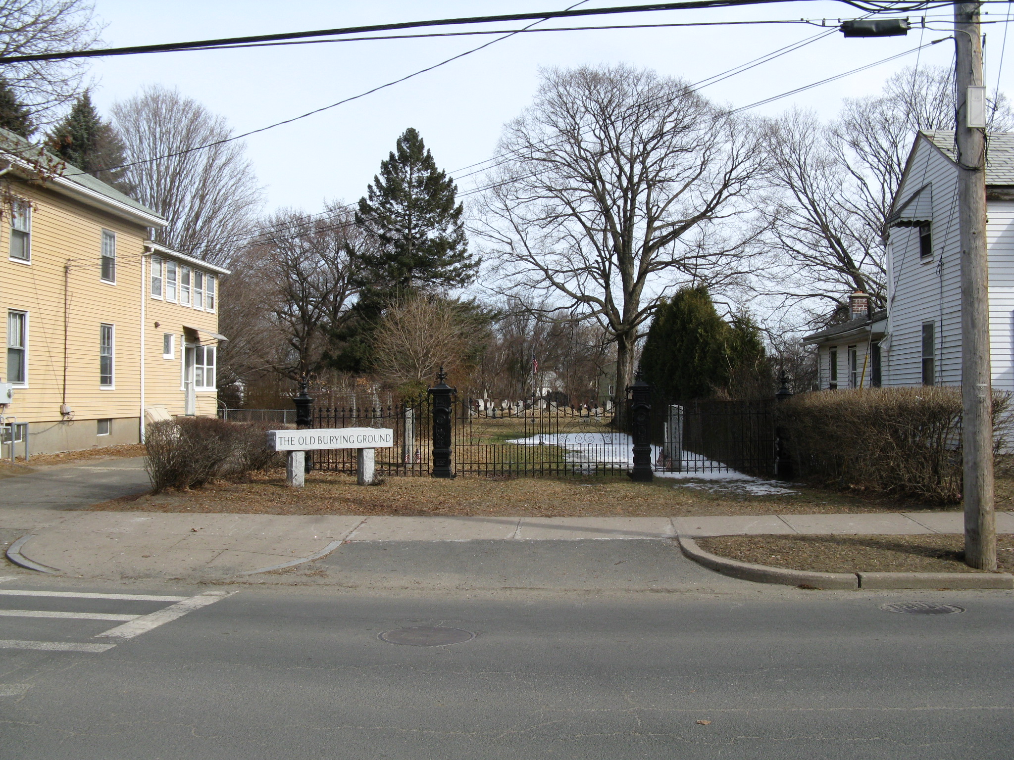
Mechanic Street Cemetery |
 |
02002-06-26 June 26, 2002 |
Mechanic St.
42°7′23″N 72°44′41″W / 42.12306°N 72.74472°W / 42.12306; -72.74472 (Mechanic Street Cemetery) |
Westfield |
|
| 35 |
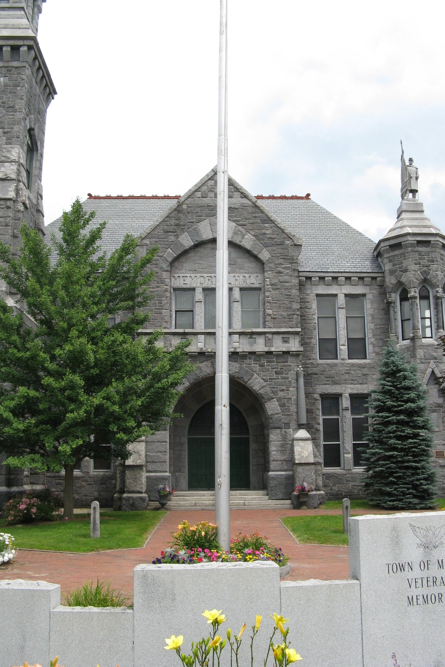
Memorial Town Hall |
 |
01984-05-17 May 17, 1984 |
Main St.
42°5′51″N 72°18′48″W / 42.0975°N 72.31333°W / 42.0975; -72.31333 (Memorial Town Hall) |
Monson |
|
| 36 |
Middlefield-Becket Stone Arch Railroad Bridge District |
|
01980-04-11 April 11, 1980 |
Middlefield vicinity
42°18′44″N 73°1′10″W / 42.31222°N 73.01944°W / 42.31222; -73.01944 (Middlefield-Becket Stone Arch Railroad Bridge District) |
Chester |
|
| 37 |
Monson Developmental Center |
|
01994-01-21 January 21, 1994 |
200 State Ave.
42°8′43″N 72°20′4″W / 42.14528°N 72.33444°W / 42.14528; -72.33444 (Monson Developmental Center) |
Monson |
|
| 38 |
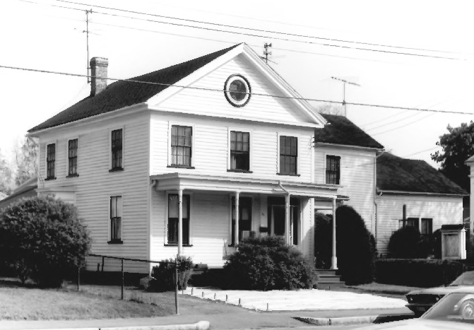
William Norcross House |
|
01984-03-29 March 29, 1984 |
14 Cushman St.
42°5′56″N 72°18′47″W / 42.09889°N 72.31306°W / 42.09889; -72.31306 (Norcross, William, House) |
Monson |
|
| 39 |
North High Street Historic District |
|
01986-06-26 June 26, 1986 |
High St. between Dwight and Lyman Sts.
42°12′29″N 72°36′26″W / 42.20806°N 72.60722°W / 42.20806; -72.60722 (North High Street Historic District) |
Holyoke |
Boundary increase (listed 1992-12-24): 233--411 High St.; Boundary increase II (listed 2008-09-12): 580 Dwight St., 230, 234 and 236 Maple St. |
| 40 |
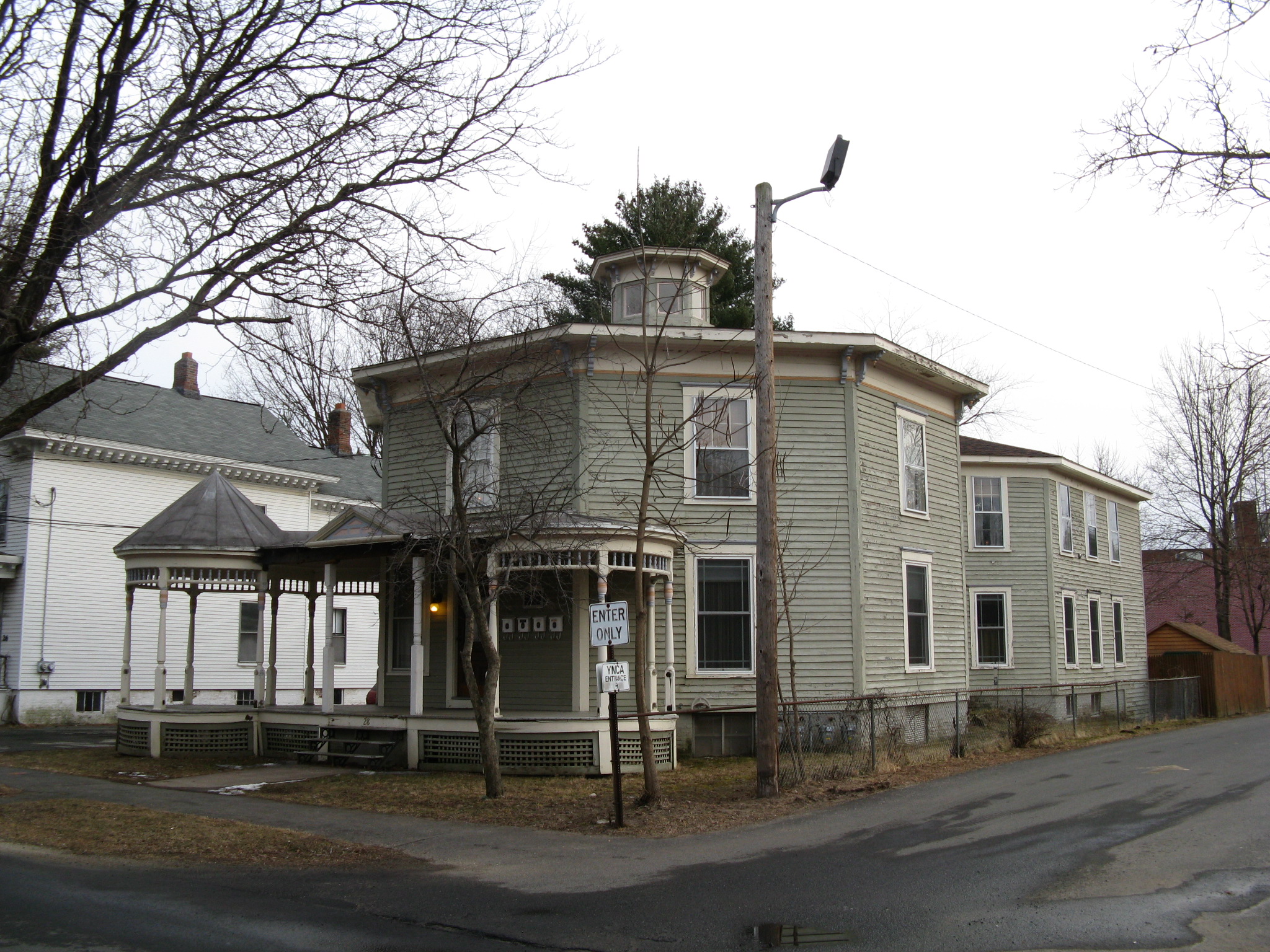
Octagon House |
 |
01982-04-01 April 1, 1982 |
28 King St.
42°7′17″N 72°45′19″W / 42.12139°N 72.75528°W / 42.12139; -72.75528 (Octagon House) |
Westfield |
|
| 41 |
Our Mother of Sorrows Monastery and Retreat Center |
|
02002-08-30 August 30, 2002 |
110 Monastery Ave.
42°7′7″N 72°37′57″W / 42.11861°N 72.6325°W / 42.11861; -72.6325 (Our Mother of Sorrows Monastery and Retreat Center) |
West Springfield |
|
| 42 |
Thomas D. Page House |
|
01988-10-25 October 25, 1988 |
105 East St.
42°9′22″N 72°34′39″W / 42.15611°N 72.5775°W / 42.15611; -72.5775 (Page, Thomas D., House) |
Chicopee |
|
| 43 |
Palmer Memorial Hall |
 |
01999-09-03 September 3, 1999 |
1029 Central St.
42°9′23″N 72°19′39″W / 42.15639°N 72.3275°W / 42.15639; -72.3275 (Palmer Memorial Hall) |
Palmer |
|
| 44 |
Polish National Home |
|
01980-11-14 November 14, 1980 |
136-144 Cabot St.
42°8′41″N 72°36′35″W / 42.14472°N 72.60972°W / 42.14472; -72.60972 (Polish National Home) |
Chicopee |
|
| 45 |
Prospect Hill School |
 |
02008-11-19 November 19, 2008 |
33 Montgomery St.
42°8′3″N 72°44′46″W / 42.13417°N 72.74611°W / 42.13417; -72.74611 (Prospect Hill School) |
Westfield |
|
| 46 |
Prospect Park |
|
02004-09-10 September 10, 2004 |
Maple St., Arbor Way, and the Connecticut River
42°12′43″N 72°36′21″W / 42.21194°N 72.60583°W / 42.21194; -72.60583 (Prospect Park) |
Holyoke |
|
| 47 |
Purchase-Ferre House |
|
01990-11-29 November 29, 1990 |
1289 Main St.
42°2′58″N 72°36′58″W / 42.04944°N 72.61611°W / 42.04944; -72.61611 (Purchase-Ferre House) |
Agawam |
|
| 48 |
Clovis Robert Block |
|
02002-12-05 December 5, 2002 |
338-348 Main St.
42°11′59″N 72°36′28″W / 42.19972°N 72.60778°W / 42.19972; -72.60778 (Robert, Clovis, Block) |
Holyoke |
|
| 49 |
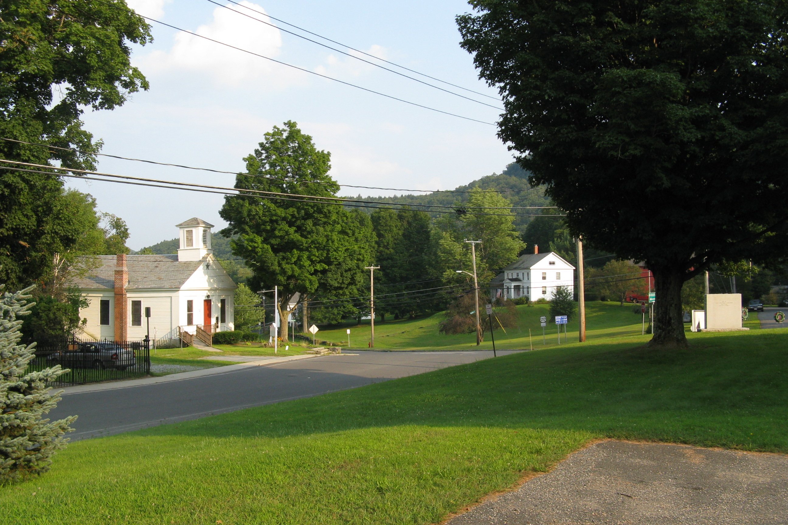
Russell Center Historic District |
 |
01996-12-27 December 27, 1996 |
Junction of Main and Lincoln Ave.
42°11′22″N 72°51′24″W / 42.18944°N 72.85667°W / 42.18944; -72.85667 (Russell Center Historic District) |
Russell |
|
| 50 |
Sanford Whip Factory |
 |
02008-12-10 December 10, 2008 |
330 Elm St.
42°7′39.36″N 72°44′50.28″W / 42.1276°N 72.7473°W / 42.1276; -72.7473 (Sanford Whip Factory) |
Westfield |
|
| 51 |
Thomas and Esther Smith House |
 |
02005-06-02 June 2, 2005 |
251 North West St.
42°4′31″N 72°41′44″W / 42.07528°N 72.69556°W / 42.07528; -72.69556 (Smith, Thomas and Esther, House) |
Agawam |
|
| 52 |
Springfield Street Historic District |
|
01991-01-25 January 25, 1991 |
Roughly bounded by Springfield St., Gaylord St. and Fairview Ave.
42°8′38″N 72°36′14″W / 42.14389°N 72.60389°W / 42.14389; -72.60389 (Springfield Street Historic District) |
Chicopee |
|
| 53 |
State Normal Training School |
 |
01983-07-07 July 7, 1983 |
Washington St.
42°7′19″N 72°45′8″W / 42.12194°N 72.75222°W / 42.12194; -72.75222 (State Normal Training School) |
Westfield |
|
| 54 |
Swetland-Pease House |
|
01980-04-09 April 9, 1980 |
SE of East Longmeadow at 191 Pease Rd.
42°2′38″N 72°29′41″W / 42.04389°N 72.49472°W / 42.04389; -72.49472 (Swetland-Pease House) |
East Longmeadow |
|
| 55 |
Union Station |
 |
01988-06-09 June 9, 1988 |
Depot St.
42°9′20″N 72°19′47″W / 42.15556°N 72.32972°W / 42.15556; -72.32972 (Union Station) |
Palmer |
|
| 56 |
United States Whip Company Complex |
|
01983-11-29 November 29, 1983 |
24 Main St.
42°7′12″N 72°44′53″W / 42.12°N 72.74806°W / 42.12; -72.74806 (United States Whip Company Complex) |
Westfield |
|
| 57 |
US Post Office-Holyoke Main |
|
01986-01-21 January 21, 1986 |
650 Dwight St.
42°12′29″N 72°36′38″W / 42.20806°N 72.61056°W / 42.20806; -72.61056 (US Post Office-Holyoke Main) |
Holyoke |
|
| 58 |
US Post Office-Palmer Main |
 |
01985-12-12 December 12, 1985 |
Park and Central Sts.
42°9′28″N 72°19′39″W / 42.15778°N 72.3275°W / 42.15778; -72.3275 (US Post Office-Palmer Main) |
Palmer |
|
| 59 |
Valentine School |
|
01983-09-16 September 16, 1983 |
Grape and Elm Sts.
42°8′46″N 72°36′12″W / 42.14611°N 72.60333°W / 42.14611; -72.60333 (Valentine School) |
Chicopee |
|
| 60 |
H. M. Van Deusen Whip Company |
 |
01987-02-18 February 18, 1987 |
42 Arnold St.
42°7′22″N 72°45′3″W / 42.12278°N 72.75083°W / 42.12278; -72.75083 (Van Deusen, H. M., Whip Company) |
Westfield |
|
| 61 |
West Granville Historic District |
 |
01991-11-05 November 5, 1991 |
Roughly, Main Rd. from W of Beach Hill Rd. to South Ln. No. 2
42°4′39″N 72°56′18″W / 42.0775°N 72.93833°W / 42.0775; -72.93833 (West Granville Historic District) |
Granville |
|
| 62 |
Westfield Center Commercial Historic District |
 |
02008-06-10 June 10, 2008 |
91-115, 100-174 Elm St.
42°7′21.76″N 72°44′54.53″W / 42.1227111°N 72.7484806°W / 42.1227111; -72.7484806 (Westfield Center Commercial Historic District) |
Westfield |
|
| 63 |
Westfield Municipal Building |
 |
01978-03-08 March 8, 1978 |
59 Court St.
42°7′14″N 72°45′19″W / 42.12056°N 72.75528°W / 42.12056; -72.75528 (Westfield Municipal Building) |
Westfield |
|
| 64 |
Westfield Whip Manufacturing Company |
 |
01985-10-17 October 17, 1985 |
360 Elm St.
42°7′41″N 72°44′50″W / 42.12806°N 72.74722°W / 42.12806; -72.74722 (Westfield Whip Manufacturing Company) |
Westfield |
|
| 65 |
Wistariahurst |
|
01973-04-23 April 23, 1973 |
238 Cabot St.
42°12′17″N 72°37′4″W / 42.20472°N 72.61778°W / 42.20472; -72.61778 (Wistariahurst) |
Holyoke |
|
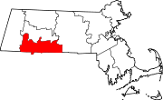
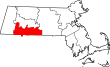 Location of Hampden County in Massachusetts