- Wales, Massachusetts
Infobox Settlement
official_name = Wales, Massachusetts
nickname =
motto =
imagesize =
image_caption =
image_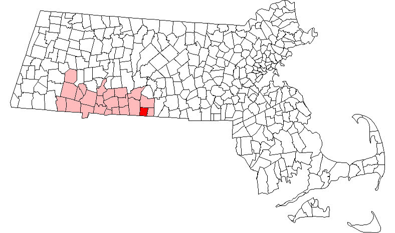
mapsize = 250px
map_caption = Location in Hampden County in Massachusetts
mapsize1 =
map_caption1 =
subdivision_type = Country
subdivision_name =United States
subdivision_type1 = State
subdivision_name1 =Massachusetts
subdivision_type2 = County
subdivision_name2 = Hampden
established_title = Settled
established_date = 1726
established_title2 = Incorporated
established_date2 = 1775
established_title3 =
established_date3 =
government_type =Open town meeting
leader_title =
leader_name =
leader_title1 =
leader_name1 =
area_magnitude =
area_total_km2 = 41.3
area_total_sq_mi = 16.0
area_land_km2 = 40.8
area_land_sq_mi = 15.8
area_water_km2 = 0.5
area_water_sq_mi = 0.2
population_as_of = 2000
settlement_type = Town
population_total = 1737
population_density_km2 = 42.6
population_density_sq_mi = 110.3
elevation_m = 289
elevation_ft = 949
timezone = Eastern
utc_offset = -5
timezone_DST = Eastern
utc_offset_DST = -4
latd = 42 |latm = 04 |lats = 10 |latNS = N
longd = 72 |longm = 13 |longs = 22 |longEW = W
website =
postal_code_type = ZIP code
postal_code = 01081
area_code = 413
blank_name = FIPS code
blank_info = 25-72390
blank1_name = GNIS feature ID
blank1_info = 0619389
footnotes =Wales is a town in Hampden County,
Massachusetts ,United States . The population was 1,737 at the 2000 census. It is part of theSpringfield, Massachusetts Metropolitan Statistical Area.History
Wales was first settled in 1726 and was officially incorporated on
August 23 1775 as South Brimfield, a name it kept untilFebruary 20 1828 .Geography
According to the
United States Census Bureau , the town has a total area of 16.0square mile s (41.3km² ), of which, 15.8 square miles (40.8 km²) of it is land and 0.2 square miles (0.5 km²) of it (1.32%) is water. Wales is bounded on the west by Monson; on the south by Stafford,Connecticut and Union,Connecticut ; on the east by Holland; and on the north by Brimfield.Education
Wales Elementary School, serving grades K-6, has its own
school committee , part of School Union 61. Wales students attend Tantasqua Regional Junior High School (grades 7-8) andTantasqua Regional High School in Sturbridge. Union 61 and the Tantasqua district share administrators, including the superintendent, and both include Brimfield, Brookfield, Holland, Sturbridge and Wales.Demographics
As of the
census GR|2 of 2000, there were 1,737 people, 660 households, and 481 families residing in the town. Thepopulation density was 110.3 people per square mile (42.6/km²). There were 796 housing units at an average density of 50.5/sq mi (19.5/km²). The racial makeup of the town was 97.75% White, 0.52% African American, 0.29% Native American, 0.17% Asian, 0.35% from other races, and 0.92% from two or more races. Hispanic or Latino of any race were 0.63% of the population.There were 660 households out of which 33.5% had children under the age of 18 living with them, 57.4% were married couples living together, 11.1% had a female householder with no husband present, and 27.1% were non-families. 20.3% of all households were made up of individuals and 5.2% had someone living alone who was 65 years of age or older. The average household size was 2.63 and the average family size was 3.01.
In the town the population was spread out with 25.0% under the age of 18, 6.4% from 18 to 24, 32.2% from 25 to 44, 29.0% from 45 to 64, and 7.3% who were 65 years of age or older. The median age was 38 years. For every 100 females there were 99.2 males. For every 100 females age 18 and over, there were 96.1 males.
The median income for a household in the town was $48,906, and the median income for a family was $51,629. Males had a median income of $39,766 versus $27,557 for females. The
per capita income for the town was $21,267. About 1.8% of families and 3.5% of the population were below thepoverty line , including 3.2% of those under age 18 and 3.9% of those age 65 or over.
Wikimedia Foundation. 2010.