- Tolland, Massachusetts
Infobox Settlement
official_name = Tolland, Massachusetts
nickname =
motto =
imagesize =
image_caption =
image_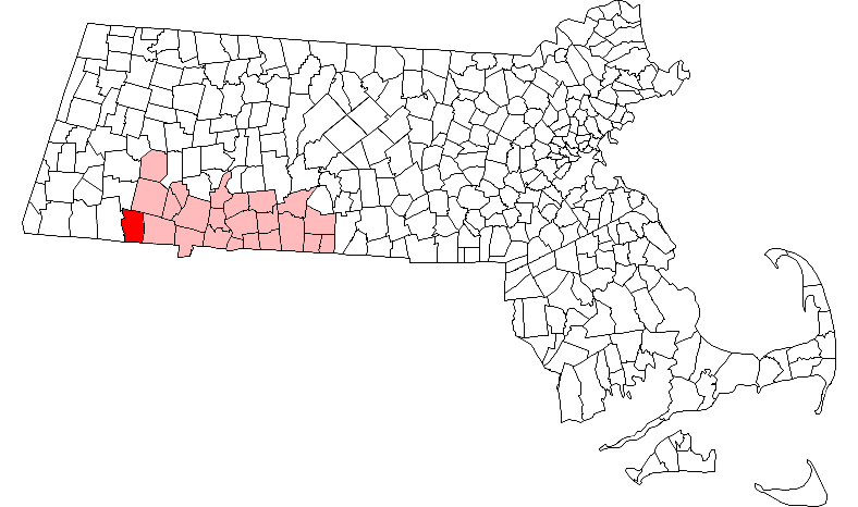
mapsize = 250px
map_caption = Location in Hampden County in Massachusetts
mapsize1 =
map_caption1 =
subdivision_type = Country
subdivision_name =United States
subdivision_type1 = State
subdivision_name1 =Massachusetts
subdivision_type2 = County
subdivision_name2 = Hampden
established_title = Settled
established_date = 1750
established_title2 = Incorporated
established_date2 = 1810
established_title3 =
established_date3 =
government_type =Open town meeting
leader_title =
leader_name =
leader_title1 =
leader_name1 =
area_magnitude =
area_total_km2 = 84.9
area_total_sq_mi = 32.8
area_land_km2 = 81.9
area_land_sq_mi = 31.6
area_water_km2 = 3.0
area_water_sq_mi = 1.1
population_as_of = 2000
settlement_type = Town
population_total = 426
population_density_km2 = 5.2
population_density_sq_mi = 13.5
elevation_m = 463
elevation_ft = 1519
timezone = Eastern
utc_offset = -5
timezone_DST = Eastern
utc_offset_DST = -4
latd = 42 |latm = 04 |lats = 52 |latNS = N
longd = 73 |longm = 00 |longs = 45 |longEW = W
website = http://www.tolland-ma.gov
postal_code_type = ZIP code
postal_code = 01034
area_code = 413
blank_name = FIPS code
blank_info = 25-70045
blank1_name = GNIS feature ID
blank1_info = 0618192
footnotes =Tolland is a town in Hampden County,
Massachusetts ,United States . The population was 426 at the 2000 census. It is part of theSpringfield, Massachusetts Metropolitan Statistical Area. Tolland formerly had a popular "Black Fly Day" parade, which was celebrated in June. It has been replaced with a picnic on the town green. The Tolland 4H group is currently constructing a hiking trail that will be open to the general public. It is located on Route 57, next to a large green sign.History
Tolland was first settled in 1750 and was officially incorporated in 1810.
Geography
According to the
US Census Bureau , the town has a total area of 32.8square mile s (84.9km² ), of which, 31.6 square miles (81.9 km²) of it is land and 1.1 square miles (3.0 km²) of it (3.48%) is water.Tolland is bordered on the north by Otis and Blandford, on the east by Granville, on the south by Hartland, CT and Colebrook, CT, and on the west by Sandisfield.
Demographics
As of the
census GR|2 of 2000, there were 426 people, 169 households, and 114 families residing in the town. Thepopulation density was 13.5 people per square mile (5.2/km²). There were 478 housing units at an average density of 15.1/sq mi (5.8/km²). The racial makeup of the town was 97.42% White, 0.94% African American, 1.17% Native American, 0.23% Asian, and 0.23% from two or more races. Hispanic or Latino of any race were 1.17% of the population.There were 169 households out of which 26.6% had children under the age of 18 living with them, 66.3% were married couples living together, 1.2% had a female householder with no husband present, and 32.0% were non-families. 28.4% of all households were made up of individuals and 13.0% had someone living alone who was 65 years of age or older. The average household size was 2.52 and the average family size was 3.06.
In the town the population was spread out with 23.9% under the age of 18, 3.3% from 18 to 24, 31.0% from 25 to 44, 28.9% from 45 to 64, and 12.9% who were 65 years of age or older. The median age was 41 years. For every 100 females there were 114.1 males. For every 100 females age 18 and over, there were 118.9 males.
The median income for a household in the town was $53,125, and the median income for a family was $65,417. Males had a median income of $41,094 versus $35,278 for females. The
per capita income for the town was $30,126. About 2.3% of families and 4.2% of the population were below thepoverty line , including none of those under age 18 and 17.7% of those age 65 or over.
Wikimedia Foundation. 2010.