- Monson, Massachusetts
-
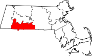
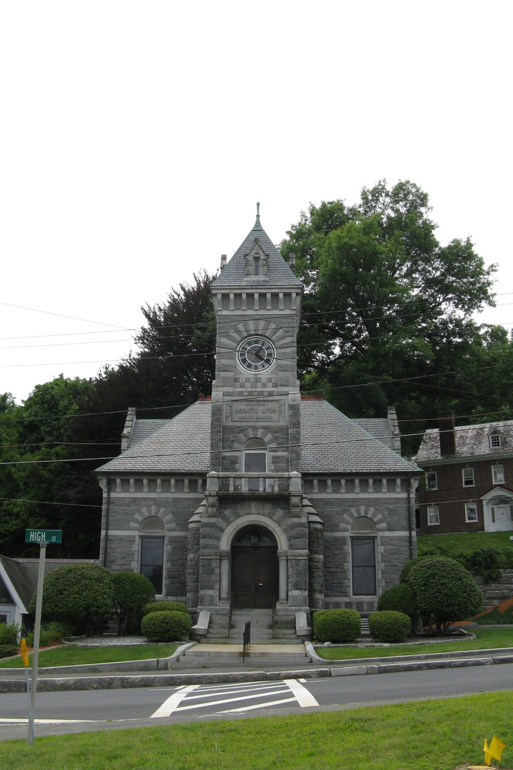
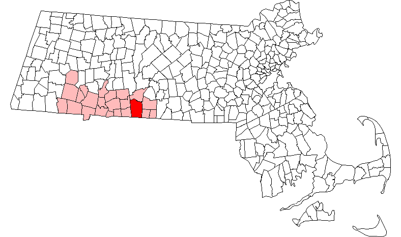
Monson, Massachusetts — Town — Monson Free Library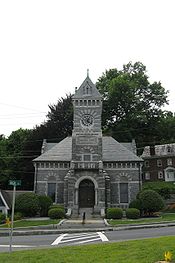 Location in Hampden County in Massachusetts
Coordinates: 42°06′15″N 72°19′10″W / 42.10417°N 72.31944°WCoordinates: 42°06′15″N 72°19′10″W / 42.10417°N 72.31944°W Country United States State Massachusetts County Hampden Settled 1715 Incorporated 1775 Government – Type Open town meeting – Board of
SelectmenRichard E. Guertin (chairman), Edward S. Harrison,
and Kathleen C. NorbutArea – Total 44.8 sq mi (116.1 km2) – Land 44.3 sq mi (114.7 km2) – Water 0.5 sq mi (1.4 km2) Elevation 407 ft (124 m) Population (2010) – Total 8,560 – Density 193.2/sq mi (74.6/km2) Time zone Eastern (UTC-5) – Summer (DST) Eastern (UTC-4) ZIP code 01057 Area code(s) 413 FIPS code 25-42145 GNIS feature ID 0618188 Website http://www.monson-ma.gov/ Monson (
 /ˈmʌnsən/) is a town in Hampden County, Massachusetts, United States. The population was 8,560 at the 2010 census. It is part of the Springfield, Massachusetts Metropolitan Statistical Area.
The village of Monson Center lies at the center of the town.
Monson was hit by a devastating EF3 tornado on June 1 2011 that destroyed an extensive amount of the town.
Contents
History
Monson was first settled in the year 1715 and was officially incorporated in 1775. The town was named after Sir John Monson, a friend of the governor.[1] Monson was largely a mill town until most of the mills in town closed down due to poor business. Monson also had a large granite quarry that was opened by Rufus Flynt, later owned by his oldest son William Flynt. It was closed around 1935. On the afternoon of Wednesday, June 1, 2011, an EF-3 tornado struck and caused extensive damage to the center of town. On the night of October 29, 2011, a rare snow storm paralyzed Monson and the many other cities and towns in Western Massachusetts.[2]
Geography
According to the United States Census Bureau, the town has a total area of 44.8 square miles (116 km2); 44.3 square miles (115 km2) of which is land and 0.5 square miles (1.3 km2) of which is water.
Monson is bordered on the north by Palmer, on the east by Brimfield and Wales, on the south by Stafford, CT, and on the west by Hampden and Wilbraham.
Demographics
Historical populations Year Pop. ±% 1850 2,831 — 1860 3,164 +11.8% 1870 3,204 +1.3% 1880 3,758 +17.3% 1890 3,650 −2.9% 1900 3,402 −6.8% 1910 4,758 +39.9% 1920 4,826 +1.4% 1930 4,918 +1.9% 1940 5,597 +13.8% 1950 6,125 +9.4% 1960 6,712 +9.6% 1970 7,355 +9.6% 1980 7,315 −0.5% 1990 7,776 +6.3% 2000 8,359 +7.5% 2001* 8,485 +1.5% 2002* 8,647 +1.9% 2003* 8,784 +1.6% 2004* 8,865 +0.9% 2005* 8,956 +1.0% 2006* 9,012 +0.6% 2007* 9,125 +1.3% 2008* 8,996 −1.4% 2009* 9,057 +0.7% 2010 8,560 −5.5% * = population estimate.
Source: United States Census records and Population Estimates Program data.[3][4][5][6][7][8][9][10][11][12]As of the census[13] of 2000, there were 8,359 people, 3,095 households, and 2,203 families residing in the town. The population density was 188.8 people per square mile (72.9/km²). There were 3,213 housing units at an average density of 72.6 per square mile (28.0/km²). The racial makeup of the town was 97.69% White, 0.67% African American, 0.23% Native American, 0.31% Asian, 0.01% Pacific Islander, 0.23% from other races, and 0.86% from two or more races. Hispanic or Latino of any race were 1.17% of the population.
There were 3,095 households out of which 34.2% had children under the age of 18 living with them, 57.9% were married couples living together, 9.4% had a female householder with no husband present, and 28.8% were non-families. 22.8% of all households were made up of individuals and 9.1% had someone living alone who was 65 years of age or older. The average household size was 2.63 and the average family size was 3.12.
In the town the population was spread out with 25.2% under the age of 18, 6.7% from 18 to 24, 31.3% from 25 to 44, 25.8% from 45 to 64, and 10.9% who were 65 years of age or older. The median age was 38 years. For every 100 females there were 97.4 males. For every 100 females age 18 and over, there were 95.5 males.
The median income for a household in the town was $52,030, and the median income for a family was $58,607. Males had a median income of $41,373 versus $30,545 for females. The per capita income for the town was $22,519. About 5.2% of families and 5.6% of the population were below the poverty line, including 6.8% of those under age 18 and 3.7% of those age 65 or over.
Trivia
- Monson, like its neighboring town of Hampden, does not have a single traffic light, but it does have a blinking light at the intersection of Route 32 and High Street in the center of town.
- Monson is home to the Monson Developmental Center, a hospital for the mentally disabled that has served as a home for epileptics and people with other disorders since the 1800s.
Notable residents
- Allan Bérubé (1946-2007), historian, activist, and author
- Samuel Robbins Brown (1810-1880), missionary
- George Stewart Miller (1884-1971), educator
- Arthur D. Norcross (1848-?), musician and politician
- Erasmus D. Peck (1808-1876), politician
- Albert G. Riddle (1816-1902), politician
- Sal Salvador (1928-1999), jazz musician
- Henry Martin Tupper (1831-1893), minister and educator
Notable places
- Conant Brook Dam
- First Church of Monson
- Flynt Quarry
- Memorial Town Hall
- Monson High School
- Peaked Mountain
- William Norcross House
Mills
References
- ^ "Profile for Monson, Massachusetts". ePodunk. http://www.epodunk.com/cgi-bin/genInfo.php?locIndex=3043. Retrieved 2010-05-07.
- ^ WWLP
- ^ "TOTAL POPULATION (P1), 2010 Census Summary File 1, All County Subdivisions within Massachusetts". United States Census Bureau. http://factfinder2.census.gov/bkmk/table/1.0/en/DEC/10_SF1/P1/0400000US25.06000. Retrieved September 13, 2011.
- ^ "Massachusetts by Place and County Subdivision - GCT-T1. Population Estimates". United States Census Bureau. http://factfinder.census.gov/servlet/GCTTable?_bm=y&-geo_id=04000US25&-_box_head_nbr=GCT-T1&-ds_name=PEP_2009_EST&-_lang=en&-format=ST-9&-_sse=on. Retrieved July 12, 2011.
- ^ "1990 Census of Population, General Population Characteristics: Massachusetts". US Census Bureau. December 1990. Table 76: General Characteristics of Persons, Households, and Families: 1990. 1990 CP-1-23. http://www.census.gov/prod/cen1990/cp1/cp-1-23.pdf. Retrieved July 12, 2011.
- ^ "1980 Census of the Population, Number of Inhabitants: Massachusetts". US Census Bureau. December 1981. Table 4. Populations of County Subdivisions: 1960 to 1980. PC80-1-A23. http://www2.census.gov/prod2/decennial/documents/1980a_maABC-01.pdf. Retrieved July 12, 2011.
- ^ "1950 Census of Population". Bureau of the Census. 1952. Section 6, Pages 21-10 and 21-11, Massachusetts Table 6. Population of Counties by Minor Civil Divisions: 1930 to 1950. http://www2.census.gov/prod2/decennial/documents/23761117v1ch06.pdf. Retrieved July 12, 2011.
- ^ "1920 Census of Population". Bureau of the Census. Number of Inhabitants, by Counties and Minor Civil Divisions. Pages 21-5 through 21-7. Massachusetts Table 2. Population of Counties by Minor Civil Divisions: 1920, 1910, and 1920. http://www2.census.gov/prod2/decennial/documents/41084506no553ch2.pdf. Retrieved July 12, 2011.
- ^ "1890 Census of the Population". Department of the Interior, Census Office. Pages 179 through 182. Massachusetts Table 5. Population of States and Territories by Minor Civil Divisions: 1880 and 1890. http://www2.census.gov/prod2/decennial/documents/41084506no553ch2.pdf. Retrieved July 12, 2011.
- ^ "1870 Census of the Population". Department of the Interior, Census Office. 1872. Pages 217 through 220. Table IX. Population of Minor Civil Divisions, &c. Massachusetts. http://www2.census.gov/prod2/decennial/documents/1870e-05.pdf. Retrieved July 12, 2011.
- ^ "1860 Census". Department of the Interior, Census Office. 1864. Pages 220 through 226. State of Massachusetts Table No. 3. Populations of Cities, Towns, &c.. http://www2.census.gov/prod2/decennial/documents/1860a-08.pdf. Retrieved July 12, 2011.
- ^ "1850 Census". Department of the Interior, Census Office. 1854. Pages 338 through 393. Populations of Cities, Towns, &c.. http://www2.census.gov/prod2/decennial/documents/1850c-11.pdf. Retrieved July 12, 2011.
- ^ "American FactFinder". United States Census Bureau. http://factfinder.census.gov. Retrieved 2008-01-31.
External links
Municipalities and communities of Hampden County, Massachusetts Cities Agawam | Chicopee | Holyoke | Palmer | Springfield | West Springfield | Westfield
Towns Blandford | Brimfield | Chester | East Longmeadow | Granville | Hampden | Holland | Longmeadow | Ludlow | Monson | Montgomery | Russell | Southwick | Tolland | Wales | Wilbraham
CDPs Other
villageFootnotes ‡This populated place also has portions in an adjacent county or counties
Categories:- Towns in Hampden County, Massachusetts
- Springfield, Massachusetts metropolitan area

Wikimedia Foundation. 2010.