- Palmer, Massachusetts
-
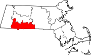
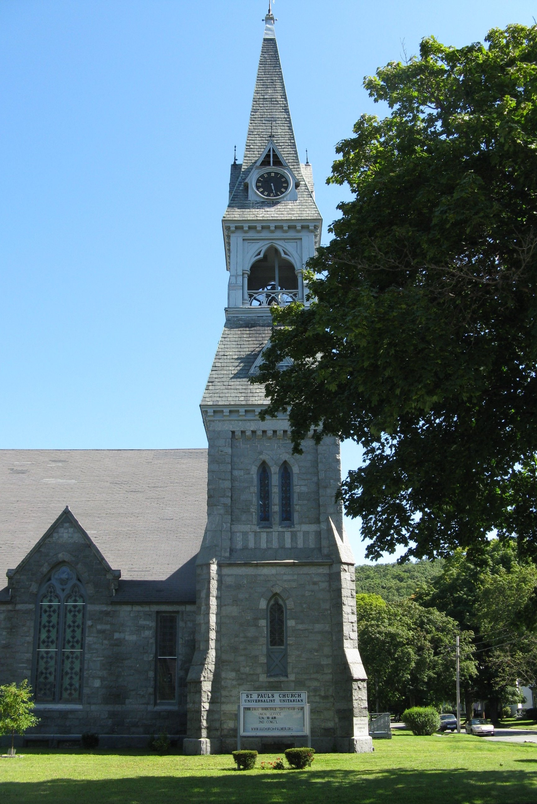
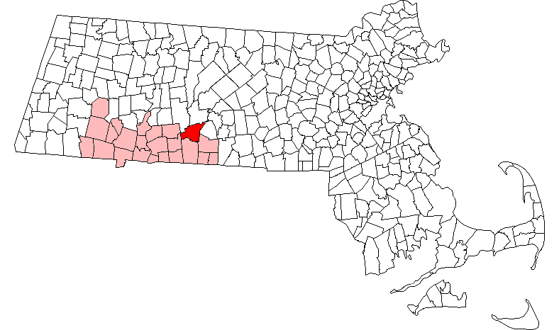
Palmer, Massachusetts — City — St. Paul's Church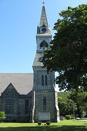 Location in Hampden County in Massachusetts
Coordinates: 42°09′30″N 72°19′45″W / 42.15833°N 72.32917°WCoordinates: 42°09′30″N 72°19′45″W / 42.15833°N 72.32917°W Country United States State Massachusetts County Hampden Settled 1727 Incorporated 1775 Government – Type Council-manager – Councilors-at-large Paul Burns, Council President
Michael Magiera, Karl, Williams, Eric Duda, William Hielman, District Councilors, Barbara Barry, Phil Hebert, Raymond Remillard and Roger Duguay– Town Manager Matthew Streeter Area – Total 32.0 sq mi (82.9 km2) – Land 31.5 sq mi (81.7 km2) – Water 0.5 sq mi (1.3 km2) Elevation 330 ft (101 m) Population (2000) – Total 12,497 – Density 396.3/sq mi (153.0/km2) Time zone Eastern (UTC-5) – Summer (DST) Eastern (UTC-4) ZIP code 01069 Area code(s) 413 FIPS code 25-52105 GNIS feature ID 0619387 The Town of Palmer is a city in Hampden County, Massachusetts, United States. The population was 12,140 as of the 2000 census. It is part of the Springfield, Massachusetts Metropolitan Statistical Area. Although known as a town, Palmer adopted a home rule charter in 2004 with a council-manager form of government and is considered a city under Massachusetts law.
The communities of Bondsville, Thorndike, Depot Village, and Three Rivers are located in the town.
Contents
History
Palmer is composed of four separate and distinct villages: Depot Village (named for the ornate Union Station railroad terminal designed by architect Henry Hobson Richardson), Thorndike, Three Rivers, and Bondsville. The villages began to develop their distinctive characters in the 18th century, and by the 19th century, two rail lines and a trolley line opened the town to population growth. Today, each village has its own post office and fire stations. Palmer's first settler was John King. He was born in Edwardstone, Suffolk, England. He built his home in 1716 on the banks of the Chicopee River. A large group of Scottish-Irish Presbyterians followed, arriving in 1727. In 1775, Massachusetts officially incorporated Palmer. Depot Village became Palmer's main commercial and business center during the late 19th century and remains so today. Palmer's industry developed in Bondsville. During the 18th century, saw and grist mills were established by the rivers. By 1825, Palmer woolen mills began to produce textiles. Subsequently, the Blanchard Scythe Factory, Wright Wire Woolen Mills, and the Holden-Fuller Woolen Mills developed major industrial capacity, and constructed large amounts of workers' housing. By 1900, Boston Duck (which made heavy cotton fabric) had over 500 employees in the town. Camp Ramah in New England is located in Palmer, and it is one of the older Ramah camps. The 20th century brought about a shift of immigrants in Palmer from those of French and Scottish origin to those of primarily Polish and French-Canadian extraction.
Future development
The New England Region of the Sports Car Club of America has reached an agreement with the Town of Palmer to construct a new road course near their town. Palmer Motorsports Park will operate along a similar vein as Buttonwillow Raceway Park in California, in that it will be owned and operated by a limited liability corporation formed by New England Region. This effort is to ensure that NER would have its own "flagship" racetrack, as the two tracks it currently uses - New Hampshire Motor Speedway and Lime Rock Park in Connecticut - are heavily used by NASCAR. The benefits to the town would include upwards of $50,000 a year in property income taxes and increased business at local gas stations, restaurants, motels and retail stores.
As of 2011, Palmer is the site favored by Mohegan Sun for a "resort style" casino.[1] This casino would lie directly off of Palmer's exit on the Mass Pike, not far from its Main Street, where the railroad would bring additional tourists. Ironically, the Palmer Amtrak stop is scheduled, in late 2012, to be re-routed to the Central Corridor Rail Line, with a southern terminus in New London, Connecticut and a northern terminus in Brattleboro, Vermont, passing the original Mohegan Sun - so, hypothetically, one could travel door-to-door from one Mohegan Sun to the other by rail.
Geography
According to the United States Census Bureau, the town has a total area of 32.0 square miles (82.9 km²), of which 31.5 square miles (81.7 km²) are land and 0.5 square mile (1.3 km²) (1.53%) is water. The town is bordered by Ludlow and Wilbraham on the southwest, Belchertown on the northwest, Ware on the northeast, Warren on the east, Brimfield on the southeast, and Monson on the south.
Demographics
Historical populations Year Pop. ±% 1850 3,974 — 1860 4,082 +2.7% 1870 3,631 −11.0% 1880 5,504 +51.6% 1890 7,520 +36.6% 1900 7,801 +3.7% 1910 8,610 +10.4% 1920 9,896 +14.9% 1930 9,677 −2.2% 1940 9,149 −5.5% 1950 9,533 +4.2% 1960 10,358 +8.7% 1970 11,680 +12.8% 1980 11,389 −2.5% 1990 12,054 +5.8% 2000 12,497 +3.7% 2001* 12,677 +1.4% 2002* 12,872 +1.5% 2003* 13,009 +1.1% 2004* 13,122 +0.9% 2005* 13,185 +0.5% 2006* 13,217 +0.2% 2007* 13,276 +0.4% 2008* 13,000 −2.1% 2009* 13,101 +0.8% 2010 12,140 −7.3% * = population estimate.
Source: United States Census records and Population Estimates Program data.[2][3][4][5][6][7][8][9][10][11]As of the census[12] of 2000, there were 12,497 people, 5,078 households, and 3,331 families residing in the town. The population density was 396.3 people per square mile (153.0/km²). There were 5,402 housing units at an average density of 171.3 per square mile (66.2/km²). The racial makeup of the town was 96.82% White, 0.75% Black or African American, 0.23% Native American, 0.56% Asian, 0.44% from other races, and 1.19% from two or more races. Hispanic or Latino of any race were 1.23% of the population.
There were 5,078 households out of which 31.6% had children under the age of 18 living with them, 48.5% were married couples living together, 12.3% had a female householder with no husband present, and 34.4% were non-families. 28.7% of all households were made up of individuals and 13.0% had someone living alone who was 65 years of age or older. The average household size was 2.45 and the average family size was 3.01.
In the town the population was spread out with 25.2% under the age of 18, 6.8% from 18 to 24, 30.5% from 25 to 44, 22.0% from 45 to 64, and 15.5% who were 65 years of age or older. The median age was 38 years. For every 100 females there were 93.5 males. For every 100 females age 18 and over, there were 88.9 males.
The median income for a household in the town was $41,443, and the median income for a family was $49,358. Males had a median income of $35,748 versus $26,256 for females. The per capita income for the town was $18,664. About 5.8% of families and 7.9% of the population were below the poverty line, including 10.3% of those under age 18 and 9.8% of those age 65 or over.
Schools
The town of Palmer is served by four schools. Old Mill Pond Elementary School serves grades K through 4, Converse Middle School serves grades 5 through 7, and Palmer High School serves grades 8 through 12. Pathfinder Regional Vocational Technical High School is also located in Palmer, and serves grades 9 through 12.
Railroads
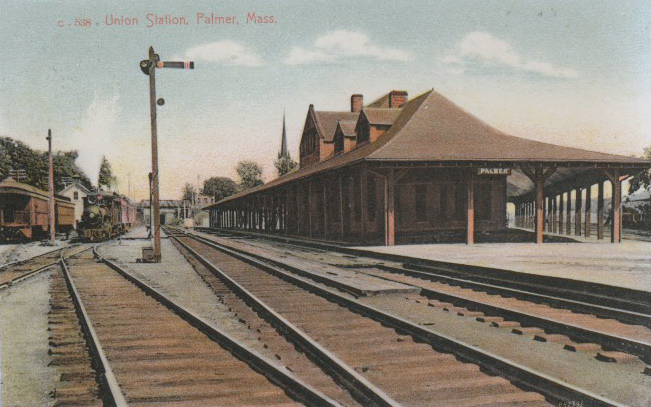
 Vintage Postcard View of Palmer Union Station
Palmer has been called the "Town of Seven Railroads". Those railroads included the Boston & Albany, Central Vermont, Boston & Maine, Ware River, Central Massachusetts, Hampden, and Southern New England railroads.[13]
Currently, the old B&A line is owned by CSX, and the old Central Vermont by New England Central Railroad. Massachusetts Central Railroad interchanges with the two roads in town. The Amtrak passenger trains Lake Shore Limited and Vermonter pass through Palmer, but the town does not have a station stop.
The Palmer Union Station is now home to the Steaming Tender Restaurant.
Camp
Camp Ramah in New England is located in Palmer.
References
- ^ WBUR Morning Edition. "A Casino in Palmer's Backyard". 2010-05-18. http://www.wbur.org/2010/05/18/palmer-casino. Retrieved 2010-0-07.]
- ^ "TOTAL POPULATION (P1), 2010 Census Summary File 1, All County Subdivisions within Massachusetts". United States Census Bureau. http://factfinder2.census.gov/bkmk/table/1.0/en/DEC/10_SF1/P1/0400000US25.06000. Retrieved September 13, 2011.
- ^ "Massachusetts by Place and County Subdivision - GCT-T1. Population Estimates". United States Census Bureau. http://factfinder.census.gov/servlet/GCTTable?_bm=y&-geo_id=04000US25&-_box_head_nbr=GCT-T1&-ds_name=PEP_2009_EST&-_lang=en&-format=ST-9&-_sse=on. Retrieved July 12, 2011.
- ^ "1990 Census of Population, General Population Characteristics: Massachusetts". US Census Bureau. December 1990. Table 76: General Characteristics of Persons, Households, and Families: 1990. 1990 CP-1-23. http://www.census.gov/prod/cen1990/cp1/cp-1-23.pdf. Retrieved July 12, 2011.
- ^ "1980 Census of the Population, Number of Inhabitants: Massachusetts". US Census Bureau. December 1981. Table 4. Populations of County Subdivisions: 1960 to 1980. PC80-1-A23. http://www2.census.gov/prod2/decennial/documents/1980a_maABC-01.pdf. Retrieved July 12, 2011.
- ^ "1950 Census of Population". Bureau of the Census. 1952. Section 6, Pages 21-10 and 21-11, Massachusetts Table 6. Population of Counties by Minor Civil Divisions: 1930 to 1950. http://www2.census.gov/prod2/decennial/documents/23761117v1ch06.pdf. Retrieved July 12, 2011.
- ^ "1920 Census of Population". Bureau of the Census. Number of Inhabitants, by Counties and Minor Civil Divisions. Pages 21-5 through 21-7. Massachusetts Table 2. Population of Counties by Minor Civil Divisions: 1920, 1910, and 1920. http://www2.census.gov/prod2/decennial/documents/41084506no553ch2.pdf. Retrieved July 12, 2011.
- ^ "1890 Census of the Population". Department of the Interior, Census Office. Pages 179 through 182. Massachusetts Table 5. Population of States and Territories by Minor Civil Divisions: 1880 and 1890. http://www2.census.gov/prod2/decennial/documents/41084506no553ch2.pdf. Retrieved July 12, 2011.
- ^ "1870 Census of the Population". Department of the Interior, Census Office. 1872. Pages 217 through 220. Table IX. Population of Minor Civil Divisions, &c. Massachusetts. http://www2.census.gov/prod2/decennial/documents/1870e-05.pdf. Retrieved July 12, 2011.
- ^ "1860 Census". Department of the Interior, Census Office. 1864. Pages 220 through 226. State of Massachusetts Table No. 3. Populations of Cities, Towns, &c.. http://www2.census.gov/prod2/decennial/documents/1860a-08.pdf. Retrieved July 12, 2011.
- ^ "1850 Census". Department of the Interior, Census Office. 1854. Pages 338 through 393. Populations of Cities, Towns, &c.. http://www2.census.gov/prod2/decennial/documents/1850c-11.pdf. Retrieved July 12, 2011.
- ^ "American FactFinder". United States Census Bureau. http://factfinder.census.gov. Retrieved 2008-01-31.
- ^ One Town & Seven Railroads - Palmer Public Library 2008
External links
- Town website
- Home rule charter of Palmer
- Massachusetts official website - Town of Palmer
- DCR Palmer Reconnaissance Report
 Chisholm, Hugh, ed (1911). "Palmer, Massachusetts". Encyclopædia Britannica (11th ed.). Cambridge University Press.
Municipalities and communities of Hampden County, Massachusetts Cities Agawam | Chicopee | Holyoke | Palmer | Springfield | West Springfield | Westfield
Towns CDPs Other
villageFootnotes ‡This populated place also has portions in an adjacent county or counties
Categories:- Cities in Massachusetts
- Populated places in Hampden County, Massachusetts
- Springfield, Massachusetts metropolitan area

Wikimedia Foundation. 2010.