| [3] |
Landmark name[4] |
Image |
Date listed |
Location |
City or Town |
Summary |
| 1 |
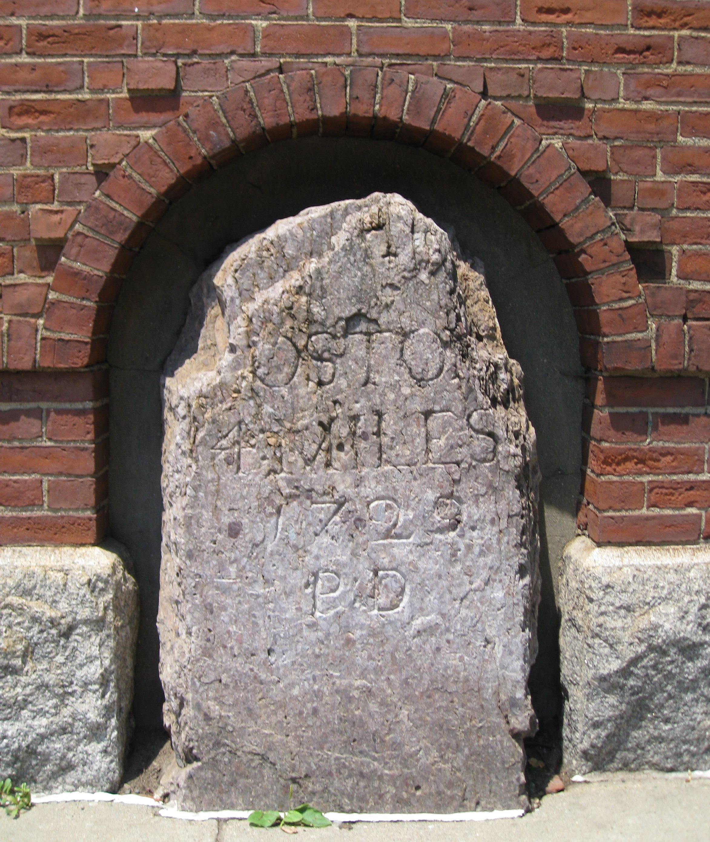
1767 Milestones |
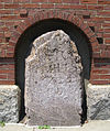 |
01971-04-07 April 7, 1971 |
Between Boston and Springfield along Old Post Rd.
42°6′25″N 72°34′46″W / 42.10694°N 72.57944°W / 42.10694; -72.57944 (1767 Milestones) |
Springfield |
The one Springfield marker is on the grounds of the Springfield Armory. Other markers are found in Worcester, Middlesex, Norfolk, and Suffolk counties. |
| 2 |
Ames Hill/Crescent Hill District |
|
01974-05-01 May 1, 1974 |
Bounded by sections of Central, Maple, Mill, and Pine Sts., Crescent Hill, Ames Hill Drive, and Maple Ct.
42°5′24″N 72°34′37″W / 42.09°N 72.57694°W / 42.09; -72.57694 (Ames Hill/Crescent Hill District) |
Springfield |
|
| 3 |
Apremont Triangle Historic District |
|
01983-05-27 May 27, 1983 |
Junction of Pearl, Hillman, Bridge, and Chestnut
42°6′19″N 72°35′21″W / 42.10528°N 72.58917°W / 42.10528; -72.58917 (Apremont Triangle Historic District) |
Springfield |
|
| 4 |
Bangs Block |
|
01983-02-24 February 24, 1983 |
1119 Main St.
42°6′0″N 72°35′9″W / 42.1°N 72.58583°W / 42.1; -72.58583 (Bangs Block) |
Springfield |
|
| 5 |
Baystate Corset Block |
|
01983-02-24 February 24, 1983 |
395-405 Dwight St. and 99 Taylor St.
42°6′21″N 72°35′31″W / 42.10583°N 72.59194°W / 42.10583; -72.59194 (Baystate Corset Block) |
Springfield |
|
| 6 |
Belle and Franklin Streets Historic District |
|
01989-03-02 March 2, 1989 |
77-103 Belle St. and 240-298 Franklin St.
42°6′45″N 72°35′31″W / 42.1125°N 72.59194°W / 42.1125; -72.59194 (Belle and Franklin Streets Historic District) |
Springfield |
|
| 7 |
Bicycle Club Building |
|
01983-02-24 February 24, 1983 |
264-270 Worthington St.
42°6′18″N 72°35′32″W / 42.105°N 72.59222°W / 42.105; -72.59222 (Bicycle Club Building) |
Springfield |
|
| 8 |
Burbach Block |
|
01983-02-24 February 24, 1983 |
1113-1115 Main St.
42°6′0″N 72°35′9″W / 42.1°N 72.58583°W / 42.1; -72.58583 (Burbach Block) |
Springfield |
|
| 9 |
The Calhoun Apartments |
|
02009-11-05 November 5, 2009 |
1391-1399 Dwight St. and 85 Jefferson Ave.
42°6′57.97″N 72°36′12.6″W / 42.1161028°N 72.6035°W / 42.1161028; -72.6035 (Calhoun Apartments, The) |
Springfield |
|
| 10 |
Carlton House Block |
|
01983-02-24 February 24, 1983 |
9-13 Hampden St.
42°6′13″N 72°35′40″W / 42.10361°N 72.59444°W / 42.10361; -72.59444 (Carlton House Block) |
Springfield |
|
| 11 |
Chapin National Bank Building |
|
01983-02-24 February 24, 1983 |
1675-1677 Main St.
42°6′16″N 72°35′42″W / 42.10444°N 72.595°W / 42.10444; -72.595 (Chapin National Bank Building) |
Springfield |
|
| 12 |
Colonial Block |
 |
01983-02-24 February 24, 1983 |
1139-55 Main St.
42°6′1″N 72°35′11″W / 42.10028°N 72.58639°W / 42.10028; -72.58639 (Colonial Block) |
Springfield |
|
| 13 |
Court Square Historic District |
 |
01974-05-02 May 2, 1974 |
Bounded by Main, State, Broadway, Pynchon Sts. and City HallPl.
42°6′2″N 72°35′22″W / 42.10056°N 72.58944°W / 42.10056; -72.58944 (Court Square Historic District) |
Springfield |
|
| 14 |
Cutler and Porter Block |
|
01983-02-24 February 24, 1983 |
109 Lyman St.
42°6′24″N 72°35′31″W / 42.10667°N 72.59194°W / 42.10667; -72.59194 (Cutler and Porter Block) |
Springfield |
|
| 15 |
Downtown Springfield Railroad District |
|
01983-05-27 May 27, 1983 |
Roughly bounded by Lyman, Main, Murray, and Spring Sts.
42°6′31″N 72°35′25″W / 42.10861°N 72.59028°W / 42.10861; -72.59028 (Downtown Springfield Railroad District) |
Springfield |
|
| 16 |
Driscoll's Block |
|
01983-02-24 February 24, 1983 |
211-13 Worthington St.
42°6′14″N 72°35′33″W / 42.10389°N 72.5925°W / 42.10389; -72.5925 (Driscoll's Block) |
Springfield |
|
| 17 |
Ethel Apartment House |
|
01987-03-06 March 6, 1987 |
70 Patton St.
42°6′36″N 72°35′57″W / 42.11°N 72.59917°W / 42.11; -72.59917 (Ethel Apartment House) |
Springfield |
|
| 18 |
First Church of Christ, Congregational |
 |
01972-02-01 February 1, 1972 |
50 Elm St.
42°6′3″N 72°35′23″W / 42.10083°N 72.58972°W / 42.10083; -72.58972 (First Church of Christ, Congregational) |
Springfield |
|
| 19 |
Fitzgerald's Stearns Square Block |
|
01983-02-24 February 24, 1983 |
300-308 Bridge St.
42°6′15″N 72°35′30″W / 42.10417°N 72.59167°W / 42.10417; -72.59167 (Fitzgerald's Stearns Square Block) |
Springfield |
|
| 20 |
Forest Park Heights Historic District |
|
01982-08-31 August 31, 1982 |
Off MA 21
42°5′4″N 72°34′19″W / 42.08444°N 72.57194°W / 42.08444; -72.57194 (Forest Park Heights Historic District) |
Springfield |
|
| 21 |
French Congregational Church |
|
01983-02-24 February 24, 1983 |
33-37 Bliss St.
42°5′58″N 72°35′16″W / 42.09944°N 72.58778°W / 42.09944; -72.58778 (French Congregational Church) |
Springfield |
|
| 22 |
Fuller Block |
 |
01983-02-24 February 24, 1983 |
1531-1545 Main St.
42°6′12″N 72°35′33″W / 42.10333°N 72.5925°W / 42.10333; -72.5925 (Fuller Block) |
Springfield |
|
| 23 |
Guenther & Handel's Block |
|
01983-02-24 February 24, 1983 |
7-9 Stockbridge St.
42°6′2″N 72°35′11″W / 42.10056°N 72.58639°W / 42.10056; -72.58639 (Guenther & Handel's Block) |
Springfield |
|
| 24 |
Gunn and Hubbard Blocks |
|
01980-12-03 December 3, 1980 |
463-477 State St.
42°6′27″N 72°34′40″W / 42.1075°N 72.57778°W / 42.1075; -72.57778 (Gunn and Hubbard Blocks) |
Springfield |
|
| 25 |
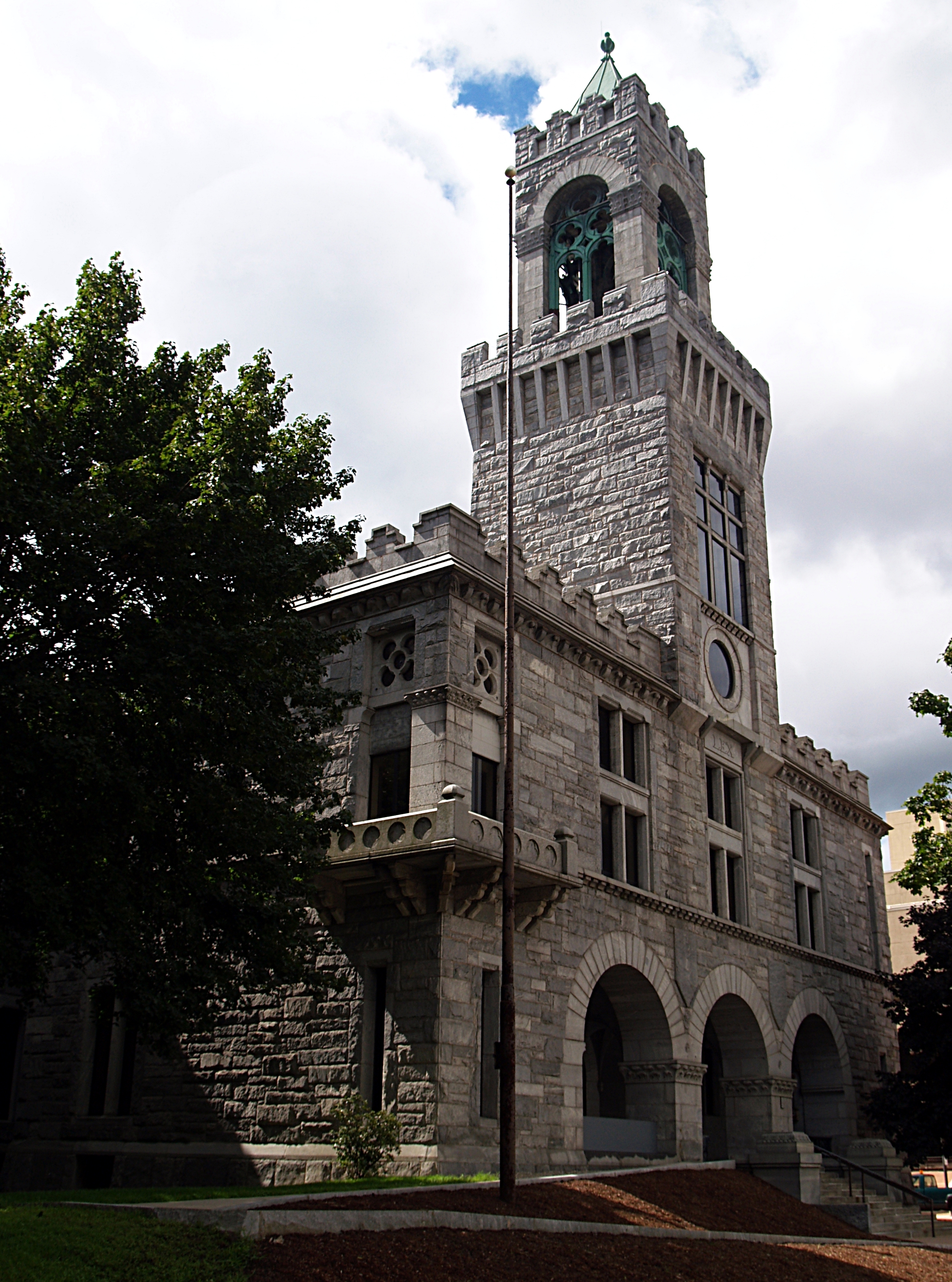
Hampden County Courthouse |
 |
01972-02-01 February 1, 1972 |
Elm St.
42°6′1″N 72°35′20″W / 42.10028°N 72.58889°W / 42.10028; -72.58889 (Hampden County Courthouse) |
Springfield |
|
| 26 |
Hampden Savings Bank |
|
01983-02-24 February 24, 1983 |
1665 Main St.
42°6′16″N 72°35′40″W / 42.10444°N 72.59444°W / 42.10444; -72.59444 (Hampden Savings Bank) |
Springfield |
|
| 27 |
Haynes Hotel Waters Building |
|
01983-02-24 February 24, 1983 |
1386-1402 Main St.
42°6′8″N 72°35′26″W / 42.10222°N 72.59056°W / 42.10222; -72.59056 (Haynes Hotel Waters Building) |
Springfield |
|
| 28 |
Henking Hotel and Cafe |
|
01983-02-24 February 24, 1983 |
15-21 Lyman St.
42°6′30″N 72°35′39″W / 42.10833°N 72.59417°W / 42.10833; -72.59417 (Henking Hotel and Cafe) |
Springfield |
|
| 29 |
Hiberian Block |
|
01983-02-24 February 24, 1983 |
345-349 Worthington St.
42°6′21″N 72°35′26″W / 42.10583°N 72.59056°W / 42.10583; -72.59056 (Hiberian Block) |
Springfield |
|
| 30 |
Indian Orchard Branch Library |
|
01999-02-26 February 26, 1999 |
44 Oak St.
42°9′33″N 72°30′17″W / 42.15917°N 72.50472°W / 42.15917; -72.50472 (Indian Orchard Branch Library) |
Springfield |
|
| 31 |
Kennedy-Worthington Blocks |
|
01979-06-14 June 14, 1979 |
1585-1623 Main St. and 166-190 Worthington St.
42°6′15″N 72°35′36″W / 42.10417°N 72.59333°W / 42.10417; -72.59333 (Kennedy-Worthington Blocks) |
Springfield |
|
| 32 |
Kenwyn Apartments |
|
01994-11-14 November 14, 1994 |
6 Kenwood Park and 413-415 Belmont Ave.
42°5′14″N 72°33′47″W / 42.08722°N 72.56306°W / 42.08722; -72.56306 (Kenwyn Apartments) |
Springfield |
|
| 33 |
Laurel Hall |
|
01987-03-06 March 6, 1987 |
72-74 Patton St.
42°6′36″N 72°35′57″W / 42.11°N 72.59917°W / 42.11; -72.59917 (Laurel Hall) |
Springfield |
|
| 34 |
Maple-Union Corners |
|
01976-04-26 April 26, 1976 |
77, 83, 76-78, 80-84 Maple St.
42°6′5″N 72°34′56″W / 42.10139°N 72.58222°W / 42.10139; -72.58222 (Maple-Union Corners) |
Springfield |
|
| 35 |
Masonic Temple |
|
01983-11-10 November 10, 1983 |
339-341 State St.
42°6′20″N 72°34′52″W / 42.10556°N 72.58111°W / 42.10556; -72.58111 (Masonic Temple) |
Springfield |
|
| 36 |
McIntosh Building |
|
01983-02-24 February 24, 1983 |
158-64 Chestnut St.
42°6′21″N 72°35′25″W / 42.10583°N 72.59028°W / 42.10583; -72.59028 (McIntosh Building) |
Springfield |
|
| 37 |
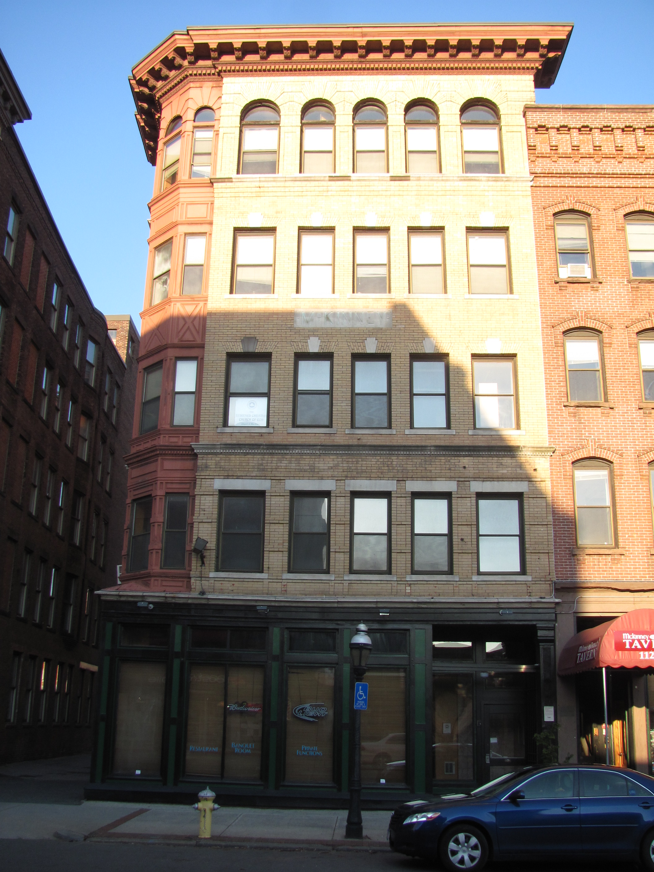
McKinney Building |
 |
01983-02-24 February 24, 1983 |
1121-27 Main St.
42°6′0″N 72°35′10″W / 42.1°N 72.58611°W / 42.1; -72.58611 (McKinney Building) |
Springfield |
|
| 38 |
McKnight District |
|
01976-04-26 April 26, 1976 |
Roughly bounded by Penn Central, State St., the Armory, and includes both sides of Campus Pl., and Dartmouth St.
42°6′52″N 72°34′19″W / 42.11444°N 72.57194°W / 42.11444; -72.57194 (McKnight District) |
Springfield |
|
| 39 |
Memorial Square District |
|
01977-08-29 August 29, 1977 |
Main and Plainfield Sts.
42°6′37″N 72°36′10″W / 42.11028°N 72.60278°W / 42.11028; -72.60278 (Memorial Square District) |
Springfield |
|
| 40 |
Mills-Hale-Owen Blocks |
|
01985-10-31 October 31, 1985 |
959-991 Main St.
42°5′56″N 72°35′6″W / 42.09889°N 72.585°W / 42.09889; -72.585 (Mills-Hale-Owen Blocks) |
Springfield |
|
| 41 |
Mills-Stebbins Villa |
 |
01973-10-15 October 15, 1973 |
3 Crescent Hill
42°5′27″N 72°34′41″W / 42.09083°N 72.57806°W / 42.09083; -72.57806 (Mills-Stebbins Villa) |
Springfield |
|
| 42 |
Milton-Bradley Company |
|
01983-02-24 February 24, 1983 |
Park, Cross, and Willow Sts.
42°6′1″N 72°35′1″W / 42.10028°N 72.58361°W / 42.10028; -72.58361 (Milton-Bradley Company) |
Springfield |
|
| 43 |
Morgan Block |
|
01983-05-27 May 27, 1983 |
313-333 Bridge St.
42°6′15″N 72°35′27″W / 42.10417°N 72.59083°W / 42.10417; -72.59083 (Morgan Block) |
Springfield |
|
| 44 |
Myrtle Street School |
|
01985-01-03 January 3, 1985 |
64 Myrtle St.
42°9′30″N 72°30′25″W / 42.15833°N 72.50694°W / 42.15833; -72.50694 (Myrtle Street School) |
Springfield |
|
| 45 |
New Bay Diner Restaurant |
|
02003-12-04 December 4, 2003 |
950 Bay St.
42°7′51″N 72°33′17″W / 42.13083°N 72.55472°W / 42.13083; -72.55472 (New Bay Diner Restaurant) |
Springfield |
|
| 46 |
Olmsted-Hixon-Albion Block |
|
01983-02-24 February 24, 1983 |
1645-1659 Main St.
42°6′15″N 72°35′40″W / 42.10417°N 72.59444°W / 42.10417; -72.59444 (Olmsted-Hixon-Albion Block) |
Springfield |
|
| 47 |
Patton and Loomis Block |
|
01983-02-24 February 24, 1983 |
1628-40 Main St.
42°6′14″N 72°35′40″W / 42.10389°N 72.59444°W / 42.10389; -72.59444 (Patton and Loomis Block) |
Springfield |
|
| 48 |
Patton Building |
 |
01983-02-24 February 24, 1983 |
15-19 Hampden St.
42°6′13″N 72°35′40″W / 42.10361°N 72.59444°W / 42.10361; -72.59444 (Patton Building) |
Springfield |
|
| 49 |
Produce Exchange Building |
|
01983-02-24 February 24, 1983 |
194-206 Chestnut and 115-125 Lyman St.
42°6′25″N 72°35′30″W / 42.10694°N 72.59167°W / 42.10694; -72.59167 (Produce Exchange Building) |
Springfield |
|
| 50 |
Quadrangle-Mattoon Street Historic District |
|
01974-05-08 May 8, 1974 |
Bounded by Chestnut St. to the W, State St. to the S, and includes properties on Mattoon, Salem, Edwards and Elliot Sts.
42°6′16″N 72°35′10″W / 42.10444°N 72.58611°W / 42.10444; -72.58611 (Quadrangle-Mattoon Street Historic District) |
Springfield |
|
| 51 |
Radding Building |
 |
01983-02-24 February 24, 1983 |
143-147 State St.
42°6′4″N 72°35′13″W / 42.10111°N 72.58694°W / 42.10111; -72.58694 (Radding Building) |
Springfield |
|
| 52 |
Republican Block |
|
01978-01-26 January 26, 1978 |
1365 Main St.
42°6′8″N 72°35′25″W / 42.10222°N 72.59028°W / 42.10222; -72.59028 (Republican Block) |
Springfield |
|
| 53 |
Julia Sanderson Theater |
|
01979-05-10 May 10, 1979 |
1676-1708 Main St.
42°6′14″N 72°35′44″W / 42.10389°N 72.59556°W / 42.10389; -72.59556 (Sanderson, Julia, Theater) |
Springfield |
|
| 54 |
Smith Carriage Company District |
 |
01983-02-24 February 24, 1983 |
Bounded by Main, Peabody, Willow, and Park Sts.
42°6′0″N 72°35′5″W / 42.1°N 72.58472°W / 42.1; -72.58472 (Smith Carriage Company District) |
Springfield |
|
| 55 |
Smith's Building |
|
01983-02-24 February 24, 1983 |
201-207 Worthington St.
42°6′14″N 72°35′34″W / 42.10389°N 72.59278°W / 42.10389; -72.59278 (Smith's Building) |
Springfield |
|
| 56 |
South Congregational Church |
|
01976-04-30 April 30, 1976 |
45 Maple St.
42°6′8″N 72°35′1″W / 42.10222°N 72.58361°W / 42.10222; -72.58361 (South Congregational Church) |
Springfield |
|
| 57 |
South Main Street School |
|
01985-01-03 January 3, 1985 |
11 Acushnet Ave.
42°5′31″N 72°34′46″W / 42.09194°N 72.57944°W / 42.09194; -72.57944 (South Main Street School) |
Springfield |
|
| 58 |
Springfield Armory National Historic Site |
 |
01966-10-15 October 15, 1966 |
Armory Sq.
42°6′29″N 72°34′54″W / 42.10806°N 72.58167°W / 42.10806; -72.58167 (Springfield Armory National Historic Site) |
Springfield |
|
| 59 |
Springfield District Court |
|
01983-02-24 February 24, 1983 |
1600 E. Columbus Ave.
42°6′3″N 72°35′29″W / 42.10083°N 72.59139°W / 42.10083; -72.59139 (Springfield District Court) |
Springfield |
|
| 60 |
Springfield Fire & Marine Insurance Co. |
|
01983-02-24 February 24, 1983 |
195 State St.
42°6′6″N 72°35′11″W / 42.10167°N 72.58639°W / 42.10167; -72.58639 (Springfield Fire & Marine Insurance Co.) |
Springfield |
|
| 61 |
Springfield Safe Deposit and Trust Company |
 |
02003-11-08 November 8, 2003 |
127-131 State St.
42°6′5″N 72°35′12″W / 42.10139°N 72.58667°W / 42.10139; -72.58667 (Springfield Safe Deposit and Trust Company) |
Springfield |
|
| 62 |
Springfield Steam Power Company Block |
 |
01983-02-24 February 24, 1983 |
51-59 Taylor St.
42°6′18″N 72°35′33″W / 42.105°N 72.5925°W / 42.105; -72.5925 (Springfield Steam Power Company Block) |
Springfield |
|
| 63 |
St. Joseph's Church |
|
01983-02-24 February 24, 1983 |
Howard St. and E. Columbus Ave.
42°5′52″N 72°35′16″W / 42.09778°N 72.58778°W / 42.09778; -72.58778 (St. Joseph's Church) |
Springfield |
|
| 64 |
Stacy Building |
 |
01983-05-27 May 27, 1983 |
41-43 Taylor St.
42°6′17″N 72°35′35″W / 42.10472°N 72.59306°W / 42.10472; -72.59306 (Stacy Building) |
Springfield |
|
| 65 |
State Armory |
|
01976-05-03 May 3, 1976 |
29 Howard St.
42°5′55″N 72°35′12″W / 42.09861°N 72.58667°W / 42.09861; -72.58667 (State Armory) |
Springfield |
|
| 66 |
Stearns Building |
 |
01983-02-24 February 24, 1983 |
289-309 Bridge St.
42°6′14″N 72°35′28″W / 42.10389°N 72.59111°W / 42.10389; -72.59111 (Stearns Building) |
Springfield |
|
| 67 |
Trinity Block |
|
01983-02-24 February 24, 1983 |
266-84 Bridge St.
42°6′15″N 72°35′35″W / 42.10417°N 72.59306°W / 42.10417; -72.59306 (Trinity Block) |
Springfield |
|
| 68 |
Union Trust Company Building |
 |
01978-01-09 January 9, 1978 |
1351 Main St.
42°6′8″N 72°35′22″W / 42.10222°N 72.58944°W / 42.10222; -72.58944 (Union Trust Company Building) |
Springfield |
|
| 69 |
United Electric Co. Building |
 |
01983-02-24 February 24, 1983 |
73 State St.
42°6′0″N 72°35′18″W / 42.1°N 72.58833°W / 42.1; -72.58833 (United Electric Co. Building) |
Springfield |
|
| 70 |
Upper Worthington Historic District |
|
01983-03-31 March 31, 1983 |
Worthington, Federal, Summit and Armory Sts.
42°6′47″N 72°34′52″W / 42.11306°N 72.58111°W / 42.11306; -72.58111 (Upper Worthington Historic District) |
Springfield |
|
| 71 |
The Verona Apartments |
|
02009-11-05 November 5, 2009 |
1245-1255 Dwight St. and 6-10 Allendale St.
42°6′51.42″N 72°36′6.95″W / 42.1142833°N 72.6019306°W / 42.1142833; -72.6019306 (Verona Apartments, The) |
Springfield |
|
| 72 |
W C A Boarding House |
|
01983-02-24 February 24, 1983 |
19 Bliss St.
42°5′59″N 72°35′14″W / 42.09972°N 72.58722°W / 42.09972; -72.58722 (W C A Boarding House) |
Springfield |
|
| 73 |
Walker Building |
|
01983-02-24 February 24, 1983 |
1228-1244 Main St.
42°6′3″N 72°35′17″W / 42.10083°N 72.58806°W / 42.10083; -72.58806 (Walker Building) |
Springfield |
|
| 74 |
Wason-Springfield Steam Power Blocks |
|
01979-06-19 June 19, 1979 |
27-43 Lyman St. and 26-50 Taylor St.
42°6′17″N 72°35′37″W / 42.10472°N 72.59361°W / 42.10472; -72.59361 (Wason-Springfield Steam Power Blocks) |
Springfield |
|
| 75 |
Water Shops Armory |
|
01980-12-03 December 3, 1980 |
1 Allen St.
42°5′43″N 72°33′48″W / 42.09528°N 72.56333°W / 42.09528; -72.56333 (Water Shops Armory) |
Springfield |
|
| 76 |
Wells Block |
|
01983-02-24 February 24, 1983 |
250-264 Worthington St.
42°6′18″N 72°35′35″W / 42.105°N 72.59306°W / 42.105; -72.59306 (Wells Block) |
Springfield |
|
| 77 |
Whitcomb Warehouse |
|
01983-02-24 February 24, 1983 |
32-34 Hampden St.
42°6′13″N 72°35′44″W / 42.10361°N 72.59556°W / 42.10361; -72.59556 (Whitcomb Warehouse) |
Springfield |
|
| 78 |
Willy's Overland Block |
|
01983-02-24 February 24, 1983 |
151-157 Chestnut and 10-20 Winter Sts.
42°6′21″N 72°35′24″W / 42.10583°N 72.59°W / 42.10583; -72.59 (Willy's Overland Block) |
Springfield |
|
| 79 |
Winchester Square Historic District |
|
01979-05-10 May 10, 1979 |
U.S. 20
42°6′38″N 72°33′45″W / 42.11056°N 72.5625°W / 42.11056; -72.5625 (Winchester Square Historic District) |
Springfield |
|
| 80 |
Worthy Hotel |
 |
01983-02-24 February 24, 1983 |
1571 Main St.
42°6′13″N 72°35′34″W / 42.10361°N 72.59278°W / 42.10361; -72.59278 (Worthy Hotel) |
Springfield |
|
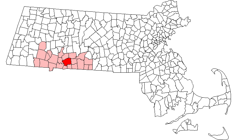
 Location of Springfield in Massachusetts