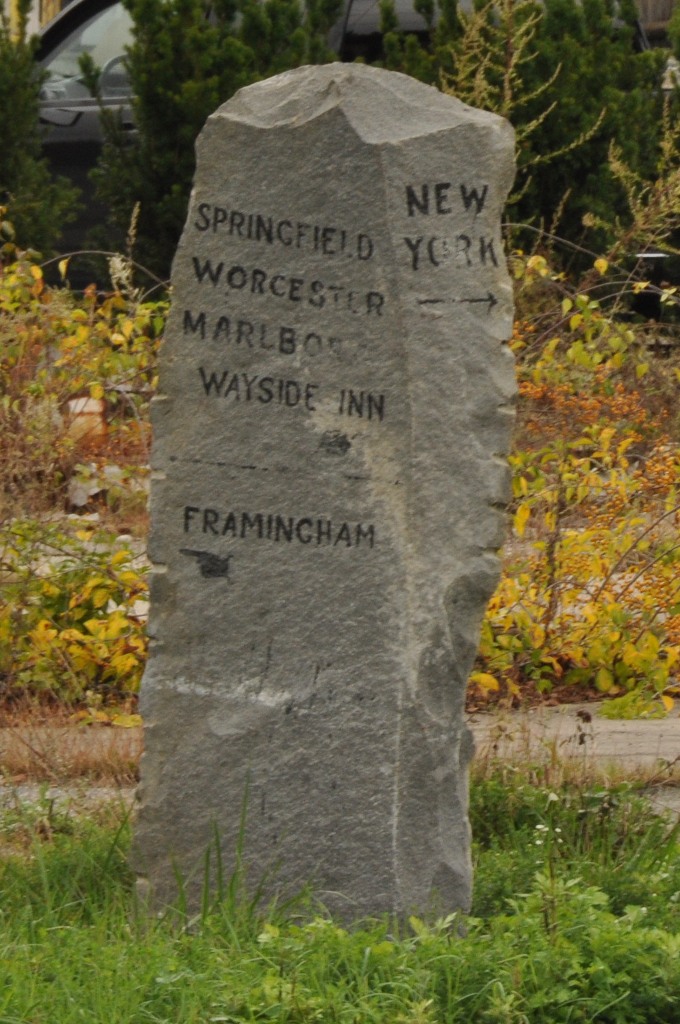
1767 Milestones

1767 Milestones
1767 Milestones
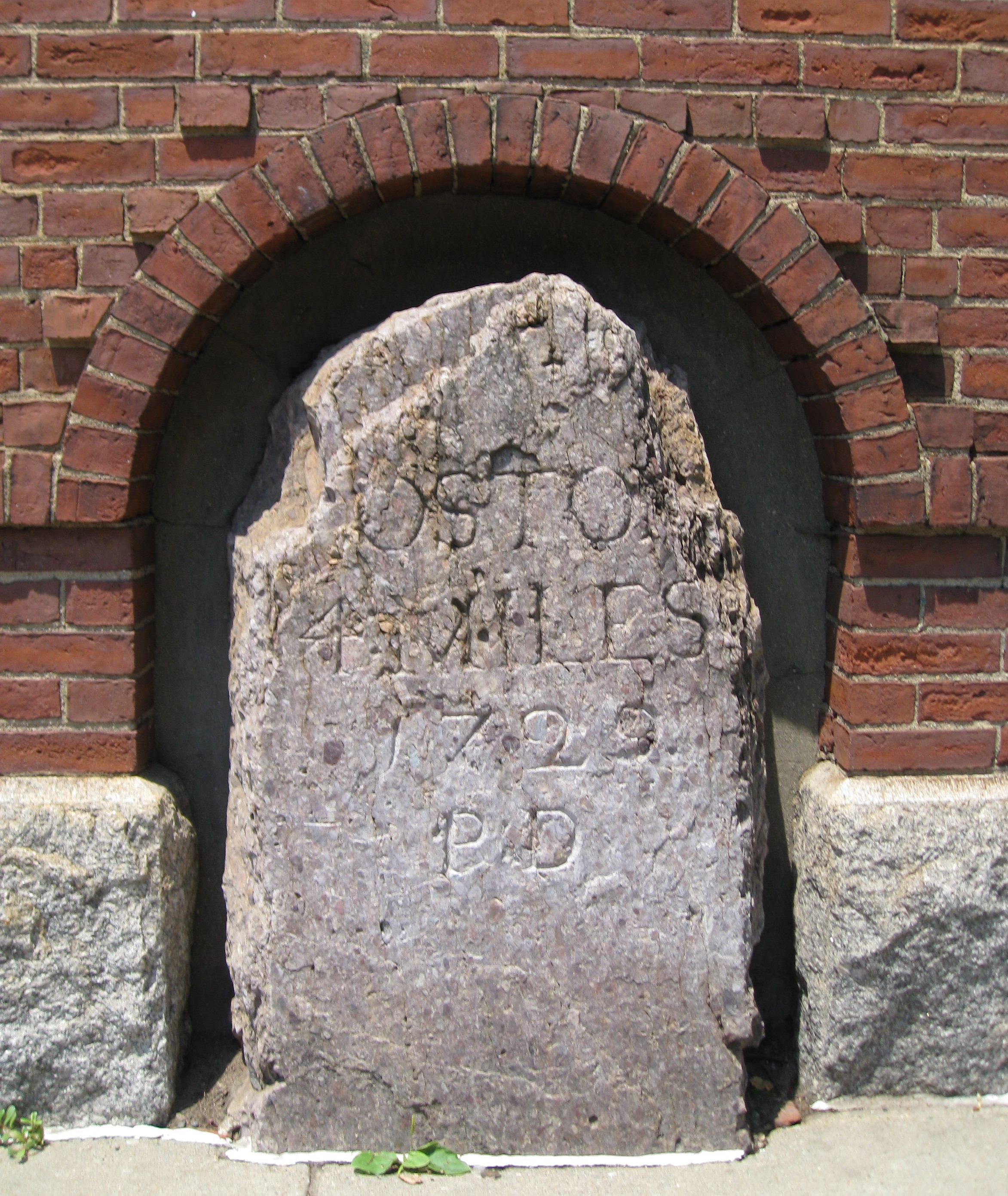
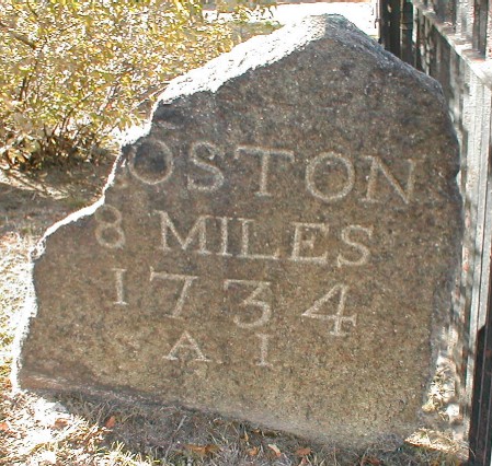
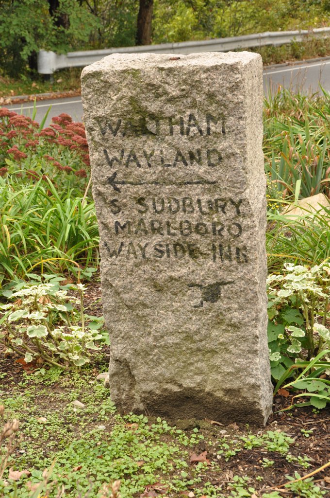
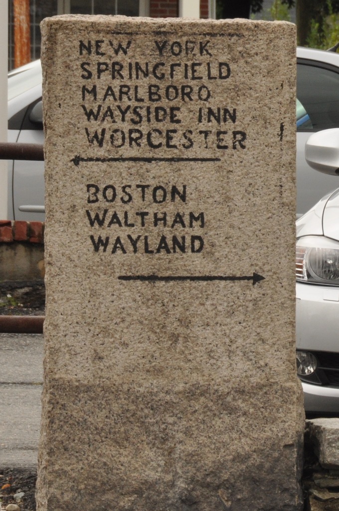
Location: Massachusetts
Built: no later than 1767
Architect: Unknown (some erected by Paul Dudley)
Architectural style: No Style Listed
Governing body: State; some stones under local or private ownership
NRHP Reference#: 71000084 (all milestones), 85003300 (Brookline, Harvard Ave milestone)[1]
Added to NRHP: April 7, 1971

The 1767 Milestones are historic milestones located along the route of the Upper Boston Post Road between the cities of Boston and Springfield in Massachusetts. The 40 surviving milestones were added to the National Register of Historic Places in 1971.[1]

The first stone was erected by Paul Dudley, one of the prominent citizens of early 18th century Massachusetts, in Roxbury, which was at the time a separate community. Roxbury was located at the end of the Boston Neck, a narrow isthmus separating the mainland from the Shawmut Peninsula, where Boston was located. Travelers going by land from Boston to other areas had to travel over the neck and through Roxbury to reach their destinations. The Roxbury junction where Dudley placed the first stone was where several routes branched, heading south and west across New England.

Dudley erected several stones along the road from Boston to Cambridge which wound its way from Beacon Hill along what is now Washington Street through the Dudley Square area to what is now Huntington Avenue, then along Harvard Street through Brookline Village, Coolidge Corner, and Allston crossing into Cambridge at the Great Bridge, where modern JFK Street in Cambridge becomes North Harvard Street in Allston. The stones that Mr. Dudley erected have the initial PD on them, usually at the bottom of the stone.[2] The most chatty of these milestones (not part of this collection), is inscribed P Dudley rather than PD, and is located on the corner of Centre and South Streets in Jamaica Plain.

Miles
to Boston
Year
Placed
Image Location Town Notes
01 1744 Centre and Roxbury Streets
42°19′48″N 71°5′29″W / 42.33°N 71.09139°W / 42.33; -71.09139 (Parting Ways Milestone)
Boston, Roxbury This stone is called the "Parting Ways" Stone.
04 1729 1767MilestoneHuntington.JPG 841 Huntington Avenue
42°19′57″N 71°6′42″W / 42.3325°N 71.11167°W / 42.3325; -71.11167 (Milestone 4)
Boston, Mission Hill
05 1729 BrooklineMA Milestone5.jpg 210 Harvard Ave.
42°20′24″N 71°7′17″W / 42.34°N 71.12139°W / 42.34; -71.12139 (Milestone 5)
Brookline
06 1729 142 Harvard Ave.
42°21′5″N 71°7′56″W / 42.35139°N 71.13222°W / 42.35139; -71.13222 (Milestone 6)
Boston, Brighton
07 240 N. Harvard St.
42°21′52″N 71°7′42″W / 42.36444°N 71.12833°W / 42.36444; -71.12833 (Milestone 7)
Boston, Brighton
08 1734 Upper Post Road MP 8.jpg Old Burial Ground
(Mass. Ave. and Garden St.)
42°22′29″N 71°7′10″W / 42.37472°N 71.11944°W / 42.37472; -71.11944 (Milestone 8)
Cambridge
23 WaylandMA Milestone23.jpg River Road and Water Row
42°22′14″N 71°23′12″W / 42.37056°N 71.38667°W / 42.37056; -71.38667 (Milestone 23)
Wayland
24 SudburyMA Milestone24.jpg Route 20 and Landham Road
42°21′39″N 71°24′8″W / 42.36083°N 71.40222°W / 42.36083; -71.40222 (Milestone 24)
Sudbury
25 SudburyMA Milestone25.jpg Route 20 and Concord Road
42°21′44″N 71°24′59″W / 42.36222°N 71.41639°W / 42.36222; -71.41639 (Milestone 25)
Sudbury
26 SudburyMA Milestone26.jpg Route 20 and Nobscot Road
42°21′36″N 71°25′30″W / 42.36°N 71.425°W / 42.36; -71.425 (Milestone 26)
Sudbury
27 SudburyMA Milestone27.jpg Nobscot Road and Dudley Road
42°21′13″N 71°25′55″W / 42.353533°N 71.431886°W / 42.353533; -71.431886 (Milestone 27)
Sudbury
28 SudburyMA Milestone28.jpg Route 20 and Peakham Road
42°21′35″N 71°27′32″W / 42.35972°N 71.45889°W / 42.35972; -71.45889 (Milestone 28)
Sudbury
29 SudburyMA Milestone29.jpg Wayside Inn Road and Dutton Road
42°21′28″N 71°28′19″W / 42.35778°N 71.47194°W / 42.35778; -71.47194 (Milestone 29)
Sudbury
33 143 E. Main St.
42°19′44″N 71°37′25″W / 42.32889°N 71.62361°W / 42.32889; -71.62361 (Milestone 33)
Northborough
35 Boston Post Road and Dean Park
42°17′45″N 71°41′43″W / 42.29583°N 71.69528°W / 42.29583; -71.69528 (Milestone 35)
Shrewsbury
43 West Main St. near I-290
42°17′35″N 71°44′58″W / 42.29306°N 71.74944°W / 42.29306; -71.74944 (Milestone 43)
Shrewsbury
47 Lincoln St.
42°17′10″N 71°47′28″W / 42.28611°N 71.79111°W / 42.28611; -71.79111 (Milestone 47)
Worcester
48 39 Salisbury St.
42°16′18.5″N 71°47′59″W / 42.271806°N 71.79972°W / 42.271806; -71.79972 (Milestone 48)
Worcester
53 Route 9 at Collier's Corner
42°14′24″N 71°53′10″W / 42.24°N 71.88611°W / 42.24; -71.88611 (Milestone 53)
Leicester
54 Main St. east of Paxton St.
42°14′43″N 71°54′30″W / 42.24528°N 71.90833°W / 42.24528; -71.90833 (Milestone 54)
Leicester
56 Route 9
42°15′2″N 71°56′40″W / 42.25056°N 71.94444°W / 42.25056; -71.94444 (Milestone 56)
Leicester
57 Route 9
42°15′21″N 71°57′21″W / 42.25583°N 71.95583°W / 42.25583; -71.95583 (Milestone 57)
Leicester
58 Route 9
42°15′6″N 71°58′34″W / 42.25167°N 71.97611°W / 42.25167; -71.97611 (Milestone 58)
Spencer
59 Route 9, Spencer Shopper's Village
42°14′46″N 71°59′20″W / 42.24611°N 71.98889°W / 42.24611; -71.98889 (Milestone 59)
Spencer
60 Route 9 at Dewey St.
42°14′12″N 72°0′28″W / 42.23667°N 72.00778°W / 42.23667; -72.00778 (Milestone 60)
Spencer
61 Route 9
42°13′52″N 72°1′40″W / 42.23111°N 72.02778°W / 42.23111; -72.02778 (Milestone 61)
Spencer
62 Route 9
42°13′38″N 72°2′40″W / 42.22722°N 72.04444°W / 42.22722; -72.04444 (Milestone 62)
East Brookfield
63 North Brookfield Rd.
42°13′42″N 72°4′1″W / 42.22833°N 72.06694°W / 42.22833; -72.06694 (Milestone 63)
East Brookfield
64 Elm Hill Rd., near North Brookfield line
42°13′49″N 72°4′45″W / 42.23028°N 72.07917°W / 42.23028; -72.07917 (Milestone 64)
Brookfield
65 Elm Hill Rd., east of North Brookfield Rd.
42°13′18″N 72°5′40″W / 42.22167°N 72.09444°W / 42.22167; -72.09444 (Milestone 65)
Brookfield
66 Route 9
42°12′57″N 72°6′29″W / 42.21583°N 72.10806°W / 42.21583; -72.10806 (Milestone 66)
Brookfield
67 Foster Hill Rd.
42°13′33″N 72°7′14″W / 42.22583°N 72.12056°W / 42.22583; -72.12056 (Milestone 67)
West Brookfield
68 East end of town common
42°14′10″N 72°8′15″W / 42.23611°N 72.1375°W / 42.23611; -72.1375 (Milestone 68)
West Brookfield
69 Route 9
42°14′1″N 72°9′22″W / 42.23361°N 72.15611°W / 42.23361; -72.15611 (Milestone 69)
West Brookfield
70 Route 67 near Old Patrick Rd.
42°13′19″N 72°10′22″W / 42.22194°N 72.17278°W / 42.22194; -72.17278 (Milestone 70)
Warren
71 Burbank and Washington Sts.
42°12′46″N 72°10′59″W / 42.21278°N 72.18306°W / 42.21278; -72.18306 (Milestone 71)
Warren
72 Bemis and Washington Rds.
42°12′7″N 72°11′22″W / 42.20194°N 72.18944°W / 42.20194; -72.18944 (Milestone 72)
Warren
73 Mape St. (Route 19)
42°11′53″N 72°12′20″W / 42.19806°N 72.20556°W / 42.19806; -72.20556 (Milestone 73)
Warren
74 Read St. east of West Warren Rd.
42°11′9″N 72°13′18″W / 42.18583°N 72.22167°W / 42.18583; -72.22167 (Milestone 74)
Warren
99 State Rd. (Route 20) at Springfield Armory
42°6′25″N 72°34′46″W / 42.10694°N 72.57944°W / 42.10694; -72.57944 (Milestone 99)
Springfield
Source unless otherwise cited: NRHP nomination papers[3]

References

See also


Wikimedia Foundation. 2010.

Игры ⚽ Поможем написать курсовую

Look at other dictionaries:

  • National Register of Historic Places listings in Brookline, Massachusetts — This is a list of the National Register of Historic Places listings in Brookline, Massachusetts. Map of all coordinates from Google Map of all coordinates from Bing …   Wikipedia

  • Boston Post Road — Routes of the Boston Post Road The Boston Post Road was a system of mail delivery routes between New York City and Boston, Massachusetts that evolved into the first major highways in the United States. The three major alignments were the Lower… …   Wikipedia

  • National Register of Historic Places listings in Boston, Massachusetts — Location of Boston in Massachusetts This is a list of the National Register of Historic Places listings in Boston, Massachusetts. This is intended to be a complete list of the properties and districts on the National Register of Historic Places… …   Wikipedia

  • National Register of Historic Places listings in Middlesex County, Massachusetts — Location of Middlesex County in Massachusetts This is a listing of places in Middlesex County in the U.S. state of Massachusetts that are listed in the National Register of Historic Places …   Wikipedia

  • National Register of Historic Places listings in Springfield, Massachusetts — Location of Springfield in Massachusetts This is a list of the National Register of Historic Places listings in Springfield, Massachusetts. This is intended to be a complete list of the properties and districts on the National Register of… …   Wikipedia

  • National Register of Historic Places listings in Worcester, Massachusetts — This is a list of properties and historic districts on the National Register of Historic Places in Worcester, Massachusetts. Map of all coordinates from Google Map of all coordinates from Bing …   Wikipedia

  • National Register of Historic Places listings in Worcester County, Massachusetts — Location of Worcester County in Massachusetts This is a list of the National Register of Historic Places listings in Worcester County, Massachusetts. It is intended to be a complete list of the properties and districts on the National Register of …   Wikipedia

  • Boston Post Road — Routen der Boston Post Road Die Boston Post Road war ein System von einzelnen Postrouten zwischen New York City und Boston in Massachusetts, entlang dessen sich später die ersten großen Highways in den Vereinigten Staaten entwickelten. Die Route… …   Deutsch Wikipedia

  • Shrewsbury, Massachusetts — Infobox Settlement| official name = Town of Shrewsbury nickname = motto = imagesize = 250px image caption = Homestead of General Artemas Ward image mapsize = 250px map caption = Location in Worcester County in Massachusetts mapsize1 = map… …   Wikipedia

  • National Register of Historic Places listings in Massachusetts — This is a list of properties and districts in Massachusetts listed on the National Register of Historic Places. There are over 4,000 listings in the state, representing about 5% of all NRHP listings nationwide. Listings appear in all of… …   Wikipedia

Share the article and excerpts

Direct link
Do a right-click on the link above
and select “Copy Link”