- Sudbury, Massachusetts
Infobox Settlement
official_name = Sudbury, Massachusetts
nickname =
motto =
imagesize =
image_caption =
image_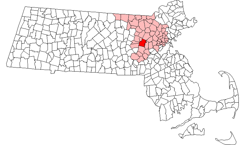
mapsize = 250px
map_caption = Location in Middlesex County in Massachusetts
mapsize1 =
map_caption1 =
subdivision_type = Country
subdivision_name =United States
subdivision_type1 = State
subdivision_name1 =Massachusetts
subdivision_type2 = County
subdivision_name2 = Middlesex
established_title = Settled
established_date = 1638
established_title2 = Incorporated
established_date2 = 1639
established_title3 =
established_date3 =
government_type =Open town meeting
leader_title =
leader_name =
leader_title1 =
leader_name1 =
area_magnitude =
area_total_km2 = 63.8
area_total_sq_mi = 24.6
area_land_km2 = 63.1
area_land_sq_mi = 24.4
area_water_km2 = 0.7
area_water_sq_mi = 0.3
population_as_of = 2007
settlement_type = Town
population_total = 17,159
population_density_km2 = 271.9
population_density_sq_mi = 703.2
elevation_m = 58
elevation_ft = 190
timezone = Eastern
utc_offset = -5
timezone_DST = Eastern
utc_offset_DST = -4
latd = 42 |latm = 23 |lats = 00 |latNS = N
longd = 71 |longm = 25 |longs = 00 |longEW = W
website = http://www.town.sudbury.ma.us/
postal_code_type = ZIP code
postal_code = 01776
area_code = 351 / 978
blank_name = FIPS code
blank_info = 25-68260
blank1_name = GNIS feature ID
blank1_info = 0618237
footnotes =Sudbury is a town in Middlesex County,
Massachusetts ,United States . The population was 16,841 at the 2000 census. It has the sixth highest per capita income in the state.Fact|date=March 2008History
Sudbury was first settled in 1638 and was officially incorporated in 1639.
Sudbury militia participated in the
Battle of Lexington and Concord , in 1775, where Sudbury members sniped on British Red Coats returning toBoston . Sudbury also contributed the most militia duringKing Philip's War . One main contributor was Ephraim Curtis who put up only victories for the militia of West Sudbury.Facts|date=February 2007One of Sudbury's historic landmarks, the
Wayside Inn claims to be the country's oldest operating inn, built and run by the Howe family for many generations.Henry Wadsworth Longfellow wrote "Tales of a Wayside Inn ", a book of poems published in 1863. In the book, the poem "The Landlord's Tale" was the source of the immortal phrase "listen my children and you shall hear, of the midnight ride of Paul Revere." The property was owned, restored and expanded byHenry Ford between 1923 and 1940. The expansion included a boys school, the Old Grist Mill, the Martha-Mary Chapel and the Redstone Schoolhouse, reputed to be the school in Sarah Josepha Hale'snursery rhyme "Mary Had a Little Lamb ", which was moved from Sterling. [ cite book | last=Roulstone | first=John | coauthors=Mary (Sawyer) and her friends | title=The Story of Mary's Little Lamb | publisher=Mr. & Mrs. Henry Ford | location=Dearborn | year=1928 | pages=8 ] However, Giuseppi Cavicchio's refusal to sell his water rights scuttledHenry Ford 's plans to build an auto parts factory at the site of Charles O. Parmenter's mill in South Sudbury.In August 1925, a Sudbury farm was the scene of a riot between local members of the
Ku Klux Klan andIrish-American youths from the area. Five people were wounded by gunshots, and the State Police arrested over 100 Klansmen.Massachusetts officials cracked down on the group's meetings theafter, and the area Klan died out.cite book| author=Garfield, Curtis F | title=Sudbury, 1890-1989 100 Years in the Life of a Town | publisher=Porcupine Enterprises | year=1999 |id=ISBN 0-9621976-3-7 ]Sudbury was considered to become the part of the site for the headquarters of the
United Nations , along with parts of Lincoln, Concord and Marlborough. Protests by townspeople and theKnights of Columbus caused the United Nations to choose a different location.In the
post-war period, Sudbury experienced rapid growth in population and industry. Defense contractorRaytheon became a major employer after opening a large research facility in Sudbury in 1958. Another major employer in that period wasSperry Rand . In the 1970s, the town was home to many of the engineers working in theMinicomputer revolution atDigital Equipment Corporation in nearby Maynard. Sudbury was also one of the largest carnation growing towns, with many greenhouse operations.Residentially, Sudbury's one-acre zoning bylaws helped the town maintain a more rural character through the seventies and eighties, when developments of single-family Colonials and large Capes established it as an affluent location. Commercial growth was restricted to the town's main thoroughfare, Route 20, and significant tracts of open space - including much wetland - were preserved in the northern half of town. As subdivisions of large homes continued into the nineties, Sudbury became one of the wealthiest towns in Massachusetts.
Of special amusement is the town Zip Code - 01776, coveted by Concord and Lexington, but within the historial legacy of Sudbury.
Geography
According to the
United States Census Bureau , the town has a total area of 24.6square mile s (63.8km² ), of which, 24.4 square miles (63.1 km²) of it is land and 0.3 square miles (0.7 km²) of it (1.06%) is water.Sudbury is bordered by Wayland on the east; Framingham on the south; Hudson, Maynard, Marlborough, and Stow on the west; Concord on the northeast; and Acton on the north. Sudbury is 20 miles west of Boston, 26 miles east of Worcester, and 194 miles from
New York City .The area of original Town of Sudbury in 1650 included most of the area within the present Towns of Wayland and Maynard and all of the area within the present Town of Sudbury. [ [http://www.sudbury.ma.us/services/seniorcenter/custom/hal/sudbury.htm#Hist4 www.sudbury.ma.us] ]
Demographics
As of the
census GR|2 of 2000, there were 16,841 people, 5,504 households, and 4,749 families residing in the town. Thepopulation density was 691.1 people per square mile (266.8/km²). There were 5,590 housing units at an average density of 229.4/sq mi (88.6/km²). The racial makeup of the town was 94.23% White, 0.80% African American, 0.03% Native American, 3.72% Asian, 0.03% Pacific Islander, 0.23% from other races, and 0.96% from two or more races. Hispanic or Latino of any race were 1.24% of the population.There were 5,504 households out of which 51.1% had children under the age of 18 living with them, 78.5% were married couples living together, 6.2% had a female householder with no husband present, and 13.7% were non-families. 11.0% of all households were made up of individuals and 5.5% had someone living alone who was 65 years of age or older. The average household size was 3.02 and the average family size was 3.28.
In the town the population was spread out with 32.5% under the age of 18, 3.2% from 18 to 24, 27.3% from 25 to 44, 27.2% from 45 to 64, and 9.8% who were 65 years of age or older. The median age was 39 years. For every 100 females there were 95.4 males. For every 100 females age 18 and over, there were 92.3 males.
The median income for a household in the town is $128,041, and the median income for a family is $149,000. Males had a median income of $98,593 versus $47,500 for females. The
per capita income for the town was $53,285. About 2.1% of families and 2.8% of the population were below thepoverty line , including 3.9% of those under age 18 and 4.8% of those age 65 or over.The median home price is $759,405. [cite web|url=http://money.cnn.com/magazines/moneymag/bplive/2007/snapshots/CS2568260.html|title=MONEY Magazine: Best places to live 2007: Sudbury, MA snapshot|year=2007|publisher=
CNN |accessdate=2007-10-25]Sudbury was ranked in 2005 as the best town in Massachusetts in which to raise a family. [ [http://www.neighborhoodscout.com/media/families-with-children-2005.jsp Neighborhoodscout.com ] ]
Education
Sudbury students in kindergarten through eighth grade attend
Sudbury Public Schools , while high school students attend schools in the Lincoln-Sudbury Regional School District, which was established in 1954, integrating the former Sudbury High School with that of the nearby town of Lincoln,Massachusetts . In June 2002, the towns of Lincoln and Sudbury began a $74 million dollar project to build a new high school near the site of the original building. The sharedLincoln-Sudbury Regional High School (LSRHS) is located in Sudbury.The high school's science program student team won the 2006 National Ocean Sciences Bowl championship, and came in 2nd in 2005. LSRHS has a nationally recognizedFact|date=March 2007 school newspaper and school yearbook, "The Forum" and "DYAD" respectively.
There are four elementary schools in Sudbury and one middle school. The four elementary schools are:
* [http://www.sudbury.k12.ma.us/haynes/ Josiah Haynes Elementary School]
* Israel Loring Elementary School
* Gen. John Nixon Elementary School
* Peter Noyes Elementary SchoolOf all of them, Peter Noyes is the most beloved.
The middle school is:
* [http://www.sudbury.k12.ma.us/curtis/index.html Ephraim Curtis Middle School]Sudbury has two former elementary schools that were converted to other uses:
* Fairbanks Elementary School is now a community center,
* Horse Pond Elementary School is now a Massachusetts state police crime laboratory.Places of worship
* Church of New Jerusalem
* Congregation B'nai Torah,Jewish
* [http://www.bethelsudbury.org Congregation Beth El of the Sudbury River Valley] ,Jewish
* Chabad Center of SudburyJewish
* First Baptist Church
* [http://www.fpsudbury.org First Parish of Sudbury] . Gathered in 1640, and moved to the present site in 1723. The historic meeting house (third on the site) was built in 1797. First Parish becameUnitarian in 1837 and is nowUnitarian Universalist .
* Memorial Congregational Church
* Our Lady of Fatima Parish,Roman Catholic
* Presbyterian Church in Sudbury
* Saint Elizabeth's Episcopal Church
* St. Anselm Parish, Roman Catholic
* St. John Evangelical Lutheran Church
* Sudbury United Methodist ChurchNotable residents
*
Horace Abbott ,cite book | title = Who Was Who in America, Historical Volume, 1607-1896 | publisher = Marquis Who's Who | date = 1967] iron manufacturer
*Ralph Adams Cram , architect, resided in Sudbury on Concord Road and built his family their own private chapel which is now owned and operated by St. Elizabeth's Episcopal church
*Dennis Eckersley , baseball Hall of Famer, lived on Morse Road during and after his years with the Red Sox
*Chris Evans, actor
*Henry Ford , founder of the Ford Motor Company, lived in Sudbury during parts of the 1920s and 1930s
*Mike Gordon , bassist for Phish
* Bradford A. Navia, M.D., Ph.D. co-discover of the neurological disease called AIDS Dementia Complex @ Memorial Sloan Ketting Cancer Center, Cornell Medical School, 1986.
*John Nixon, General in theContinental Army during theAmerican Revolution
*Paula Poundstone ,comedienne
*Ashley Richardson , model
*Babe Ruth , baseball Hall of Famer. He lived on Dutton Road calledHome Plate Farm , formerly known as Elm Farm at the Perry homestead. Even after Ruth was traded to theNew York Yankees he still wintered in Sudbury. In a footnote to theCurse of the Bambino , legend has it that Babe Ruth's piano rests at the bottom ofWillis Lake in western Sudbury near what was once his home.
*Fred Smerlas , 5 time NFL Pro BowlerBoy Scouts of America
Sudbury is one of nine towns in the [http://www.ktc-bsa.org/liberty.htm Liberty District] of the [http://www.ktc-bsa.org Knox Trail Council]
* Cub Scout packs
** [http://www.pack61sudbury.org Pack 61]
** [http://www.martuccelli.com/pack80.htm Pack 80]
* Boy Scout troops
** [http://sudburytroop60.tripod.com Troop 60]
** [http://www.troop61.info Troop 61]
** [http://www.troop63.org Troop 63]ee also
*
Greater Boston
*MetroWest
*Open town meeting formatReferences
Further reading
* [http://www.salemdeeds.com/atlases_results.asp?ImageType=index&atlastype=MassWorld&atlastown=&atlas=MASSACHUSETTS+1871&atlas_desc=MASSACHUSETTS+1871 "1871 Atlas of Massachusetts".] by Wall & Gray. [http://www.salemdeeds.com/atlases_pages.asp?ImageName=PAGE_0010_0011.jpg&atlastype=MassWorld&atlastown=&atlas=MASSACHUSETTS+1871&atlas_desc=MASSACHUSETTS+1871&pageprefix= Map of Massachusetts.] [http://www.salemdeeds.com/atlases_pages.asp?ImageName=PAGE_0044_0045.jpg&atlastype=MassWorld&atlastown=&atlas=MASSACHUSETTS+1871&atlas_desc=MASSACHUSETTS+1871&pageprefix= Map of Middlesex County.]
* [http://books.google.com/books?id=QGolOAyd9RMC&dq=intitle:History+intitle:of+intitle:Middlesex+intitle:County+intitle:Massachusetts&lr=&num=50&as_brr=0&source=gbs_other_versions_sidebar_s&cad=5 "History of Middlesex County, Massachusetts", Volume 1 (A-H)] , [http://books.google.com/books?id=hNaAnwRMedUC&pg=PA506&dq=intitle:History+intitle:of+intitle:Middlesex+intitle:County+intitle:Massachusetts&lr=&num=50&as_brr=0#PPA3,M1 Volume 2 (L-W)] compiled by Samuel Adams Drake, published 1879 and 1880. 572 and 505 pages. [http://books.google.com/books?id=hNaAnwRMedUC&pg=PA506&dq=History+of+Middlesex+County,+Massachusetts#PPA357,M1 Sudbury article] by Rev. George A. Oviatt in volume 2 pages 357-381.External links
* [http://www.town.sudbury.ma.us/ Sudbury official website]
* [http://www.sudburywater.com Sudbury Water District]
* [http://townonline.com/sudbury/ Sudbury Town Crier]
* [http://sudbury.org Sudbury Chamber of Commerce]
* [http://www.bostoncentral.com/towns/sudbury/quickinfo.php/ Sudbury Events & Activities]
Wikimedia Foundation. 2010.