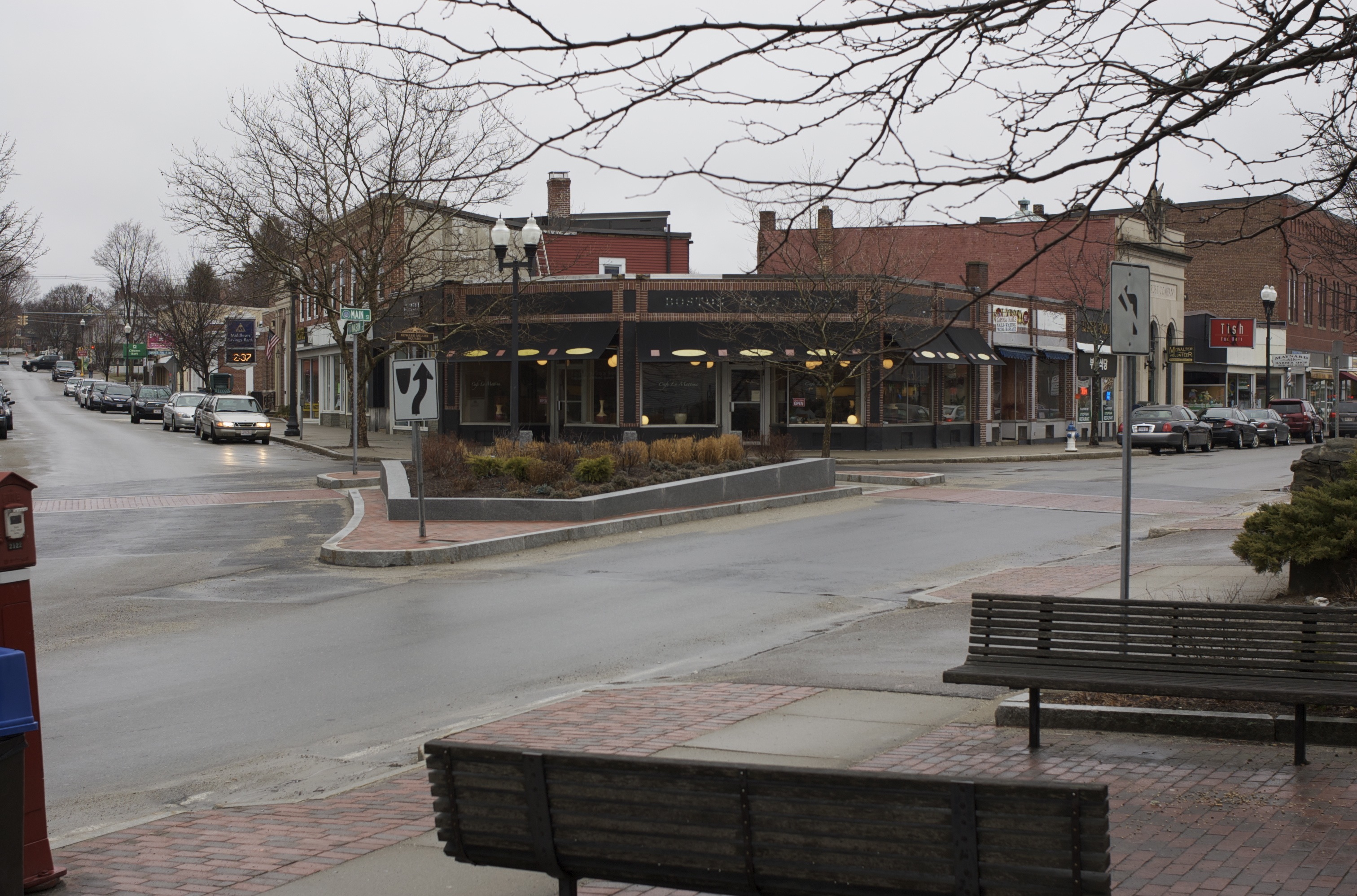
- Maynard, Massachusetts
-
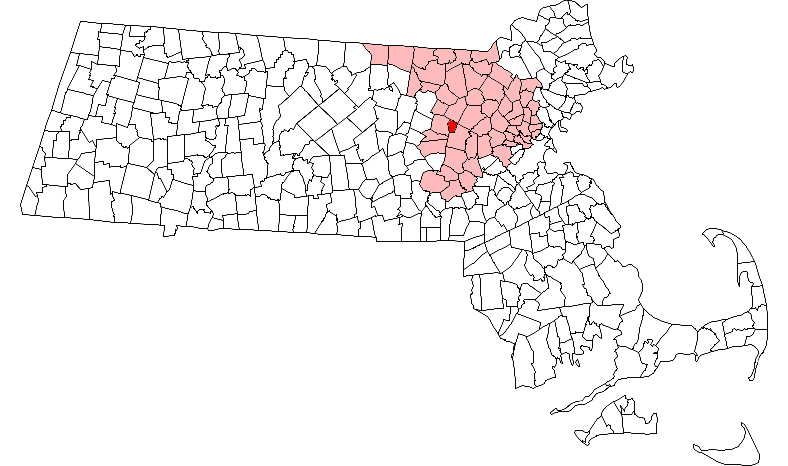
Maynard, Massachusetts — Town —  Location in Middlesex County in Massachusetts
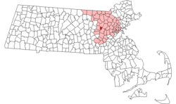
Coordinates: 42°26′00″N 71°27′00″W / 42.4333333°N 71.45°WCoordinates: 42°26′00″N 71°27′00″W / 42.4333333°N 71.45°W Country United States State Massachusetts County Middlesex Settled 1638 Incorporated 1871 Government – Type Open town meeting Area – Total 5.4 sq mi (13.9 km2) – Land 5.2 sq mi (13.6 km2) – Water 0.1 sq mi (0.3 km2) Elevation 186 ft (57 m) Population (2010) – Total 10,106 – Density 1,957.1/sq mi (748.3/km2) Time zone Eastern (UTC-5) – Summer (DST) Eastern (UTC-4) ZIP code 01754 Area code(s) 351 / 978 FIPS code 25-39625 GNIS feature ID 0618229 Website http://web.maynard.ma.us/ Maynard is a town in Middlesex County, Massachusetts, United States. As of the 2010 census, the town population was 10,106.
Contents
History
Maynard, located on the Assabet River, was incorporated as an independent municipality in 1871. Prior to that it was known as 'Assabet Village' but was legally still part of the towns of Stow and Sudbury. There were some exploratory town-founding rumblings in 1870, followed by a petition to the Commonwealth of Massachusetts, filed January 26, 1871. Supportive petitions with additional signers were filed January 26, February 14 and February 17. State approval was granted April 19, 1871. In return, the new town paid Sudbury and Stow about $23,600 and $8,000 respectively. Sudbury got more money because it owned shares in the railroad, plus the mills were in Sudbury and more land came from Sudbury.
The community was named after Amory Maynard, the man whom with William Knight, had bought water-rights to the Assabet River, installed a dam and built a large carpet mill in 1847. The community grew along with the Assabet Woolen Mill and made the highest percentage of wool for U.S. Military uniforms for the Civil War. The woolen mill went bankrupt in 1898; it was purchased in 1899 by the American Woolen Company, a multi-state corporation, which greatly modernized and expanded the mill complex from 1900 through 1919.
After the mill shut down in 1950, local businessmen bought the property and began leasing it as office space. Digital Equipment Corporation moved into the complex in 1957. The company eventually made Maynard its worldwide headquarters, giving Maynard the nickname "Mini Computer Capital of the World". It remained there until 1998 when Digital was sold to Compaq, which was itself later bought out by Hewlett Packard in 2002.
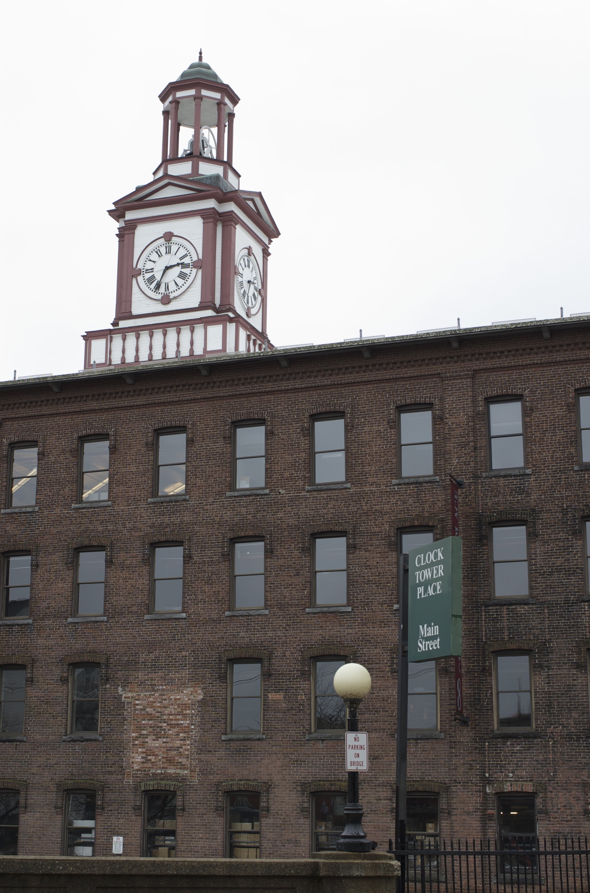
"The Mill", as locals call it, was renovated in the late 1990s and renamed Clock Tower Place and houses many businesses, including the headquarters of Powell Flutes and Monster.com. The mill complex is also home to the oldest working, hand-wound clock in the country (see image).
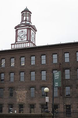 Clock Tower Place, seen from Main St.
Geography
Maynard is located at 42°25′50″N 71°27′21″W / 42.43056°N 71.45583°W (42.430781, -71.455943).[1]
According to the United States Census Bureau, the town has a total area of 5.4 square miles (13.9 km²), of which, 5.2 square miles (13.6 km²) of it is land and 0.1 square miles (0.3 km²) of it (2.42%) is water.
Maynard borders the following towns: Acton, Concord, Sudbury and Stow.
Demographics
Historical populations Year Pop. ±% 1880 2,201 — 1890 2,700 +22.7% 1900 3,142 +16.4% 1910 6,390 +103.4% 1920 7,086 +10.9% 1930 7,156 +1.0% 1940 6,812 −4.8% 1950 6,978 +2.4% 1960 7,695 +10.3% 1970 9,710 +26.2% 1980 9,590 −1.2% 1990 10,325 +7.7% 2000 10,433 +1.0% 2001* 10,484 +0.5% 2002* 10,430 −0.5% 2003* 10,435 +0.0% 2004* 10,372 −0.6% 2005* 10,313 −0.6% 2006* 10,242 −0.7% 2007* 10,326 +0.8% 2008* 10,442 +1.1% 2009* 10,627 +1.8% 2010 10,106 −4.9% * = population estimate. Source: United States Census records and Population Estimates Program data.[2][3][4][5][6][7][8] As of the census[9] of 2000, there were 10,433 people, 4,292 households, and 2,811 families residing in the town. The population density was 1,990.6 people per square mile (768.7/km²). There were 4,406 housing units at an average density of 840.7 per square mile (324.6/km²). The racial makeup of the town was 94.64% White, 1.04% Black or African American, 0.27% Native American, 1.62% Asian, 1.18% from other races, and 1.26% from two or more races. Hispanic or Latino of any race were 2.78% of the population. 23.3% were of Irish, 15.5% Italian, 10.3% English, 6.0% German, 5.1% French and 5.1% Polish ancestry according to Census 2000.
There were 4,292 households out of which 28.9% had children under the age of 18 living with them, 52.4% were married couples living together, 9.9% had a female householder with no husband present, and 34.5% were non-families. 28.5% of all households were made up of individuals and 10.3% had someone living alone who was 65 years of age or older. The average household size was 2.43 and the average family size was 3.02.
In the town the population was spread out with 23.4% under the age of 18, 5.4% from 18 to 24, 35.1% from 25 to 44, 23.8% from 45 to 64, and 12.2% who were 65 years of age or older. The median age was 38 years. For every 100 females there were 91.6 males. For every 100 females age 18 and over, there were 87.0 males.
The median income for a household in the town was $60,812, and the median income for a family was $71,875. Males had a median income of $49,279 versus $36,609 for females. The per capita income for the town was $27,016. About 3.8% of families and 5.6% of the population were below the poverty line, including 7.4% of those under age 18 and 6.0% of those age 65 or over.
Further Reading and Information
Town of Maynard: http://www.townofmaynard-ma.gov/
Maynard Historical Society: http://maynardhistory.org/
Boothroyd, Paul and Lewis Halprin (1999). Maynard Massachusetts, Images of America. Mount Pleasant, SC: Arcadia Publishing. ISBN 0738500747
Boothroyd, Paul and Lewis Halprin (1999). Assabet Mills, Images of America. Mount Pleasant, SC: Arcadia Publishing. ISBN 0738502626
Boothroyd, Paul and Lewis Halprin. (2005) Maynard, Postcard History Series. Mount Pleasant, SC: Arcadia Publishing. ISBN 0738539465
Brown, Peggy Jo (2005). Hometown Soldiers: Civil War Veterans of Assabet Village and Maynard Massachusetts. Maynard, MA: Flying Heron Press.
Cummings, O.R. (1967). Concord, Maynard & Hudson Street Railway. Warehouse Point, CN: National Railway Historical Society.
Gutteridge, William H. (1921). A Brief History of the Town of Maynard, Massachusetts. Maynard, MA: Town of Maynard.
Mark, David A. (2011). MAYNARD: History and Life Outdoors. Charleston, SC: The History Press. ISBN 9781609493035
Sheridan, Ralph (1971). A History of Maynard 1871-1971. Town of Maynard Historical Committee.
Voogd, Jan (2007). Maynard Massachusetts, A House in the Village. Charleston, SC: The History Press. ISBN 9781596292055
References
- ^ "US Gazetteer files: 2010, 2000, and 1990". United States Census Bureau. 2011-02-12. http://www.census.gov/geo/www/gazetteer/gazette.html. Retrieved 2011-04-23.
- ^ "TOTAL POPULATION (P1), 2010 Census Summary File 1, All County Subdivisions within Massachusetts". United States Census Bureau. http://factfinder2.census.gov/bkmk/table/1.0/en/DEC/10_SF1/P1/0400000US25.06000. Retrieved September 13, 2011.
- ^ "Massachusetts by Place and County Subdivision - GCT-T1. Population Estimates". United States Census Bureau. http://factfinder.census.gov/servlet/GCTTable?_bm=y&-geo_id=04000US25&-_box_head_nbr=GCT-T1&-ds_name=PEP_2009_EST&-_lang=en&-format=ST-9&-_sse=on. Retrieved July 12, 2011.
- ^ "1990 Census of Population, General Population Characteristics: Massachusetts". US Census Bureau. December 1990. Table 76: General Characteristics of Persons, Households, and Families: 1990. 1990 CP-1-23. http://www.census.gov/prod/cen1990/cp1/cp-1-23.pdf. Retrieved July 12, 2011.
- ^ "1980 Census of the Population, Number of Inhabitants: Massachusetts". US Census Bureau. December 1981. Table 4. Populations of County Subdivisions: 1960 to 1980. PC80-1-A23. http://www2.census.gov/prod2/decennial/documents/1980a_maABC-01.pdf. Retrieved July 12, 2011.
- ^ "1950 Census of Population". Bureau of the Census. 1952. Section 6, Pages 21-10 and 21-11, Massachusetts Table 6. Population of Counties by Minor Civil Divisions: 1930 to 1950. http://www2.census.gov/prod2/decennial/documents/23761117v1ch06.pdf. Retrieved July 12, 2011.
- ^ "1920 Census of Population". Bureau of the Census. Number of Inhabitants, by Counties and Minor Civil Divisions. Pages 21-5 through 21-7. Massachusetts Table 2. Population of Counties by Minor Civil Divisions: 1920, 1910, and 1920. http://www2.census.gov/prod2/decennial/documents/41084506no553ch2.pdf. Retrieved July 12, 2011.
- ^ "1890 Census of the Population". Department of the Interior, Census Office. Pages 179 through 182. Massachusetts Table 5. Population of States and Territories by Minor Civil Divisions: 1880 and 1890. http://www2.census.gov/prod2/decennial/documents/41084506no553ch2.pdf. Retrieved July 12, 2011.
- ^ "American FactFinder". United States Census Bureau. http://factfinder.census.gov. Retrieved 2008-01-31.
Municipalities and communities of Middlesex County, Massachusetts Cities 
Towns Acton | Arlington | Ashby | Ashland | Ayer | Bedford | Belmont | Billerica | Boxborough | Burlington | Carlisle | Chelmsford | Concord | Dracut | Dunstable | Framingham | Groton | Holliston | Hopkinton | Hudson | Lexington | Lincoln | Littleton | Maynard | Natick | North Reading | Pepperell | Reading | Sherborn | Shirley | Stoneham | Stow | Sudbury | Tewksbury | Townsend | Tyngsborough | Wakefield | Wayland | Westford | Weston | Wilmington | Winchester
CDPs Ayer | Cochituate | Fort Devens | East Pepperell | Groton | Hopkinton | Hudson | Littleton Common | Pepperell | Pinehurst | Shirley | Townsend | West Concord
Other
villagesAuburndale | Chestnut Hill | Gleasondale | Nabnasset | Newton Centre | Newton Highlands | Newton Lower Falls | Newton Upper Falls | Newtonville | Nonantum | North Billerica | North Chelmsford | Waban | West Newton
Categories:- Towns in Middlesex County, Massachusetts
- Early American industrial centers

Wikimedia Foundation. 2010.