- Malden, Massachusetts
-
Malden Massachusetts — City — Malden High School
SealLocation in Middlesex County in Massachusetts
Coordinates: 42°25′30″N 71°04′00″W / 42.425°N 71.0666667°W Country United States State Massachusetts County Middlesex Settled 1640 Incorporated 1649 Government - Type Mayor-council city - Mayor Richard Howard Area - Total 5.1 sq mi (13.2 km2) - Land 5.1 sq mi (13.1 km2) - Water 0.0 sq mi (0.1 km2) Elevation 13 ft (4 m) Population (2010) - Total 59,450 - Density 11,656.8/sq mi (4,503.7/km2) Time zone Eastern (UTC-5) - Summer (DST) Eastern (UTC-4) ZIP code 02148 Area code(s) 339 / 781 FIPS code 25-37875 GNIS feature ID 0612773 Website http://www.cityofmalden.org/ Malden is a suburban city in Middlesex County, Massachusetts, United States. The population was 59,450 at the 2010 census. In 2009 Malden was ranked as the "Best Place to Raise Your Kids" in Massachusetts by Bloomberg Businessweek Magazine.[1][2]
Contents
History
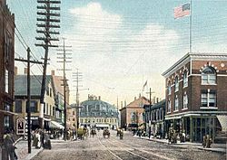 Pleasant Street c. 1906
Malden, a hilly woodland area north of the Mystic River, was settled by Puritans in 1640 on land purchased in 1629 from the Pennacook tribe. The area was originally called the "Mistick Side"[3] and was a part of Charlestown. It was incorporated as a separate town in 1649.[4] The name Malden was selected by Joseph Hills, an early settler and landholder, and was named after Maldon, England.[5] Malden, which originally included what are now the adjacent cities of Melrose (until 1850) and Everett (until 1870), was incorporated as a city in 1882.
The first code of enacted laws printed in New England was compiled here by Joseph Hills in 1648.[citation needed] At the time of the American Revolution, the population was about 1000, and the citizens were involved early in resisting the oppression of Britain; they stopped using tea in 1770 to protest the Revenue Act of 1766, and Malden also has the reputation of being the first town to petition the colonial government to withdraw from the British Empire.[4]
Malden High School, in conjunction with Medford High School, has the second-oldest continuous high school football rivalry in the United States, with the first "Thanksgiving Day Game" dating back to 1889.[6]
Malden is the site of the controversial Fells Acres child abuse case.
Malden contains a number of historic churches and was the birthplace of several well known musicians and actors. Massachusetts was the first state in the USA to issue same-sex marriage licenses. The first marriage of a same-sex couple occurred in Malden, MA at 9:15 AM on May 17, 2004.
Geography
Malden is located at 42°25.5′N 71°4′W / 42.425°N 71.067°WCoordinates: 42°25.5′N 71°4′W / 42.425°N 71.067°W.[7] It is bordered by Melrose on the north, Stoneham on the northwest, Medford on the west, Everett on the south, Revere on the east, and Saugus on the northeast.
According to the United States Census Bureau, the city has a total area of 5.1 square miles (13 km2), of which 5.1 square miles (13 km2) is land and 0.04 square miles (0.10 km2) (0.78%) is water. Bordered on the north by the cliffs of Middlesex Fells, Malden is drained by the Malden River. One of Malden's finest and most notable landmarks is the public library which was designed by Henry Hobbs Richardson and built in 1885.
Demographics
Historical populations Year Pop. ±% 1790 1,033 — 1800 1,059 +2.5% 1810 1,384 +30.7% 1820 1,731 +25.1% 1830 2,010 +16.1% 1840 2,514 +25.1% 1850 3,520 +40.0% 1860 5,865 +66.6% 1870 7,367 +25.6% 1880 12,017 +63.1% 1890 23,031 +91.7% 1900 33,664 +46.2% 1910 44,404 +31.9% 1920 49,103 +10.6% 1930 58,036 +18.2% 1940 58,010 −0.0% 1950 59,804 +3.1% 1960 57,676 −3.6% 1970 56,127 −2.7% 1980 53,386 −4.9% 1990 53,884 +0.9% 2000 56,340 +4.6% 2001* 56,269 −0.1% 2002* 55,899 −0.7% 2003* 55,577 −0.6% 2004* 55,153 −0.8% 2005* 55,748 +1.1% 2006* 55,392 −0.6% 2007* 55,505 +0.2% 2008* 55,652 +0.3% 2009* 56,146 +0.9% 2010 59,450 +5.9% * = population estimate.
Source: United States Census records and Population Estimates Program data.[8][9][10][11][12][13][14][15][16][17][18]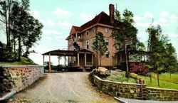 Kernwood Club in 1910
As of the census[19] of 2010, there were 59,450 people, 25,161 households, and 13,575 families residing in the city. The population density was 11,788.6 people per square mile (4,290.5/km²). There were 23,634 housing units at an average density of 4,657.5 per square mile (1,799.8/km²). The racial makeup of the city was 52.5% White, 14.8% African American, 0.14% Native American, 20.1% Asian, 0.06% Pacific Islander, 2.10% from other races, and 3.46% from two or more races. 8.6% of the population were Hispanic or Latino of any race.
There were 23,009 households out of which 25.4% had children under the age of 18 living with them, 42.8% were married couples living together, 12.3% had a female householder with no husband present, and 41.0% were non-families. 32.2% of all households were made up of individuals and 11.5% had someone living alone who was 65 years of age or older. The average household size was 2.42 and the average family size was 3.13.
In the city the population was spread out with 19.9% under the age of 18, 8.5% from 18 to 24, 36.9% from 25 to 44, 20.8% from 45 to 64, and 13.9% who were 65 years of age or older. The median age was 36 years. For every 100 females there were 92.8 males. For every 100 females age 18 and over, there were 90.0 males.
The median income for a household in the city was $45,654, and the median income for a family was $55,557. Males had a median income of $37,741 versus $31,157 for females. The per capita income for the city was $22,004. About 6.6% of families and 9.2% of the population were below the poverty line, including 11.6% of those under age 18 and 10.2% of those age 65 or over.
Education
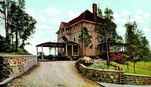
 High School in c. 1906
Malden has five public elementary/middle schools; one charter elementary, middle, and high school; one public high school; one Catholic high school; and one public preschool. The website for the public schools is:www.malden.mec.edu. The elementary schools in Malden were replaced in the late 1990s with five new facilities: Linden School, Beebe School, Forestdale School, Salemwood School, Mystic Valley Regional Charter School, and Ferryway School. The old (but newest of the old schools) Chester W. Holmes School, built c. 1962 to replace Faulkner School, which burned down, was remodeled around the time the other schools were rebuilt and is now the Early Learning Center. Malden is also home to Malden High School, Mystic Valley Regional Charter School (MVRCS), and Malden Catholic High School.
Neighborhoods
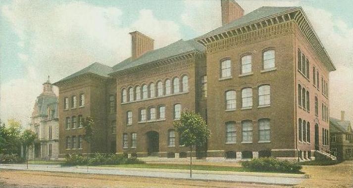
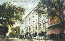 Malden Auditorium in 1909
Like many communities in New England, many towns and neighborhoods are organized around "Squares" which are locations of crossroads and town commons dating from the colonial and early 19th century years. Many of the neighborhoods in Malden take their name and identity from the Square they are centered around.
Malden's squares include Malden Square (formerly Converse Square, and the location of Downtown Malden), Oak Grove Square (at Oak Grove T Station), Bellrock Square (at the intersections of Cross, Main and Medford Sts.), Judson Square (near Ferryway School), former Suffolk Square (at Cross and Bryant Streets, and the location of a thriving Jewish community, Maplewood Square (at Lebanon, Maplewood and Salem Streets) and Linden Square.
Some of the neighborhoods in Malden include Faulkner (location of the former Suffolk Square) West End, Edgeworth, Linden, Ferryway, Forestdale, Maplewood, Bellrock, and Belmont Hill (located between Bellrock and Ferryway).
Faulkner
The Faulkner neighborhood is generally bounded by Ferry St on the west, the City of Everett on the South, at Dell St on the east and Salem Street on the north. A few of the streets north of Salem Street around Pierce St are sometimes considered part of Faulkner. In colonial times, Harvell's Mill was located here (at the intersection of Cross Street and the old B&M Railroad tracks, between Eastern Ave and Salem Streets), just below the cliffs, on Harvell's Brook, which drained west to the Malden River. A road from South Malden (now Everett) crossed here to meet Salem Street just uphill. Formerly called Harvell's Brook Lane, it was re-named Cross Street. In the 19th century a railroad was built along Harvell's Brook, named the Saugus Branch, and the brook was channeled to become a sewage ditch called the Saugus Branch Brook. During this time industry sprouted in this area, and a large immigrant neighborhood focused around Bryant and Cross Streets took shape named Suffolk Square. In the early 20th century Saugus Branch Brook was culverted due to pollution. In the 1920s and 30s Jewish immigrants from East Boston and Chelsea, as well as the West and North Ends of Boston, began to migrate to Suffolk Square. During this time Faulkner was served by three trolley lines and two commuter rail stations by what is now the MBTA. All that remains is the Route 105 T bus line. In the 1950s out-migration by the Jewish community to northern suburbs and the decline of railroads and mill-based industry led to a condition of dilapidated and shabby housing of triple deckers and empty storefronts. Ambitious but experimental urban renewal modeled on Boston's Scolley Square and West End projects leveled Suffolk Square and most of the neighborhood. Controversy around redevelopment projects led to the loss of the commercial center at Suffolk Square and the replacement of dense 3-family houses with suburban-like low-income and senior public housing. Housing projects include Suffolk Manor Senior Housing, Bowdoin Apartments and Newland Street Projects. The neighborhood was once served by Lincoln Elementary, Lincoln Jr High/ Middle School and Daniels Elementary as well at as the former Faulkner school at Peirce and Salem Streets. At the beginning of the 21st century a small section of Harvell's Brook was daylighted and partially restored at Roosevelt Park during the construction of the Salemwood School on the east end of the park. Parks in this neighborhood include Daniels Park, Lincoln Commons, Roosevelt Park and Harvard St. Park.
West End
The West End neighborhood is the northwest section of the city, along the border with Medford, Ma. It contains the Immaculate Conception Parish, the Fellsmere Pond and Amerige Park. The Beebe School is located in the West End neighborhood. The Malden Hospital, when it was operating, was also located in the West End. The Fells Acre incident occurred here..
Edgeworth
The Edgeworth neighborhood is the southwest section of the city. It contains Devir Park, Pearl St. Park, and Callahan Park. The city’s football stadium, MacDonald Stadium is in Edgeworth. A school in Edgeworth is the former Emerson grammar school. The Converse Rubber Factory and offices once operated in Edgeworth at the bottom of Pearl Street. This is the original home of the Converse "All-Star" Basketball Sneakers. Malden Catholic High School was originally located in Edgeworth on Highland Ave. The school's football team played their home games at Brother Gilbert Stadium, located at Commercial & Medford Streets in Edgeworth.
Ferryway
Ferryway is the south central section of the city. It contains the Ferryway School and Newman Park. The land where the school is now used to be called Ferryway green.
Forestdale
Forestdale is the north central section of the city and it contains the Forestdale School and park. It also has the largest park in Malden, Pine Banks Park, and the largest cemetery, Forest Dale Cemetery. Parts of Forest street follow an old Indian path.
Linden
Linden is the southeast section of the city, generally everything east of Broadway/Route 99. It contains the Linden School and Hunting Field, and a moderately sized mountainous area topped with an apartment complex called Granada Highlands. A large portion of this neighborhood was once a marshy area up until the late 19th century. The Linden Land Company sold off house lots on land that was created by filling in the marsh around the Hunting Field area. People are known to still dig up old glass bottles and other items on their property on occasion. Hunting field was once a park that encompassed the entire area inside of Broadway, Salem St., Eastern Ave., and Claremont Street, save for a few homes and a large trolley car barn that was located where Econo Lodge is today. The park at one point had public gardens and a fountain. Over time the land was obliterated by construction of a gated and private housing project for war veterans in the late 40s and the Linden elementary school in 1953. The veterans housing has since been converted to low-income housing. One of the last remaining vestiges of this park is "the No-Name street", which was the old entrance. One of the original park's large oak trees still stands here on the corner of Claremont St., as well as some stone walls.
Maplewood
Maplewood is located approximately one mile east of Malden Square. By car, one can follow either Salem Street or Route 60 directly to Maplewood Square. Most of Maplewood lies within Malden’s Ward Six. Maplewood comprises three neighborhoods: South Broadway, Maplewood Highlands (a hilly area to the northeast) and Maplewood lowlands, the most populous of the neighborhoods, which includes Maplewood Square, the heart of the Maplewood neighborhood.
Numerous public buses connect Maplewood to the MBTA's Orange line. Travel time from Maplewood to Boston, via public transit, is as little as 30-minutes. Travel time from Maplewood to the Square One Mall in Saugus is about 15-minutes. An MBTA public transit subway and Commuter Rail station is located 1.3 miles (2.1 km) from Maplewood Square. Maplewood Square is five miles (8 km) from downtown Boston, one mile (1.6 km) from Route One, and two miles (3 km) from Route 93.
Maplewood Square has one gas station (Superior Gas), two convenience stores, a Citizens Bank, drug store, barber shop, fish market, meat market, three pizza parlors, an optometrist, a dentist, an accountant, a Dunkin Donuts, a tailor and dry cleaner, a ballroom dance studio, hair and nail salons, a barber shop, insurance agencies, two children's dance studios, a breakfast restaurant, Patrick’s Pub, Ristorante Serena, and two Chinese restaurants (one take-out, the other dine-in). There is a Stop and Shop near Maplewood Square, as well as a Planet Fitness. Maplewood's churches include Catholic, Baptist, Methodist, and Lutheran congregations. Maplewood also has a Jewish temple. Maplewood's schools include the K-8 building of the Mystic Valley Regional Charter School and Malden Catholic High School, situated at the end of Maplewood Street.
Housing in Maplewood ranges from modern one-family homes in new developments to many homes over a hundred years old, which have been updated over the years. There are many apartments available in one- and two-family homes, as well as in some newer apartment complexes like the Cliffside Apartments on Broadway.
There are three public parks in the neighborhood: Roosevelt, South Broadway and Trafton. Trafton Park has recently been renovated with a tot lot, tennis courts and an off-leash dog run. The future Northern Strand Bike trail will travel through Maplewood on its route to the Atlantic ocean.
Bellrock
Bellrock is the southwest section of the city, bordered by Main Street on the east, Charles Street on the north, the Malden River on the west, and the Everett line on the south. It contains Bell Rock Memorial Park (listed on the National Register of Historic Places) and Bell Rock Cemetery (also listed), which contains marked graves dating back to 1670. Bell Rock Cemetery was called Sandy Bank until the establishment of the Salem Street Cemetery in 1832; it was then known as the Old Burial Ground for half a century until it was renamed in 1882. Also located in this area are the headquarters for New England Coffee, which is credited for "making the entire city of Malden smell like roasted coffee."[20]
Fire department
The City of Malden is protected at all times by the professional fire fighters of the Malden Fire Department. The Department operates out of three city-wide firehouses.At one time, one firehouse was shared with the Revere, Massachusetts Fire Department (closed 2010). The Malden Fire Department operates an apparatus fleet of 3 engines (with 2 reserve engines), two ladder trucks, one command car, one fire prevention unit, one fire alarm unit, and one mechanic unit.
Fire Station locations
Fire Headquarters - Fire Station # 1: 80 Salem Street - Ladder 1, Engine 1,Engine 2, Car 1, Car 2, Fire Prevention Unit, Fire Alarm Unit
Fire Station # 2: 4 Laurel Street - CLOSED
Fire Station # 3: 332 Pleasant Street - Ladder 3, Engine 3
Fire Station # 4 (shared with Revere Fire and Rescue Department): 5 Overlook Ridge Drive THIS FIRE STATION IS IN REVERE MA - Engine 4
Transportation
Major highways
Route 28, Route 60, Route 99, and U.S. 1 run through Malden. Route 16 and Interstate 93 are a short distance outside the city's borders.
Rail
The city is served by the Orange Line subway that connects it to downtown Boston. The city's subway stops are Malden Center and Oak Grove. The MBTA's commuter rail also has one stop in the city (Malden Center) and can stop at Oak Grove if necessary. During the first few years of the 2000s, the MBTA updated signal systems and Orange Line service was replaced by shuttle buses at night. Since September 2007, such service interruptions have been limited to occasional weekends, while signal system repairs necessitated closing off the northern portion of the Orange Line and rerouting passengers via replacement bus service from either the Haymarket subway stop or Wellington Station.
There is a sizable section of the old Boston and Maine "Saugus Branch" railroad line running across the middle of the Malden. This line is currently owned by the MBTA, but has been out of use since the late 1990s. A plan exists to create a bike trail (Bike to the Sea) along the side of these tracks on right-of-way land. Progress has been hampered by lack of funds and land encroachment (fences erected across the railroad line).
Bus
Bus service to all adjacent communities is also available via the service of the MBTA.
Air
Boston's Logan International Airport is easily accessible from Malden.
Arts
Malden is home to a vibrant and rapidly expanding artist community.
Malden Arts
Malden Arts is a grassroots organization serving as an umbrella for diverse arts-related initiatives in Malden. Malden Arts promotes the arts in Malden, builds community among artists who live or work in Malden, and supports the revitalization of Malden and strengthening of community bonds through the arts. Malden Arts was founded in 2006 by local artists. Malden Arts first project was Window Arts Malden, which turns the windows of local businesses into galleries for local artists to display their work.[21]
Points of interest
Recreation
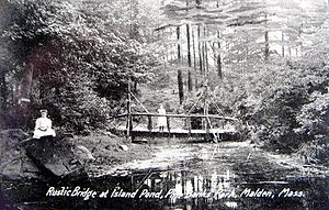 Pine Banks Park in 1908
Approximately 30 park sites throughout the city provide a variety of recreational facilities including tennis courts, basketball courts, playgrounds and ballfields. Other sites include a 400-meter synthetic running track at Macdonald Stadium; 56 acres (23 ha) of the Middlesex Fells Reservation; the 25-acre (10 ha) Fellsmere Pond; a DCR-owned and operated swimming pool; a 30,000 square feet (2,800 m²) fieldhouse built under the new school rebuilding plan; the state-of-the-art Malden YMCA finished construction in early 2007; and Pine Banks Park, operated by a Board of Trustees with equal representation by the cities of Malden and Melrose.
Notable residents
- Johnny A., musician
- Jack Albertson, Academy Award, Emmy Award and Tony Award-winning American actor, comedian, dancer, singer, musician
- Ed Ames, (born 1927), singer and actor
- The Ames Brothers, singers
- Walter Brennan, (b. 1894), Academy Award winning actor[citation needed]
- George Loring Brown (1814-1889), painter
- George R. Carey, (b. 1851), civil engineer, surveyor, American inventor of an early system of television (1877)[citation needed]
- Gary Cherone, (b.1961), recording artist, rock vocalist for Extreme and Van Halen
- Elisha S. Converse, (1820-1904), First mayor of Malden, businessman, founder and president of Boston Rubber Shoe Company, representative and senator in state congress, philanthropist
- "Lord" Timothy Dexter, businessman
- Gary DiSarcina, Major League Baseball player, born in Malden.
- Erle Stanley Gardner, lawyer, author of the Perry Mason mysteries
- Breno Giacomini, professional football player (Green Bay Packers)
- Harold Gomberg, principal oboist of the New York Philharmonic from 1943 through 1977
- Norman Greenbaum, (b. 1942), singer/songwriter
- Willis Hunt, senior federal judge for the Northern District of Georgia
- Adoniram Judson, Baptist missionary in Burma
- Toni Kelner, mystery writer
- Keith Knight, cartoonist, hip hop artist
- Wladek Kowalski, a.k.a. "Killer Kowalski", (1926–2008), retired Canadian professional wrestler, trained Triple H, Chyna, and Kenny Dykstra, and owned and operated Killer Kowalski's Pro Wrestling School in Malden, which survived his death in August 2008 and still operates.
- Ellis F. Lawrence, architect
- Fred A. Leuchter, execution technician featured in Errol Morris's documentary Mr. Death and Holocaust denier
- Barbara Margolis (1929–2009), prisoners' rights advocate who served as the official greeter of New York City.[22]
- Ed Markey, a Democratic member of the United States House of Representatives since 1976, representing the 7th District of Massachusetts.
- Kevin McGlinchy, professional baseball player, Atlanta Braves, 1999–2000
- Edmund Noble, (1853–1937), author, journalist from Boston Herald, editor of Free Russia (1892–1894)
- Patrick O'Hearn, film and video editor, animator
- Elliot Paul, author, journalist
- Lawrence Palmer, ice hockey player, born in Malden
- Mike Road, actor
- Richard Rodenheiser, 1956 and 1960 USA Olympic hockey team silver and gold medalist
- Dana Rosenblatt, professional boxer
- Dan Ross, NFL player for the Cincinnati Bengals, Seattle Seahawks, and the Green Bay Packers[23]
- Aafia Siddiqui, neuroscientist (alleged Al-Qaeda operative), convicted of assaulting with a deadly weapon and attempting to kill U.S. soldiers and FBI agents
- Frank Stella, painter and printmaker
- Freeman Tilden, reporter and author, National Park Service "Father of Interpretation"
- John Volpe, Governor of Massachusetts, U.S. Ambassador to Italy
- Michael Wigglesworth, puritan minister, author[24]
Literary and film references
- Life in early 20th century Malden is the subject of the memoir Linden on the Saugus Branch by writer Elliot Paul. The name Linden refers to the eastern-most section of Malden that borders Revere. Linden was formerly served by the Saugus Branch of the B&M Railroad that ran from Everett to West Lynn via Malden and Saugus. While train service was terminated in the 1950s, and freight ceased to travel the line by the late 90s, the tracks remain in place.
- In contemporary literature, Malden became a setpiece for Stephen King's zombie thriller Cell (novel). King has referenced Malden several times over the years in his various works, as he has (or had) relatives who lived in the city.
- Malden's Suffolk Square is the setting for the 2003 novel Sin of Omission by David Evans Katz (link: www.sinofomission.com). In the novel, Malden is thinly disguised as "Middlesex".
- Parts of Toni Kelner's 2008 mystery novel Without Mercy are set in Malden. The book's protagonist lives in an apartment near Malden Center, and describes local businesses Pearl Street Station and Town Pizza House.
- A memorable gun purchase scene near the beginning of the 1973 film The Friends of Eddie Coyle starring Robert Mitchum was shot in the quarry and around the stone crusher of the former Rowe Quarry on the eastern border of the city. A still of this scene is printed on the recently released Criterion Collection DVD of this movie, used as cover art.
- Parts of the movie Monument Ave. starring Denis Leary were filmed in Malden.
- Stop and Shop in Malden was referenced in the 2010 film "The Town."
References
 1852 Map of Boston area showing Malden
- ^ "The Best Places to Raise Your Kids 2009: Massachusetts - BusinessWeek". Images.businessweek.com. http://images.businessweek.com/ss/08/11/1110_best_places_for_kids/22.htm. Retrieved 2011-03-11.
- ^ Abel, David (November 13, 2008). "Magazine calls Malden state's best place to raise children - The Boston Globe". Boston.com. http://www.boston.com/news/local/articles/2008/11/13/magazine_calls_malden_states_best_place_to_raise_children/. Retrieved 2011-03-11.
- ^ History of Middlesex County, p. 114-116.
- ^ a b History of Malden – City Website
- ^ Corey, Deloraine. The History of Malden, Massachusetts, 1633–1785.
- ^ Malden/Medford Football: By the numbers
- ^ "US Gazetteer files: 2010, 2000, and 1990". United States Census Bureau. 2011-02-12. http://www.census.gov/geo/www/gazetteer/gazette.html. Retrieved 2011-04-23.
- ^ "TOTAL POPULATION (P1), 2010 Census Summary File 1, All County Subdivisions within Massachusetts". United States Census Bureau. http://factfinder2.census.gov/bkmk/table/1.0/en/DEC/10_SF1/P1/0400000US25.06000. Retrieved September 13, 2011.
- ^ "Massachusetts by Place and County Subdivision - GCT-T1. Population Estimates". United States Census Bureau. http://factfinder.census.gov/servlet/GCTTable?_bm=y&-geo_id=04000US25&-_box_head_nbr=GCT-T1&-ds_name=PEP_2009_EST&-_lang=en&-format=ST-9&-_sse=on. Retrieved July 12, 2011.
- ^ "1990 Census of Population, General Population Characteristics: Massachusetts". US Census Bureau. December 1990. Table 76: General Characteristics of Persons, Households, and Families: 1990. 1990 CP-1-23. http://www.census.gov/prod/cen1990/cp1/cp-1-23.pdf. Retrieved July 12, 2011.
- ^ "1980 Census of the Population, Number of Inhabitants: Massachusetts". US Census Bureau. December 1981. Table 4. Populations of County Subdivisions: 1960 to 1980. PC80-1-A23. http://www2.census.gov/prod2/decennial/documents/1980a_maABC-01.pdf. Retrieved July 12, 2011.
- ^ "1950 Census of Population". Bureau of the Census. 1952. Section 6, Pages 21-10 and 21-11, Massachusetts Table 6. Population of Counties by Minor Civil Divisions: 1930 to 1950. http://www2.census.gov/prod2/decennial/documents/23761117v1ch06.pdf. Retrieved July 12, 2011.
- ^ "1920 Census of Population". Bureau of the Census. Number of Inhabitants, by Counties and Minor Civil Divisions. Pages 21-5 through 21-7. Massachusetts Table 2. Population of Counties by Minor Civil Divisions: 1920, 1910, and 1920. http://www2.census.gov/prod2/decennial/documents/41084506no553ch2.pdf. Retrieved July 12, 2011.
- ^ "1890 Census of the Population". Department of the Interior, Census Office. Pages 179 through 182. Massachusetts Table 5. Population of States and Territories by Minor Civil Divisions: 1880 and 1890. http://www2.census.gov/prod2/decennial/documents/41084506no553ch2.pdf. Retrieved July 12, 2011.
- ^ "1870 Census of the Population". Department of the Interior, Census Office. 1872. Pages 217 through 220. Table IX. Population of Minor Civil Divisions, &c. Massachusetts. http://www2.census.gov/prod2/decennial/documents/1870e-05.pdf. Retrieved July 12, 2011.
- ^ "1860 Census". Department of the Interior, Census Office. 1864. Pages 220 through 226. State of Massachusetts Table No. 3. Populations of Cities, Towns, &c.. http://www2.census.gov/prod2/decennial/documents/1860a-08.pdf. Retrieved July 12, 2011.
- ^ "1850 Census". Department of the Interior, Census Office. 1854. Pages 338 through 393. Populations of Cities, Towns, &c.. http://www2.census.gov/prod2/decennial/documents/1850c-11.pdf. Retrieved July 12, 2011.
- ^ "1950 Census of Population". Bureau of the Census. 1952. Section 6, Pages 21-7 through 21-09, Massachusetts Table 4. Population of Urban Places of 10,000 or more from Earliest Census to 1920. http://www2.census.gov/prod2/decennial/documents/23761117v1ch06.pdf. Retrieved July 12, 2011.
- ^ "American FactFinder". United States Census Bureau. http://factfinder.census.gov. Retrieved 2008-01-31.
- ^ [1], Yelp reviews
- ^ "Malden Arts.html". Maldenarts.com. http://www.maldenarts.com/index.html. Retrieved 2011-03-11.
- ^ Fox, Margalit. "Barbara Margolis, Prisoners’ Advocate, Dies at 79", The New York Times, July 12, 2009. Accessed July 21, 2009.
- ^ "Dan Ross". NFL. http://www.nfl.com/players/danross/profile?id=ROS569520. Retrieved March 15, 2010.
- ^ "About Michael Wigglesworth and his Poetry". Fire and Ice: Puritan and Reformed Writings. http://www.puritansermons.com/poetry/wigglife.htm. Retrieved May 20, 2007.
-
- Malden CrimeWatch Inc. (2009-present) Can be found on Facebook. It is the first Non-profit Crime Watch in the city. The group meets every month at the Linden School.
External links
- Official website
- Malden Public Library
- Malden Observer, local newspaper
- Malden HomePage- Your online source for all things Malden
- History of Middlesex County, Volume II, p. 113 etc. (Medford, by W. H. Whitmore). 1880, published by Estes and Lauriat; edited by Samual Adams Drake.
- Births, Marriages and Deaths in the Town of Malden, 1649–1850 by Deloraine Pendre Corey, published 1903.
Municipalities and communities of Middlesex County, Massachusetts Cities 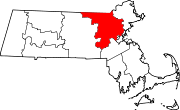
Towns Acton | Arlington | Ashby | Ashland | Ayer | Bedford | Belmont | Billerica | Boxborough | Burlington | Carlisle | Chelmsford | Concord | Dracut | Dunstable | Framingham | Groton | Holliston | Hopkinton | Hudson | Lexington | Lincoln | Littleton | Maynard | Natick | North Reading | Pepperell | Reading | Sherborn | Shirley | Stoneham | Stow | Sudbury | Tewksbury | Townsend | Tyngsborough | Wakefield | Wayland | Westford | Weston | Wilmington | Winchester
CDPs Ayer | Cochituate | Fort Devens | East Pepperell | Groton | Hopkinton | Hudson | Littleton Common | Pepperell | Pinehurst | Shirley | Townsend | West Concord
Other
villagesAuburndale | Chestnut Hill | Gleasondale | Nabnasset | Newton Centre | Newton Highlands | Newton Lower Falls | Newton Upper Falls | Newtonville | Nonantum | North Billerica | North Chelmsford | Waban | West Newton
Categories:- Cities in Massachusetts
- Malden, Massachusetts
- Populated places established in 1640


Wikimedia Foundation. 2010.