- Acton, Massachusetts
-
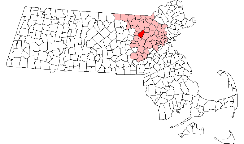
Acton, Massachusetts — Town — Acton Town Hall Location in Middlesex County in Massachusetts
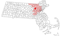
Coordinates: 42°29′06″N 71°26′00″W / 42.485°N 71.4333333°WCoordinates: 42°29′06″N 71°26′00″W / 42.485°N 71.4333333°W Country United States State Massachusetts County Middlesex Settled 1639 Incorporated 1735 Government – Type Open Town Meeting – Town Manager Steven L. Ledoux – Board of
SelectmenMike Gowing(Chair)
Pam Harting-Barrat(Vice-Chair)
Janet Adachi
John Sonner
David CloughArea – Total 20.3 sq mi (52.5 km2) – Land 20.0 sq mi (51.7 km2) – Water 0.3 sq mi (0.8 km2) Elevation 260 ft (79 m) Population (2010) – Total 21,924 – Density 1,037.7/sq mi (401.4/km2) Time zone Eastern (UTC-5) – Summer (DST) Eastern (UTC-4) ZIP code 01720, 01718 Area code(s) 351 / 978 FIPS code 25-00380 GNIS feature ID 0618213 Website www.acton-ma.gov Acton is a suburban town in Middlesex County, Massachusetts, United States about twenty-one miles west-northwest of Boston along Route 2 west of Concord and about ten miles (18 km) southwest of Lowell. The population was 21,924 at the 2010 census. It is bordered by Westford and Littleton to the north, Concord and Carlisle to the east, Stow and Maynard to the south, and Boxborough to the west. Acton became an incorporated town in 1735. The town employs the Open Town Meeting form of government with a Town Manager and an elected, 5-member Board of Selectmen. Acton was named the 16th Best Place To Live among small towns in the country by Money Magazine in 2009 and in 2011. The local high school, Acton-Boxborough Regional High School, was named a Blue Ribbon School by the U.S. Department of Education in 2009.[1]
Contents
Geography
Acton is located at 42°29′N 71°27′W / 42.483°N 71.45°W. According to the United States Census Bureau, the town has a total area of 20.3 square miles (53 km2), of which 20.0 square miles (52 km2) is land and 0.3 square miles (0.78 km2), or 1.53 percent, is water. Almost all of Acton is forested, except for where it has been cleared for residential or agricultural use. Some forested areas have been put aside for special use by corporations.
The current geography of Acton was created when the last wave of glaciers retreated approximately ten thousand years ago. Acton has nine drumlins — hills which are composed of glacial till. In addition, Wills Hole and Grassy Pond are kettle ponds which were formed in depressions in the till formed by large blocks of ice.
Acton has two primary stream systems: the Nashoba Brook system including the incoming streams Butter Brook, Will's Hole Brook and Conant Brook and the Fort Pond Brook system including the incoming streams Guggins Brook, Inch Brook, Grassy Pond Brook, Pratt's Brook and Coles Brook. Both stream systems empty into the Assabet River, which passes briefly through the town at its southern corner. Nagog Pond in the north, forms Acton's border with the Town of Littleton and provides drinking water to the Town of Concord. A small artificial pond is at NARA Park in North Acton.
The five village centers
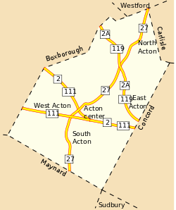
While Acton Center has been the civic center of the town since the revolution, the four other villages centers earned their nomenclature from the names of their corresponding railroad station.
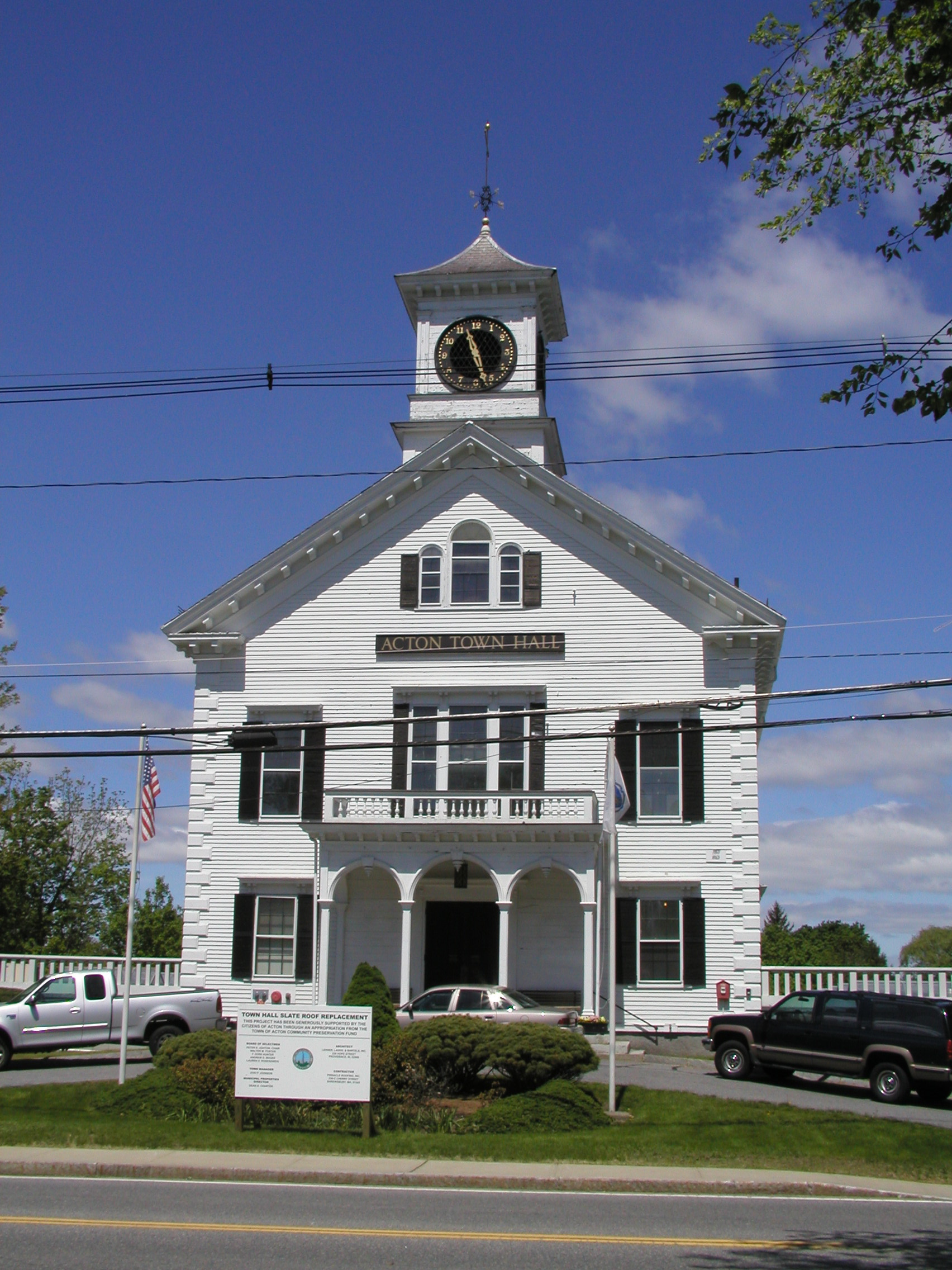
- Acton Center is the civic center of the town and is the site of the town hall, the main public library, a children's playground, an obelisk monument commemorating Acton deaths in "the Concord Fight" of the Revolutionary War, a fire station, a Congregational church, a 64-acre (260,000 m2) arboretum and conservation area, and the former post office. The modern post office and the police station are each located about one-half mile away in opposite directions along Main Street. Otherwise, Acton Center is generally a residential area.
- West Acton is an important commercial area of town, consisting of several commercial developments centered along Route 111. It developed in response to the growth of the Fitchburg Railroad in the 19th century. The West Acton Station was located on land now occupied by New London Pizza.
- South Acton used to be the most industrialized area of the town of Acton. In the 18th century, this area held many mills and other small industrial developments that used water power generated by Fort Pond Brook. The area includes the Faulkner Homestead ('Faulkner House'), the oldest home still standing in Acton. The Faulkner Homestead was owned by the Faulkner family who also owned and ran a mill across the street. Jones Tavern is another still-standing revolutionary-era structure in South Acton that is listed on the National Register of Historic Places. The South Acton (MBTA station) is the only rail station on the Fitchburg line still active in Acton.
- East Acton was originally a small commercial area that grew up around the East Acton train station in the 19th century. With the advent of the automobile, and the demise of this branch of the railroad, East Acton became a largely residential area with a commercial base that is disposed along the Route 2A corridor.
- North Acton has had major growth in the period since 1975-80. With the growth of the Rte 2A/119 corridor, North Acton has developed many commercial complexes and condominium buildings. The North Acton Recreation Area (also called NARA Park) contains a small swimming pond, an open air auditorium, playing fields, and hiking trails.
The current Master Plan for the town encourages development in the village centers in an attempt to prevent further sprawl and preserve open space in the rest of the town.
Demographics
Historical populations Year Pop. ±% 1850 1,685 — 1860 1,726 +2.4% 1870 1,593 −7.7% 1880 1,797 +12.8% 1890 1,897 +5.6% 1900 2,120 +11.8% 1910 2,136 +0.8% 1920 2,162 +1.2% 1930 2,482 +14.8% 1940 2,701 +8.8% 1950 3,510 +30.0% 1960 7,238 +106.2% 1970 14,770 +104.1% 1980 17,544 +18.8% 1990 17,872 +1.9% 2000 20,331 +13.8% 2001* 20,734 +2.0% 2002* 20,769 +0.2% 2003* 20,746 −0.1% 2004* 20,633 −0.5% 2005* 20,561 −0.3% 2006* 20,537 −0.1% 2007* 20,702 +0.8% 2008* 20,899 +1.0% 2009* 21,232 +1.6% 2010 21,924 +3.3% * = population estimate.
Source: United States Census records and Population Estimates Program data.[2][3][4][5][6][7][8][9][10][11]According to the census[12] of 2000, there were 20,331 people, 7,495 households, and 5,540 families residing in the town. The population density was 1,018.1 per square mile (393.1/km²). There were 7,680 housing units at an average density of 384.6 per square mile (148.5/km²). The racial makeup of the town was 88.4% White, 8.6% Asian, 0.7% African American, 0.1% Native American, >1% Pacific Islander, 0.6% from other races, and 1.5% from two or more races.
Of the 7,495 households, 43.1% had children under the age of eighteen living with them, 65.1% were married couples living together, 6.5% had a female householder with no husband present, and 26.1% were non-families. 21.4% of all households were made up of individuals and 5.3% had someone living alone who was 65 years of age or older. The average household size was 2.69 and the average family size was 3.19.
The age distribution of the population was 29.5% under the age of 18, 4.3% from 18 to 24, 31.5% from 25 to 44, 26.4% from 45 to 64, and 8.4% 65 years of age or older. The median age was 38 years. For every 100 females there were 97.2 males. For every 100 females age eighteen and over, there were 94.2 males.
For those age 25 years or older in Acton during the 2000 census, 97.8% had a high school degree or higher, 69.3% had a bachelor's degree or higher, and 33.9% had a graduate degree or higher. Also, 98.0% were employed with a mean commute time of 31.0 minutes.
The median income for a household in the town is $125,532, and the median income for a family is $143,352.[13] Males had a median income of $89,371 versus $48,113 for females. The per capita income for the town was $53,153. About 1.7% of families and 2.9% of the population were below the poverty line, including 2.4% of those under age 18 and 3.3% of those age 65 or over.
History
Acton's history reflects the history of Massachusetts, New England, and the United States.
Acton was first settled by Native Americans who used the Assabet, Sudbury and Concord rivers for transportation and the fields for farming seasonal crops. There is evidence of Native American settlements in Acton which go back 7000 years. When the colonists arrived in this area, the Native American population dropped dramatically due to European diseases for which they had no immunity.
Colonization Era through Revolutionary Era
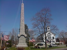 Isaac Davis Monument and the Acton Town Hall
Concord was the first colonial town that was settled in this area. Concord residents used the land which is now Acton as grazing fields for their animals. The first colonial residents moved to Acton in 1639.
Acton was established as an independent town on July 3, 1735. Acton has held annual town meetings since 1735, the records of which are held at Acton's Memorial Library.[14]
Acton residents participated in the growing hostility with Great Britain by sending a list of grievances to King George III on Oct. 3rd, 1774. The anniversary of this day is celebrated in Acton as Crown Resistance Day.[15]
At the beginning of the Revolutionary War, on April 19, 1775, a company of minutemen from Acton responded to the call to arms initiated by Paul Revere (who rode with other riders, William Dawes and Samuel Prescott, with Prescott the only one of the three who was able reach Acton itself) and fought at the North Bridge in Concord as part of the Battle of Lexington and Concord. The Acton minutemen were led by Captain Isaac Davis. When a company was needed to lead the advance on the bridge which was defended by the British regulars, Captain Davis was heard to reply, "I haven't a man who is afraid to go." The Acton men led because, unlike other militias there, they were fully equipped with bayonets.
The colonists advanced on the bridge; in the exchange of musket fire that followed, Captain Isaac Davis and Private Abner Hosmer of Acton were killed. Davis was the first officer to die in the American Revolutionary War. In Acton they refer to "the battle of Lexington, fought in Concord, by men of Acton."
Each year on Patriots' Day (traditionally April 19; since 1969, observed on the 3rd Monday in April as part of a 3-day Patriots' Day weekend), the Acton Minutemen[16] lead a march from Acton Center to the Old North Bridge in Concord. This route is known as 'The Isaac Davis Trail' and is listed on the National Register of Historic Places. Since 1957, Acton's Troop 1 [2] of the Boy Scouts of America have organized an annual march along the Isaac Davis line of march, and since 1976 the "Scouters of the Isaac Davis Trail" have organized the annual Isaac Davis Camporee [3].
Industrialization and Civil War
During the 19th century, Acton participated in the growing Industrial Revolution. By the mid-19th century, Acton was an industrial center for the production of barrels (cooperage). There were also three gristmills and four sawmills in town.[17]
On October 1, 1844 the railroad came to Acton. The Fitchburg Railroad was routed through South and West Acton so that it could serve the mills. South Acton became a busy rail center and was the division point for the Marlborough Branch Railroad. With the railroad came increasing development in those areas. In addition to the Fitchburg Railroad, two others crossed the town: the Nashua and Acton, and the Framingham and Lowell. These two railroads shared a double track right-of-way that ran from West Concord (aka Concord Junction) through East Acton and then splitting in North Acton in the vicinity of Route 27 and Ledgerock Way.
In 1874, the population of the town was almost 1700. The town established its first newspaper, The Acton Patriot, and the residents of West Acton formed the first library, The Citizen's Library. In 1890, the Memorial Library was completed and given to the town by William A. Wilde as a memorial to the Acton soldiers who fought in the Civil War.
W. R. Grace Superfund Site
In the early 1950s, W. R. Grace and Company established a manufacturing facility in South Acton to produce concrete additives, organic chemicals and other industrial materials. W. R. Grace disposed of industrial waste from this facility in unlined impoundments (lagoons) through 1980.[18]
The main areas that contained high levels of arsenic and manganese were Sinking Pond located on the Southeast border of the W. R. Grace property and the North Lagoon Wetland on the Northeast border. Prior to 1980, there were other lagoons and an on-site industrial landfill present where effluent waste flowed into or solid waste was buried. [19]
Complaints from locals around the site in Acton and Concord were filed concerning strange odors and irritants in the air. Since the dumping had been occurring for so long, residents in Acton and Concord could have been exposed to airbore, water, and soil contamination for over 27 years. The W.R. Grace area was also located less than a mile from another Superfund investigation at the Starmet plant which used depleted uranium to create anti-tank weapons for the U.S. army.[20]
The complaints eventually led to water samples taken from the Assabet 1 and 2 wells finding the amount of VOC contamination was far too high. In 1978 vinylidene chloride and other industrial contaminants were detected in two of the town wells, Assabet 1 and Assabet 2, which were closed. In 1983 the Acton W. R. Grace site was placed on the list of United States Environmental Protection Agency (EPA) Superfund sites as a National Priority for cleanup.[18]
The wells were put back online for a few months at time from 1983-1984 using carbon filtration and airstripping. The carbon was halted, but an airstripper is still used to remove VOCs. The water from these wells currently meets or exceeds the requirements of the Safe Drinking Water Act (AWD).[20]
In August, 2006, W. R. Grace and the EPA reached agreement on a scope-of-work pact that describes the work necessary to clean up the site.
As of 2011, the EPA has started excavating sediments from Sinking Pond containing arsenic and manganese which will dewatered then transported to a disposal facility. The areas will be sampled to ensure safe levels of contaminants then re-vegetated to restore then wetlands properly. Precautions such as air quality monitoring during excavation and removing dust from the vehicles before leaving the site will be taken to ensure locals are not exposed.[21]
Government
Acton uses the Open Town Meeting form of town government. The town charter specifies that the annual town meeting must begin on the first Monday in April. The selectmen may also call a special town meeting at other times of the year to consider other business. Citizens may force a special town meeting by submitting a petition signed by 200 registered voters to the town clerk. Anyone may attend Town Meeting but only registered voters may vote. Acton also has a water district, which is run separately from town government, as a public utility.
Acton's elected officials include the following: the board of selectmen (5 members), the town moderator, the Acton public school committee (6 members), the Acton representatives to the Acton / Boxborough regional school committee (6 members). In addition, the town moderator appoints a finance committee (9 members) which issues an opinion on each of the warrant articles presented to Town Meeting. In addition, a separate and independent branch of government, the Acton Water District, was established in 1912 and consists of three Commissioners, a Moderator, a Secretary, an appointed District Attorney, Finance Committee, Land-Water Use Advisory Committee, and paid professional staff.
The town services are primarily funded through the residential property tax, which is subject to the limitations imposed by State "Proposition 2½." The Water District is funded through water rates, connection fees and property rental. The Water District revenues, however, are not subject to State "Proposition 2½."
Civic infrastructure
The civic infrastructure grew to accommodate the increasing population. A Water District was established in 1912 and a town-wide Fire Department was established in 1913. Acton was the first town in the area to have water-bound macadam highways.
In 2005 a new Public Safety Building was built that expanded space for the Police Department and provided for a Joint Dispatch area with the Fire Department.
Water district
The Acton Water District is a community public water supply that delivers drinking water to the majority (about 90 percent) of the residents of the town of Acton, Massachusetts. All of the water provided from the District comes from seven wells located within the town of Acton. The District's system consists of 106 miles (171 km) of water main, four storage tanks, and water treatment facilities including aeration, activated granulated carbon (GAC), an advanced Zenon(R) filtration facility, plus fluoridation and state mandated chlorination.
Sewers
Most homes and businesses in Acton (approximately 80%) use private on-site sewage systems (i.e. septic tanks). Higher density developments such as condominiums and apartment buildings (approximately 10% of the town) use private sewers which go to small-scale private treatment plants.
In 2001, Acton completed its first public sewer system, which serves approximately 10% of the town, primarily in South Acton. A betterment fee is charged to property owners whose property is sited proximate to the sewage lines, whether or not they connect to the system.
Town Recreation areas
Conservation lands
Acton has a total of over 1,650 acres (7 km2) of town-owned conservation lands.
- Acton Arboretum: A park in the center of Acton which consists of 53 acres (210,000 m2) of woods, meadows, swamp, ponds, old apple orchards, a glacial esker, and a bog. The land was purchased by the town in 1976 and was designated an Arboretum in 1986. It now includes a 19th century herb garden, a hosta garden, a wildflower garden, a butterfly garden and a rhododendron garden. A fragrance garden is being constructed.
- Pratt's Brook: A 57-acre (230,000 m2) property located in South Acton.
- Great Hill. A 185-acre (0.7 km2) property located in South Acton behind the School Street fire station, which includes picnic tables. In addition there is a skating pond and two sets of playing fields.
- Grassy Pond and Nagog Hill. Two adjoining conservation areas located in North Acton which total 250 acres (1.0 km2) of land.
- Wills Hole Conservation Area and Town Forest. A 73-acre (300,000 m2) property located in North Acton off of Quarry Road, adjacent to the North Acton Recreation Area (NARA Park), includes a Bog and abuts an inactive granite quarry (private property).
- Nashoba Brook, Spring Hill, Camp Acton. Three adjoining conservation areas in North Acton that total over 400 acres (1.6 km2). Additional adjoining acreage will be added when the Robbins Mill development is completed. The trails in this area are Acton's portion of the Bay Circuit Trail and Greenway which is a planned hiking path that will encircle Boston - starting in Ipswich and ending in Duxbury. A interpretive historical trail, named the Trail Through Time, also overlays the trail system and stops at various farms, cellars and mills.
- Bulette Land/Town Forest consists of 48 acres (190,000 m2)[citation needed], mainly of wetlands and forest.
- Heath Hen Meadow consists of 99 acres (400,000 m2) of land.
- Jenks Land consists of 30 acres (120,000 m2) of land. It is home to over 170 species of birds that one man had recorded one year.
- Morrison Farm & Ice House Pond: Located off of Concord Rd, these 70 acres (280,000 m2) includes a house, a stable and corral, and various open fields and water.
These town conservation areas, and some smaller ones, are described and mapped in a website maintained by the town's volunteer Land Stewardship Committee.[22]
Playing fields & playgrounds
- Leary Field: Contains an all purpose turf field and is home to Acton-Boxborough Regional High School athletics.
- High School Complex Contains three contiguous grass playing fields used for multiple sports, three tennis courts, a softball diamond and two baseball diamond (one lighted).
- Elm Street Complex: Contains two tennis courts and a lighted softball baseball diamond, primarily used by the Adult & Youth Softball Leagues. It is adjacent to the Douglas School yard which contains a baseball diamond and a basketball court.
- Gates Fields Contains two softball diamond located at the Gates School and a large grass area used for JH Field Hockey.
- North Acton Recreation Area (NARA): Contains a softball diamond, a large configurable field used for multiple sports, a swimming pond, playground and performance stage.
- Veterans Field: Contains two baseball diamonds and a playground.
- Jones Field: It contains a single baseball diamond and a playground.
- Great Hill: Contains a large configurable field, a smaller single soccer field, and a playground. This is located in the front portion of the conservation area.
- School Street Fields: Located off School Street near Route 2 is a large grass surface configurable to several multi-dimension playing fields.
- Concord Road: Located next to Morrison Farm on Woodlawn Cemetery land is used primarily for soccer.
Education
At the beginning of the century, each village in Acton had its own grade school, but the town struggled with how to provide a high school education for its students. For most of the early 20th century (until 1925), Acton students were sent to Concord's high school.
In 1953, new schools were constructed to accommodate the growth in the student population. In 1957, Acton and Boxborough created a regional school district for grades 7-12. The Merriam School was constructed in 1958. Other schools quickly followed: Douglas (1966), Gates (1968), and Conant (1971). In 1967 a building was constructed for the junior high. In 1973 a huge addition was added to this building and it became the high school; the junior high moved to the old high school building.
Acton Public School District (elementary)
The Acton Public School District consists of five elementary schools and the Acton Public School Pre-school.
Acton has an unusual method of assigning students to elementary schools, called "Open Enrollment." First-time incoming kindergarten parents participate in a lottery-based selection process where the parents "choose" the school by listing their preferences in ranked order.
This method of school choice has a large impact on the nature of the town. Acton is less oriented around neighborhoods than towns which have neighborhood based schools. Other child-oriented activities such as town sport teams are also not organized around the school system. As a result, students and families are likely to have social connections that are independent of their neighborhood.
While the curriculum in the district is fairly standardized, each of the elementary schools has a different teaching philosophy. The schools and their philosophy of education are:
- Conant School. Named for Luther Conant who taught for 17 years in the school district, served on the School Committee, and was Town Moderator for 40 years. The school emphasizes the Whole language approach when teaching students to read. The Conant School has an English as a Second Language (ESL) program.
- Douglas School. Named for Carolyn T. Douglas who was a teacher and principal in the Acton schools from 1940 to 1967. The school emphasizes Phonics for learning to read. The Douglas School has an ESL program (English as a Second Language).
- Gates School. Named for Paul P. Gates who was the school physician from 1948 to 1968. The school emphasizes Phonics for learning to read.
- McCarthy-Towne School. Named for Julia McCarthy who taught at the South Acton School from 1906 to 1952 and Marion Towne who was a teacher in the primary and secondary schools in Acton from 1921 to 1959. McCarthy-Towne integrates language arts, math, social studies, science and art in the study of curriculum "units." The school has an ESL (English as a Second Language) program and also includes two CASE (Concord Area Special Education) classrooms. McCarthy-Towne has a very active parent volunteer program. McCarthy-Towne School is housed in the Parker Damon Building (named for McCarthy-Towne's first principal, J.Parker Damon), which it shares with the Merriam School.
- Merriam School. Named for Florence A. Merriam who taught for 35 years in Acton. Merriam offers a project-based curriculum. At Merriam, teachers teach the same group of students for two years (i.e., a teacher will teach first grade one year, second grade the next and then wrap back to first). Merriam School is housed in the Parker Damon Building which it shares with the McCarthy-Towne school.
Acton-Boxborough Regional Schools (junior high and high school)
The Acton-Boxborough Regional School District consists of the Raymond J. Grey Junior High School for grades 7 and 8, and the Acton-Boxborough Regional High School for grades 9 through 12. The regional district serves students from the towns of Acton and Boxborough. In addition, some students are accepted from neighboring towns as 'choice' students if the school committee decides this is in the best interest of the district. Both the junior high and high school were enlarged and renovated in 2000–2005. They have multiple on-campus shops: the Junior High School Store, the High School Store, and the cafeterias.
Cultural institutions
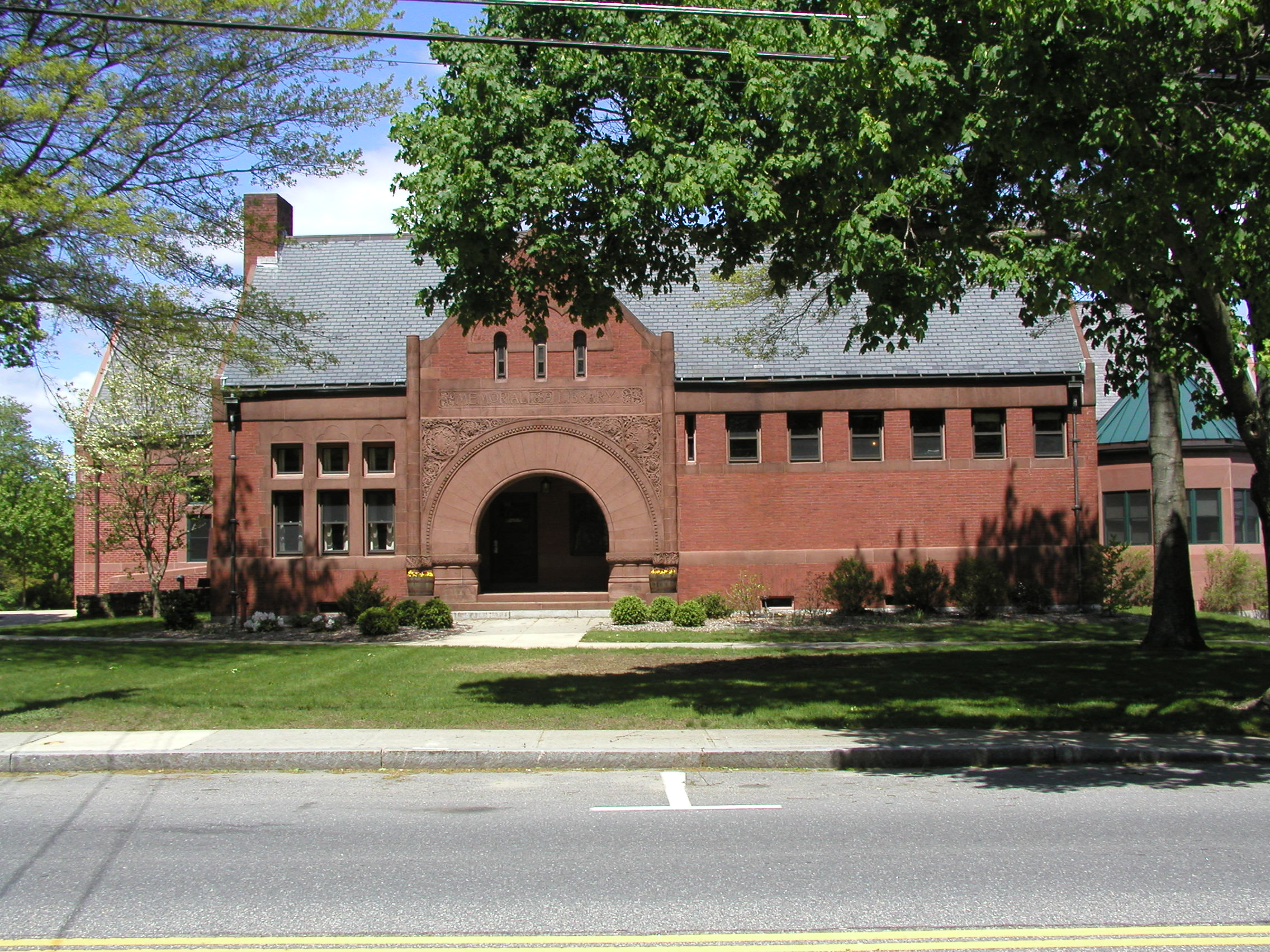
 Acton Memorial Library
Libraries
Acton has two public libraries: the Acton Memorial Library and the West Acton Citizens' Library (The Secret Library).
The Acton Memorial Library was given to the town of Acton by William Allan Wilde as a memorial to its Civil War veterans in 1890. The building was expanded in 1967, and a second major expansion was completed in 1999.
There are also libraries in each of the elementary schools, the Junior High, and the High School.
The Acton Historical Society owns the Jenks Library which contains historical maps, documents, photographs and drawings.
Museums
- The Discovery Museums are two separate science museums located on the same site. The Children's Discovery Museum has exhibits suitable for younger children, while the Science Discovery Museum focuses on older children. The location is well guarded by Bessie, the large dinosaur statue and museum mascot, located in the front grounds of the facility.
- Iron Work Farm: Settlement of South Acton; 'Iron Work Farm in Acton, Inc.' is a non-profit, historical corporation chartered in Massachusetts since 1964, that ooperates two historic houses: Jones Tavern and Faulkner House. Each house is open to the public on the last Sunday of the month from May to October. The facilities are also open as part of the local Patriots' Day holiday observance each April.
- Hosmer House: This Revolutionary War-era home, which is owned and maintained by the Acton Historical Society, is typically open to the public on Patriots' Day, September 27 ('Crown Resistance Day'), as well as May 27 and June 24, from 2 to 4 o'clock.
Theater
Acton has two local theater groups: Theater III and Open Door Theater. Theater III was founded in 1956. It produces several plays and/or musicals a year in the historically interesting old church building on Central Street. Open Door Theater is a community theater group which was founded to provide an inclusive theater experience. Open Door produces one large musical each year which features a large number of actors ranging in age from 9 to adult including people with special needs.
Points of interest
- Jones Tavern. [4] The main part of the tavern, originally home to the Jones family of South Acton, was built in 1732 as a house for Samuel Jones, Jr. By 1750 it had become a tavern and general store. It is speculated to be the first store in Acton and holds the distinction of being the town’s longest established business, merging into James Tuttle’s store in 1845 and operating under various names until 1950.
- The Faulkner House and Mills.[23] The house was built for Ephraim Jones (1679–1710), founder in 1702 of an early textile business and other mills that formed the nucleus of the present town of Acton. The largest and most central house of this settlement, it served as the local garrison house for protection from Indian raids made along the Massachusetts frontier during Queen Anne's War of 1702–1713. The Faulkner homestead served as a garrison for South Acton Militia during the Revolutionary War.
- Town Center: The civic center of town is marked by the Acton Monument which is the final resting place of Capt. Isaac Davis, James Hayward and Abner Hosmer. The stone on which Capt Davis mortally fell is situated between the west side of the monument and Rt 27. The Main entrance to the Town Hall, around the rear of the building, contains Isaac Davis's plow which was used by Daniel Chester French for the statue he cast for North Bridge.
- Bruce Freeman Rail Trail. [5]
Transportation

Acton is five miles (8 km) from I-495 and ten miles (16 km) from I-95/Route 128. Routes 2, 2A, 27, 62, 111, and 119 run through town.
The MBTA Commuter Rail Fitchburg Line train stops at the South Acton station. South Acton is a major station on the line at which many trains terminate. Besides the urban stops at Cambridge (Porter Square) and Boston (North Station Terminal), it is the only station on the line at which all trains stop. The MBTA Fitchburg Line provides service to Fitchburg, Leominster, Shirley, Ayer, Littleton, Concord, Lincoln, Weston, Waltham, Belmont, Cambridge, and Boston.
Yankee Lines provides a commuter bus service to Copley Square in Boston from the intersection of Route 2A and 119 in Acton.
In media
- Acton is the setting of the poem "The Vanishing Red," by New England poet Robert Frost (Mountain Interval, 1920).
- Acton is a setting in "The Cure" an episode of the TV series Fringe, however the actual filming was not done in Acton.
- Acton was nominated as the 16th Best Place To Live in the Country by Money Magazine in 2009.
- Acton features prominently in the TNT series Falling Skies about an alien invasion. The main character is a former Boston University professor who is now second-in-command of the Second Massachusetts, a group of fighter and civilians fleeing an overrun Boston. The group heads to Acton to set up a new base of operations and raid the Acton Armory.
- Acton was nominated as the 16th Best Place To Live in the Country by Money Magazine in 2011.
Notable residents
- Tom Barrasso, NHL professional hockey player, graduated from Acton-Boxborough Regional High School in 1983[citation needed]
- Bob Brooke, NHL professional hockey player[citation needed]
- James Brown, co-founder of Little, Brown and Company publisher[24]
- Steve Carell (b.1962), comedic actor, grew up in South Acton[citation needed]
- Howie Carr, talk-radio personality[citation needed]
- John Ruggles Cotting (1783–1867), clergyman, author, and noted geologist[24]
- Robert Creeley (1926–2005), poet, grew up in West Acton[citation needed]
- Isaac Davis (1745–1775), Captain of the Acton Minutemen at the Old North Bridge in Concord at the Battle of Lexington and Concord; the first officer to die in the American Revolution[citation needed]
- Dan Duquette, former general manager of the Boston Red Sox[citation needed]
- Henry Durant (1803–1875), Congregational clergyman, first president of College of California, two-term mayor of Oakland, California[24]
- Christian Finnegan, comedian, grew up in the Forest Glen neighborhood of West Acton in the 1980s[citation needed]
- Mary Josephine Hannon (1865–1964), maternal grandmother of President John F. Kennedy[citation needed]
- Jesse Lauriston Livermore (1877–1940), famous early 20th century stock trader[citation needed]
- Ian Moran, NHL professional hockey player[citation needed]
- Bill Morrissey (1951-2011), Folk music singer/songwriter, graduated ABRHS in 1969
- Jeff Norton (b.1965), NHL professional hockey player[citation needed]
- Caroll Spinney (b.1933), puppeteer who created the Sesame Street characters Big Bird and Oscar the Grouch[citation needed]
- Kate Whoriskey, artistic director of Intiman Theatre in Seattle, WA.[citation needed]
References
- ^ Stephen Vittorioso (Sep 28, 2009). "Acton-Boxborough Regional High named Blue Ribbon School". http://www.wickedlocal.com/acton/news/education/x593052417/Acton-Boxborough-Regional-High-named-Blue-Ribbon-school.
- ^ "TOTAL POPULATION (P1), 2010 Census Summary File 1, All County Subdivisions within Massachusetts". United States Census Bureau. http://factfinder2.census.gov/bkmk/table/1.0/en/DEC/10_SF1/P1/0400000US25.06000. Retrieved September 13, 2011.
- ^ "Massachusetts by Place and County Subdivision - GCT-T1. Population Estimates". United States Census Bureau. http://factfinder.census.gov/servlet/GCTTable?_bm=y&-geo_id=04000US25&-_box_head_nbr=GCT-T1&-ds_name=PEP_2009_EST&-_lang=en&-format=ST-9&-_sse=on. Retrieved July 12, 2011.
- ^ "1990 Census of Population, General Population Characteristics: Massachusetts". US Census Bureau. December 1990. Table 76: General Characteristics of Persons, Households, and Families: 1990. 1990 CP-1-23. http://www.census.gov/prod/cen1990/cp1/cp-1-23.pdf. Retrieved July 12, 2011.
- ^ "1980 Census of the Population, Number of Inhabitants: Massachusetts". US Census Bureau. December 1981. Table 4. Populations of County Subdivisions: 1960 to 1980. PC80-1-A23. http://www2.census.gov/prod2/decennial/documents/1980a_maABC-01.pdf. Retrieved July 12, 2011.
- ^ "1950 Census of Population". Bureau of the Census. 1952. Section 6, Pages 21-10 and 21-11, Massachusetts Table 6. Population of Counties by Minor Civil Divisions: 1930 to 1950. http://www2.census.gov/prod2/decennial/documents/23761117v1ch06.pdf. Retrieved July 12, 2011.
- ^ "1920 Census of Population". Bureau of the Census. Number of Inhabitants, by Counties and Minor Civil Divisions. Pages 21-5 through 21-7. Massachusetts Table 2. Population of Counties by Minor Civil Divisions: 1920, 1910, and 1920. http://www2.census.gov/prod2/decennial/documents/41084506no553ch2.pdf. Retrieved July 12, 2011.
- ^ "1890 Census of the Population". Department of the Interior, Census Office. Pages 179 through 182. Massachusetts Table 5. Population of States and Territories by Minor Civil Divisions: 1880 and 1890. http://www2.census.gov/prod2/decennial/documents/41084506no553ch2.pdf. Retrieved July 12, 2011.
- ^ "1870 Census of the Population". Department of the Interior, Census Office. 1872. Pages 217 through 220. Table IX. Population of Minor Civil Divisions, &c. Massachusetts. http://www2.census.gov/prod2/decennial/documents/1870e-05.pdf. Retrieved July 12, 2011.
- ^ "1860 Census". Department of the Interior, Census Office. 1864. Pages 220 through 226. State of Massachusetts Table No. 3. Populations of Cities, Towns, &c.. http://www2.census.gov/prod2/decennial/documents/1860a-08.pdf. Retrieved July 12, 2011.
- ^ "1850 Census". Department of the Interior, Census Office. 1854. Pages 338 through 393. Populations of Cities, Towns, &c.. http://www2.census.gov/prod2/decennial/documents/1850c-11.pdf. Retrieved July 12, 2011.
- ^ "American FactFinder". United States Census Bureau. http://factfinder.census.gov. Retrieved 2008-01-31.
- ^ http://factfinder.census.gov/servlet/ADPTable?_bm=y&-context=adp&-qr_name=ACS_2007_3YR_G00_DP3YR3&-ds_name=ACS_2007_3YR_G00_&-tree_id=3307&-redoLog=true&-_caller=geoselect&-geo_id=06000US2501700380&-format=&-_lang=en
- ^ "Acton Memorial Library Online Historical Collections". Actonmemoriallibrary.org. http://www.actonmemoriallibrary.org/histcoll.htm. Retrieved 2008-11-24.
- ^ "Early Acton History". Users.rcn.com. http://users.rcn.com/greenela/id62.htm#acton_s_crown_resistance_day_. Retrieved 2008-11-24.
- ^ Steve Crosby. "Acton Minutemen home page". Actonminutemen.org. http://www.actonminutemen.org/index.html. Retrieved 2008-11-24.
- ^ Acton Historical Society: "A Brief History of Acton", page 33. Beacon Publishing Company, 1974.
- ^ a b "Acton Citizens for Environmental Safety". Actonaces.org. http://www.actonaces.org/. Retrieved 2008-11-24.
- ^ Frieden, Thomas. "W. R. GRACE SUPERFUND SITE ACTON, MIDDLESEX COUNTY, MASSACHUSETTS CERCLIS NO: MAD001002252 APRIL 5, 2011". http://www.acton-ma.gov/DocumentView.aspx?DID=1027. Retrieved 13 July 2011.
- ^ a b "Waste Site Cleanup & Reuse in New England". http://yosemite.epa.gov/r1/npl_pad.nsf/8b160ae5c647980585256bba0066f907/7b6349f1a22ffdf3852569e5006ca840!OpenDocument. Retrieved 13 July 2011.
- ^ Golden, Derrick. "W.R. Grace Community Update". http://www.actonwater.com/Web%20Ready/WR%20Grace%20Community%20Update.pdf. Retrieved 13 July 2011.
- ^ [1][dead link]
- ^ "Jones Tavern". Ironworkfarm.org. http://www.ironworkfarm.org/jonestavern.htm. Retrieved 2008-11-24.[dead link]
- ^ a b c Who Was Who in America, Historical Volume, 1607–1896. Chicago: Marquis Who's Who. 1963.
Bibliography
- Acton Historical Society (1974). A Brief History of Acton. Beacon Publishing Company.
- Acton Historical Society (1985). Acton: A Second Look.
- L. McElroy, P. Shanahan, A. Sheehan, A. Shubert (2001). A Guide to Acton Conservation Lands. Acton Conservation Commission.
- League of Women Voters (2000). Acton: Know Your Town. League of Women Voters.
- William A. Klauer (2001). Images of America: Acton. Arcadia Publishing. ISBN 2-00-109304-7.
- Town of Acton "State of the Town" Meeting. 2005.
External links
- Official Town Website
- Acton Public Schools and Acton-Boxborough Regional School District
- Community Profile
- Acton Water District Website
- Acton Memorial Library
- The Discovery Museums
- The Beacon newspaper
- Theatre III
- Open Door Theater
- Massachusetts 351 Project: Acton
- Early Acton History
- Nashoba Valley Chorale: An SATB chorus that rehearses in Littleton and performs in neighboring communities, from Acton to Pepperell
Municipalities and communities of Middlesex County, Massachusetts Cities 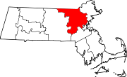
Towns Acton | Arlington | Ashby | Ashland | Ayer | Bedford | Belmont | Billerica | Boxborough | Burlington | Carlisle | Chelmsford | Concord | Dracut | Dunstable | Framingham | Groton | Holliston | Hopkinton | Hudson | Lexington | Lincoln | Littleton | Maynard | Natick | North Reading | Pepperell | Reading | Sherborn | Shirley | Stoneham | Stow | Sudbury | Tewksbury | Townsend | Tyngsborough | Wakefield | Wayland | Westford | Weston | Wilmington | Winchester
CDPs Ayer | Cochituate | Fort Devens | East Pepperell | Groton | Hopkinton | Hudson | Littleton Common | Pepperell | Pinehurst | Shirley | Townsend | West Concord
Other
villagesAuburndale | Chestnut Hill | Gleasondale | Nabnasset | Newton Centre | Newton Highlands | Newton Lower Falls | Newton Upper Falls | Newtonville | Nonantum | North Billerica | North Chelmsford | Waban | West Newton
Categories:- Towns in Middlesex County, Massachusetts


Wikimedia Foundation. 2010.