- Wilmington, Massachusetts
Infobox Settlement
official_name = Wilmington, Massachusetts
nickname =
motto =
imagesize =
image_caption =
image_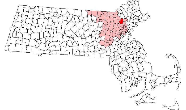
mapsize = 250px
map_caption = Location in Middlesex County in Massachusetts
mapsize1 =
map_caption1 =
subdivision_type = Country
subdivision_name =United States
subdivision_type1 = State
subdivision_name1 =Massachusetts
subdivision_type2 = County
subdivision_name2 = Middlesex
established_title = Settled
established_date = 1665
established_title2 = Incorporated
established_date2 = 1730
established_title3 =
established_date3 =
government_type =Open town meeting
leader_title = Town
Manager
leader_name = Michael Caira
leader_title1 =
leader_name1 =
area_magnitude =
area_total_km2 = 44.6
area_total_sq_mi = 17.2
area_land_km2 = 44.4
area_land_sq_mi = 17.1
area_water_km2 = 0.2
area_water_sq_mi = 0.1
population_as_of = 2007
settlement_type = Town
population_total = 21,679
population_density_km2 = 488.3
population_density_sq_mi = 1,267.8
elevation_m = 29
elevation_ft = 96
timezone = Eastern
utc_offset = -5
timezone_DST = Eastern
utc_offset_DST = -4
latd = 42 |latm = 32 |lats = 47 |latNS = N
longd = 71 |longm = 10 |longs = 27 |longEW = W
website = [http://www.town.wilmington.ma.us/ www.town.wilmington.ma.us]
postal_code_type = ZIP code
postal_code = 01887
area_code = 978
blank_name = FIPS code
blank_info = 25-80230
blank1_name = GNIS feature ID
blank1_info = 0618246
footnotes = "For other towns and places named Wilmington, seeWilmington ."Wilmington is a town in Middlesex County,
Massachusetts ,United States . The population was 21,363 at the 2000 census.History
Wilmington was first settled in
1665 and was officially incorporated in1730 , from parts of Woburn, Reading and Billerica. Minutemen from Wilmington responded to the alarm on April 19, 1775 and fought at Merriam's Corner in Concord. Wilmington men also fought at Bunker Hill.The
Middlesex Canal passed through Wilmington. Chartered in 1792, opened in 1803, it provided freight and passenger transport between theMerrimack River and Boston. One important cargo on the canal was hops. From the middle of the 18th century untl the early 19th century, Massachusetts was the acknowledged leader in hop production in North America. Middlesex County in particular was famous for its hop yards, and Wilmington was the first place where the culture grew to a fever pitch. [Tomlan, Michael, "Tinged with Gold: Hop Culture in the U.S." Univ. of Georgia, 1992.]When Lowell was built in the 1820s, the canal became a primary means of transporting cotton to and from the mills. It was abandoned in 1852 after the construction of the
Boston and Lowell Railroad .The Boston and Lowell Railroad was built in 1835. The line is now the oldest operating rail line in the U.S. Wilmington is also served by the Haverhill Division (the old B&M Portland Division). A spur track known as the Wildcat connects the Haverhill and Lowell divisions.
Wilmington is where the
Baldwin apple was discovered.Wilmington is also home to the Col. Joshua Harnden Tavern, which probably served as a stop on the
underground railroad and now houses the Wilmington TownMuseum .Wilmington is considered a
cancer cluster [http://www.mass.gov/dph/beha/cau/reports/wilmington/wilmington.htm] [http://www.mass.gov/dph/beha/cau/reports/wilmington/evaluation87to95.pdf] [http://www.uml.edu/umlmainpage/umlnews/pdf/ChildhoodCancerinMassachusettsv135.7.03.pdf ] ,possibly due to industrial chemical contamination. Themovie andbook "A Civil Action " discusses circumstances similar to those found in Wilmington, although the events of both the book and the movie focus primarily on nearby Woburn.Since the completion of Route 128, Wilmington's population has quadrupled. Route 93, Route 62 and Route 38 also help to make Wilmington an easy place to commute to
Boston .Geography
Wilmington is located at coor dms|42|33|30|N|71|10|13|W|city (42.559576, -71.170317).GR|1
According to the
United States Census Bureau , the CDP has a total area of 17.2square mile s (44.6km² ), of which, 17.1 square miles (44.4 km²) of it is land and 0.1 square miles (0.2 km²) of it (0.46%) is water.Wilmington borders the following towns: Andover, North Reading, Reading, Woburn, Burlington, Billerica, and Tewksbury.
Much of Wilmington was built on or still is
wetlands . TheIpswich River starts in Wilmington.There is one lake in the town, Silver Lake, a
kettle lake formed in the retreat of thePleistocene glaciers at the end of the lastice age . [Crosby, Irving B., 1928, Boston through the Ages: The Geological Story of GreaterBoston, Marshall Jones Company, Boston, MA] It is open for swimming during thesummer .Demographics
The Census Bureau has defined Wilmington as a
census-designated place that is equivalent to the town. As of thecensus GR|2 of 2000, there were 21,363 people, 7,027 households, and 5,776 families residing in the town. Thepopulation density was 1,247.0 people per square mile (481.5/km²). There were 7,158 housing units at an average density of 417.8/sq mi (161.3/km²). The racial makeup of the town was 96.31% White, 0.41% Black or African American, 0.08% Native American, 2.03% Asian, 0.42% from other races, and 0.74% from two or more races. Hispanic or Latino of any race were 0.95% of the population.There were 7,027 households out of which 41.5% had children under the age of 18 living with them, 69.6% were married couples living together, 9.8% had a female householder with no husband present, and 17.8% were non-families. 14.0% of all households were made up of individuals and 5.9% had someone living alone who was 65 years of age or older. The average household size was 3.00 and the average family size was 3.33.
In the town the population was spread out with 27.6% under the age of 18, 5.9% from 18 to 24, 33.5% from 25 to 44, 22.2% from 45 to 64, and 10.8% who were 65 years of age or older. The median age was 36 years. For every 100 females there were 98.1 males. For every 100 females age 18 and over, there were 94.1 males.
The median income for a household in the town was $70,652, and the median income for a family was $76,760. Males had a median income of $50,446 versus $36,729 for females. The
per capita income for the town was $25,835. About 1.8% of families and 1.9% of the population were below thepoverty line , including 1.7% of those under age 18 and 2.7% of those age 65 or over. It is the 181st richest place in Massachusetts. SeeMassachusetts locations by per capita income .Education
Wilmington has its own
schools .Kindergarten students attend the Wildwood Street and Boutwell Street Schools. Grades 1-3 attend the Woburn Street School and the Shawsheen School. Grades 4 and 5 attend the North Intermediate School and the West Intermediate School. Grades 6-8 attend WilmingtonMiddle School . High School Students attend Wilmington High School. Wilmington High's mascot is the wildcat and its athletic teams participate in theCape Ann League or CAL. The Wildcats' colors are Navy Blue, Columbia Blue and White and the primary rivals are the Tewksbury Redmen of the Merrimack Valley Conference. The rivalry reaches its highest point everyThanksgiving when the two towns square off in a football game. In the 2007 season, Wilmington lost to Tewksbury for the first time since 2002 and still trails in the overall series history that started with two games in 1935. The series has never been disrupted although they did not play on Thanksgiving in 1935 or from 1941 to 1956. In those years, their game was played on November 11th. Wilmington is also home to Abundant Life Christian School a Pre-K to 8 private religious school.Government
Wilmington has an open
town meeting , aboard of selectmen and atown manager . The current town manager is Michael Caira. Five of the town's six districts are represented in theMassachusetts House of Representatives byJames R. Miceli , the last is represented byCharles A. Murphy . The town's state senator isBruce Tarr . Wilmington is in the Massachusetts 6th Congressional District and is represented in theUnited States House of Representatives byJohn F. Tierney .Points of Interest
*The Wilmington Town Common and Rotary Park are in the center of town and there are multiple parks and public recreation facilities throughout town which have walking paths, soccer fields, baseball diamonds, and other athletic facilities.
*
Aleppo Shrine Auditorium : a 2,650-seat indoor arena, home of the Boston Derby Dames women's flat track roller derby league* Ristuccia Ice Arena : the practice rink of the
Boston Bruins * Silver Lake : Open for swimming in the summer, ice-skating in winter, and fishing year-round. There is also a playground open all seasons.
* [http://www.camp40acres.org/ Camp 40 Acres] : camping and recreation facility owned by Wilmington Junior Camps, Inc.Transportation
MBTA Commuter Rail provides service from Boston'sNorth Station with the Wilmington station on itsLowell Line and the North Wilmington station on itsHaverhill/Reading Line .Notable residents
*
Loammi Baldwin , Revolutionary WarColonel , notedCivil Engineer and the man who popularized the Baldwin Apple. Baldwin lived in nearby Woburn, never in Wilmington.
*John Ball , developer of the Baldwin Apple.
*Jason Bere , formerMLB pitcher andAmerican League All-Star in 1994.
*Yuan Cheng ,Physicist .
*Mike Esposito, running back and kick returner for theAtlanta Falcons in the late 1970s. He also set a number of rushing records atBoston College .
*Benjamin Harnden , member of Minutemen, grandfather of Gen. Henry Harnden.
*Henry Harnden , Civil War Officer, present at the capture ofJefferson Davis . He was the first to confirm Davis's identity, and is credited with his capture.
*John Harnden , capt. of Minutemen company at Bunker Hill.
*Joseph Harnden , died in lines at Cambridge, Dec. 24, 1775 inAmerican Revolution .
*Joshua Harnden , namesake of the Harnden Tavern, great-uncle of Henry Harnden.
*Thomas Holmes, Executive withW.R. Grace andIngersoll Rand .
*Ezra Otis Kendall , LL.D., 1818-1899 prof. of mathematics and astronomy atUniv. of Pennsylvania . Author ofUranography , a guide to the heavens, with atlas, Philadelphia, 1844. Half-brother to Timothy Walker and Sears Cook Walker.
*Benjamin Thompson , Jr., Count Rumford, taught school in Wilmington 1768-1769. [Rev. Samuel Sewall's 1868 biography of Thompson [http://www.homeofourfathers.com/lisbeth/benjaminthompsonjrlifestory.htm] ]
*Asa Sheldon , 19th Cent. contractor, builder of railroads & bridges, author of autobiography "Wilmington Farmer", reprinted in paperback as "Yankee Drover". [Sheldon, Asa, forward by John Seelye, "Yankee Drover, Being the Unpretending Life of Asa Sheldon, Farmer, Trader, and Working Man 1788-1870", originally published as "Life of Asa G. Sheldon: Wilmington Farmer, in Two Arrangements", 1862, E. T. Moody, Woburn, Mass., new edition 1988, University Press of New England, Hanover, NH.]
*Sears Cook Walker , [19th Century] astronomer, brother of Timothy Walker, half-brother of E.O. Kendall.
*Timothy Walker, noted 19thcentury jurist , author of Introduction to American Law, founder of Cincinnati Law School.
*Phillis Wheatley , first publishedAfrican-American poet .
*Ryland Blackinton , guitarist ofCobra Starship , graduated from Wilmington High School.References
External links
* [http://www.town.wilmington.ma.us/ Wilmington official website]
* [http://www.wilmingtonpoliceunion.com/ Wilmington Police Patrolman's Union]
* [http://www.wilmingtonwalks.org/ Wilmington Walks] , organization to promote walking in town
Wikimedia Foundation. 2010.