- Andover, Massachusetts
Infobox Settlement
official_name = Andover, Massachusetts
nickname =
motto =
imagesize =
image_caption =
image_
mapsize = 250px
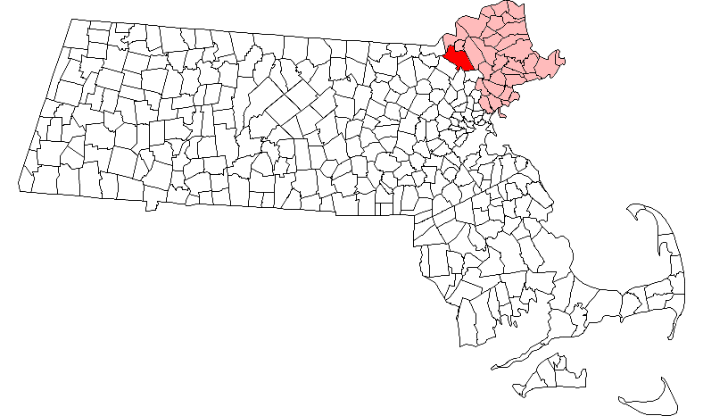
map_caption = Location in Essex County in Massachusetts
mapsize1 =
map_caption1 =
subdivision_type = Country
subdivision_name =United States
subdivision_type1 = State
subdivision_name1 =Massachusetts
subdivision_type2 = County
subdivision_name2 = Essex
established_title = Settled
established_date = 1642
established_title2 = Incorporated
established_date2 = 1646
established_title3 =
established_date3 =
government_type =Open town meeting
leader_title =Town Manager
leader_name = Reginald "Buzz" Stapczynski
leader_title1 = Board of
Selectmen
leader_name1 = Ted Teichert (2009)
Mary Lyman (2011)
Alexander Vispoli (2010)
Jerry Stabile (2010)
Brian Major (2009)
area_magnitude =
area_total_km2 = 83.2
area_total_sq_mi = 32.1
area_land_km2 = 80.3
area_land_sq_mi = 31.0
area_water_km2 = 2.9
area_water_sq_mi = 1.1
population_as_of = 2000
settlement_type = Town
population_total = 31247
population_density_km2 = 389.1
population_density_sq_mi = 1007.8
elevation_m = 55
elevation_ft = 180
timezone = Eastern
utc_offset = -5
timezone_DST = Eastern
utc_offset_DST = -4
latd = 42 |latm = 39 |lats = 30 |latNS = N
longd = 71 |longm = 08 |longs = 15 |longEW = W
website = [http://www.andoverma.gov/ www.andoverma.gov]
postal_code_type = ZIP code
postal_code = 01810
area_code = 351 / 978
blank_name = FIPS code
blank_info = 25-01465
blank1_name = GNIS feature ID
blank1_info = 0619444
footnotes =Andover is a town in Essex County,
Massachusetts ,United States . It was incorporated in 1646 and as of the 2000 census population was 31,247. It is part of the Boston-Cambridge-Quincy,Massachusetts -New Hampshire metropolitan statistical area .Part of the town comprises the
census-designated place of Andover.History
Establishment and incorporation
In 1634, the Great and General Court of Massachusetts set aside a portion of land in what is now Essex County for an inland plantation, including parts of what is now Andover, North Andover and South Lawrence. In order to encourage settlement, early colonists were offered three years' immunity from taxes, levies and services (except military service). The first permanent settlement in the Andover area was established in 1641 by
John Woodbridge and a group of settlers from Newbury and Ipswich.Shortly after they arrived, they purchased a piece of land from the local
Pennacook tribal chief Cutshamache for the price of "six pounds of currency and a coat" and on the condition that Roger, a local Pennacook man, would still be allowed to plant his corn and take alewives from a local water source. Roger's Brook, a small stream which cuts through the eastern part of town, is named in his honor. In May 1646 the settlement was incorporated as a town and was named Andover. This name was likely chosen in honor of the town of Andover in England, which was near the original home of some of the first residents. The first recorded town meeting was held in 1656 in the home of settler John Osgood.The old burying ground in what is now North Andover marks the center of the early town. Contrary to popular belief, the towns split due to the location of the Old North Church, also located in what is now North Andover. So technically, what is now Andover was not incorporated as a township until many years after 1646. The villagers from the southwestern part of the town were tired of walking all the way to the extreme north of what was then Andover, and decided to build their own church central to what is now Andover. Logically you would think the northern part of the town would keep the name Andover, due to their higher stake of villagers, but fights and quibbles throughout the church and town meetings ultimately led to the elder part of town being known as what is now North Andover. Early on the general populous was concentrated together around the Old Center (North Andover) for protection from feared Indian attacks, but the Indians were fairly peaceful until the outbreak of
King Philip's War in 1675. King Philip was an Indian who organized a revolt against the white settlers throughout most of New England. Six Indian raids occurred between 1676 and 1698 until ever-increasing numbers of white settlers established control of the land. Fact|date=March 2007Witchcraft
During the Salem witch trials in 1692, Andover resident Joseph Ballard asked for help for his wife from several girls in the neighboring
Salem Village who were already identifying witches there. After visiting Elizabeth Ballard, the girls claimed that several people in Andover had bewitched her: Ann Foster, her daughter Mary Lacey Sr. and her granddaughter Mary Lacey Jr. During the course of the legal proceedings, more than 40 Andover citizens, mostly women and their children, were formally accused of having made a covenant with theDevil . Three Andover residents,Martha Carrier ,Mary Parker , and Samuel Wardwell, were convicted and executed. Five others either pled guilty at arraignment or were convicted at trial:Ann Foster , Mary Lacey Sr., and Abigail Faulkner Sr. (daughter of Andover's minister,Francis Dane ) in 1692 and Wardwell's wife Sarah and Rev. Dane's granddaughter, Elizabeth Johnson Jr. in 1693. Those who were not executed were granted reprieves by Gov.William Phips , but the convictions remained on their records. In 1713, in response to petitions initiated in 1703 by Abigail Faulkner Sr. and Sarah Wardwell, Massachusetts GovernorThomas Dudley reversed the attainder on the names of those who were convicted in the episode.The two parishes and the division of the town
By 1705, Andover's population had begun to move southward and the idea of a new meeting house in the south end of town was proposed. This was strongly opposed by the people living near the original meeting house in the north, but the dispute was finally settled in 1709 when the Great and General Court divided Andover into two parishes, North and South. After the division of the two parishes, South Andover established the South Parish "Burying-Yard," as it was called, with early Andover settler Robert Russell the first to be interred at age 80 in December, 1710. [ [http://books.google.com/books?id=xf7UNTRnW4gC&pg=PA119&lpg=PA119&dq=%22robert+russell%22+scotland+andover&source=web&ots=gt_aPRzH_m&sig=3k_GwKcWtNG54MniSzWg9u6ugFo&hl=en#PPA512,M1 Historical Sketches of Andover, Sarah Loring Bailey, 1880] ] But despite this split, the town remained politically one unit.
For many years Andover was geographically one of the largest towns in the Commonwealth of Massachusetts; in 1826 a third parish was established and West Parish Church was constructed on Reservation Road. In 1854, a measure was passed to divide the town into two separate political units according to the old parish boundaries. The name Andover was assumed by the more populous and wealthy West and South parishes, while the name North Andover was given to the North Parish.
Andover in the Revolutionary War
Records show that on the morning of April 19, 1775, approximately 350 Andover men marched toward Lexington. Although they did not arrive in time for the battle that day, they did go on to participate in the battle of Bunker Hill two months later and fought in subsequent skirmishes with the Redcoats during the war.
Among the Andover men who were representatives to the Massachusetts Constitutional Convention were Col.
Samuel Osgood , Zebadiah Abbot, John Farnum and Samuel Phillips, Jr. Phillips - who would later go on to foundPhillips Academy - was later appointed byJohn Adams to help draft the Massachusetts state constitution.Death of President-elect Franklin Pierce's son
On January 6, 1853, Benjamin "Bennie" Pierce, (1841–1853) the 11- or 12-year-old son of President-elect
Franklin Pierce , was killed in a train accident in town. TheBoston & Maine noon express, traveling from Boston to Lawrence, was moving at 40 miles per hour when an axle broke. The only coach, in which Franklin Pierce was also riding, went down an embankment and broke in two. (The baggage car and locomotive had remained on the track.) Pierce's son was the only one killed, but it was initially reported that Pierce was also a fatality. He was only badly bruised. Jane Pierce, the child's mother, was also on the train. The Pierces had previously lost two other children. The death is said to have cast a pall on the couple, especially Jane, who entertained hardly at all in the White House and spent much of her time writing letters to her dead children. She died, still grief-stricken, in 1863. [cite web
title = Jane Means Appleton Pierce
publisher = History Central.com
date =
url = http://www.historycentral.com/Bio/ladies/pierce.html
accessdate = 2006-09-24 ]Civil War
The anti-slavery movement had many supporters in Andover long before the
American Civil War began. William Jenkins - an ardent abolitionist and friend ofWilliam Lloyd Garrison - and several others provided stops on the Underground Railway for runaway slaves. It should be noted thatHarriet Beecher Stowe , author ofUncle Tom's Cabin , was a long time resident. Her home, known as "Stowe House," is now owned byPhillips Academy Andover. Her body is buried in Phillips Academy's cemetery. When the Confederate Army shelledFort Sumter in 1861, a company of 79 volunteers formed. By the time the war ended in 1865, 600 Andover men had served in the Union Army.hawsheen Village
In 1919, the
American Woolen Company announced plans to build a million dollar mill in the already-existing mill community of Frye Village and rename the region "Shawsheen." The village was completely rebuilt as a "model industrial community" and became the site of the company's headquarters. The mill began operating in 1922 and within two years the village contained more than 200 houses, several community buildings, a few tennis courts, a swimming area, abowling green , an athletic field and a golf course. The employees rented their homes from the company; the brick structures were reserved for upper management and the wooden buildings for those of lesser position. This industrialutopia , however, was short-lived - by the early 1940s almost all of the houses and administration buildings were in private hands. The mills became a victim of changing technology as synthetic fibers became more popular than wool. The American Woolen Company closed its mills in 1953, and the buildings today house a variety of businesses, homes, and apartments. The village left its mark nationally, however, when itssoccer team, theShawsheen Indians won the national soccer championship in 1925.Geography
According to the
United States Census Bureau , the town has a total area of 32.1square mile s (83.2km² ), of which, 31.0 square miles (80.3 km²) of it is land and 1.1 square miles (2.9 km²) of it (3.49%) is water. Significant water areas include the Shawsheen River and Haggetts Pond, located in west Andover, which serves as the town's reservoir.Haggetts Pond was originally set apart from other waters, but since the late 1990s has had waters added from the nearbyMerrimack River to supplement the growing needs of the town.Andover borders the following cities and towns: Lawrence, North Andover, North Reading, Wilmington, Tewksbury, Dracut and Methuen. Methuen and Dracut are opposite the Merrimack River from Andover, and are not accessible directly from Andover except by
Interstate 93 , which connects Andover with Methuen. Dracut is unreachable across the Merrimack.Demographics
Infobox Mass Town Govt
align = right
wraparound = yes
county= Essex
clerk_courts = Thomas H. Driscoll, Jr. (D)
cty_treasurer = Position Eliminated
da = Jonathan W. Blodgett (D)
deeds = Robert F. Kelley (D)
probate =
sheriff = Frank G. Cousins, Jr. (R)
state_rep = Barry R. Finegold (D)
Barbara A. L'Italien (D)
state_sen = Susan C. Tucker (D)
gov_councilors = Mary-Ellen Manning (D)
fed_rep =Niki Tsongas (D-5th District),
fed_sen =Edward Kennedy (D)
John Kerry (D)As of thecensus of 2000, there were 31,247 people, 11,305 households, and 8,490 families residing in the town. Thepopulation density was 1,007.8 people per square mile (389.1/km²). There were 11,590 housing units at an average density of 144.3 persons/km² (373.8 persons/sq mi). The racial makeup of the town was 91.60% White, 0.75%African American , 0.06% Native American, 5.73%Asia n, 0.04% Pacific Islander, 0.84% from other races, and 0.99% from two or more races. 1.81% of the population wereHispanic orLatino of any race.There are 11,305
household s out of which 40.3% have children under the age of 18 living with them, 65.6% were married couples living together, 7.5% have a woman whose husband does not live with her, and 24.9% were non-families. 21.6% of all households were made up of individuals and 9.2% had someone living alone who was 65 years of age or older. The average household size was 2.74 and the average family size was 3.24.In the town the population was spread out with 28.8% under the age of 18, 4.7% from 18 to 24, 27.5% from 25 to 44, 26.8% from 45 to 64, and 12.3% who were 65 years of age or older. The median age was 40 years. For every 100 females there were 92.9 males. For every 100 females age 18 and over, there were 87.9 males.
The median income for a household in the town was $87,683, and the median income for a family was $104,820. Males had a median income of $78,291 versus $44,292 for females. The
per capita income for the town was $41,133. 3.9% of the population and 2.5% of families were below the poverty line. Out of the total people living inpoverty , 3.7% are under the age of 18 and 6.8% are 65 or older.Education
Public schools
Andover has a public school system.
*Elementary schools (K-5)- Shawsheen, Bancroft, West Elementary, South, Sanborn, High Plain
*Middle Schools (6-8)- Doherty, West Middle, Wood Hill
*High Schools (9-12)- Andover High SchoolPrivate schools
*Saint Augustine's, Catholic, serves grades K-8
*The Pike School , serves grades Pre-K-9
*Phillips Academy , serves grades 9-12 (Post-Grad)
* Montessori School
*Greater Lawrence Technical School , serves grades 9-12Higher Education
*
Massachusetts School of Law Transportation
Andover is an important location for businesses due to its proximity to several major roads in Massachusetts, including I-93, I-95, and I-495. Andover is also on the [http://www.mbta.com/schedules_and_maps/rail/lines/?route=HAVRHILL Haverhill-Boston Commuter Rail Line.] Also by going to Woburn or Haverhill on the Commuter Line you can connect to the Amtrak Train to
Portsmouth, New Hampshire andPortland, Maine . For local bus transportation, Andover is served by theMerrimack Valley Regional Transit Authority .Points of interest
*
Phillips Academy , a prep school founded in 1778 with many famous alumni [http://www.andover.edu/about_andover/notable_alums.htm]
*Andover is home to a large IRS service center, accepting tax forms from several neighboring states.
*Andover is the site of a large factory owned byRaytheon , the builder of thePatriot Missile which warranted a visit from then-PresidentGeorge H. W. Bush (himself an alumnus of Phillips Academy).
*Andover is home to the second oldest land preservation society in the country, theAndover Village Improvement Society (AVIS), which controls over 1,100 acres.Notable residents
*
Abiel Abbot , (1770-1828), Massachusetts clergyman and authorcite book | title = Who Was Who in America, Historical Volume, | publisher = Marquis Who's Who | location = Chicago | date = 1963]
*Benjamin Abbot , teacher at thePhillips Exeter Academy .
*Amos Abbott ,United States Congressman from Massachusetts
* John Adams, teacher at the Phillips Exeter Academy from 1810 through 1832.
*Apollo Sunshine , band, members from Andover
*Harriette Newell Woods Baker , author of over 200 short stories
* Laura Bernieri, Screenwriter, Film Producer
*Anne Bradstreet , 17th-century Poet
* Charlotte Emerson Brown, founder of Rockford Conservancy of Music, president ofGeneral Federation of Women's Clubs , greatly increased club's membership
*Michael Casey , poet
*Michael Chiklis , actor, "The Shield "
* Andrew Coburn, author, Edgar Allan Poe Award nominee, [http://www.mhl.org/andover/authors.htm#ANDREW_] [http://www.fantasticfiction.co.uk/c/andrew-coburn/]
* Kathleen Dalton, author, "Theodore Roosevelt: A Strenuous Live"
* Linda Sones Fineburg, author [http://www.mhl.org/andover/authors.htm#ANDREW_]
*Barry Finegold , member of the Mass. House of Representatives (served 1996 - present)
*Abiel Foster ,clergyman andUnited States Congressman fromNew Hampshire .
*Joseph Frye ,brigadier general in theContinental Army who advocated separation ofMaine from Massachusetts.Fryeburg, Maine , is named in his honor.
* Martin Johnson,lead singer andguitarist for bandBoys Like Girls
*Howard Koh , Harvard University Professor and former Massachusetts Commissioner of Public Health (1997-2003)
* Brian Kelley, CEO and founder ofNew Life Network
* Susan Kelly, author, Anthony Award nominee [http://www.mhl.org/andover/authors.htm#ANDREW_] [http://susankellyonwriting.blogspot.com/]
*Jay Leno , entertainer, "The Tonight Show "
*Jim Loscutoff , formerBoston Celtics player
*Joshua Miner , founder ofOutward Bound USA
*Paul Monette , author, National Book Award winner for non-fiction [http://www.mhl.org/andover/authors.htm#ANDREW_]
*Mary McGarry Morris ,National Book Award andPEN/Faulkner finalist and best-selling author of "Songs in Ordinary Time ," "Vanished," "A Dangerous Woman," "Fiona Range," "A Hole In the Universe," and "The Lost Mother [http://www.mhl.org/andover/authors.htm#ANDREW_] [http://www.marymcgarrymorris.com]
* Samuel Phillips Newman, clergyman, educator, author, professor and later president ofBowdoin College .
* Susan O'Neill, author "Don't Mean Nothing: Short Stories of Vietnam" [http://www.susanoneill.us/]
*Samuel Osgood ,United States Postmaster General under PresidentGeorge Washington .
*Randall Pfeffer , author
* Piebald, band
*Salem Poor , freed slave who fought at the Battle of Bunker Hill and has had a postage stamp issued in his honor [http://library.thinkquest.org/2667/Poor.htm]
*Jenny Powers , actress on Broadway
*Blanchard Ryan , actress, "Open Water (film) "
* Jeanne Schinto, author, [http://www.mhl.org/andover/authors.htm#ANDREW_]
*Elizabeth Stuart Phelps , nineteenth-century author
*Samuel Francis Smith , the author of the national hymn “America,” written while he was a student atAndover Theological Seminary .
*Harriet Beecher Stowe , lived in Andover while husband taught at Andover Theological Seminary, is buried in Andover [http://www.findagrave.com/cgi-bin/fg.cgi?page=gr&GRid=992]
*George L. Street, III , winner of Medal of Honor for actions in World War 2 [cite web
title = Commander George Levick Street III
work =World War II Congressional Medal of Honor Recipient
publisher =medalofhonor.com
date =
url =http://www.medalofhonor.com/GeorgeStreet.htm
accessdate = ]
*Frederic A. Stott , winner of Navy Cross, followed and observed the Iditarod, Author of "On and Off the Trail: Seventy Years with the Appalachian Mountain Club" [cite web
title = Stott, Frederick A.
work =Full Text Citations For Award of The Navy Cross To U.S. Marines, World War II
publisher = Home of Heroes
date =
url =http://www.homeofheroes.com/valor/1_Citations/03_wwii-nc/nc_06wwii_usmcR.html
accessdate = ]
* Deborah Warren, poet, winner of Robert Frost AwardSee also:
List of notable Phillips Academy alumni ee also
*Ballardvale
*List of towns in Massachusetts References
ources
*Bailey, Sarah Loring. [http://www.usigs.org/library/books/ma/Andover1880/index.html Historical Sketches of the Town of Andover.] Published 1894.
*Farnum, John, Moses Abbott. [http://www.salemdeeds.com/atlases_pages.asp?ImageName=ANDOVER.jpg&atlastype=Atlases&atlastown=ESSEX+COUNTY&atlas=ESSEX+COUNTY+1795&atlas_desc=ESSEX+COUNTY+1795&pageprefix= 1795 Map of Andover.]
*Dorman, Moses. [http://www.salemdeeds.com/atlases_pages.asp?ImageName=ANDOVER.jpg&atlastype=Atlases&atlastown=ESSEX+COUNTY&atlas=ESSEX+COUNTY+1830&atlas_desc=ESSEX+COUNTY+1830&pageprefix= 1830 Map of Andover.]
*Beers, D.G. 1872 Atlas of Essex County [http://www.salemdeeds.com/atlases_pages.asp?ImageName=PLATE_0051.jpg&atlastype=Atlases&atlastown=ESSEX+COUNTY&atlas=ESSEX+COUNTY+1872&atlas_desc=ESSEX+COUNTY+1872&pageprefix= 1872 Map of Andover. Plate 51.] [http://www.salemdeeds.com/atlases_pages.asp?ImageName=PLATE_0053.jpg&atlastype=Atlases&atlastown=ESSEX+COUNTY&atlas=ESSEX+COUNTY+1872&atlas_desc=ESSEX+COUNTY+1872&pageprefix= Andover Center. Plate 53.] [http://www.salemdeeds.com/atlases_pages.asp?ImageName=PLATE_0053.jpg&atlastype=Atlases&atlastown=ESSEX+COUNTY&atlas=ESSEX+COUNTY+1872&atlas_desc=ESSEX+COUNTY+1872&pageprefix= North Andover and Sutton Mills. Plate 53.] [http://www.salemdeeds.com/atlases_pages.asp?ImageName=PLATE_0048.jpg&atlastype=Atlases&atlastown=ESSEX+COUNTY&atlas=ESSEX+COUNTY+1872&atlas_desc=ESSEX+COUNTY+1872&pageprefix= Lawrence South Side. Plate 48.]
*Walker, George H. 1884 Atlas of Essex County, Massachusetts [http://www.salemdeeds.com/atlases_pages.asp?ImageName=PAGE_0110_0111.jpg&atlastype=Atlases&atlastown=ESSEX+COUNTY&atlas=ESSEX+COUNTY+1884&atlas_desc=ESSEX+COUNTY+1884&pageprefix=1884 Map of Andover. Plate 110-111.] [http://www.salemdeeds.com/atlases_pages.asp?ImageName=PAGE_0112.jpg&atlastype=Atlases&atlastown=ESSEX+COUNTY&atlas=ESSEX+COUNTY+1884&atlas_desc=ESSEX+COUNTY+1884&pageprefix= Frye Village and Ballardville, Andover. Plate 112.] [http://www.salemdeeds.com/atlases_pages.asp?ImageName=PAGE_0107.jpg&atlastype=Atlases&atlastown=ESSEX+COUNTY&atlas=ESSEX+COUNTY+1884&atlas_desc=ESSEX+COUNTY+1884&pageprefix= Dove Residence Andover. Plate 107.] [http://www.salemdeeds.com/atlases_pages.asp?ImageName=PAGE_0113.jpg&atlastype=Atlases&atlastown=ESSEX+COUNTY&atlas=ESSEX+COUNTY+1884&atlas_desc=ESSEX+COUNTY+1884&pageprefix= Phillips Academy. Plate 113.]
* [http://andoverma.gov/about/history.php History of the Town from andoverma.gov]
* [http://www.mass.gov/portal/site/massgovportal/menuitem.e1ed4a776e6931c14db4a11030468a0c/?pageID=mg2localgovccpage&L=1&L0=home&L1=Resident&sid=massgov2&selectCity=Andover A collection of resources from mass.gov]
* [http://www.mass.info/andover.ma/about.htm Andover.Mass.info]
* [http://www.southchurch.com/time_line.htm Andover and South Church Timeline]External links
* [http://andoverma.gov/ Town of Andover]
** [http://andoverma.gov/about/history.php History of Andover]
* [http://www.mainstreetmaps.com/MA/Andover/ GIS Property Maps]
* [http://www.mhl.org Memorial Hall Library]
* [http://www.andover.edu/addison/home.htm Addison Gallery of American Art]
* [http://www.andover.edu Phillips Academy Andover]
Wikimedia Foundation. 2010.