- Newbury, Massachusetts
-
For other uses, see Newbury (disambiguation).
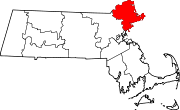
Newbury, Massachusetts — Town — Newbury Elm in c. 1910 Location in Essex County in Massachusetts
Coordinates: 42°46′00″N 70°50′45″W / 42.7666667°N 70.84583°WCoordinates: 42°46′00″N 70°50′45″W / 42.7666667°N 70.84583°W Country United States State Massachusetts County Essex Settled 1635 Incorporated 1635 Government – Type Open town meeting Area – Total 26.5 sq mi (68.5 km2) – Land 24.3 sq mi (62.8 km2) – Water 2.2 sq mi (5.7 km2) Elevation 37 ft (11 m) Population (2010) – Total 6,666 – Density 274.3/sq mi (106.1/km2) Time zone Eastern (UTC-5) – Summer (DST) Eastern (UTC-4) ZIP code 01951 Area code(s) 351 / 978 FIPS code 25-45175 GNIS feature ID 0619452 Website "Newbury, Massachusetts". http://www.townofnewbury.org/. Newbury is a town in Essex County, Massachusetts, United States. The population was 6,666 at the 2010 census. Newbury includes the villages of Old Town (Newbury Center), Plum Island and Byfield, home of The Governor's Academy (formerly Governor Dummer Academy), a private preparatory school.
Contents
History
Newbury Plantation was settled and incorporated in 1635. The Rev. Thomas Parker and cousin Rev. James Noyes along with his brother Nicholas Noyes led a group of approximately 100 pioneers from Wiltshire, England. They sailed from the River Thames aboard the ship Mary and John, first landing in Agawam (now Ipswich) in 1634. They arrived the next spring at the Quascacunquen River, now the Parker River. A commemorative stone marks the spot where Nicholas Noyes was the first of the new settlers to leap ashore at Newbury. The site had once been a village of the Pawtucket Indians, who hunted, fished or farmed. Many settlers would do the same. In 1791, 3,000 head of cattle grazed town lands, or on the region's abundant salt marsh hay. Other trades included tanning and shipbuilding. Newbury originally included Newburyport, set off in 1764, and West Newbury, set off in 1819.
Quascancunquen means "waterfall," referring to the falls in Byfield where Central Street crosses the Parker River. In 1636, the first water powered mill was established at the falls. Gristmills and sawmills were built, and in 1794, the first textile mill in Massachusetts. At Byfield in 1763 was founded the nation's first preparatory school, Dum'r (Dummer) Charity School, known subsequently as Dummer Academy, Governor Dummer Academy, and now The Governor's Academy. It was also site of the first female seminary, founded in 1807. Byfield developed into a mill village, and once had six water powered mills, manufacturing various products from woolens to snuff.
The railroad entered the community in 1850, carrying freight but also tourists, helping Plum Island develop into a Victorian seaside resort. Back on the mainland, silver was discovered in a large field in 1878, and the Chipman Silver Mine would begin operations until it finally closed in 1925. By 1905, however, the economy had shifted to back to agriculture, and Newbury became a supplier of eggs, milk and poultry. Some would dig for clams or hay the salt marshes. The town is today primarily residential, with many examples of fine antique architecture.
Geography
According to the United States Census Bureau, the town has a total area of 26.5 square miles (69 km2), of which, 24.2 square miles (63 km2) of it is land and 2.2 square miles (5.7 km2) of it (8.32%) is water. Newbury lies just south of the mouth of the Merrimack River, and is drained by the Little River and Parker River, which, along with the Plum Island River, drains into the Plum Island Sound, separating Plum Island from the mainland. Much of the town land is made of marshes, and quite a bit is protected land, included in the Parker River National Wildlife Refuge, Old Town Hill Reservation Area, Kents Island Wildlife Management Area, Downfall Wildlife Management Area and parts of the Mill River Wildlife Management Area and Crane Pond Wildlife Management Area.
Newbury is located along the Atlantic Ocean, and is bordered by Newburyport to the north, West Newbury to the northwest, a small portion of Groveland to the west, Georgetown to the southwest, and Rowley to the south. The center of Newbury lies 19 miles east of Lawrence, 19 miles north of Salem, 32 miles north-northeast of Boston and 24 miles south of Portsmouth, New Hampshire.
Interstate 95 passes through the western part of town, with two exits providing access to the town. U.S. Route 1, locally known as the Newburyport Turnpike, passes from north to south through the middle of the town, and Massachusetts Route 1A's northernmost portion passes through the east of town, just inland from the marshes. The town is home to the Plum Island Airport, a private general aviation airport; the nearest national service is at Logan International Airport. The Newburyport/Rockport Line of the MBTA Commuter Rail passes through town, with its northern terminus just over the Newburyport line.
Demographics

Historical populations Year Pop. ±% 1850 4,426 — 1860 1,444 −67.4% 1870 1,430 −1.0% 1880 1,566 +9.5% 1890 1,427 −8.9% 1900 1,601 +12.2% 1910 1,482 −7.4% 1920 1,303 −12.1% 1930 1,530 +17.4% 1940 1,599 +4.5% 1950 1,994 +24.7% 1960 2,519 +26.3% 1970 3,804 +51.0% 1980 4,529 +19.1% 1990 5,623 +24.2% 2000 6,717 +19.5% 2001* 6,712 −0.1% 2002* 6,731 +0.3% 2003* 6,709 −0.3% 2004* 6,675 −0.5% 2005* 6,786 +1.7% 2006* 6,752 −0.5% 2007* 6,780 +0.4% 2008* 6,840 +0.9% 2009* 6,910 +1.0% 2010 6,666 −3.5% * = population estimate.
Source: United States Census records and Population Estimates Program data.[1][2][3][4][5][6][7][8][9][10]As of the census[11] of 2000, there were 6,717 people, 2,514 households, and 1,815 families residing in the town. The population density was 277.0 people per square mile (106.9/km²). There were 2,816 housing units at an average density of 116.1 per square mile (44.8/km²). The racial makeup of the town was 98.32% White, 0.37% African American, 0.13% Native American, 0.45% Asian, 0.01% Pacific Islander, 0.28% from other races, and 0.43% from two or more races. Hispanic or Latino of any race were 0.91% of the population.
There were 2,514 households out of which 35.7% had children under the age of 18 living with them, 61.5% were married couples living together, 7.4% had a female householder with no husband present, and 27.8% were non-families. 22.6% of all households were made up of individuals and 9.1% had someone living alone who was 65 years of age or older. The average household size was 2.66 and the average family size was 3.16.
 Plum Island Hotel in c. 1910
In the town the population was spread out with 27.1% under the age of 18, 4.3% from 18 to 24, 30.0% from 25 to 44, 27.9% from 45 to 64, and 10.7% who were 65 years of age or older. The median age was 40 years. For every 100 females there were 94.0 males. For every 100 females age 18 and over, there were 91.7 males.
The median income for a household in the town was $74,836, and the median income for a family was $83,428. Males had a median income of $52,366 versus $35,656 for females. The per capita income for the town was $34,640. About 1.2% of families and 3.1% of the population were below the poverty line, including 2.3% of those under age 18 and 9.2% of those age 65 or over.
Points of interest
- Coffin House (c. 1678)
- Dole-Little House (c. 1715)
- James Noyes House (c. 1637)
- Spencer-Peirce-Little Farm (c. 1675-1700)
- Swett-Ilsley House (c. 1670)
Notable residents
- Jonathan Singletary Dunham, Prominent early American settler of Woodbridge Township, New Jersey, President Barack Obama’s eighth great-grandfather
- Richard Dummer, settled in Newbury in May 1635
- William Dummer, Lt. Governor of the Massachusetts Bay Colony
- Theophilus Parsons, Chief Justice of the Massachusetts Supreme Judicial Court
- Joshua Coffin, American antiquary and abolitionist
- Henry Sewall, First immigrated to Newbury, Massachusetts in 1634 and became the first ancestor of the Sewalls in America.[12]
- Rev. John Woodbridge, Settled in Newbury, Massachusetts in 1634 and married Mercy Dudley, daughter of Governor Thomas Dudley. He served as Town Clerk of Newbury from 1634 to 1638 and as Deputy to the General Court, 1639-40-41. He was ordained over the church in Andover, 24 October 1645.
- Samuel Moore settled in Newbury in 1634, and then emigrated to Woodbridge, New Jersey where he held many offices in the fledgling colony
- Moses Little, Colonel of the 12th Continental Regiment during the American Revolution.
See also
- Parker River National Wildlife Refuge
Sources
- ^ "TOTAL POPULATION (P1), 2010 Census Summary File 1, All County Subdivisions within Massachusetts". United States Census Bureau. http://factfinder2.census.gov/bkmk/table/1.0/en/DEC/10_SF1/P1/0400000US25.06000. Retrieved September 13, 2011.
- ^ "Massachusetts by Place and County Subdivision - GCT-T1. Population Estimates". United States Census Bureau. http://factfinder.census.gov/servlet/GCTTable?_bm=y&-geo_id=04000US25&-_box_head_nbr=GCT-T1&-ds_name=PEP_2009_EST&-_lang=en&-format=ST-9&-_sse=on. Retrieved July 12, 2011.
- ^ "1990 Census of Population, General Population Characteristics: Massachusetts". US Census Bureau. December 1990. Table 76: General Characteristics of Persons, Households, and Families: 1990. 1990 CP-1-23. http://www.census.gov/prod/cen1990/cp1/cp-1-23.pdf. Retrieved July 12, 2011.
- ^ "1980 Census of the Population, Number of Inhabitants: Massachusetts". US Census Bureau. December 1981. Table 4. Populations of County Subdivisions: 1960 to 1980. PC80-1-A23. http://www2.census.gov/prod2/decennial/documents/1980a_maABC-01.pdf. Retrieved July 12, 2011.
- ^ "1950 Census of Population". Bureau of the Census. 1952. Section 6, Pages 21-10 and 21-11, Massachusetts Table 6. Population of Counties by Minor Civil Divisions: 1930 to 1950. http://www2.census.gov/prod2/decennial/documents/23761117v1ch06.pdf. Retrieved July 12, 2011.
- ^ "1920 Census of Population". Bureau of the Census. Number of Inhabitants, by Counties and Minor Civil Divisions. Pages 21-5 through 21-7. Massachusetts Table 2. Population of Counties by Minor Civil Divisions: 1920, 1910, and 1920. http://www2.census.gov/prod2/decennial/documents/41084506no553ch2.pdf. Retrieved July 12, 2011.
- ^ "1890 Census of the Population". Department of the Interior, Census Office. Pages 179 through 182. Massachusetts Table 5. Population of States and Territories by Minor Civil Divisions: 1880 and 1890. http://www2.census.gov/prod2/decennial/documents/41084506no553ch2.pdf. Retrieved July 12, 2011.
- ^ "1870 Census of the Population". Department of the Interior, Census Office. 1872. Pages 217 through 220. Table IX. Population of Minor Civil Divisions, &c. Massachusetts. http://www2.census.gov/prod2/decennial/documents/1870e-05.pdf. Retrieved July 12, 2011.
- ^ "1860 Census". Department of the Interior, Census Office. 1864. Pages 220 through 226. State of Massachusetts Table No. 3. Populations of Cities, Towns, &c.. http://www2.census.gov/prod2/decennial/documents/1860a-08.pdf. Retrieved July 12, 2011.
- ^ "1850 Census". Department of the Interior, Census Office. 1854. Pages 338 through 393. Populations of Cities, Towns, &c.. http://www2.census.gov/prod2/decennial/documents/1850c-11.pdf. Retrieved July 12, 2011.
- ^ "American FactFinder". United States Census Bureau. http://factfinder.census.gov. Retrieved 2008-01-31.
- ^ Graves, Eben W. (2007). The Descendants of Henry Sewall (1576-1656) of Manchester and Coventry, England, and Newbury and Rowley, Massachusetts (1st ed. ed.). Boston, Massachusetts: Newbury Street Press. p. 229. ISBN 978-0-88082-198-8.
Bibliography
- Coffin, Joshua (1845). A Sketch of the History of Newbury, Newburyport, and West Newbury from 1635 to 1845. Boston: Samuel G. Drake.
- Currier, John J. (1902). History of Newbury, Mass., 1635-1902. Boston: Damrell & Upham. OCLC 2303477. http://openlibrary.org/books/OL6922835M/History_of_Newbury_Mass._1635-1902.
- Noyes, Henry E.; Noyes, Harriette E., eds (1904) [1897]. Genealogical Record of Some of the Noyes Descendants of James, Nicholas and Peter Noyes. Volume I: Descendants of Nicholas Noyes. Boston: New England Historic Genealogical Society.
- Noyes, Henry E.; Noyes, Harriette E., eds (1904). Genealogical Record of Some of the Noyes Descendants of James, Nicholas and Peter Noyes. Volume II: Descendants of James and Peter Noyes. Boston: New England Historic Genealogical Society.
External links
- March, E. 1795 Map of Newbury. At the Essex County Registry of Deeds in Salem, Massachusetts.
- Anderson, Philander. 1830 Map of Newbury.
- Beers, D.G. 1872 Atlas of Essex County, Massachusetts Newbury. Plate 25.West Newbury. Plate 27.
- Walker, George H. 1884 Atlas of Essex County, Massachusetts Newbury. Plate 139.
- Newbury Vital Records to 1849.
- Historical Society of Old Newbury
- The 375th Anniversary Website (1635-2010)
- Library of Congress. Historic American Buildings Survey.
- Knight-Short House, 6 High Street, Newbury Old Town, MA
- Jackman-Willett House, Lower Green vicinity, Newbury Old Town, MA
- Dr. Peter Toppan House, Newbury Old Town, MA
- Milestones UU, VV, WW, XX, YY & ZZ, Various Newbury locations, Newbury Old Town, MA
Municipalities and communities of Essex County, Massachusetts Cities Amesbury | Beverly | Gloucester | Haverhill | Lawrence | Lynn | Methuen | Newburyport | Peabody | Salem
Towns Andover | Boxford | Danvers | Essex | Georgetown | Groveland | Hamilton | Ipswich | Lynnfield | Manchester-by-the-Sea | Marblehead | Merrimac | Middleton | Nahant | Newbury | North Andover | Rockport | Rowley | Salisbury | Saugus | Swampscott | Topsfield | Wenham | West Newbury
CDPs Other
villagesAnnisquam | Ballardvale | Beverly Farms | Bradford | Byfield | Clifton | Plum Island
Categories:- Newbury, Massachusetts
- Populated places established in 1635


Wikimedia Foundation. 2010.