- Southbridge, Massachusetts
Infobox Settlement|
official_name = Southbridge, Massachusetts
nickname =
motto =
imagesize =
image_caption =
image_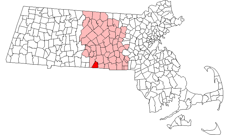
mapsize = 250px
map_caption = Location in Worcester County in Massachusetts
mapsize1 =
map_caption1 =
subdivision_type = Country
subdivision_name =United States
subdivision_type1 = State
subdivision_name1 =Massachusetts
subdivision_type2 = County
subdivision_name2 = Worcester
established_title = Settled
established_date = 1730
established_title2 = Incorporated
established_date2 = 1816
established_title3 =
established_date3 =
government_type = Manager-Town Council
leader_title =Town Manager
leader_name = Clayton Carlisle
leader_title1 = Town Council
leader_name1 = Pamela A. Regis
Conrad L. Vandal
Kenneth M. O'Brien
Laurent E. McDonald
Alex Dolphin
Steven S. Lazo
Catherine E. Nikolla
Robert F. King
David A. Livengood
area_magnitude =
area_total_km2 = 54.0
area_total_sq_mi = 20.9
area_land_km2 = 52.7
area_land_sq_mi = 20.4
area_water_km2 = 1.3
area_water_sq_mi = 0.5
population_as_of = 2000
settlement_type = Town
population_total = 17214
population_density_km2 = 326.4
population_density_sq_mi = 845.4
elevation_m = 149
elevation_ft = 489
timezone = Eastern
utc_offset = -5
timezone_DST = Eastern
utc_offset_DST = -4
latd = 42 |latm = 04 |lats = 30 |latNS = N
longd = 72 |longm = 02 |longs = 02 |longEW = W
website = http://www.ci.southbridge.ma.us/
postal_code_type = ZIP code
postal_code = 01550
area_code = 508 / 774
blank_name = FIPS code
blank_info = 25-63270
blank1_name = GNIS feature ID
blank1_info = 0618383
footnotes = The Town of Southbridge is a city [Mass City-Town Note|Mass_Town=Southbridge|] in Worcester County,Massachusetts ,United States . The population was 17,214, at the 2000 census.For geographic and demographic information on the
census-designated place Southbridge, please see the article Southbridge (CDP),Massachusetts .History
The area now known as Southbridge was initially inhabited by Native Americans of the
Nipmuck andMohegan tribes, with the dividing line for their territory as theQuinebaug River . Local inhabitants likely paid tribute to both tribes to be left in peace. As early as 1638, John Winthrop Jr. purchased a tract of land formining lead in what is now Leadmine Road inSturbridge (it was thought at the time that where there's lead, there should besilver nearby). Southbridge was first settled by Europeans in1730 and it was incorporated in1816 ; among the first settlers was Moses Marcy, who owned a home on the site of what is now Notre Dame church and who was elected to Congress, and the Dennison family. Water power from the Quinebaug River made Southbridge a good location for saw and grist mills in the 1700s and textile mills in the 1800s. After theAmerican Civil War , many immigrants of Irish andFrench Canadian descent came to work and live there; by the 1930s they had been joined byPoles ,Greeks ,Italians , and others. Southbridge has a long history of manufacture of optical products. Under the leadership of the Wells family, The American Optical Company ("AO") became the world's largest manufacturer of ophthalmic products and at its height employed more than 6,000 people around the world. Many of its workers were exempted from the draft duringWorld War II since they were doing vital defense work, including makingNorden bombsights and even some work on theAtomic Bomb . By the early 1960s, the town had a movie theatre, an AM radio station (WESO), and an airport. New immigrants fromPuerto Rico ,Laos , andVietnam began arriving in the 1970s and 1980s. The American Optical Company shut down in1984 , and the town is still struggling from the loss of these and other manufacturing jobs.Geography
According to the
United States Census Bureau , the city has a total area of 20.9square mile s (54.0km² ), of which, 20.4 square miles (52.7 km²) of it is land and 0.5 square miles (1.3 km²) of it (2.40%) is water.The principal road in Southbridge is Route 131, known as Main Street through downtown and East Main Street past the "AO Rotary" and through Sandersdale, a village on the town's east side. North-south roads include Eastford Road and Elm Street (Route 198), and Worcester Street-Mechanic Street-North Woodstock Road (Route 169).
Southbridge was formed out of portions of two of its neighboring towns: Sturbridge to the west and Dudley to the east. Other neighboring towns are Charlton to the north, and Woodstock,
Connecticut , to the south.Demographics
As of the
census GR|2 of 2000, there were 17,214 people, 7,077 households, and 4,522 families residing in the city. Thepopulation density was 845.4 people per square mile (326.4/km²). There were 7,511 housing units at an average density of 368.9/sq mi (142.4/km²). The racial makeup of the city was 85.23% White, 1.43% Black or African American, 0.42% Native American, 1.52% Asian, 0.06% Pacific Islander, 8.70% from other races, and 2.63% from two or more races. Hispanic or Latino of any race were 20.17% of the population.There were 7,077 households out of which 31.1% had children under the age of 18 living with them, 43.6% were married couples living together, 15.5% had a female householder with no husband present, and 36.1% were non-families. 29.7% of all households were made up of individuals and 12.1% had someone living alone who was 65 years of age or older. The average household size was 2.41 and the average family size was 2.98.
In the city the population was spread out with 25.4% under the age of 18, 8.6% from 18 to 24, 30.3% from 25 to 44, 20.7% from 45 to 64, and 15.1% who were 65 years of age or older. The median age was 36 years. For every 100 females there were 92.8 males. For every 100 females age 18 and over, there were 87.2 males.
The median income for a household in the city was $33,913, and the median income for a family was $41,863. Males had a median income of $36,008 versus $25,685 for females. The
per capita income for the city was $18,514. About 13.0% of families and 15.4% of the population were below thepoverty line , including 25.8% of those under age 18 and 10.2% of those age 65 or over.Government
Infobox Mass Town Govt
county= Worcester
clerk_courts =Dennis P. McManus (D)
cty_treasurer = Position Eliminated
da = Joseph D. Early, Jr. (D)
deeds = Anthony J. Vigliotti (D)
probate = Stephen Abraham (D)
sheriff = Guy W. Glodis (D)
state_rep = Geraldo Alicea (D)
state_sen = Richard T. Moore (D)
gov_councilors = Thomas J. Foley (D)
fed_rep =Richard E. Neal (D-2nd District),
fed_sen =Edward Kennedy (D)John Kerry (D)Education
Southbridge has three public elementary schools, formerly "neighborhood schools" serving grades K-5. Since the 1988-1989 school year, however, all kindergarten and 1st grade classes have been at Eastford Road School; all of grades 2-3 at Charlton Street School; and all of grades 4-5 at West Street School. Grades 6-8 are at Mary E. Wells Junior High School, the former high school building. Grades 9-12 are at Southbridge High School, which includes the old Cole Trade School building. Southbridge residents can also attend Bay Path Vocational Technical High School in Charlton, MA.
In addition to the public schools, a parochial private school,
Trinity Catholic Academy , serves the elementary grades.Transportation
Southbridge has a small airfield,
Southbridge Municipal Airport .Points of interest
* [http://www.southbridgehotel.com/ Southbridge Hotel and Conference Center] - Combination hotel and office complex built behind the historical American Optical building.
* [http://www.nae.usace.army.mil/recreati/wvl/wvlhome.htm Westville Lake and Recreation Area] - Outdoor recreation area along theQuinebaug River .Notable residents
*
Félix Gatineau
*George Thorndike Angell - Founder of theMassachusetts Society for the Prevention of Cruelty to Animals , the first animal protection group in the country. Angell Animal Medical Centers are named after him. Born in Southbridge, MA. A plaque honoring him is at corner of Elm & Main Streets in Southbridge.
*William L. Marcy - Senator and Governor of New York, Secretary of War, and Secretary of State. Born in Southbridge, MA. The street where he was born is named Marcy Street, and formerly a school was named after him.
*John Fitzgerald - Center for the Dallas Cowboys. Played inSuper Bowl XII . Born and raised in Southbridge. Played fullback for Southbridge High School, and then at Boston College.ee also
* List of Registered Historic Places in Southbridge,
Massachusetts References
External links
* [http://www.ci.southbridge.ma.us/ Southbridge official website]
* [http://www.dickwhitney.net/RBWSouthbridge.html History and info of Southbridge, MA]
* [http://www.dickwhitney.net/HistoryofSouthbridge.pdf History of Southbridge, MA (PDF)]
* [http://www.southbridgeeveningnews.com/ The Southbridge Evening News]
* [http://www.yoursouthbridge.com/ yourSouthbridge.com: Events, Activities, and Business Listings]
Wikimedia Foundation. 2010.