- Marlborough, Massachusetts
-
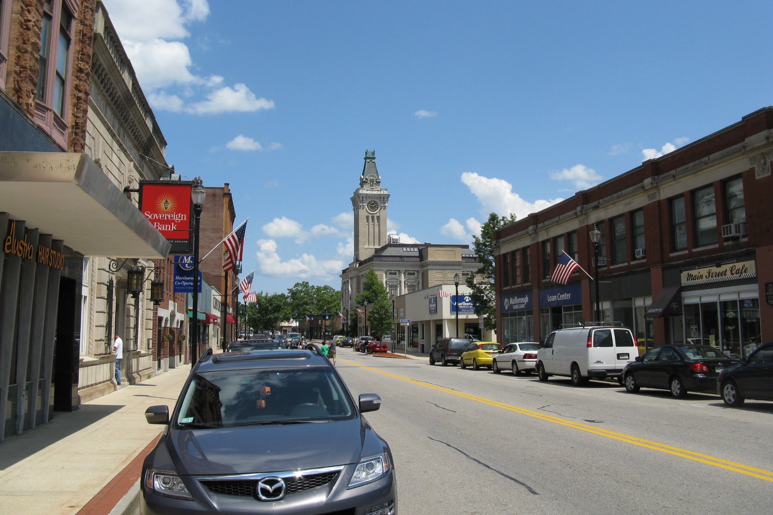
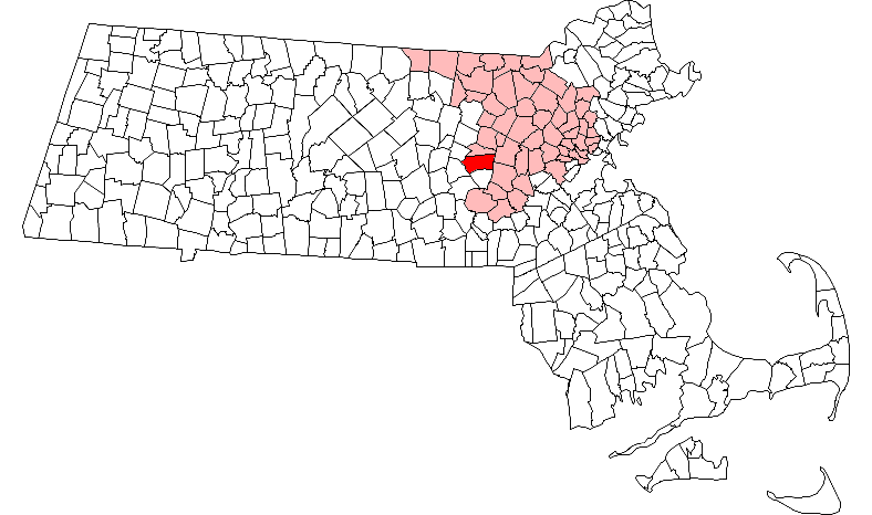
Marlborough, Massachusetts — City — Main Street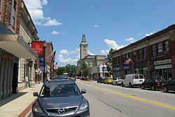 Location in Middlesex County in Massachusetts
Coordinates: 42°20′45″N 71°33′10″W / 42.34583°N 71.55278°WCoordinates: 42°20′45″N 71°33′10″W / 42.34583°N 71.55278°W Country United States State Massachusetts County Middlesex Settled 1657 Incorporated 1660 Government – Type Mayor-council city – Mayor Arthur Vigeant Area – Total 22.2 sq mi (57.4 km2) – Land 21.1 sq mi (54.6 km2) – Water 1.1 sq mi (2.8 km2) Elevation 450 ft (137 m) Population (2010) – Total 38,499 – Density 1,804.0/sq mi (697.2/km2) Time zone Eastern (UTC-5) – Summer (DST) Eastern (UTC-4) ZIP code 01752 Area code(s) 508 / 774 FIPS code 25-38715 GNIS feature ID 0611360 Website http://www.marlborough-ma.gov/ Marlborough (often spelled Marlboro) is a city in Middlesex County, Massachusetts, United States. The population was 38,499 at the 2010 census. Marlborough became a prosperous industrial town in the 19th century and made the transition to high technology industry in the late 20th century after the construction of the Massachusetts Turnpike.
Marlborough was declared a town in 1660. It was later created a city because of the population size.
Contents
History
John Howe had come to the area in 1656 as a fur trader and built a house at the intersection of two Indian trails, Nashua Trail and Connecticut path.[1] He could speak the language of the Algonquian Indians though the local tribe referred to themselves as the Pennacooks. The settlers were welcomed by the Indians because they protected them from other tribes they were at war with. In the 1650s, several families left the nearby town of Sudbury, 18 miles west of Boston, to start a new town. The village was named after Marlborough, the market town in Wiltshire, England. It was first settled in 1657 by 14 men led by Edmund Rice; in 1656 Rice petitioned the Massachusetts General Court to create the city of Marlborough and it was officially incorporated in 1660. Rice was elected a Selectman at Marlborough in 1657. Sumner Chilton Powell wrote, in Puritan Village: The Formation of a New England Town, "Not only did Rice become the largest individual landholder in Sudbury, but he represented his new town in the Massachusetts legislature for five years and devoted at least eleven of his last fifteen years to serving as selectman and judge of small causes."[2]
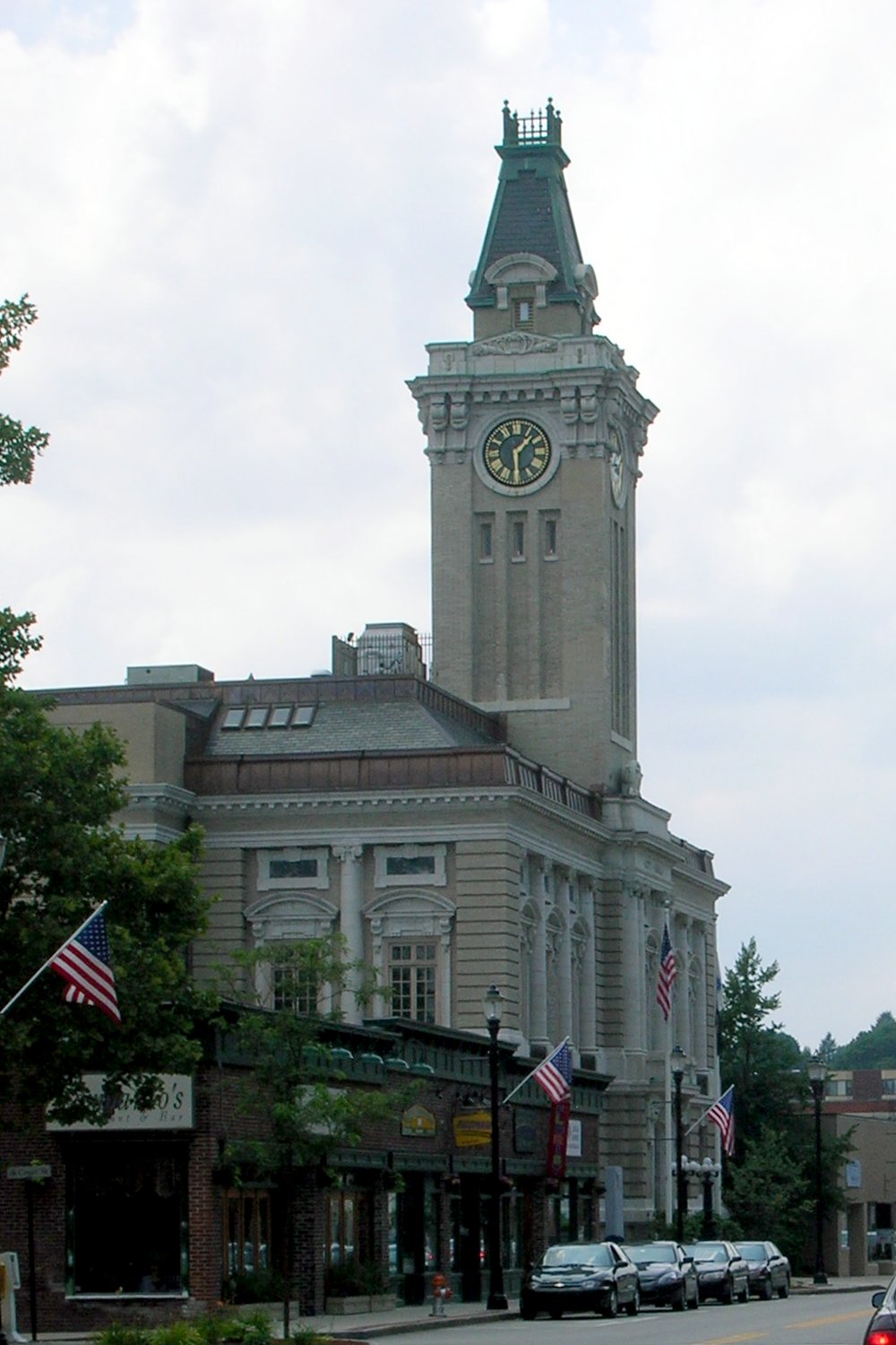
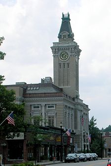 City Hall (1905) by Allen, Collins & Berry
The Reverend William Brimstead was the first minister of the Puritan church and Johnathan Johnson was the first blacksmith.
Marlborough was one of the seven "Praying Indian Towns" because they were converted to Christianity by the Rev. John Eliot of Roxbury. In 1674 a deed was drawn up dividing the land between the settlers and the natives. This is the only record of names of the natives. The document was signed by:
- Old Nequenit
- Robin (Robin Hill in Marlborough is named after him)
- Benjamin Wuttanamitt
- Great James
- Mary, the widow of Peter Naskonit, on behalf of her child David Moses
- Assoake, the widow of James Norwell "On behalf of my children"
- Sarah Conomy, sole executrix of my late husband Oomonog
- Elizebeth, the only daughter and sole heir of Solomon, deceased. (Solomon Pond in Northborough is named after him and hence Solomon Pond Mall)
- James Spence on behalf of his wife.
The settlement was almost destroyed by Native Americans in 1676 during King Philip's War.
In 1711 Marlborough's territory included Northborough, Southborough, Westborough and Hudson. As population, business, and travel grew in the colonies, Marlborough became a favored rest stop on the Boston Post Road. Many travelers stopped at its inns and taverns, including George Washington, who visited the Williams Tavern (see citation below) soon after his inauguration in 1789.[3]
In 1836, Samuel Boyd, known as the "father of the city," and his brother Joseph, opened the first shoe manufacturing business - an act that would change the community forever. By 1890, with a population of 14,000, Marlborough had become a major shoe manufacturing center, producing boots for Union soldiers, as well as footwear for the civilian population. Marlborough became so well known for its shoes that its official seal was decorated with a factory, a shoe box, and a pair of boots when it was incorporated as a city in 1890.[4]
The Civil War resulted in the creation of one of the region's most unusual monuments. Legend has it that a company from Marlborough, assigned to Harpers Ferry, appropriated the bell from the firehouse where John Brown last battled for the emancipation of the slaves. The company left the bell in the hands of one Mrs. Elizabeth Snyder for 30 years, returning in 1892 to bring it back to Marlborough. The bell now hangs in a tower at the corner of Route 85 and Main Street.
Around that time, Marlborough is believed to have been the first community in the country to receive a charter for a streetcar system, edging out Baltimore by a few months. The system, designed primarily for passenger use, provided access to Milford to the south, and Concord to the north. As a growing industrialized community, Marlborough began attracting skilled craftsmen from Quebec, Ireland, Italy, and Greece.[5]
Shoe manufacturing continued in Marlborough long after the industry had fled many other New England communities. Rice & Hutchins, Inc. operated several factories in Marlborough from 1875 to 1929. Famous Frye boots were manufactured here through the 1970s, and The Rockport Company, founded in Marlborough in 1971, continues to maintain an outlet store in the city. In 1990, when Marlborough celebrated its centennial as a city, the festivities included the construction of a park in acknowledgment of the shoe industry, featuring statues by the sculptor David Kapenteopolous.
The construction of Interstates 495 and 290 and the Massachusetts Turnpike has enabled Marlborough to begin its fifth century on the cutting edge of a new industry: high technology and specialized electronics. Today, thousands flock here to work at Fidelity Investments, Raytheon, Hewlett-Packard, AMD, Sun Microsystems, Navilyst Medical, Netezza, Boston Scientific, Sepracor, 3Com, Egenera, Evergreen Solar and the many other electronics and computer firms that provide the strong business community in the city. Because of the city's central location with easy access to major highways and the pro-business, pro-development policies of the city government, the population of Marlborough has more than doubled in the last 25 years to over 38,000 at the time of the last census.
-
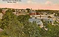
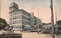
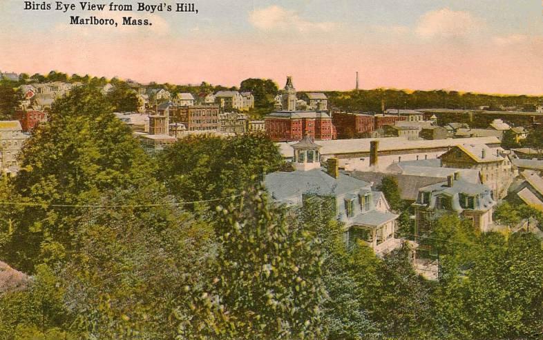
Bird's-eye view c. 1912
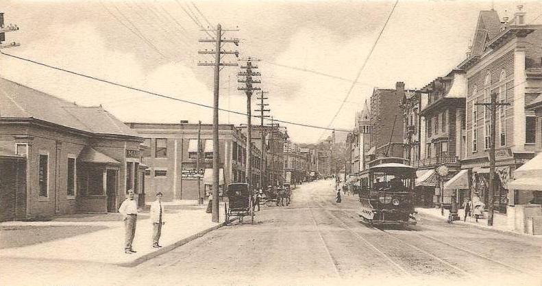
-
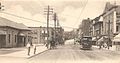
Main Street in 1906
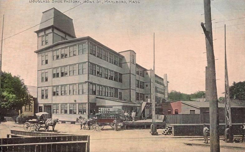
-
Shoe factory c. 1910
-
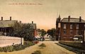
Lincoln Street c. 1908
Geography
Marlborough is located at 42°21′3″N 71°32′51″W / 42.35083°N 71.5475°W (42.350909, -71.547530).[6] According to the United States Census Bureau, the city has a total area of 22.2 square miles (57 km2), of which, 21.1 square miles (55 km2) of it is land and 1.1 square miles (2.8 km2) of it (4.87%) is water. Marlborough is drained by the Assabet River. Within city limits are three large lakes, known as Lake Williams, Millham Reservoir and Fort Meadow Reservoir. A portion of Fort Meadow Reservoir extends into nearby Hudson.
Marlborough is crossed by Interstate 495, U.S. Route 20 and Massachusetts Route 85. The eastern terimus of Interstate 290 is also in Marlborough.
Adjacent towns
Marlborough is located in eastern Massachusetts, bordered by six towns:
- Hudson on the north
- Berlin and Northborough on the west
- Southborough on the south
- Sudbury and a small portion of Framingham on the east
Demographics
Historical populations Year Pop. ±% 1790 1,554 — 1800 1,735 +11.6% 1810 1,674 −3.5% 1820 1,952 +16.6% 1830 2,077 +6.4% 1840 2,101 +1.2% 1850 2,941 +40.0% 1860 5,911 +101.0% 1870 8,474 +43.4% 1880 10,127 +19.5% 1890 13,805 +36.3% 1900 13,609 −1.4% 1910 14,579 +7.1% 1920 15,028 +3.1% 1930 15,587 +3.7% 1940 15,154 −2.8% 1950 15,756 +4.0% 1960 18,819 +19.4% 1970 27,936 +48.4% 1980 30,617 +9.6% 1990 31,813 +3.9% 2000 36,255 +14.0% 2001* 37,914 +4.6% 2002* 37,972 +0.2% 2003* 37,817 −0.4% 2004* 37,615 −0.5% 2005* 37,384 −0.6% 2006* 37,936 +1.5% 2007* 37,984 +0.1% 2008* 38,079 +0.3% 2009* 38,465 +1.0% 2010 38,499 +0.1% * = population estimate.
Source: United States Census records and Population Estimates Program data.[7][8][9][10][11][12][13][14][15][16][17]As of the census[18] of 2000, there were 36,255 people, 14,501 households, and 9,280 families residing in the city. The population density was 1,719.4 people per square mile (663.7/km²). There were 14,903 housing units at an average density of 706.8 per square mile (272.8/km²). The racial makeup of the city was 87.70% White, 2.17% African American, 0.20% Native American, 3.76% Asian, 0.04% Pacific Islander, 3.27% from other races, and 2.86% from two or more races. Hispanic or Latino of any race were 6.06% of the population.
There were 14,501 households out of which 30.4% had children under the age of 18 living with them, 51.5% were married couples living together, 9.0% had a female householder with no husband present, and 36.0% were non-families. 28.4% of all households were made up of individuals and 8.3% had someone living alone who was 65 years of age or older. The average household size was 2.47 and the average family size was 3.07.
In the city the population was spread out with 23.3% under the age of 18, 7.0% from 18 to 24, 36.7% from 25 to 44, 21.5% from 45 to 64, and 11.6% who were 65 years of age or older. The median age was 36 years. For every 100 females there were 97.2 males. For every 100 females age 18 and over, there were 94.8 males.
The median income for a household in the city was $56,879, and the median income for a family was $70,385. Males had a median income of $49,133 versus $32,457 for females. The per capita income for the city was $28,723. About 4.7% of families and 6.8% of the population were below the poverty line, including 8.9% of those under age 18 and 10.3% of those age 65 or over.
Education
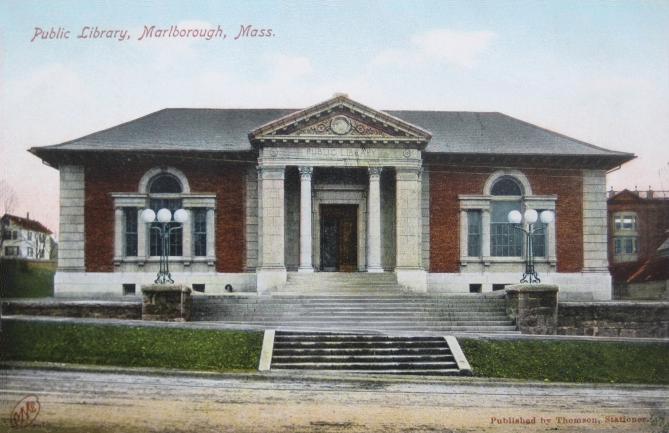
 Public library (1903-04), a Carnegie library designed by Peabody & Stearns
Public schools
- Advanced Math and Science Academy Charter School
- Assabet Valley Regional Technical High School
- Marlborough High School
- 1LT Charles W. Whitcomb School Formerly 4-7 School, Marlborough Middle School, and Marlborough Intermediate Elementary School
- Raymond C. Richer Elementary School
- Francis J.Kane Elementary School
- Sgt. Charles J. Jaworek Elementary School
- Early Childhood Center
See also Marlborough Public Schools
Charter schools
Advanced Math & Science Academy grades ( 6-12 )
Parochial schools
Private schools
- Hillside School (5-9)
- New Covenant Christian School (K-8)
- Wayside Academy (9-12)
After school programs
Media
Newspapers
The MetroWest Daily News, a daily newspaper covering Marlborough and surrounding communities in the MetroWest region
Enterprise-Sun, the city's former daily newspaper
Main Street Journal / msjnews.com - Marlborough's hometown local news
Television
Channel 8 (Comcast), Channel 34 (Verizon): m8, Public-access television (Marlborough Cable Trust). [1]
Channel 10 (Comcast), Channel 33 (Verizon): WMCT, Your Community Station (Marlborough Cable Trust). [2]
Channel 98: Marlborough Public Schools' student run station
Radio
Internet
Points of interest
 The Peter Rice Homestead (c.1688), home of the Marlborough Historical Society
-
This list is incomplete; you can help by expanding it.
- The Peter Rice Homestead (c. 1688) -- 377 Elm Street
- Solomon Pond Mall
- John Brown Bell
- New England Sports Center
- Various War Memorials Throughout Downtown Area
- Callahan State Park
- Jericho Hill recreational area
- Memorial Forest Reservation and Desert Natural Area
- Assabet River Rail Trail
- Ghiloni Nature Trail / State Forest
- Assabet River
- Marlborough Country Club
- Cider Knoll Conservation Area
- Wayside Country Store
- Trombetta's Farm
Notable residents
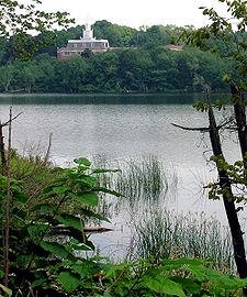 Marlborough District Courthouse, seen from across Lake Williams
- Horatio Alger, Jr., author, graduated from high school in Marlborough in 1847 (The town's annual Horatio Alger Street Fair was renamed the Harvest Fair in 2007.)
- Asa Brigham, politician and businessman
- John Buckley, baseball pitcher
- Mike Burns, Olympian and World Cup soccer player
- Rich Busa, marathon runner
- Bobby Butler, NHL hockey player
- Marcia Cross, actress best known for her role in Desperate Housewives; graduated from Marlborough High School in 1980
- Aaron Dalbec, guitarist in bands including Converge and Bane
- Crystal Eastman, lawyer, journalist and activist
- Charles "Duke" Farrell, catcher of the World Series–winning Boston Americans team of 1903
- Gilman Bigelow Howe, genealogist and author
- James Simon Kunen, author of The Strawberry Statement: Notes of a College Revolutionary
- Gregory Maguire, author of Wicked: The Life and Times of the Wicked Witch of the West
- Robert J. Murray, Under Secretary of the Navy
- Roy Nutt, businessman and computer pioneer
- Ken Reynolds, Major League Baseball player
- Edmund Rice, co-founder and early resident
- Franklin Pierce Rice, printer, publisher and antiquarian
- Henry Rice, Massachusetts state legislator and subject of Gilbert Stuart portrait
- John Rock, gynecologist and obstetrician, co-credited with developing the first effective oral contraceptive, the Pill[19]
- Lucy Goodale Thurston, missionary
- John Patrick Treacy, Roman Catholic Bishop of the Diocese of La Crosse
- Bobb Trimble, musician
- Paul Warnke, diplomat
Sister Cities And Towns
Cities
 – Akiruno, Tokyo, Japan from November 3, 1998
Towns
 - Marlborough, Wiltshire, Wiltshire England United Kingdom from 1657
See also
References
- ^ "Marlborough Massachusetts Genealogy". USGenWeb. Archived from the original on 2006-10-16. http://web.archive.org/web/20061016140135/http://www.rootsweb.com/~mamiddle/Marlborough/index.html. Retrieved 2007-03-01.
- ^ "Who was Edmund Rice?". The Edmund Rice (1638) Association, Inc.. http://www.edmund-rice.org/. Retrieved 2007-05-14.
- ^ "Marlborough Massachusetts History - Williams Tavern". History RootsWeb. http://freepages.history.rootsweb.ancestry.com/~historyofmarlborough/williamstavernstory.htm. Retrieved 2010-02-10.
- ^ History of Marlborough
- ^ History of Marlborough
- ^ "US Gazetteer files: 2010, 2000, and 1990". United States Census Bureau. 2011-02-12. http://www.census.gov/geo/www/gazetteer/gazette.html. Retrieved 2011-04-23.
- ^ "TOTAL POPULATION (P1), 2010 Census Summary File 1, All County Subdivisions within Massachusetts". United States Census Bureau. http://factfinder2.census.gov/bkmk/table/1.0/en/DEC/10_SF1/P1/0400000US25.06000. Retrieved September 13, 2011.
- ^ "Massachusetts by Place and County Subdivision - GCT-T1. Population Estimates". United States Census Bureau. http://factfinder.census.gov/servlet/GCTTable?_bm=y&-geo_id=04000US25&-_box_head_nbr=GCT-T1&-ds_name=PEP_2009_EST&-_lang=en&-format=ST-9&-_sse=on. Retrieved July 12, 2011.
- ^ "1990 Census of Population, General Population Characteristics: Massachusetts". US Census Bureau. December 1990. Table 76: General Characteristics of Persons, Households, and Families: 1990. 1990 CP-1-23. http://www.census.gov/prod/cen1990/cp1/cp-1-23.pdf. Retrieved July 12, 2011.
- ^ "1980 Census of the Population, Number of Inhabitants: Massachusetts". US Census Bureau. December 1981. Table 4. Populations of County Subdivisions: 1960 to 1980. PC80-1-A23. http://www2.census.gov/prod2/decennial/documents/1980a_maABC-01.pdf. Retrieved July 12, 2011.
- ^ "1950 Census of Population". Bureau of the Census. 1952. Section 6, Pages 21-10 and 21-11, Massachusetts Table 6. Population of Counties by Minor Civil Divisions: 1930 to 1950. http://www2.census.gov/prod2/decennial/documents/23761117v1ch06.pdf. Retrieved July 12, 2011.
- ^ "1920 Census of Population". Bureau of the Census. Number of Inhabitants, by Counties and Minor Civil Divisions. Pages 21-5 through 21-7. Massachusetts Table 2. Population of Counties by Minor Civil Divisions: 1920, 1910, and 1920. http://www2.census.gov/prod2/decennial/documents/41084506no553ch2.pdf. Retrieved July 12, 2011.
- ^ "1890 Census of the Population". Department of the Interior, Census Office. Pages 179 through 182. Massachusetts Table 5. Population of States and Territories by Minor Civil Divisions: 1880 and 1890. http://www2.census.gov/prod2/decennial/documents/41084506no553ch2.pdf. Retrieved July 12, 2011.
- ^ "1870 Census of the Population". Department of the Interior, Census Office. 1872. Pages 217 through 220. Table IX. Population of Minor Civil Divisions, &c. Massachusetts. http://www2.census.gov/prod2/decennial/documents/1870e-05.pdf. Retrieved July 12, 2011.
- ^ "1860 Census". Department of the Interior, Census Office. 1864. Pages 220 through 226. State of Massachusetts Table No. 3. Populations of Cities, Towns, &c.. http://www2.census.gov/prod2/decennial/documents/1860a-08.pdf. Retrieved July 12, 2011.
- ^ "1850 Census". Department of the Interior, Census Office. 1854. Pages 338 through 393. Populations of Cities, Towns, &c.. http://www2.census.gov/prod2/decennial/documents/1850c-11.pdf. Retrieved July 12, 2011.
- ^ "1950 Census of Population". Bureau of the Census. 1952. Section 6, Pages 21-7 through 21-09, Massachusetts Table 4. Population of Urban Places of 10,000 or more from Earliest Census to 1920. http://www2.census.gov/prod2/decennial/documents/23761117v1ch06.pdf. Retrieved July 12, 2011.
- ^ "American FactFinder". United States Census Bureau. http://factfinder.census.gov. Retrieved 2008-01-31.
- ^ "John Rock: Pioneer in the Development of Oral Contraceptives", Marc A. Shampo, PhD and Robert A. Kyle, MD
Further reading
- 1871 Atlas of Massachusetts. by Wall & Gray.Map of Massachusetts. Map of Middlesex County.
- History of the Town of Marlborough, Middlesex County, Massachusetts. by Charles Hudson, and Joseph Allen. Published 1862, 544 pages.
- History of Middlesex County, Massachusetts, Volume 1 (A-H), Volume 2 (L-W) compiled by Samuel Adams Drake, published 1879 and 1880. 572 and 505 pages. Marlborough Section in Volume 2 page 137 by R.A.Griffin and E.L.Bigelow.
External links
- City of Marlborough, Massachusetts
- Marlborough Public Library
- Marlborough Historical Society
- Marlborough Airport
- Marlborough Regional Chamber of Commerce
Municipalities and communities of Middlesex County, Massachusetts Cities 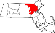
Towns Acton | Arlington | Ashby | Ashland | Ayer | Bedford | Belmont | Billerica | Boxborough | Burlington | Carlisle | Chelmsford | Concord | Dracut | Dunstable | Framingham | Groton | Holliston | Hopkinton | Hudson | Lexington | Lincoln | Littleton | Maynard | Natick | North Reading | Pepperell | Reading | Sherborn | Shirley | Stoneham | Stow | Sudbury | Tewksbury | Townsend | Tyngsborough | Wakefield | Wayland | Westford | Weston | Wilmington | Winchester
CDPs Ayer | Cochituate | Fort Devens | East Pepperell | Groton | Hopkinton | Hudson | Littleton Common | Pepperell | Pinehurst | Shirley | Townsend | West Concord
Other
villagesAuburndale | Chestnut Hill | Gleasondale | Nabnasset | Newton Centre | Newton Highlands | Newton Lower Falls | Newton Upper Falls | Newtonville | Nonantum | North Billerica | North Chelmsford | Waban | West Newton
Categories:- Cities in Massachusetts
- Marlborough, Massachusetts
- Populated places established in 1657


Wikimedia Foundation. 2010.