- Amesbury, Massachusetts
Infobox Settlement
official_name = Amesbury, Massachusetts
nickname =
motto =
imagesize = 250px
image_caption = "Thomas Macy House" in c. 1905
image_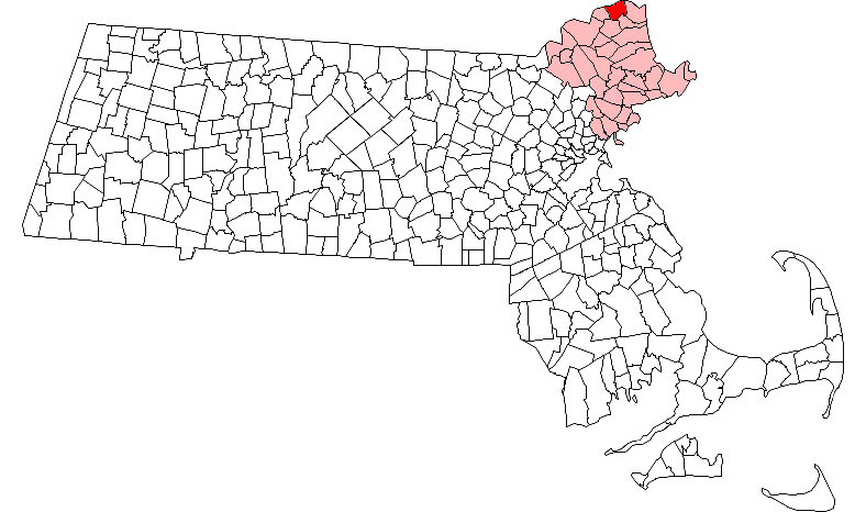
mapsize = 250px
map_caption = Location in Essex County in Massachusetts
mapsize1 =
map_caption1 =
subdivision_type = Country
subdivision_name =United States
subdivision_type1 = State
subdivision_name1 =Massachusetts
subdivision_type2 = County
subdivision_name2 = Essex
established_title = Settled
established_date = 1642
established_title2 = Incorporated
established_date2 = 1668
established_title3 =
established_date3 =
government_type = Mayor-council city
leader_title =Mayor
leader_name = Thatcher W. Kezer III
leader_title1 =
leader_name1 =
area_magnitude =
area_total_km2 = 35.4
area_total_sq_mi = 13.7
area_land_km2 = 32.1
area_land_sq_mi = 12.4
area_water_km2 = 3.2
area_water_sq_mi = 1.2
population_as_of = 2007
settlement_type = Town
population_total = 16,429
population_density_km2 = 511.8
population_density_sq_mi = 1,324.9
elevation_m = 15
elevation_ft = 50
timezone = Eastern
utc_offset = -5
timezone_DST = Eastern
utc_offset_DST = -4
latd = 42 |latm = 51 |lats = 30 |latNS = N
longd = 70 |longm = 55 |longs = 50 |longEW = W
website = [http://www.ci.amesbury.ma.us/ www.ci.amesbury.ma.us]
postal_code_type = ZIP code
postal_code = 01913
area_code = 351 / 978
blank_name = FIPS code
blank_info = 25-01185
blank1_name = GNIS feature ID
blank1_info = 0618292
footnotes = The Town of Amesbury is a city [Mass City-Town Note|Mass_Town=Amesbury|] in Essex County,Massachusetts ,United States . In 1890, 9798 people lived in Amesbury; in 1900, 9473; in 1910, 9894; in 1920, 10,036; and in 1940, 10,862. The population was 16,450 at the 2000 census. A former farming andmill town , Amesbury is today largely residential.History
Settled in 1642, Amesbury was first recognized as "Salisbury New Town" in 1666 when it formally separated from Salisbury. It was incorporated as "Amesbury" in 1668, after
Amesbury in Wiltshire,England .Originally the boundary between Amesbury and Salisbury was the Powwow River. In 1876 Merrimac was created out of West Amesbury. In 1886 West Salisbury was annexed to Amesbury so the mill area on the Powwow River was unified. See the maps linked below.
Beginning as a modest farming community, it would develop an aggressive maritime and industrial economy. The 90 foot drop in the falls of the
Powwow River providedwater power forsawmills andgristmill s.Shipbuilding ,shipping andfishing were also important. Theferry across theMerrimack River to Newburyport was a lively business until the construction of bridges to Deer Island. Newton,New Hampshire would be set off from Amesbury in 1741, when the border between the two colonies was adjusted.In the 19th century,
textile mills were built at the falls, as was a mechanized nail-making factory, believed to be the nation's first. The "Merrimac Hat Company" produced more hats than any of its competitors. Beginning in 1853, Amesbury became famous for building carriages, a trade which would evolve into the manufacture of automobile bodies. The industry, however, would end with theGreat Depression . Amesbury also produced "Hoyt's Buffalo Brand Peanut Butter Kisses". In 1876, the town of Merrimac was set off from Amesbury. In 1996, the town changed its status to a city, and adopted the mayor and municipal council form of government, although it retained the title "Town of Amesbury." The current mayor is Thatcher W. Kezer III.The community has an impressive collection of early
architecture , particularly in the Federal and Victorian styles. Following a recent restoration of the historic downtown, many new restaurants opened. The "Doughboy ," a memorial sculpture by Leonard Craske, stands on the front lawn of the Amesbury Middle School. It was dedicatedNovember 11 ,1929 . Craske is best known as sculptor for the "Fishermens' Memorial" in Gloucester. There is here a monument erected toJosiah Bartlett , who was born in Amesbury.Geography
Amesbury is located at coor dms|42|51|29|N|70|55|50|W|GR|1. According to the
United States Census Bureau , the city has a total area of 13.6 square miles (35.4 km²), of which, 12.4 square miles (32.1 km²) of it is land and 1.2 square miles (3.2 km²) of it (9.08%) is water. Amesbury is drained by thePowwow River . "Powwow Hill", elevation 332 feet (98 m), is the highest point in town. Once the site of Indian gatherings, or "powwows," it has views toMaine andCape Ann .Demographics
"For additional demographic information on the central urban area of Amesbury, which is a
census-designated place , see the article Amesbury (CDP),Massachusetts . It provodes details that are included in the aggregate numbers reported here."As of the
census of 2000, there were 16,450 people, 6,380 households, and 4,229 families residing in the city. Thepopulation density was 1,326.3 people per square mile (512.2/km²). There were 6,623 housing units at an average density of 206.2 persons/km² (534.0 persons/sq mi). The racial makeup of the city was 97.19% White, 0.64%African American , 0.22% Native American, 0.58%Asia n, 0.02% Pacific Islander, 0.24% from other races, and 1.10% from two or more races. 0.95% of the population wereHispanic orLatino of any race.There were 6,380 households out of which 34.5% had children under the age of 18 living with them, 51.2% were married couples living together, 11.3% have a woman whose husband does not live with her, and 33.7% were non-families. 26.8% of all households were made up of individuals and 8.9% had someone living alone who was 65 years of age or older. The average household size was 2.52 and the average family size was 3.09.
In the city the population was spread out with 26.1% under the age of 18, 6.1% from 18 to 24, 33.8% from 25 to 44, 22.0% from 45 to 64, and 12.0% who were 65 years of age or older. The median age was 37 years. For every 100 females there were 93.1 males. For every 100 females age 18 and over, there were 89.7 males.
The median income for a household in the city was $51,906, and the median income for a family was $62,875. Males had a median income of $43,489 versus $31,968 for females. The
per capita income for the city was $24,103. 5.9% of the population and 3.9% of families were below the poverty line. Out of the total people living in poverty, 7.0% are under the age of 18 and 8.2% are 65 or older.Education
* Amesbury Academy
*Amesbury High School
*Amesbury Middle School
* Amesbury Elementary School
* Charles C. Cashman Elemetary School
*Amesbury Public Schools Amesbury's high school football rival is
Newburyport ; the two teams play against each other every Thanksgiving Day.Points of interest
* [http://www.lowellsboatshop.com/ Lowell's Boat Shop] (1793) 459 Main St. A working museum. 978-834-0050.
* Amesbury Carriage Museum 270 Main St.
* Amesbury Hat Museum 978-388-0091 which displays hats of the old Merrimack Hat Factory.
*Josiah Bartlett Museum (1870) 270 Main St.
*Macy-Colby House (c. 1654) 257 Main St.
*Mary Baker Eddy Historic House 277 Main Street
*John Greenleaf Whittier Home [http://www.essexheritage.org/sites/amesbury_whittier-home.shtml 86 Friend St.]
* Friends' Meeting House (1850) 120 Friend St.
* [http://salisburypoint.tnsing.com/ Salisbury Point Railroad Historical Society] 9 Water St.
* Old Powder House (1810)
*Rocky Hill Meeting House (c. 1785) [http://www.spnea.org/visit/homes/rocky.htm 4 Portsmouth Road.]
* Alliance Park (Site of the Construction of the "U.S.S. Alliance " in 1777)Notable residents
*
Susanna North Martin , victim of Salem Witch trials in 1692, * [http://www.rootsweb.com/~nwa/sm.html]
*Josiah Bartlett (1729-1795), signer of theDeclaration of Independence , firstGovernor of New Hampshire cite book | title = Who Was Who in America, Historical Volume, 1607-1896 | publisher = Marquis Who's Who | location = Chicago | date = 1963]
*Paine Wingate (1739-1838), preacher, statesman
*Daniel Blaisdell , (1762-1833),United States Congressman from New Hampshire
*Luther Colby, (1814-1894), journalist,spiritualist .
*John Greenleaf Whittier (1807-1892), poet
* William Ezra Northen, (1819-1897), vice president and engineer of theNew York and New Haven Railroad , chief engineer of theChicago Main Drainage Canal.
*Mary Baker Eddy (1821-1910), founder ofChristian Science
*Harriet Prescott Spofford (1835-1921), author
*William A. Paine (1844-1929), businessman
*Robert Frost (1874-1963), poet
*Nathaniel Currier (1813-1888) American Lithographer,Currier and Ives
*Jeffrey Donovan , actor. Star of television show "Burn Notice"
* Roland H. Woodwell, biographer
* Keegan Hamilton, bassist of popular recording artists, Long Walk Home
* Greg Kell, former guitarist of heavy metal band, Guns Up!
* Chris Chasse, musician for band Rise Against
* Bryan P.T. Riley, author (writes under pseudonym Paul Thomas)
* Christopher Baird, lead singer for band Lustra, writer and performer of 'Scotty Doesn't Know" from the movie Eurotrip.
* All four members of the band The Brew;Kelly Kane, Dave Drouin, and brothers Joe and Chris Plante. http://www.thebrew.bizister City
Amesbury is sister cities with:
*flagicon|Kenya Esabalu,Kenya References
Publications
* J. Merrill, [http://books.google.com/books?hl=en&id=6-eW00EwnWcC&dq=history+of+amesbury&printsec=frontcover&source=web&ots=RiXKSNQZ3W&sig=ttogBrNawPGytlWKCz1L022gHJw "History of Amesbury"] (Haverhill, 1880) Full image at books.google
* Sargeant, Christopher. [http://www.salemdeeds.com/atlases_pages.asp?ImageName=AMESBURY.jpg&atlastype=Atlases&atlastown=ESSEX+COUNTY&atlas=ESSEX+COUNTY+1795&atlas_desc=ESSEX+COUNTY+1795&pageprefix= 1794 Map of Amesbury.]
* Clough, Aaron. [http://www.salemdeeds.com/atlases_pages.asp?ImageName=SALISBURY.jpg&atlastype=Atlases&atlastown=ESSEX+COUNTY&atlas=ESSEX+COUNTY+1795&atlas_desc=ESSEX+COUNTY+1795&pageprefix= 1795 Map of Salisbury.]* Nichols, W., J S Morse. [http://www.salemdeeds.com/atlases_pages.asp?ImageName=AMESBURY.jpg&atlastype=Atlases&atlastown=ESSEX+COUNTY&atlas=ESSEX+COUNTY+1830&atlas_desc=ESSEX+COUNTY+1830&pageprefix= 1830 Map of Amesbury.]
* Anderson, Philander. [http://www.salemdeeds.com/atlases_pages.asp?ImageName=SALISBURY.jpg&atlastype=Atlases&atlastown=ESSEX+COUNTY&atlas=ESSEX+COUNTY+1830&atlas_desc=ESSEX+COUNTY+1830&pageprefix= 1830 Map of Salisbury.]*Beers, D.G. 1872 Atlas of Essex County, Massachusetts [http://www.salemdeeds.com/atlases_pages.asp?ImageName=PLATE_0009.jpg&atlastype=Atlases&atlastown=ESSEX+COUNTY&atlas=ESSEX+COUNTY+1872&atlas_desc=ESSEX+COUNTY+1872&pageprefix= Amesbury. Plate 9.] [http://www.salemdeeds.com/atlases_pages.asp?ImageName=PLATE_0012.jpg&atlastype=Atlases&atlastown=ESSEX+COUNTY&atlas=ESSEX+COUNTY+1872&atlas_desc=ESSEX+COUNTY+1872&pageprefix= Amesbury and Salisbury Mills. Now Amesbury Center. Plate 12.] [http://www.salemdeeds.com/atlases_pages.asp?ImageName=PLATE_0015.jpg&atlastype=Atlases&atlastown=ESSEX+COUNTY&atlas=ESSEX+COUNTY+1872&atlas_desc=ESSEX+COUNTY+1872&pageprefix= Salisbury. Plate 15.] [http://www.salemdeeds.com/atlases_pages.asp?ImageName=PLATE_0017.jpg&atlastype=Atlases&atlastown=ESSEX+COUNTY&atlas=ESSEX+COUNTY+1872&atlas_desc=ESSEX+COUNTY+1872&pageprefix= West Amesbury now Merrimac. And East Salisbury. Plate 17.] [http://www.salemdeeds.com/atlases_pages.asp?ImageName=PLATE_0019.jpg&atlastype=Atlases&atlastown=ESSEX+COUNTY&atlas=ESSEX+COUNTY+1872&atlas_desc=ESSEX+COUNTY+1872&pageprefix= Salisbury Point. Plate 19. (Now The Point in Amesbury).]
* Bigelow, E.H. [http://maps.bpl.org/id/10249/ Amesbury and Salisbury Mills.] Birds eye view at the Boston Public Library Website.
* Norris, George E. [http://memory.loc.gov/cgi-bin/query/D?gmd:1:./temp/~ammem_mmlf:: Amesbury.] Panaramic View. Published 1890. Burleigh Lith.Est. At the Library of Congress Website.
* Hughes & Bailey. [http://memory.loc.gov/cgi-bin/query/D?gmd:2:./temp/~ammem_mmlf:: Amesbury.] Panoramic View. Published 1914.* Walker, George H. 1884 Atlas of Essex County Massachusetts [http://www.salemdeeds.com/atlases_pages.asp?ImageName=PAGE_0169.jpg&atlastype=Atlases&atlastown=ESSEX+COUNTY&atlas=ESSEX+COUNTY+1884&atlas_desc=ESSEX+COUNTY+1884&pageprefix= 1884 Map of Amesbury. Plate 169.] [http://www.salemdeeds.com/atlases_pages.asp?ImageName=PAGE_0074.jpg&atlastype=Atlases&atlastown=ESSEX+COUNTY&atlas=ESSEX+COUNTY+1884&atlas_desc=ESSEX+COUNTY+1884&pageprefix= Amesbury,Salisbury Point. Plate 74.] [http://www.salemdeeds.com/atlases_pages.asp?ImageName=PAGE_0151.jpg&atlastype=Atlases&atlastown=ESSEX+COUNTY&atlas=ESSEX+COUNTY+1884&atlas_desc=ESSEX+COUNTY+1884&pageprefix= Merrimac Center (was West Amesbury). Plate 151.] [http://www.salemdeeds.com/atlases_pages.asp?ImageName=PAGE_0170_0171.jpg&atlastype=Atlases&atlastown=ESSEX+COUNTY&atlas=ESSEX+COUNTY+1884&atlas_desc=ESSEX+COUNTY+1884&pageprefix= Amesbury Village Mills. Plate 170-171.] [http://www.salemdeeds.com/atlases_pages.asp?ImageName=PAGE_0172.jpg&atlastype=Atlases&atlastown=ESSEX+COUNTY&atlas=ESSEX+COUNTY+1884&atlas_desc=ESSEX+COUNTY+1884&pageprefix= 1884 Map of Merrimac. Plate 172.] [http://www.salemdeeds.com/atlases_pages.asp?ImageName=PAGE_0175.jpg&atlastype=Atlases&atlastown=ESSEX+COUNTY&atlas=ESSEX+COUNTY+1884&atlas_desc=ESSEX+COUNTY+1884&pageprefix= 1884 Map of Salisbury. Plate 175.] [http://www.salemdeeds.com/atlases_pages.asp?ImageName=PAGE_0176_0177.jpg&atlastype=Atlases&atlastown=ESSEX+COUNTY&atlas=ESSEX+COUNTY+1884&atlas_desc=ESSEX+COUNTY+1884&pageprefix= Salisbury Village Mills on the Powwow River. Plate. 176-177.] [http://www.salemdeeds.com/atlases_pages.asp?ImageName=PAGE_0178.jpg&atlastype=Atlases&atlastown=ESSEX+COUNTY&atlas=ESSEX+COUNTY+1884&atlas_desc=ESSEX+COUNTY+1884&pageprefix= East Salisbury. Plate 178.] [http://www.salemdeeds.com/atlases_pages.asp?ImageName=PAGE_0166.jpg&atlastype=Atlases&atlastown=ESSEX+COUNTY&atlas=ESSEX+COUNTY+1884&atlas_desc=ESSEX+COUNTY+1884&pageprefix= Danvers Catholic Church, Folger's Carriage Factory Amesbury. Plate 166.]
* [http://www.ma-vitalrecords.org/EssexCounty/Amesbury/ Amesbury Vital Records to 1849.] Published 1913. Transcribed and put online by John Slaughter and Jodi Salerno.
*External links
* [http://www.amesburyma.gov Official Website]
* [http://www.amesburyplayhouse.com/ Amesbury Playhouse]
* [http://www.amesburylibrary.org/ Amesbury Public Library]
* [http://www.amesbury.us/ AmesburyIssues Forum]
* [http://www.rootsweb.ancestry.com/~kscomanc/farren_captain_jonathan.html A New Chronology of the Life & Times of Jonathan Farren of Amesbury, MA, and Newton, NH]
Wikimedia Foundation. 2010.