- Gloucester, Massachusetts
-
For other uses, see Gloucester (disambiguation).
Gloucester, Massachusetts — City — Man at the Wheel, Fisherman's Memorial Cenotaph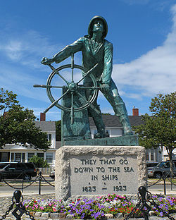

SealNickname(s): "The Place To Be In The Summer" Motto: "America's Oldest Seaport" Location in Essex County in Massachusetts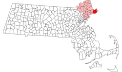
Coordinates: 42°36′57″N 70°39′45″W / 42.61583°N 70.6625°WCoordinates: 42°36′57″N 70°39′45″W / 42.61583°N 70.6625°W Country United States State Massachusetts County Essex Settled 1623 Incorporated 1642 Government – Type Mayor-council city – Mayor Carolyn Kirk Area – Total 41.5 sq mi (107.5 km2) – Land 26.0 sq mi (67.2 km2) – Water 15.5 sq mi (40.2 km2) Elevation 50 ft (15 m) Population (2010) – Total 28,789 – Density 1,166.0/sq mi (450.2/km2) Time zone Eastern (UTC-5) – Summer (DST) Eastern (UTC-4) ZIP code 01930 Area code(s) 351 / 978 FIPS code 25-26150 GNIS feature ID 0615084 Website "City of Gloucester, Massachusetts". http://www.gloucester-ma.gov/. Gloucester
 i/ˈɡlɒstər/ is a city on Cape Ann in Essex County, Massachusetts, in the United States. It is part of Massachusetts' North Shore. The population was 28,789 at the 2010 U.S. Census. An important center of the fishing industry and a popular summer destination, Gloucester consists of an urban core on the north side of the harbor and the outlying neighborhoods of Annisquam, Bay View, Lanesville, Folly Cove, Magnolia, Riverdale, East Gloucester and West Gloucester.
Contents
History
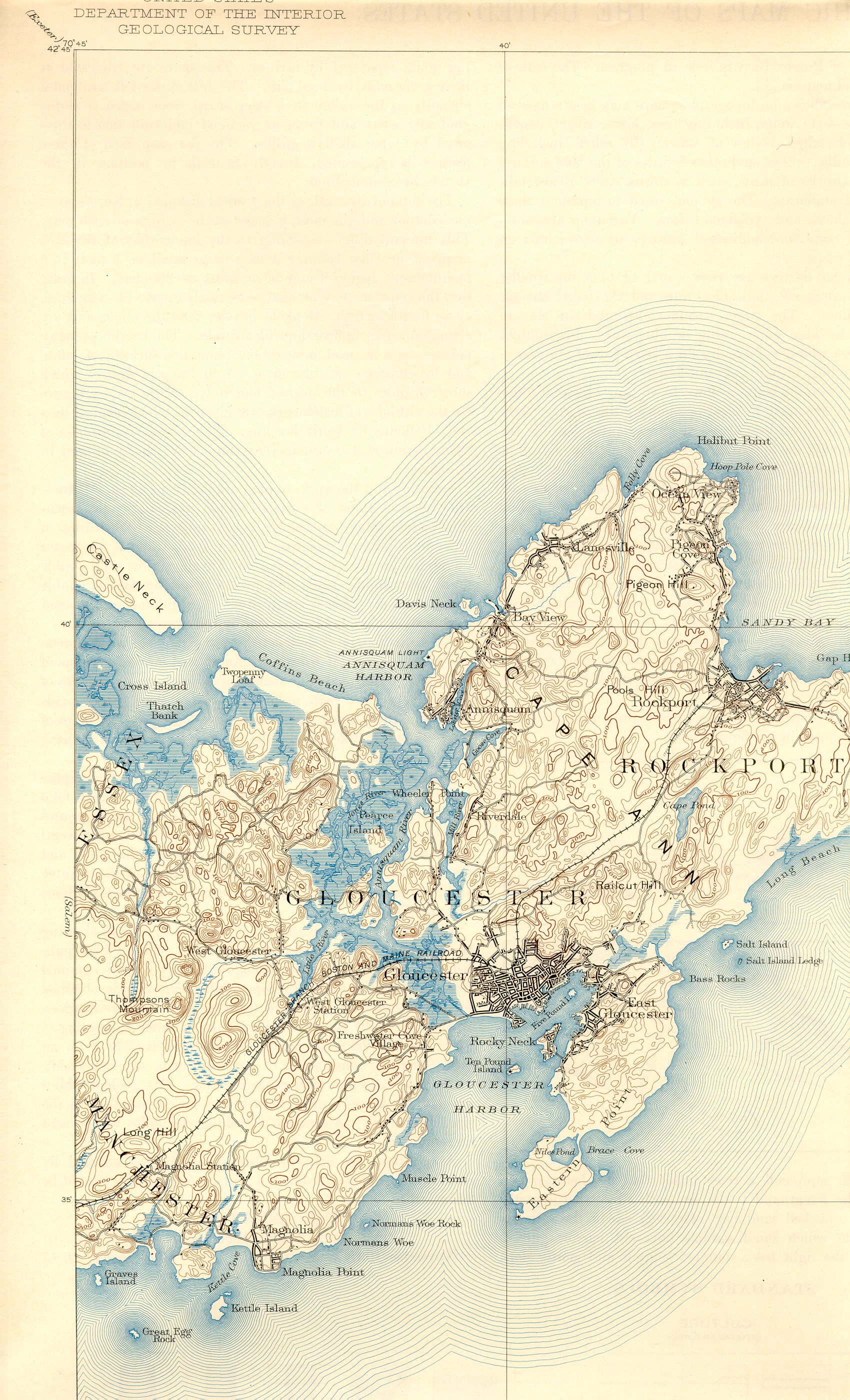
See also: Timeline of Gloucester, Massachusetts, historyThe boundaries of Gloucester originally included the town of Rockport, in an area dubbed "Sandy Bay." That village separated formally on February 27, 1840. In 1873, Gloucester was reincorporated as a city.
Early Gloucester
Gloucester was founded at Cape Ann by an expedition called the "Dorchester Company" of men from Dorchester (in the county of Dorset, England) chartered by James I in 1623. It was one of the first English settlements in what would become the Massachusetts Bay Colony, and predates both Salem in 1626 and Boston in 1630. The first company of pioneers made landing at Half Moon Beach, and settled nearby, setting up fishing stages in a field in what is now Stage Fort Park. This settlement's existence is proclaimed today by a memorial tablet, affixed to a 50' boulder in that park.
Life in this first settlement was harsh and it was short-lived. Around 1626 the place was abandoned, and the people removed themselves to Naumkeag (what is now called Salem, Massachusetts), where more fertile soil for planting was to be found. The meetinghouse was even disassembled and relocated to the new place of settlement. At some point in the following years - though no record exists - the area was slowly resettled. The town was formally incorporated in 1642. It is at this time that the name "Gloucester" first appears on tax rolls, although in various spellings. The town took its name from the city of Gloucester in South-West England, where it is assumed many of its new occupants originated.
This new permanent settlement focused on the Town Green area, an inlet in the marshes at a bend in the Annisquam River. This area is now the site of Grant Circle, a large traffic-rotary at which MA Route 128 mingles with a major city street (Washington Street/ Rt 127). Here the first permanent settlers built a meeting house and therefore focused the nexus of their settlement on the 'Island' for nearly 100 years. Unlike other early coastal towns in New England, development in Gloucester was not focused around the harbor as it is today, rather it was inland that people settled first. This is evidenced by the placement of the Town Green nearly two miles from the harbor-front.
The Town Green is also where the settlers built the first school. By Massachusetts Bay Colony Law, any town boasting 100 families or more had to provide a public schoolhouse. This requirement was met in 1698, with Thomas Riggs standing as the town's first School-Master.
Early industry included subsistence farming and logging. Because of the poor soil and rocky hills, Cape Ann was not well suited for farming on a large scale. Small family farms and livestock provided the bulk of the sustenance to the population. Fishing, for which the town is known today, was limited to close-to-shore, with families subsisting on small catches as opposed to the great bounties yielded in later years. The fisherman of Gloucester did not yet command the Grand Banks until the mid-18th century.
Early Gloucestermen cleared great swaths of the forest of Cape Ann for farm and pasture land, using the timber to build structures as far away as Boston. The rocky moors of Gloucester remained clear for two centuries until the forest reclaimed the land in the 20th century. The inland part of the island became known as the 'Commons' the 'Common Village' or "Dogtown". Here small dwellings lay scattered amongst the boulders and swamps, along roads that meandered through the hills. These dwellings were at times little more than shanties, only one was even two-stories tall. Despite their size, several generations of families were raised in such houses. One feature of the construction of these houses was that under one side of the floor was dug a cellar hole (for the keeping of food), supported by a foundation of laid-stone (without mortar). These cellar holes are still visible today along the trails throughout the inland part of Gloucester; they, and some walls, are all that remain of the village there.
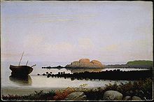
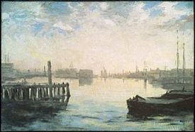 Gloucester Harbor, ca. 1877, William Morris Hunt
Growth
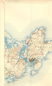 1893 map of Gloucester
The town grew, and eventually colonists lived on the opposite side of the Annisquam River. This, in a time of legally mandated church attendance, was a long way to walk - or row - on a Sunday morning. In 1718 the settlers on the opposite shore of the river split off from the First Parish community at the Green and formed 'Second Parish.' While still part of the Town of Gloucester, the people of Second, or 'West', Parish now constructed their own Meetinghouse and designated their own place of burial, both of which were in the hills near the marshes behind Wingaersheek Beach. The Meeting house is gone now, but deep in the woods on the Second Parish Road trail one can still find the scattered stones of the abandoned Burial Ground.
Other parts of town later followed suit. Third Parish, in Northern Gloucester, was founded in 1728. Fourth Parish split off from First Parish in 1742. Finally, in 1754, the people of Sandy Bay (what would later be called Rockport) split off from First Parish to found Fifth Parish. The Sandy Bay church founding was the last religious re-ordering of the Colonial Period. All of these congregations still exist in some form with the exception of Fourth Parish, the site of whose meeting house is now a highway.
At one time, there was a thriving granite industry in Gloucester.
Geography and transportation
Gloucester is located at 42°37′26″N 70°40′32″W / 42.62389°N 70.67556°W (42.624015, -70.675521).[1] According to the United States Census Bureau, the city has a total area of 41.5 square miles (107 km2), of which, 26.0 square miles (67 km2) of it is land and 15.5 square miles (40 km2) of it (37.42%) is water.
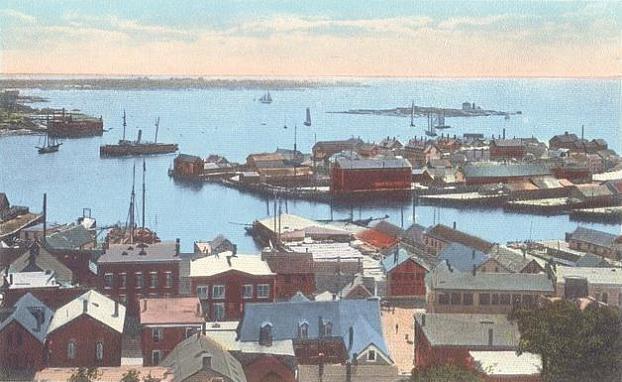
Gloucester occupies most of the eastern end of Cape Ann, except for the far tip, which is the town of Rockport. The city is split in half by the Annisquam River, which flows southward from Ipswich Bay through the middle of the city, connected to Gloucester Harbor by the Blynman Canal. The land along the northwestern shore of the river is marshy, creating several small islands. Gloucester Harbor is divided into several smaller coves, as well as the Western Harbor (site of the Fisherman's Memorial) and the Inner Harbor (home to the Gloucester fishing fleet). The eastern side of Gloucester Harbor is divided from the rest of Massachusetts Bay by Eastern Point, extending some two miles outward from the mainland. There are several parks in the city, the largest of which are Ravenswood Park, Stage Fort Park and Mount Ann Park.
Gloucester lies between Ipswich Bay to the north and Massachusetts Bay to the south. The city is bordered on the east by Rockport, and on the west by Ipswich, Essex and Manchester-by-the-Sea to the west. (The town line with Ipswich is located across Essex Harbor, and as such there is no land connection between the towns.) Gloucester lies 16 miles east-northeast of Salem, and 31 miles northeast of Boston. Gloucester lies at the eastern terminus of Route 128, which ends at Route 127A. Route 127A begins at Route 127 just east of the Route 128 terminus, heading into Rockport before terminating there. Route 127 enters from Manchester-by-the-Sea before crossing the Blynman Canal and passing through downtown towards Rockport. It then re-enters Gloucester near Folly Cove, running opposite of its usual north-south orientation towards its terminus at Route 128. Route 133 also terminates within the city, entering from Essex and terminating just west of the Blynman Canal at Route 127. Besides the bridge over the Blynman Canal, there are only two other connections between the eastern and western halves of town, the A. Piatt Andrew Memorial Bridge, carrying Route 128, and the Boston & Maine Railroad Bridge, just north of the Blynman Canal.
Gloucester is home to the Cape Ann Transportation Authority, which serves the city and surrounding towns. Two stops, in West Gloucester and in downtown Gloucester, provide access to the Newburyport/Rockport Line of the MBTA Commuter Rail, which extends from Rockport along the North Shore to Boston's North Station. The nearest airport is the Beverly Municipal Airport, with the nearest national and international air service being at Boston's Logan International Airport.
Demographics
Historical populations Year Pop. ±% 1790 5,317 — 1800 5,313 −0.1% 1810 5,943 +11.9% 1820 6,384 +7.4% 1830 7,510 +17.6% 1840 6,350 −15.4% 1850 7,786 +22.6% 1860 10,904 +40.0% 1870 15,389 +41.1% 1880 19,329 +25.6% 1890 24,651 +27.5% 1900 26,121 +6.0% 1910 24,398 −6.6% 1920 22,947 −5.9% 1930 24,204 +5.5% 1940 24,046 −0.7% 1950 25,167 +4.7% 1960 25,789 +2.5% 1970 27,941 +8.3% 1980 27,768 −0.6% 1990 28,716 +3.4% 2000 30,273 +5.4% 2001* 30,580 +1.0% 2002* 30,610 +0.1% 2003* 30,550 −0.2% 2004* 30,342 −0.7% 2005* 30,209 −0.4% 2006* 30,123 −0.3% 2007* 30,148 +0.1% 2008* 30,326 +0.6% 2009* 30,530 +0.7% 2010 28,789 −5.7% * = population estimate.
Source: United States Census records and Population Estimates Program data.[2][3][4][5][6][7][8][9][10][11][12]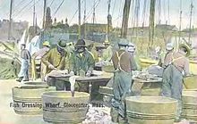 Fish Dressing Wharf in c. 1908
As of the 2000 census[13], there were 30,273 people, 12,592 households, and 7,895 families residing in the city. The population density was 1,166.0 people per square mile (450.2/km²). There were 13,958 housing units at an average density of 537.6 per square mile (207.6/km²). The racial makeup of the city was 91.99% White, 6.61% African American, 0.72% Asian, 0.12% Native American, 0.02% Pacific Islander, 0.50% from other races, and 1.03% from two or more races. Hispanic or Latino of any race were 15.48% of the population. 22.6% were of Italian, 16.2% Irish, 11.1% English, 8.5% Portuguese and 7.1% American ancestry according to Census 2000.
There were 12,592 households out of which 27.6% had children under the age of 18 living with them, 48.8% were married couples living together, 10.6% had a female householder with no husband present, and 37.3% were non-families. 30.7% of all households were made up of individuals and 11.4% had someone living alone who was 65 years of age or older. The average household size was 2.38 and the average family size was 3.00.
 Drying Fish in c. 1915
In the city the population was spread out with 22.0% under the age of 18, 6.5% from 18 to 24, 29.9% from 25 to 44, 26.1% from 45 to 64, and 15.6% who were 65 years of age or older. The median age was 40 years. For every 100 females there were 92.0 males. For every 100 females age 18 and over, there were 88.8 males.
The median income for a household in the city was $58,568, and the median income for a family was $80,970 from a 2007 estimate.[14] Males had a median income of $41,465 versus $30,566 for females. The per capita income for the city was $25,595. About 7.1% of families and 8.8% of the population were below the poverty line, including 11.8% of those under age 18 and 11.2% of those age 65 or over.
Politics
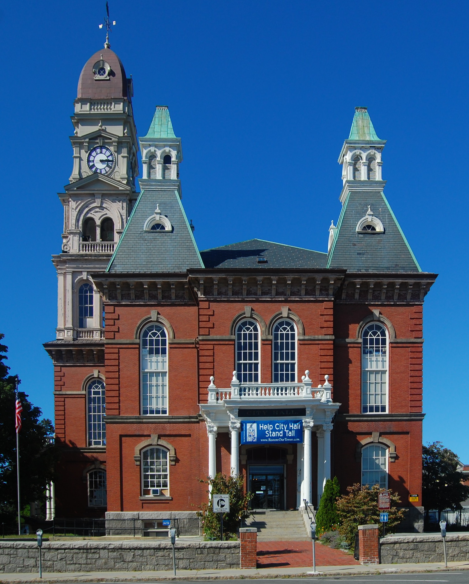
 Gloucester City Hall, built in 1871
Gloucester is a city, with a Strong-Mayor-Council System. The current mayor of Gloucester is Carolyn Kirk as of July 1, 2008. The Mayor is also reserved a seat on the School Committee. City offices are elected every two years (those ending with odd numbers). In 2007 over 40 people ran for the 15 elected seats in the city's government.
The city is divided into five Wards, each split into two precincts:
- Ward 1 - East Gloucester - includes Eastern Point and Rocky Neck
- Ward 2 - Downtown and the Harbor area
- Ward 3 - The Western edge of the 'island' from Stacy Boulevard to Wheeler's Point - includes the Heights at Cape Ann and Pond View Village.
- Ward 4 - North Gloucester - includes Riverdale, Annisquam, Bay View, and Lanesville.
- Ward 5 - The entirety of West Gloucester west of the Annisquam River and Blynman Canal to Manchester-by-the-Sea and Essex - includes the Wingaersheek area and Village of Magnolia.
As late as the mid 20th Century Gloucester had as many as eight wards, but they have been since reorganized into current number.
On November 7, 2005, incumbent Mayor John Bell was re-elected to a third term in office. He stated his intention not to run for reelection and stepped down in January 2008.
On November 6, 2007 Carolyn Kirk was elected as the Mayor of Gloucester.
Voter registration and party enrollment as of October 15, 2008[15] Party Number of voters Percentage Democratic 6,056 28.87% Republican 2,208 10.53% Unaffiliated 12,563 59.89% Minor parties 149 0.71% Total 20,976 100% Education
The following schools are located within the Gloucester Public Schools District:
- Gloucester High School (9-12)
- Ralph B. O'Maley Middle School (6-8)
- Gloucester Community Arts Charter School (K-8)
- East Gloucester Elementary School (K-5)
- Plum Cove Elementary School (K-5)
- Beeman Elementary School (K-5)
- Veteran's Memorial School (K-5)
- West Parish Elementary School (K-5)
Economy
Gorton's of Gloucester and Varian Semiconductor are among the companies based in Gloucester.
Gloucester and the sea
 Harbor View & Ten Pound Island Light in c. 1915
The town was an important shipbuilding center, and the first schooner was reputedly built there in 1713. The community developed into an important fishing port, largely due to its proximity to Georges Bank and other fishing banks off the east coast of Nova Scotia and Newfoundland. Gloucester's most famous (and nationally recognized) seafood business was founded in 1849 -- John Pew & Sons. It became Gorton-Pew Fisheries in 1906, and in 1957 changed its name to Gorton's of Gloucester. The iconic image of the "Gorton's Fisherman", and the products he represents, are known throughout the country and beyond. Besides catching and processing seafood, Gloucester is also a center for fish research.
In the late 19th century Gloucester, Massachusetts saw an influx of Portuguese and Italian immigrants seeking work in the towns flourishing fishing industry and a better life in America. Some present day fishermen of Gloucester are descendents of these early immigrants. The strong Portuguese and Italian influence is evident in the many festivals celebrated throughout the year. During the Catholic celebration, St Peter's Fiesta, relatives of fishermen past and present carry oars representing many of the fishing vessels who call Gloucester their home. Saint Peter is the Patron Saint of the fishermen.
Seafaring and fishing have been, and still are, very dangerous undertakings. In its over 350-year history, Gloucester has lost over 10,000 men to the Atlantic Ocean. The names of all the lost that are known are painted on a huge mural in the main staircase at City Hall, and also on a new memorial cenotaph on Stacy Boulevard. The list has continued to lengthen despite increased safety requirements.
Arts
Painting and printmaking
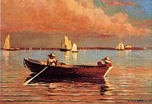
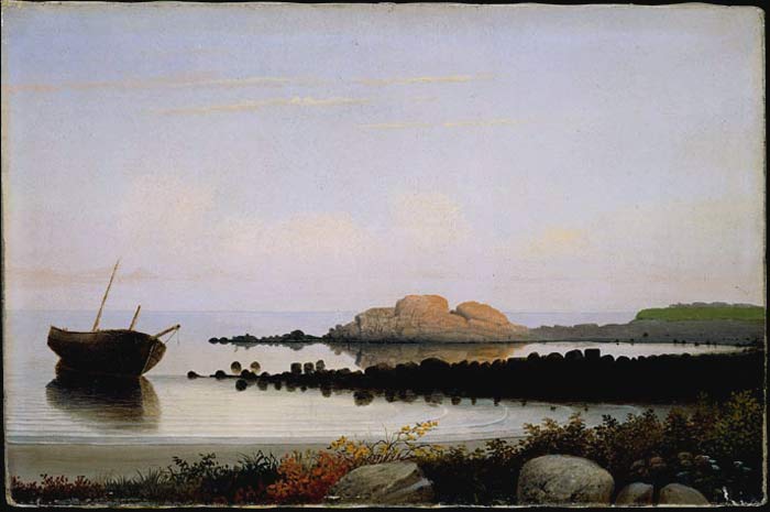
 Brace's Rock, Eastern Point, Gloucester, c. 1864 by Fitz Henry Lane
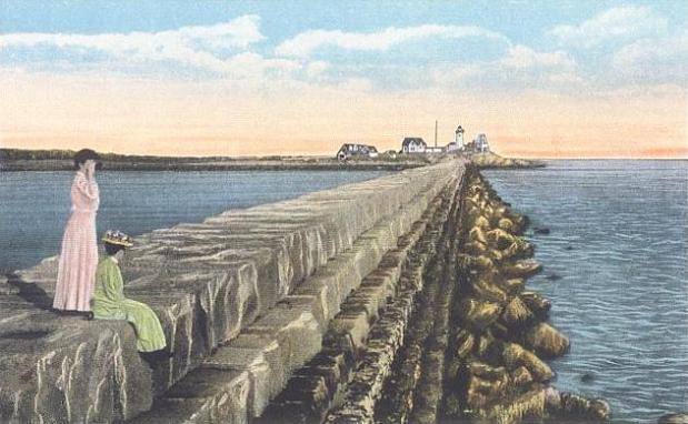
 Eastern Point Breakwater & Lighthouse in c. 1915
Gloucester's scenic beauty, active fishing industry, and renowned arts community have attracted and inspired painters since the early 19th century, as they do today. The first Gloucester painter of note was native-born Fitz Henry Lane, whose home still exists on the waterfront. The premier collection of his works is in the Cape Ann Historical Museum, which holds 40 of his paintings and 100 of his drawings. Other painters subsequently attracted to Gloucester include Edward Hopper, William Morris Hunt, Winslow Homer, Childe Hassam, John Twachtman, Frederick Mulhaupt, Frank Duveneck, Cecilia Beaux, Jane Peterson, Gordon Grant, Harry DeMaine, Emile Gruppe, Stuart Davis, Joseph Solman, Mark Rothko, Milton Avery, Barnett Newman, William Meyerowitz, Joan Lockhart, Theresa Bernstein, and Marsden Hartley and artists from the Ashcan School such as Edward Hopper, John Sloan, Robert Henri, William Glackens, and Maurice Prendergast.
Smith Cove is home to the Rocky Neck Art Colony, the oldest art colony in the country. Folly Cove was the home of the Folly Cove Designers, influential to this day in print design and technique.
Sculpture
Several important sculptors have lived and worked in East Gloucester, Annisquam, Lanesville and Folly Cove. They include George Aarons, Anna Hyatt Huntington, Charles Grafly, Paul Manship and his daughter-in-law Margaret Cassidy Manship, Walker Hancock, and George Demetrios. In addition, Aristides Demetrios grew up in Folly Cove.
Literature
The city was appropriately used as the on-location setting for the adaptation of the book The Perfect Storm. Perhaps the most famous story based in Gloucester is Captains Courageous by Rudyard Kipling, written in 1897, and made into a movie starring Spencer Tracy in 1937.
Charles Olson (1910–1970), a poet and teacher at Black Mountain College, composed a 635 page poem known as "The Maximus Poems" which centered on the city of Gloucester.
Gloucester is often referred to in the works of horror writer H. P. Lovecraft. It is believed that the fictional town of Innsmouth in Lovecraft's famous The Shadow Over Innsmouth is partially based on Cape Ann as a whole and Gloucester in particular.[16]
Gloucester and its Coast Guard station are the center of the land actions in Michael J. Tougias' 2005 book Ten Hours Until Dawn, recounting the loss of the pilot boat Can Do and its crew during the Blizzard of 1978.[17]
Comics
Gloucester is the birthplace of Marvel character Dane Whitman whose superhero alter ego is the Black Knight.
Film
- The Bostonians – ocean front scenes were filmed on rocks at Rafes Chasm Park, off Herperus Avenue.
- Eastern Point Yacht Club in Gloucester was the starting line of the Amazing Race 17.
- Captains Courageous was set in Gloucester.
- The Perfect Storm was filmed and set in Gloucester.
- Moonlight Mile was filmed almost entirely in Gloucester, with some shots in Marblehead.
- Portions of Stuck on You were filmed in Gloucester and in neighboring Rockport. (The rink scenes were filmed at the O'Maley School.)
- The Good Son was filmed in Gloucester and other Cape Ann communities.
- The Russians Are Coming, The Russians Are Coming takes place on a fictional Gloucester island and was filmed in Mendocino, California.
- Mermaids had scenes shot in the Magnolia area of Gloucester.
- Author! Author! had scenes shot on Good Harbor Beach in Gloucester.
- Polis is This: Charles Olson and the Persistence of Place is a one hour documentary about the poet Charles Olson which the Boston Phoenix called the best film about an American poet ever made.
- The Gloucester 18 is a documentary film that investigates the Gloucester pregnancy pact, and was filmed entirely in Gloucester.
- The Women was partly filmed in Annisquam
- Grown Ups
Points of interest
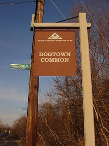 The entrance to Dogtown Commons, on Cherry Street
- Dogtown Common
- Ravenswood Park
- Annisquam
- Norman's Woe, known for several shipwrecks, including the The Wreck of the Hesperus
- The schooner Adventure
- Rocky Neck Art Colony, America's oldest working art colony
Gloucester's most noted landmark is the harborside "Man at the Wheel" statue (also known as the "Gloucester Fisherman's Memorial Cenotaph"), dedicated to "They that go down to the sea in ships", which is a quote from Psalm 107:23-32.
Gloucester has a professional theatre company known as Gloucester Stage Company, which stages five to eight plays each season, primarily in the summer months. Located in East Gloucester, the theatre sits at water's edge overlooking Smith's Cove. It was founded in 1979 by local arts and business leaders to encourage playwrights and their new works. Israel Horovitz is the GSC's artistic director, and has been since he helped found it, though he is retiring after the 2006 season. Over the years, plays developed at Gloucester Stage Company have gone on to critical acclaim and popular success, on and off Broadway, nationally and internationally. The group draws theatre-goers from Gloucester, neighboring North Shore districts, greater Boston area, as well as seasonal residents and tourists.
Gloucester's largest annual event is St. Peter's Fiesta, sponsored by the local Italian-American community. It is held the weekend closest to the saint's feast day. Highlights include the blessing of the fleet, and the greasy pole contest.
The city has much significant architecture, from pre-revolutionary houses to the hilltop 1870 City Hall, which dominates the town and harbor. It also has exotic waterfront homes now converted to museums, including Beauport, built 1907–1934 by designer Henry Davis Sleeper in collaboration with local architect Halfdan Hanson, said to raise eclecticism to the level of genius. In addition, it has Hammond Castle, built 1926–1929 by inventor John Hays Hammond, Jr. as a setting for his collection of Roman, Medieval and Renaissance artifacts. Gloucester was also the home of feminist writer Judith Sargent Murray and John Murray, the founder of the first Universalist Church in America. Their house still exists as the Sargent House Museum. Many museums are located in the main downtown area, such as the Cape Ann Historical Association, and the Gloucester Maritime Heritage Center.
Notable residents
This is an incomplete list of one-time residents of Gloucester, Massachusetts
- A. Piatt Andrew, congressman, Assistant Treasury Secretary, and Harvard professor
- The Ashcan School artists such as Robert Henri, John Sloan, Edward Hopper, and William Glackens spent their summers painting in Gloucester
- Roger Babson, founder of Babson College and presidential candidate for the Prohibition Party in 1940
- Cecilia Beaux, painter and society portraitist
- Howard Blackburn, fisherman and adventurer
- Hugo Burnham, drummer and founding member of British post-punk band Gang of Four
- Clarence Birdseye, founder of the modern frozen food industry
- Phil Bolger, Prolific 20th century boat designer with 668 designs to his credit, designed the Canadian-built tall ship HMS Rose later renamed HMS Surprise for use in Master and Commander: The Far Side of the World
- Virginia Lee Burton (1909–1968) children's book author and illustrator (The Little House and Mike Mulligan and His Steam Shovel), founder of the Folly Cove Designers group.
- Bo Burnham – Actor,Comedian, Grew up in Gloucester
- Roger Cressey, former member of the United States National Security Council, terrorism analyst for NBC News, president of Good Harbor Consulting, and adjunct professor at Georgetown University
- Vincent Ferrini, poet, first Poet Laureate of Gloucester
- Henry Ferrini, critically acclaimed independent filmmaker, nephew of Vincent Ferrini
- Gregory Gibson, author of Goneboy: a Walkabout, Demon of the Waters and Hubert's Freaks
- Whoopi Goldberg, actress and comedian, summers in Gloucester
- Emil Gruppe, painter
- John Hays Hammond, Jr., inventor known as "The Father of Radio Control", built Hammond Castle as his home and laboratory
- Walker Hancock, sculptor
- Israel Horovitz playwright
- Alpheus Hyatt, American naturalist and paleontologist
- Alfred "Centennial" Johnson, first recorded single-handed crossing of the Atlantic Ocean
- Fitz Henry Lane, Luminist painter, was born and lived in Gloucester
- Tony Millionaire, artist and animator best known for his comic strip Maakies and Cartoon Network's Drinky Crow Show, grew up in Gloucester. [1]
- William Monahan, Academy Award–winning American screenwriter.
- The Rev. Sun Myung Moon, leader of the Unification Church, spent a great deal of time in Gloucester and the Unification Church at one time held a large amount of waterfront property. [2]
- John Murray, founder of the Universalist denomination in the United States
- Judith Sargent Murray, feminist, essayist, playwright, and poet
- Charles Olson, Black Mountain College poet
- Herb Pomeroy, influential jazz musician, was born in Gloucester
- Marc Randazza, First Amendment lawyer, legal commentator, and legal author was born in Gloucester. He maintains a portion of his law practice in Gloucester.
- Benjamin A. Smith II, former U.S. Senator from Massachusetts (1960–1962), Mayor of Gloucester (1954–1955), was born in Gloucester
- Ben Smith, Olympic ice hockey coach, son of Benjamin A. Smith II, was born in Gloucester.[18]
- William Stacy (1734–1802) American Revolutionary War officer, and pioneer to the Ohio Country, was born in Gloucester.[19]
- Capt. Marty Welch, schooner captain, winner of first International Fishing Schooner Championship Races.
- Jacques-Yves Cousteau, Invented and tested the "Aqua Lung" SCUBA regulator in Lanesville village on the Northern part of Gloucester's Cape Ann
References
- ^ "US Gazetteer files: 2010, 2000, and 1990". United States Census Bureau. 2011-02-12. http://www.census.gov/geo/www/gazetteer/gazette.html. Retrieved 2011-04-23.
- ^ "TOTAL POPULATION (P1), 2010 Census Summary File 1, All County Subdivisions within Massachusetts". United States Census Bureau. http://factfinder2.census.gov/bkmk/table/1.0/en/DEC/10_SF1/P1/0400000US25.06000. Retrieved September 13, 2011.
- ^ "Massachusetts by Place and County Subdivision - GCT-T1. Population Estimates". United States Census Bureau. http://factfinder.census.gov/servlet/GCTTable?_bm=y&-geo_id=04000US25&-_box_head_nbr=GCT-T1&-ds_name=PEP_2009_EST&-_lang=en&-format=ST-9&-_sse=on. Retrieved July 12, 2011.
- ^ "1990 Census of Population, General Population Characteristics: Massachusetts". US Census Bureau. December 1990. Table 76: General Characteristics of Persons, Households, and Families: 1990. 1990 CP-1-23. http://www.census.gov/prod/cen1990/cp1/cp-1-23.pdf. Retrieved July 12, 2011.
- ^ "1980 Census of the Population, Number of Inhabitants: Massachusetts". US Census Bureau. December 1981. Table 4. Populations of County Subdivisions: 1960 to 1980. PC80-1-A23. http://www2.census.gov/prod2/decennial/documents/1980a_maABC-01.pdf. Retrieved July 12, 2011.
- ^ "1950 Census of Population". Bureau of the Census. 1952. Section 6, Pages 21-10 and 21-11, Massachusetts Table 6. Population of Counties by Minor Civil Divisions: 1930 to 1950. http://www2.census.gov/prod2/decennial/documents/23761117v1ch06.pdf. Retrieved July 12, 2011.
- ^ "1920 Census of Population". Bureau of the Census. Number of Inhabitants, by Counties and Minor Civil Divisions. Pages 21-5 through 21-7. Massachusetts Table 2. Population of Counties by Minor Civil Divisions: 1920, 1910, and 1920. http://www2.census.gov/prod2/decennial/documents/41084506no553ch2.pdf. Retrieved July 12, 2011.
- ^ "1890 Census of the Population". Department of the Interior, Census Office. Pages 179 through 182. Massachusetts Table 5. Population of States and Territories by Minor Civil Divisions: 1880 and 1890. http://www2.census.gov/prod2/decennial/documents/41084506no553ch2.pdf. Retrieved July 12, 2011.
- ^ "1870 Census of the Population". Department of the Interior, Census Office. 1872. Pages 217 through 220. Table IX. Population of Minor Civil Divisions, &c. Massachusetts. http://www2.census.gov/prod2/decennial/documents/1870e-05.pdf. Retrieved July 12, 2011.
- ^ "1860 Census". Department of the Interior, Census Office. 1864. Pages 220 through 226. State of Massachusetts Table No. 3. Populations of Cities, Towns, &c.. http://www2.census.gov/prod2/decennial/documents/1860a-08.pdf. Retrieved July 12, 2011.
- ^ "1850 Census". Department of the Interior, Census Office. 1854. Pages 338 through 393. Populations of Cities, Towns, &c.. http://www2.census.gov/prod2/decennial/documents/1850c-11.pdf. Retrieved July 12, 2011.
- ^ "1950 Census of Population". Bureau of the Census. 1952. Section 6, Pages 21-7 through 21-09, Massachusetts Table 4. Population of Urban Places of 10,000 or more from Earliest Census to 1920. http://www2.census.gov/prod2/decennial/documents/23761117v1ch06.pdf. Retrieved July 12, 2011.
- ^ "American FactFinder". United States Census Bureau. http://factfinder.census.gov. Retrieved 2008-01-31.
- ^ US Census Fact Finder
- ^ "Registration and party enrollment statistics as of October 15, 2008" (PDF). Massachusetts Elections Division. http://www.sec.state.ma.us/ele/elepdf/st_county_town_enroll_breakdown_08.pdf. Retrieved 2010-05-08.
- ^ In 1987, Will Murrray took a field trip to Newburyport and Gloucester to research locales from Lovecraft's "The Shadow Over Innsmouth". In Newburyport there is a State Street (the street where the narrator of the story boards a bus to Innsmouth) and a State Street YMCA (where the protagonist roomed and where Lovecraft himself may have stayed during his visit to the town). When he visited Gloucester, Murray found a Gilman House — more formally, the Sargeant-Murray-Gilman-Hough House — a hotel in the story but in real life a Georgian-era mansion turned into a public museum. He also found other landmarks mentioned in the story, including streets named Adams Church, Babson, Main, and Fish, and a building adorned with large, white wooden pillars on its front and side — the Legion Memorial Building — that looks remarkably like the story's Masonic Lodge (the meeting place for the Esoteric Order of Dagon). The Legion Building, built in 1844–45, served as the Gloucester Town Hall until 1867 when it became the Forbes School. Saving it from demolition, the American Legion took over the building in 1919 and, a year later, added a columned portico to the Middle Street side to match the Washington Street frontage. It has never been a Masonic Lodge, however. (Murray, "I Found Innsmouth!", Crypt of Cthulhu #57.)
- ^ Welcome to the Michael Tougias Web
- ^ "Women's Hockey: Smith is a study in history". Pittsburgh Post-Gazette. February 18, 2002. http://www.post-gazette.com/olympics/20020218olyhockfill0218p8.asp. Retrieved July 25, 2011.
- ^ Lemonds, Leo L.: Col. William Stacy – Revolutionary War Hero, Cornhusker Press, Hastings, Nebraska (1993) p. 13, 15, 61.
External links
- City of Gloucester website
- "Vital Records of Gloucester, MA to the end of the year 1849". The Massachusetts Vital Records Project. 2005-2010. http://ma-vitalrecords.org/MA/Essex/Gloucester/. Retrieved 7 August 2010.
- 1872 Map of Gloucester plate 80-81 Atlas of Essex County published 1872.
- 1872 Map of Gloucester Center - Inner Harbor plate 83 Atlas of Essex County published 1872.
- "Plate 0085, Lanesville, Bayview, Annisquam". Essex County 1872. salemdeeds.com. http://www.salemdeeds.com/atlases_pages.asp?ImageName=PLATE_0085.jpg&atlastype=Atlases&atlastown=ESSEX+COUNTY&atlas=ESSEX+COUNTY+1872&atlas_desc=ESSEX+COUNTY+1872&pageprefix.
Municipalities and communities of Essex County, Massachusetts Cities 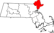
Towns Andover | Boxford | Danvers | Essex | Georgetown | Groveland | Hamilton | Ipswich | Lynnfield | Manchester-by-the-Sea | Marblehead | Merrimac | Middleton | Nahant | Newbury | North Andover | Rockport | Rowley | Salisbury | Saugus | Swampscott | Topsfield | Wenham | West Newbury
CDPs Other
villagesAnnisquam | Ballardvale | Beverly Farms | Bradford | Byfield | Clifton | Plum Island
Categories:- Gloucester, Massachusetts
- Cities in Massachusetts
- Populated coastal places in Massachusetts
- Populated places established in 1623


Wikimedia Foundation. 2010.