- Attleboro, Massachusetts
:"See also:
Attleborough ,United Kingdom "Infobox Settlement
official_name = Attleboro, Massachusetts
nickname =
motto =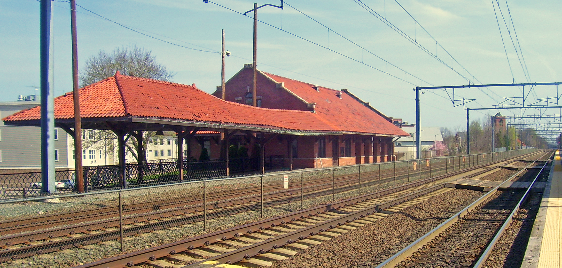
imagesize =
image_caption = Historic Attleboro train station
image_
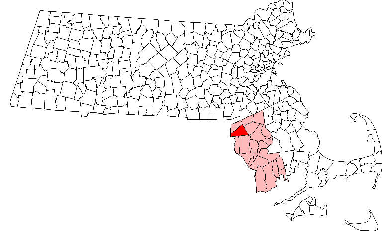
mapsize = 250px
map_caption = Location in Bristol County in Massachusetts
mapsize1 =
map_caption1 =
subdivision_type = Country
subdivision_name =United States
subdivision_type1 = State
subdivision_name1 =Massachusetts
subdivision_type2 = County
subdivision_name2 = Bristol
established_title = Settled
established_date = 1634
established_title2 = Incorporated
established_date2 = 1694 (town)
established_title3 = Reincorporated
established_date3 = 1914 (city )
government_type = Mayor-council city
leader_title =Mayor
leader_name =Kevin Dumas
leader_title1 =
leader_name1 =
area_magnitude =
area_total_km2 = 73.2
area_total_sq_mi = 28.3
area_land_km2 = 71.3
area_land_sq_mi = 27.5
area_water_km2 = 2.0
area_water_sq_mi = 0.8
population_as_of = 2007
settlement_type =City
population_total = 43,113
population_density_km2 = 604.7
population_density_sq_mi = 1,567.7
elevation_m = 42
elevation_ft = 138
timezone = Eastern
utc_offset = -5
timezone_DST = Eastern
utc_offset_DST = -4
latd = 41 |latm = 56 |lats = 40 |latNS = N
longd = 71 |longm = 17 |longs = 10 |longEW = W
website = [http://www.cityofattleboro.us/ www.cityofattleboro.us]
postal_code_type = ZIP code
postal_code = 02703
area_code = 508 / 774
blank_name = FIPS code
blank_info = 25-02690
blank1_name = GNIS feature ID
blank1_info = 0612033
footnotes =Attleboro is a city in Bristol County,
Massachusetts ,United States and is immediately north ofPawtucket, Rhode Island . Once known as "The Jewelry Capital of the World" for its many jewelry manufacturers, Attleboro had a population of 42,068 at the 2000 censusGR|2.History
Attleboro was incorporated from part of Rehoboth in 1694 as the Town of Attleborough. It was reincorporated in 1914 as the City of Attleboro. Attleboro included the town of North Attleborough until 1887, and
Cumberland, Rhode Island , until 1747. When the city re-incorporated in 1914, the "-ugh" was removed from the name; North Attleborough kept it. Like many towns in Massachusetts, it was named for a British town.During the colonial period,
Nathaniel Woodcock lived in North Attleboro. During the Native American insurgency Woodcock's son was murdered and his head was placed on a pole in his front yard. The house where Woodcock lived is now a historical monument. It is rumoredGeorge Washington once passed through and stayed near the Woodcock Garrison House at the Hatch Tavern where he swapped one shoe buckle with Israel Hatch, a revolutionary soldier and new owner of the Garrison House.The city became known for jewelry manufacturing, notably through the
L.G. Balfour Company starting in 1913. However, the company has since moved out of the city, with the site of the former plant turned into a riverfront park. The Balfour Company was not the only jewelry manufacturer or supplier to the jewelry manufacturing trade in Attleboro. At one time, Attleboro was known as "The Jewelry Capital of the World." There are jewelry related manufacturing firms in Attleboro which continue to operate. One of these companies is Guyot Brothers Company, [cite web | url=http://www.guyotbrothers.com/aboutus.htm | title=Brief history of jewelry findings manufacturer Guyot Brothers | publisher=Guyot Brothers Company, Inc. | year=2003-2007 | accessdate=2007-06-09] which was started in 1904. General Findings, M.S. Company, James A. Murphy Co., Garlan Chain, and Masters of Design, which was started by former Balfour employees, are still jewelry related manufacturing companies still currently in operation.Geography
Attleboro is located at coor dms|41|55|41|N|71|18|52|W|city (41.928099, -71.314564).GR|1 According to the
United States Census Bureau , the city has a total area of 28.3square mile s (73.2km² ), of which, 27.5 square miles (71.3 km²) of it is land and 0.8 square miles (2.0 km²) of it (2.72%) is water. Its borders are the shape of an irregular polygon, resembling a pointless triangle pointed west. It is bordered byNorth Attleborough, MA to the north,Mansfield, MA ,Norton, MA to the east,Rehoboth, MA ,Seekonk, MA andPawtucket, RI , to the south, andCumberland, RI , to the west. It includes the localities of Briggs Corner, Dodgeville, East Junction, Hebronville, and South Attleboro.The
Ten Mile River , a tributary to the Blackstone River, runs through the center of Attleboro, and is fed by several brooks and the Bungay River. Several small ponds are in the city, as well as the Manchester Pond Reservoir, located along Interstate 95. There are also two reservation areas, the Antony Lawrence Reservation Area and Coleman Reservation Area, as well as the Bungay River Conservation Area located in the north of the city.Demographics
Attleboro is officially a part of the
Providence metropolitan area .As of the
census GR|2 of 2000, there were 42,068 people, 16,019 households, and 10,924 families residing in the city, and thepopulation density was 1,529.1 people per square mile (590.4/km²). There were 16,554 housing units at an average density of 601.7/sq mi (232.3/km²). The racial makeup of the city was 91.30% White, 1.64% African American, 0.16% Native American, 3.25% Asian, 0.04% Pacific Islander, 1.82% from other races, and 1.79% from two or more races. Hispanic or Latino of any race were 4.29% of the population.There were 16,019 households out of which 33.4% had children under the age of 18 living with them, 53.6% were married couples living together, 10.6% had a female householder with no husband present, and 31.8% were non-families. 25.7% of all households were made up of individuals and 9.4% had someone living alone who was 65 years of age or older. The average household size was 2.57 and the average family size was 3.12.
In the city the population was spread out with 25.4% under the age of 18, 6.8% from 18 to 24, 34.0% from 25 to 44, 21.0% from 45 to 64, and 12.9% who were 65 years of age or older. The median age was 36 years. For every 100 females there were 94.5 males. For every 100 females age 18 and over, there were 91.0 males.
The median income for a household in the city was $50,807, and the median income for a family was $59,112. Males had a median income of $40,331 versus $28,769 for females. The
per capita income for the city was $22,660. About 3.7% of families and 6.2% of the population were below thepoverty line , including 5.6% of those under age 18 and 10.1% of those age 65 or over.Education
Attleboro has its own school department, with five elementary schools (Hill-Roberts, Hyman Fine, A. Irvin Studley, Peter Thacher and Thomas Willett), three middle schools (Brennan, Coelho and Wamsutta), and Attleboro High School. Attleboro High School's nickname is the Blue Bombardiers, and the school mascot is an eagle. They have a traditional rivalry with North Attleborough High School, whom they play for their Thanksgiving Day football game.
In addition to Attleboro High School, which has its own vocational division, students from the city and surrounding towns may choose to attend
Bishop Feehan High School , a Roman Catholic high school opened in 1961 and named for BishopDaniel Francis Feehan , second Bishop of the Diocese of Fall River. The city also has a satellite branch ofBristol Community College , which is located in the city's former high school building.Points of interest
Attleboro has four museums, including the Attleboro Arts Museum, Attleboro Area Industrial Museum, [cite web | url=http://www.industrialmuseum.com/About%20AAIM.htm | title=About Attleboro Area Industrial Museum | publisher=Attleboro Area Industrial Museum, Inc. | year=2007 | accessdate=2007-06-09] the Women at Work Museum, and the Museum at the Mill. Other points of interest within the city include:
*Capron Park, which houses azoo [cite web | url=http://www.capronparkzoo.com/about.htm | title=About the Capron Park Zoo | publisher=Capron Park Zoo | year=2007 | accessdate=2007-06-09]
*L.G. Balfour Riverwalk, which was once the site of the L.G. Balfour jewelry plant, is adjacent to the downtown business district.
*LaSalette Shrine which has a Christmas light display [cite web | url=http://www.lasalette-shrine.org/historyoflasaletteshrine.html | title=The History of the National Shrine of Our Lady of La Salette | publisher=National Shrine of Our Lady of La Salette | year=2007 | accessdate=2007-06-09]
*Triboro Youth Theatre / Triboro Musical Theatre [cite web | url=http://www.triboroyouththeatre.org/tyt/home_full.htm | title=Triboro Youth Theatre | year=2007 | accessdate=2007-06-09]
*Dodgeville MillTransportation
Attleboro is located along I-95 (which enters the state between Attleboro and Pawtucket, Rhode Island), I-295 (whose northern terminus is near the North Attleborough town line at I-95), and US 1, as well as Routes 1A, 118, 123 and 152, the last three all intersecting at Attleboro center. The city is also home to two MBTA commuter rail stations: one in the downtown area and the other near the Rhode Island border in the South Attleboro district.
Attleboro and Taunton are both served by
Greater Attleboro-Taunton Regional Transit Authority , or GATRA, which provides bus transit between the two cities and the surrounding regions.Religion
The religions represented by the churches in Attleboro reveal the historic ethnic makeup of the community. The five
Roman Catholic churches — St. John, St. Stephen, St. Joseph, St. Theresa of the Little Flower, and Holy Ghost — reflect the English/Irish, formerly French now Hispanic, and Portuguese, neighborhoods, respectively.All Saints Episcopal Church (1890) on North Main Street represents that traditional English presence in the community — though the church is now very diverse. In 2007 All Saints Episcopal Church divided over the liberal policies of the ECUSA resulting in the establishment of All Saints Anglican Church in the Hebronville village of Attleboro which is affiliated with an Anglican diocese under a Bishop in Uganda.
Second Congregational Church (1748), located near the town common, is typical of a New England town. Second Congregational had a stately white clapboard building that was destroyed by fire. A red brick building replaced it in the early 1900s.Bethany Village Fellowship , formerly Bethany Congregational Church, (1886) is located in South Attleboro at 516 Newport Ave.Murray Unitarian-Universalist Church (1875) on North Main Street is also typical of a New England town.Evangelical Covenant Church (1903) on North Main Street recently celebrated its 100th anniversary. It was historically "the Swedish church," though it includes many different ethnic groups today.Congregation
Agudas Achim on Kelly Boulevard is part of the Jewish Reconstructionist movement.There are a number of Protestant denominations represented in Attleboro including Baptist (Grace Baptist on Oakhill Avenue, the Bible Baptist on Union Street, and 1st Baptist on South Main),
Christian & Missionary Alliance (Faith Alliance on Pleasant),Advent Christian (also on Pleasant),Fruit of the Spirit Mission Church {located on Leroy Street),Assembly of God (theSouth Attleboro AOG on Newport Avenue), andNew Covenant Church on North Main Street (Rt. 152).There are also numerous non-denominational churches such as [http://www.gnbc.org Good News Bible Chapel] on West Street (1935), [http://www.candleberryministries.com Candleberry Ministries] on South Main St. (Rt. 152), and a handful of ethnic congregations started through
church planting .The Salvation Army
Bridges of Hope located on Mechanic Street offers Sunday Services as well as weekday and evening support services including "Bridging the Gap" for adolescent support.The Attleboro Area Council of Churches is very active in the community.
The Body of Christ , a new religious movement, was founded in Attleboro.Cancer
In late 2003, "
The Sun Chronicle " reported that a state probe had been launched into the deaths of four city women from glioblastoma. As of October 2005, no report has been issued, and the status of the probe is unknown.Scorecard,
Environmental Defense 's online database of polluters, lists seven facilities contributing to cancer hazards in Attleboro, including Engineered Materials Solutions Inc., the worst offender in Massachusetts. [cite web | url=http://www.scorecard.org/env-releases/state-facility-ranks.tcl?fips_state_code=25&type=tep&category=cancer&modifier=NA | title=Facilities Contributing to Cancer Hazards in Massachusetts | publisher=Scorecard | year=2005 | accessdate=2007-06-09]In 2002, the Massachusetts Public Health Department was asked to evaluate the former Shpack Landfill, on the border of Norton and Attleboro, for its cancer risks. The investigation continued through at least 2004. [cite web | url=http://cbs4boston.com/iteam/local_story_062160436.html | title=Cancer Clusters | date=
March 2 2004 | publisher=WBZ News (I-Team) | accessdate=2007-06-09] [cite web | author=Massey, Joanna | url=http://www.boston.com/news/local/articles/2004/01/25/norton_leaders_upset_at_us_delay_on_cleanup?mode=PF | title=Norton leaders upset at US delay on cleanup | date=January 25 2004 | pubisher=The Boston Globe | accessdate=2007-06-09] The informal landfill included uranium fuel rods, heavy metals, andvolatile organic compounds . [cite web | url=http://www.epa.gov/region01/superfund/sites/shpack/ | title=Waste Site Cleanup & Reuse in New England — Shpack Landfill | publisher=US Environmental Protection Agency | date=February 15 2007 | accessdate=2007-06-09]Notable residents
*
Roger Bowen , (1932-1996), American comedic actor and novelist, known for his portrayal of Lt. Col. Henry Blake in the 1970 filmM*A*S*H . Co-founder of famed comedy troupeThe Second City .
*George Bradburn , an abolitionist and women's rights campaigner was born here in 1806. [http://www.archive.org/stream/memorialofgeorge00braduoft A Memorial of George Bradburn] , Frances H. Bradburn, 1883]
*Geoff Cameron , (1985- ), professional soccer player (MLS) for the Houston Dynamo.
*Horace Capron , (1804-1885),Union Army officer duringAmerican Civil War , later an agricultural advisor toJapan whose methods revolutionized Japanese agriculture cite book | title = Who Was Who in America, Historical Volume, 1607-1896 | publisher = Marquis Who's Who | location = Chicago | date = 1963]
*David Cobb, (1748-1830),major general of theContinental Army , speaker of theMassachusetts House of Representatives ,United States Congress man from Massachusetts
*Ray Conniff , (1916-2002), prolificeasy listening musician, known for his sentimental renditions of standard songs.
*Walter Cryan , (1935-), long time news anchor forWPRI-TV andWLNE-TV television stations inProvidence , RI.
*Tom Cuddy , (1955-), journalist, sports announcer, former program director for ABC Capital City Radio. Associated with a variety of Boston and Providence radio stations.
*David Daggett , (1764-1851), United States Senator, associate justice ofConnecticut Supreme Court ,mayor ofNew Haven, Connecticut , and a founder of theYale Law School .
*Naphtali Daggett , (1727-1780),Presbyterian clergyman , professor of divinity atYale University , fought in theAmerican Revolutionary War .
*William Manchester , (1922-2004),historian andbiographer . HisThe Death of a President was his most controversial work.
*Bazaleel Mann , (1724-1796), eminent physician and a prominentpatriot of the (American Revolution ). Dr Mann was a member of the committee to report on the first constitution submitted to the people of Massachusetts, was a judge of theSuperior Court ofAttleboro [cite web | url=http://home.comcast.net/~richardson156/mannn.html | title=Newton Mann | publisher=TheBoston History Company | date=1896 | accessdate=2007-06-21] .
*Newton Mann , (1770-1860) leftAttleboro and moved toWhitesboro, NY in 1806 was an industrialist creating the first cotton factory inNew York . Mann was a prominent Whig and an outspokenAbolitionist . He created a safe-house in theunderground railroad helping many runawayslaves get toCanada [cite web | url=http://home.comcast.net/~richardson156/mannn.html | title=Newton Mann | publisher=TheBoston History Company | date=1896 | accessdate=2007-06-21] .
*Jonathan Maxcy , (1768-1820),Baptist clergyman and president ofBrown University .
*Virgil Maxcy , (1785-1844), member of theMaryland House of Delegates and theMaryland State Senate , later first solicitor of the treasury andcharge d'affaires at the United States embassy inBelgium .
*Daniel Read , (1757-1836),composer published 400 hymns in several collections [cite web | url=http://www.biography.com/search/article.do?id=9453054 | title=Danie Read | publisher=TheHistory Channel | accessdate=2007-06-21] .
*Robert Rounseville (1914-1974), operatic tenor, who appeared in the films "The Tales of Hoffmann" and "Carousel", and onstage in the original productions of the musicals "Candide" and "Man of La Mancha ".
*Preston Masterson , (1991-), graphic designer, musician, and accused computer hacker, known for his work at in theAttleboro Public Schools .
*Robert A. Weygand , (1948-), member of US House of Representatives 1997-2001 [cite web | url=http://bioguide.congress.gov/scripts/biodisplay.pl?index=W000315 | title=Weygand, Rober A | publisher=TheUnited States Congress | accessdate=2007-06-21]
*Mark Williams, (1956- ), controversial television, radio and newspaper personalityReferences
Nick R - fatass
External links
* [http://www.cityofattleboro.us/ City of Attleboro Home Page]
* [http://www.theattleborozone.com/ City Guide for All of the Attleboros]
* [http://www.attleborochamber.com/ Attleboro Chamber of Commerce]
* [http://www.attleboroschools.com/ Attleboro Public Schools]
* [http://www.sailsinc.org/attleboro/apl.asp Attleboro Public Library]
* [http://www.attleboro.org Attleboro History and Community]
* [http://www.keystomynewhouse.com Attleboro Real Estate Agent]
Wikimedia Foundation. 2010.