- Berkley, Massachusetts
Infobox Settlement
official_name = Berkley, Massachusetts
nickname =
motto =
imagesize =
image_caption = An 1895 map of Berkley
image_
mapsize = 250px
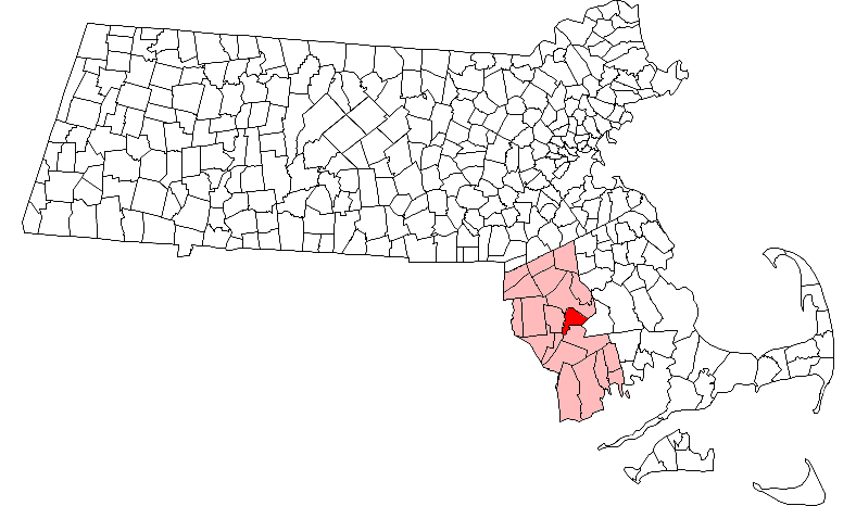
map_caption = Location in Bristol County in Massachusetts
mapsize1 =
map_caption1 =
subdivision_type = Country
subdivision_name =United States
subdivision_type1 = State
subdivision_name1 =Massachusetts
subdivision_type2 = County
subdivision_name2 = Bristol
established_title = Settled
established_date = 1638
established_title2 = Incorporated
established_date2 = 1735
established_title3 =
established_date3 =
government_type =Open town meeting
leader_title =
leader_name =
leader_title1 =
leader_name1 =
area_magnitude =
area_total_km2 = 45.0
area_total_sq_mi = 17.4
area_land_km2 = 42.8
area_land_sq_mi = 16.5
area_water_km2 = 2.1
area_water_sq_mi = 0.8
population_as_of = 2000
settlement_type = Town
population_total = 5749
population_density_km2 = 134.2
population_density_sq_mi = 347.6
elevation_m = 24
elevation_ft = 80
timezone = Eastern
utc_offset = -5
timezone_DST = Eastern
utc_offset_DST = -4
latd = 41 |latm = 50 |lats = 45 |latNS = N
longd = 71 |longm = 05 |longs = 00 |longEW = W
website = [http://www.townofberkley.com/ www.townofberkley.com]
postal_code_type = ZIP code
postal_code = 02779
area_code = 508 / 774
blank_name = FIPS code
blank_info = 25-05280
blank1_name = GNIS feature ID
blank1_info = 0619432
footnotes =Berkley is a town in Bristol County,
Massachusetts ,United States . The population was 5,749 at the 2000 census, making it the least populated town in the county.History
Berkley was first settled in 1638 and was officially incorporated in 1735. It was named for the philosopher and Bishop
George Berkeley (1685-1753), who lived in Newport, RI from 1728 to 1731. The extra 'e' was apparently dropped by mistake when officially registered by the State House. The town was formerly part of Taunton,Massachusetts and Dighton,Massachusetts .Geography
According to the
United States Census Bureau , the town has a total area of 17.4 square miles (45.0 km²), of which, 16.5 square miles (42.8 km²) of it is land and 0.8 square miles (2.1 km²) of it (4.72%) is water. The town is bordered by the Taunton River and Dighton to the west, Taunton to the north and northeast, Lakeville to the east, and the Assonet Bay and Freetown to the south. The mostly rural town is also the home to Dighton Rock State Park, the home ofDighton Rock , a tidal boulder well known for its strange markings which have been theorized to be totally or partially attributed to Vikings, Wampanoags, or Portuguse explorerMiguel Corte-Real .The town can be accessed by two state routes, Route 24 and Route 79. Route 24, a four-lane divided freeway, bisects the town, and includes one exit for the town at Padelford Street. Route 79 passes along the town's border with Lakeville, and meets Route 140 just across the town line in Taunton. The town is also known for the
Berkley-Dighton Bridge , which crosses the Taunton River to Dighton. The one-lane bridge, designed in 1896 was built in the 1890s, is the only bridge to cross the river between theBrightman Street Bridge between Fall River and Somerset, and the Plain Street Bridge in Taunton, a distance of 12.5 miles (20.1 km).Demographics
As of the
census GR|2 of 2000, there were 5,749 people, 1,843 households, and 1,566 families residing in the town. Thepopulation density was 347.6 people per square mile (134.2/km²). There were 1,885 housing units at an average density of 114.0/sq mi (44.0/km²). The racial makeup of the town was 96.73% White, 0.56% African American, 0.14% Native American, 0.37% Asian, 0.03% Pacific Islander, 1.06% from other races, and 1.11% from two or more races. Hispanic or Latino of any race were 0.96% of the population.There were 1,843 households out of which 47.1% had children under the age of 18 living with them, 73.8% were married couples living together, 7.5% had a female householder with no husband present, and 15.0% were non-families. 10.8% of all households were made up of individuals and 3.9% had someone living alone who was 65 years of age or older. The average household size was 3.11 and the average family size was 3.35.
In the town the population was spread out with 30.5% under the age of 18, 6.0% from 18 to 24, 36.0% from 25 to 44, 21.1% from 45 to 64, and 6.5% who were 65 years of age or older. The median age was 35 years. For every 100 females there were 98.7 males. For every 100 females age 18 and over, there were 97.3 males.
The median income for a household in the town was $66,295, and the median income for a family was $69,222. Males had a median income of $45,154 versus $31,639 for females. The
per capita income for the town was $21,652. About 0.7% of families and 2.5% of the population were below thepoverty line , including 0.6% of those under age 18 and 7.6% of those age 65 or over.Government
Town government
Executive Branch: Three-member Board of Selectmen with three-year staggered terms.
Legislative Branch: OpenTown Meeting .Board of Selectmen tate government
Representative in General Court
*David B. Sullivan (D-Fall River), 6th Bristol DistrictSenator in General Court
*Marc Pacheco (D-Taunton), 1st Plymouth and Bristol DistrictGovernor's Councillor
*Carole A. Fiola (D-Fall River), 1st DistrictFederal government
Representative to the
United States House of Representatives
*Barney Frank (D-Newton) (4thMassachusetts District)Senators in the
United States Senate
*Edward Kennedy (D)
*John Kerry (D)Education
*Berkley Community School - Grades Pre-K through 4
*Berkley Middle School - Grades 5 through 8
*High School: Currently, Berkley has a tuition agreement with Somerset High School. However, as of 2006 there has been talk within the town of the feasibility of building a town high school. As of 2006, there are 255 high school-aged students in the town, a number which is projected to grow to over 300 within the next 5-10 years. [ [http://berkley.homeip.net/moodle/ Source: Berkley Public Schools] ]High school students may also attend
Bristol County Agricultural High School in Dighton,Bristol-Plymouth Regional Technical School in Taunton, or local private and parochial schools; the closest Catholic high school isCoyle and Cassidy High School in Taunton.Local attractions
Created by the Berkley Historical Commission, the Bridge Village Heritage Park is at 70 Elm Street at the south-east abutment to the Berkley-Dighton Bridge. Opened October 2006, this convert|.5|acre|m2|sing=on area is aimed at canoeing and kayaking. Motor boats and boats in tow are prohibited. It is also an ideal place for fisherman, picnickers, historians, and children.
See also
*
Dighton Rock
*Greater Taunton Area
*Taunton River Watershed References
External links
* [http://www.csc-ma.us/Communities/Berkley/Berkley.htm Berkley Board of Assessors' Official Home Page]
* [http://townofberkley.com Berkley's Unofficial Home Page]
* [http://www.mass.gov/portal/index.jsp?pageID=mg2localgovccpage&L=1&L0=home&L1=Resident&sid=massgov2&selectCity=Berkley Town of Berkley]
Wikimedia Foundation. 2010.