- Northampton, Massachusetts
-
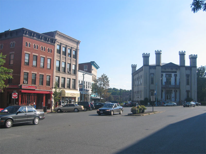
Northampton, Massachusetts — City — Northampton, Massachusetts Main Street
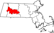
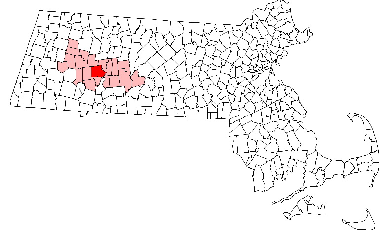
SealNickname(s): The Meadow City[1], Hamp, Lesbianville USA,[2][3] NoHo, NTown, Paradise City Motto: Caritas, educatio, justitia (Latin "Caring, education and justice") Location in Hampshire County in Massachusetts
Coordinates: 42°19′30″N 72°38′30″W / 42.325°N 72.64167°W Country United States State Massachusetts County Hampshire Settled and Charter granted 1654 Incorporated as a city 1884 Government - Type Mayor-council city - Mayor Acting Mayor David Narkewicz Area - Total 35.6 sq mi (92.2 km2) - Land 34.5 sq mi (89.3 km2) - Water 1.1 sq mi (3.0 km2) Elevation 248 ft (76 m) Population (2000) - Total 28,978 - Density 841.0/sq mi (324.7/km2) Time zone Eastern (UTC-5) - Summer (DST) Eastern (UTC-4) ZIP code 01060 Area code(s) 413 FIPS code 25-46330 GNIS feature ID 0606674 Website www.northamptonma.gov The city of Northampton is the county seat of Hampshire County, Massachusetts, United States. As of the 2010 census, the population of Northampton's central neighborhoods, (excluding its outer, incorporated villages, Florence, Massachusetts and Leeds, Massachusetts,) was 28,549. Northampton is part of the Pioneer Valley, and also one of the northernmost cities in the Knowledge Corridor - a cross-state cultural and economic partnership with other Connecticut River Valley cities and towns.
Northampton is home to Smith College and the Clarke School for the Deaf. Smith students (along with those of the associated Five Colleges) contribute to Northampton's "college town" atmosphere.
Today, Northampton is known as an artistic, musical, and counter-culture hub. It features a large and politically influential LGBT community, along with numerous alternative health and intellectual organizations.[4] Based on U.S. Census demographics, election returns, and other criteria, the website Epodunk rates Northampton as the most politically liberal medium-sized city (population 25,000-99,000) in the United States.[5]
Northampton is considered part of the Springfield Metropolitan Area, one of Massachusetts' two separate metropolitan areas. It sits approximately 15 miles north of the City of Springfield, Massachusetts.
Contents
History
Early Settlement
The area now called Northampton was once known as Norwottuck, or Nonotuck, meaning "the midst of the river"[6] by its original Pocumtuc inhabitants. According to various accounts, Northampton was named by John King (1629–1703), one of its original settlers, or possibly in his honor, since it is supposed that he came to Massachusetts from Northampton, England (Allen 9, Dwight 10, Leach 124).
The Pocumtuc confederacy occupied the Connecticut River Valley, from what is now southern Vermont and New Hampshire into northern Connecticut. The Pocumtuc tribes were Algonquian, and traditionally allied with the Mahican confederacy to the west. By 1606, an ongoing struggle between the Mahican and Iroquois confederacies led to direct attacks on the Pocumtuc by the Iroquoian Mohawk nation.[7] The Mahican confederacy had been defeated by 1628, limiting Pocumtuc access to trade routes to the west. The area suffered a major smallpox epidemic in the 1630s, following the arrival of Dutch traders in the Hudson Valley and English settlers in the Massachusetts Bay Colony during the previous two decades. It was in this context that the land making up the bulk of modern Northampton was sold to settlers from Springfield, Massachusetts in 1653, and settled the following year.[8][9] The situation in the region further deteriorated when the Mohawk escalated hostilities against the Pocumtuc confederacy and other Algonquian tribes after 1655, forcing many of the plague-devastated Algonquian groups into defensive mergers.[7] This coincided with a souring of relations between the Wampanoag and the Massachusetts Bay colonists, eventually leading to the expanded Algonquian alliance which took part in King Philip's War.
The Partition of Northampton
Northampton's territory would be enlarged beyond the original settlement, but later portions would be carved up into separate cities, towns, and municipalities. Southampton, for example, was incorporated in 1775, and included parts of the territories of modern Montgomery (which was itself incorporated in 1780) and Easthampton.[10] Westhampton was incorporated in 1778, and Easthampton in 1809.[11] Formerly, a section of Northampton called Smith's Ferry was separated from the rest of the town by the boundaries of Easthampton. The shortest path to downtown was on a road near the Connecticut River oxbow, which was subject to frequent flooding. Smith's Ferry was ceded to Holyoke, Massachusetts in 1909.[12]
The Great Awakening
In 1733, Congregational preacher Jonathan Edwards started a Christian revival in Northampton. It reached such intensity, in the winter of 1734 and the following spring, as to threaten the business of the town. In the spring of 1735, the movement began to subside and a reaction set in. But the relapse was brief, and the Northampton revival, which had spread through the Connecticut River Valley and whose fame had reached England and Scotland, was followed in 1739–1740 by the Great Awakening, under the leadership of Edwards.[citation needed]
Northampton hosted its own witch trials in the 1700s, although no alleged witches were executed.[citation needed]
After the Revolution
Members of the Northampton community were present at the Constitutional Convention.[13]
On August 29, 1786, Daniel Shays and a group of Revolutionary War Veterans (who called themselves Regulators and were also called Shaysites), stopped the civil court from sitting in Northampton.[14]
In 1805, a crowd of 15,000 gathered in Northampton to watch the executions of two Irishmen, Dominic Daley, 34, and James Halligan, 27, convicted of murder. The crowd, composed largely of New England Protestants of English ancestry, lit bonfires and expressed virulently anti-Irish and anti-Catholic sentiments. The trial evidence against Daley & Halligan was sparse, circumstantial, contrived, and perjurious.[15] The men were hanged on June 5, 1806, on Pancake Plain. Their bodies were denied a burial; they were destroyed in the local slaughterhouse. This trial "later came to be seen as epitomizing the anti-Irish sentiment that was widespread in New England in the early 19th century."[16] Daley & Halligan were exonerated of all crimes by governor Michael Dukakis in 1984. Today, a simple stone landmark stands, marking the site of Daley & Halligan's executions.
In 1835, Northampton was linked to the ocean by the New Haven and Northampton Canal,[17] but the canal enterprise foundered and after about a decade was replaced by a railroad running along the same route.[18] A flood on the Mill River on May 16, 1874, destroyed almost the entire Northampton neighborhood of Leeds.[19]
The "Paradise of America"
From 1832 until 1846, Northampton was home to a transcendentalist utopian community of abolitionists. Called the Northampton Association of Education and Industry, the community believed that the rights of all people should be "equal without distinction of sex, color or condition, sect or religion." It supported itself by producing mulberry trees and silk. Sojourner Truth, a former slave who became a national advocate for equality and justice, lived in this community until its dissolution, (and later in a house on Park Street until 1857.)[20]
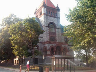
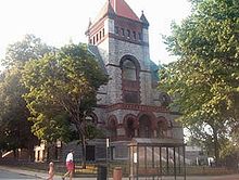 Hampshire County Courthouse in Northampton, designed by architect H.H. Richardson
In 1851, opera singer Jenny Lind, the "Swedish Nightingale", declared Northampton to be the "Paradise of America," from which Northampton took its nickname The Paradise City.
Clarke School for the Deaf was founded in Northampton in 1867. It was the United States' first permanent oral school for the deaf. Alexander Graham Bell and Grace Coolidge have served as heads of school.[citation needed]
Smith College for women was founded in Northampton in 1871. Today, Smith is the largest of the Seven Sisters colleges. Well-known Smith alumnae include Sylvia Plath, Gloria Steinem, Madeleine L'Engle and Julia Child. The first game of women's basketball was played at Smith College in 1892.
Northampton was incorporated as a city in 1883.[citation needed]
Immigrant groups that settled Northampton in large numbers included Irish, Polish, and French-Canadian.
U.S. President Calvin Coolidge worked as a lawyer in Northampton, and served as the city's mayor from 1910–1912, before moving on to the White House. After retiring from the U.S. Presidency in 1929, Coolidge moved back to Northampton. He died in the city on January 5, 1933.
Decline
During the mid-20th century, Northampton experienced several decades of economic decline, peaking in the 1970s, related to the emergence of the Rust Belt phenomenon.Though Western Massachusetts lies outside of the Rust Belt geographically, the centrality of commerce and the arts to Northampton's economy left it economically vulnerable, particularly when compounded with the decline of Springfield's manufacturing sector, Holyoke's paper industry, and massive plant closures in the nearby New York Capital District.
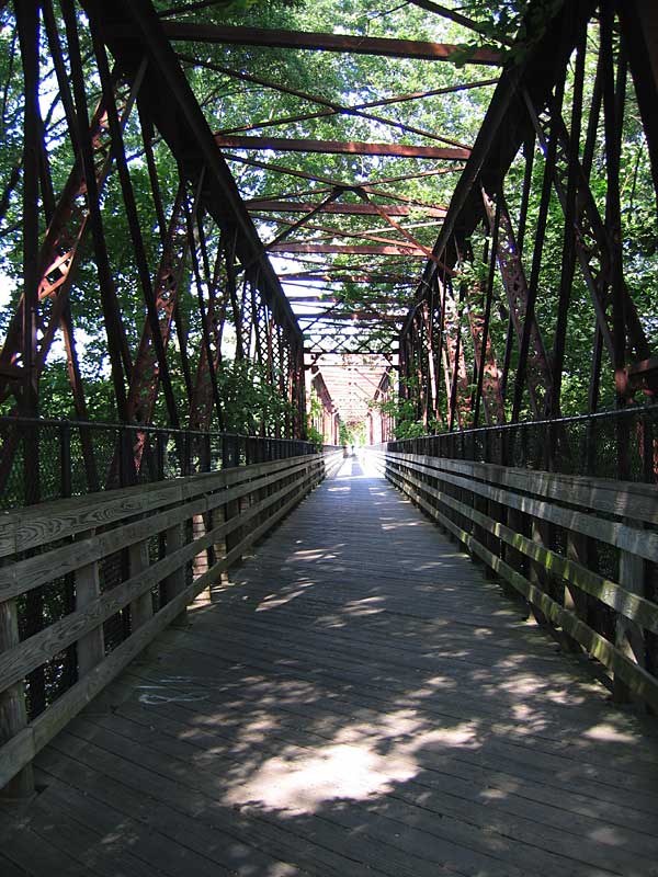
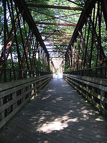 The Norwottuck Rail Trail Bridge across the Connecticut River
The Cultural Renaissance of NoHo
Today, Northampton is a thriving cultural center and an increasingly popular tourist destination. "NoHo" as many call the city, attracts patrons to its many eclectic restaurants and its lively arts and music scenes. Northampton has a particularly high number of restaurants per capita, which feature a wide range of ethnic foods. Two Northampton Farmers' Markets, held weekly, sell fresh produce from local farms.
Since 1995 Northampton has been home to the twice-yearly Paradise City Arts Festival, held at the Three County Fairgrounds on Memorial Day Weekend and Columbus Day Weekend. The Festival is ranked as the #1 arts fair in America, and is a national juried showcase for contemporary craft and fine art.
An extant opera house, the Academy of Music.[21] an 800 seat theatre operates as one venue for local productions. The Iron Horse Music hall, Northampton Community Music Center and Acardia Players serve as musical venues as well.
As Smith College is one of the Five Colleges in western Massachusetts' Pioneer Valley region, (the others are Hampshire College, Amherst College, University of Massachusetts Amherst, and Mount Holyoke College) Northampton has a particularly vibrant youth culture. Its downtown street scene is populated by counter-culture artists, street musicians, and political activists.
Northampton has a well-established music scene. The city features live music venues such as the Calvin Theater, Pines Theater, Pearl Street, Iron Horse Music Hall, The Elevens, and The Academy of Music. Musicians and bands that refer to the area as "home" include Sonic Youth, Lord Jeff, Mobius Band, Erin McKeown, The Nields, The Young@Heart Chorus, Cordelia's Dad, Greenstreet Brew, and Sore Eros.
Geography
Northampton sits on the banks of the Connecticut River, in the Pioneer Valley of Western Massachusetts. It is located at 42°19′39″N 72°39′28″W / 42.3275°N 72.65778°WCoordinates: 42°19′39″N 72°39′28″W / 42.3275°N 72.65778°W.[22]
According to the United States Census Bureau, the city has a total area of 35.6 square miles (92 km2), of which 34.5 square miles (89 km2) is land and 1.1 square miles (2.8 km2) (3.20%) is water. 21% of the city is permanently protected open space[23]
Within Northampton's city limits are the incorporated villages of Florence and Leeds.
Northampton is bordered to the north by the towns of Hatfield and Williamsburg; to the west by Westhampton; to the east by Hadley (across the Connecticut River); and to the south by Easthampton.
The art deco Calvin Coolidge Bridge connects Northampton with Hadley across the Connecticut River. The college town of Amherst is located 7.86 miles (12.65 km) east of Northampton, next to Hadley. Springfield, the Connecticut River Valley's most populous city, is located 15.74 miles (25.33 km) southeast of Northampton. Boston is located 81.57 miles (131.27 km) east of Northampton. New York City is 131.28 miles (211.27 km) southeast of Northampton.
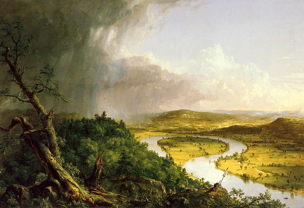
The Connecticut River's famous Oxbow is within Northampton's city limits, at the northern base of Mount Nonotuck.
Demographics
Historical populations Year Pop. ±% 1790 1,628 — 1800 2,190 +34.5% 1810 2,631 +20.1% 1820 2,854 +8.5% 1830 3,613 +26.6% 1840 3,750 +3.8% 1850 5,278 +40.7% 1860 6,788 +28.6% 1870 10,160 +49.7% 1880 12,172 +19.8% 1890 14,990 +23.2% 1900 18,643 +24.4% 1910 19,431 +4.2% 1920 21,951 +13.0% 1930 24,381 +11.1% 1940 24,794 +1.7% 1950 29,063 +17.2% 1960 20,058 −31.0% 1970 29,664 +47.9% 1980 29,286 −1.3% 1990 29,289 +0.0% 2000 28,978 −1.1% 2001* 28,792 −0.6% 2002* 29,058 +0.9% 2003* 28,931 −0.4% 2004* 28,848 −0.3% 2005* 28,660 −0.7% 2006* 28,586 −0.3% 2007* 28,538 −0.2% 2008* 28,493 −0.2% 2009* 28,528 +0.1% 2010 28,549 +0.1% * = population estimate.
Source: United States Census records and Population Estimates Program data.[24][25][26][27][28][29][30][31][32][33][34]As of the census[35] of 2000, there were 28,978 people, 11,880 households, and 5,880 families residing in the city. Northampton has the most lesbian couples per capita of any city in the US.[36] The population density was 841.0 people per square mile (324.7/km²). There were 12,405 housing units at an average density of 360.0 per square mile (139.0/km²). The racial makeup of the city was 90.01% White, 2.08% African American, 0.30% Native American, 3.13% Asian, 0.05% Pacific Islander, 2.41% from other races, and 2.03% from two or more races. Hispanic or Latino of any race were 5.24% of the population.
There were 11,880 households out of which 22.9% had children under the age of 18 living with them, 36.7% were married couples living together, 10.1% had a female householder with no husband present, and 50.5% were non-families. 37.3% of all households were made up of individuals and 10.7% had someone living alone who was 65 years of age or older. The average household size was 2.14 and the average family size was 2.87.[citation needed]
In the city the population was spread out with 17.0% under the age of 18, 15.4% from 18 to 24, 29.9% from 25 to 44, 23.9% from 45 to 64, and 13.8% who were 65 years of age or older. The median age was 37 years. For every 100 females there were 75.6 males. For every 100 females age 18 and over, there were 71.1 males.[citation needed]
The median income for a household in the city was $41,808, and the median income for a family was $56,844. Males had a median income of $37,264 versus $30,728 for females. The per capita income for the city was $24,022. About 5.7% of families and 9.8% of the population were below the poverty line, including 8.4% of those under age 18 and 9.1% of those age 65 or over.[citation needed]
Northampton's public schools include four elementary schools (kindergarten through 5th grade), one middle school (6th to 8th grade), one high school (9th to 12th grade), and one vocational-agricultural high school (9th to 12th grade). There are a few charter schools and several private schools in Northampton and surrounding towns.
According to the website ePodunk's Gay Index, which is based on figures from the 2000 U.S. Census, Northampton has a score of 535 vs. a national average score of 100, (i.e. Northampton's population includes 535% more GLBT people than the average American place.)[37]
Government
As of 2010, Mary Clare Higgins is the Mayor.[38] Previous mayors include former president Calvin Coolidge and James "Big Jim" Cahillane who served from 1954 to 1960. Also well known Judge Sean M. Dunphy was the youngest elected mayor in its history at age 28.
The Paradise City Forum was founded November 2001 to provide a nonpartisan discussion tool for the community.
Voter Registration and Party Enrollment as of October 15, 2008[39] Party Number of Voters Percentage Democratic 10,066 49.49% Republican 994 4.89% Unaffiliated 8,998 44.24% Minor Parties 280 1.38% Total 20,338 100% Public schools
Main article: Northampton Public Schools, MassachusettsTransportation
Northampton is served by Interstate 91, which passes to the east of downtown along the Connecticut River. U.S. Route 5, Massachusetts Route 9, and Massachusetts Route 10 all intersect in the city's downtown area.
The Pioneer Valley Transit Authority operates several local passenger buses which originate in Northampton, with service to local towns such as Amherst, Williamsburg, Hadley, South Hadley and Holyoke, as well as nearby universities, such as Mount Holyoke College, Amherst College, University of Massachusetts Amherst and Hampshire College. The Franklin Regional Transit Authority operates a bus to Greenfield, Massachusetts. There is a Peter Pan Bus terminal with services to Springfield, Boston, and other locations in New England. The Vermont Transit Lines bus also serves this terminal.
At present, passenger railway service to the Northampton area is provided by Amtrak via the Springfield Union Station, about a 20-minute drive south of Northampton, or a short walk from the Peter Ban Bus terminal in Springfield. The only active rail line through Northampton is operated by a Class 2 railroad regional railway, Pan Am Railways (formerly known as Guilford Rail System). The Amtrak Montrealer was the last passenger train to run through Northampton in 1988. Part of the American Recovery and Reinvestment Act of 2009 includes $8 billion for rail, of which $70 million will be spent to realign the Amtrak's Vermonter route. The Vermonter now travels from Springfield to Brattleboro, Vermont via Palmer, Massachusetts, but in the future will take the original more direct Montrealer route through Northampton. In addition to restoring the Northampton stop, stops will be added at Greenfield and possibly Holyoke.
Major domestic and limited international service is available 40 miles to the south at Bradley International Airport (BDL) in Windsor Locks, Connecticut. Northampton Airport, identified by the airport code 7B2, offers a 3365 X 50 foot runway and is within a mile-and-a-half walk from downtown.
Northampton serves as the hub of a growing rail trail network. The north-south Manhan Rail Trail extends from the downtown into neighboring Easthampton, and, as part of the Farmington Canal Trail, is planned eventually to reach New Haven. The Norwottuck Rail Trail runs eastward from Woodmont Road through Hadley, Amherst, and into Belchertown, with planned future integration into the Central Mass Rail Trail to Boston. To the west, the Northampton Bikeway provides access to the city's Florence and Leeds neighborhoods, including a route through historic Look Park, while downtown, the Bikeway provides a much-needed alternative to the congested King and Main Streets. [40]
The city of Northampton faces daily traffic congestion in the downtown area and connector roads often resulting in long delays and traffic build-up. The limitation of one bridge, one highway to nearby city of Amherst, MA and a narrow main street results in unsafe driving behavior and danger to pedestrians.[41] The City of Northampton is attempting to solve this long-occurring problem by redesigning problematic intersections and installing traffic cameras.[42]
Media
The Daily Hampshire Gazette is based in Northampton, covering Hampshire and Franklin counties. Northampton is the city of license for three commercial radio stations: WLZX, WEIB and WHMP. Northampton is also home to WXOJ-LP, a low power community radio station owned and operated by Valley Free Radio. The station was built by more than 400 volunteers from Northampton and around the country in August 2005 at the eighth Prometheus Radio Project barnraising, in conjunction with the tenth annual Grassroots Radio Coalition conference. WXOJ broadcasts music, news, and public affairs to listeners at 103.3FM. Northampton is also the birthplace of The Rainbow Times, the only lesbian-owned LGBT newspaper (found in 2006), which serves New England. According to the U.S. Census 2000, Northampton is the second gayest zip code in Massachusetts, followed by Boston, MA. In addition, Northampton is home to Northampton Community Television, which has existed in numerous forms since the mid-1980s, but which experienced a radical change in 2006 when it became an independently run nonprofit community media center.[citation needed] After a new public unveiling in November 2007, NCTV grew to over 200 active members in less than 18 months and had already attracted statewide and national attention in the community media landscape.[citation needed]
Points of interest
 The Connecticut River in Northampton
- First Church, located on Main Street, was the home church of Jonathan Edwards, 18th century theologian, philosopher and leader of the First Great Awakening.
- Smith College is a women's college (one of the Seven Sisters) founded in 1871. It is also one of the Five Colleges.
- Clarke Schools for Hearing and Speech, formerly the Clarke School for the Deaf, specializes in oral education (speech and lip-reading, as opposed to signing), and holds an annual summer camp, the theme varying from summer to summer. Clarke is also the oldest oral school for the deaf in the country, being established in 1867 on Round Hill Road overlooking the Connecticut River Valley.
- The Connecticut River and The Oxbow, are popular areas for boaters.
- 21% of Northampton is protected open space; this includes: Broad Brook/Fitzgerald Lake Conservation Area, Connecticut River Greenway (Elwell and Rainbow Beach), Mill River Greenway, Mineral Hills Conservation Area, and Saw Mill Hills/Roberts Hill Conservation Area.[23]
- Look Park is a 150+ acre recreational park founded in 1930. The park is free for visitors arriving by foot or bicycle, consistent with the will of Frank Newhall Look, who left the property to the city and requested that the park would always have free admission for the public. A day use fee or annual membership fee provides for parking. Musicians play at the park's amphitheater, e.g. Bob Dylan.
- Childs Park is a serene 40 acre city park near Cooley Dickinson Hospital. It features two ponds, both formal and rose gardens, and an Italian-style garden house.
- The Botanic Garden of Smith College is a diverse outdoor collection of trees, shrubs, and plants, as well as a fine collection of plant conservatories for the tropics, semi-tropics, and desert regions. It also includes an indoor greenhouse.
- The Mill River Greenway is a walking path on Smith College and adjacent land along the Mill River, in the Bay State Village neighborhood of Northampton. The path is sometimes also called the Paradise Pond Trail based on a misleadingly named portion of the river near Smith College's boathouse and pier.
- Northampton is a rail trail hub. Currently, the Norwottuck Rail Trail extends 18 miles from Leeds, Florence and downtown Northampton sections of Northampton to Amherst and Belchertown. The Manhan Rail Trail extends 8 miles from the Norwottuck Rail Trail, through Northampton and Easthampton to Southampton. Four other rail trail extensions are in the planning process.
- The Three County Fair is the "longest consecutive running agricultural fair in the country", having been established and incorporated in 1818.
- The Calvin Theater, Iron Horse Music Hall, and Pearl Street Nightclub are among the many venues that play host to Northampton's music scene.
- The Academy of Music, built in 1890 by Edward H.R. Lyman, is the only municipally owned theatre in the United States, and is the first to be so owned. Boris Karloff and Harry Houdini (who installed a trap door in the stage) performed there. Today, it serves as a music venue, cinema, and performance space.
- The Northampton Independent Film Festival (NIFF) is held each fall. Founded as the Northampton Film Festival in 1995 by Howard Polonsky and Dee DeGeiso, it has continued to grow under a variety of directors. It is now one of the largest in New England.
- Forbes Library built in 1894 is Northampton's public library. The second floor houses the Calvin Coolidge presidential library.
- Mirage Studios, the Creators of the Teenage Mutant Ninja Turtles Franchise. In the TMNT series, the turtles and Casey Jones visit Casey Jones' grandmother's farm in Northampton, Massachusetts.
- Northampton Community Music Center Each May, students from the (NCMC) fill the streets with music.
- LGBT Pride On the first Saturday of May, Northampton marks the annual Lesbian, Gay, Bisexual and Transgender Pride March & Rally with a colorful parade down Main Street, ending with an all-day family-friendly festival at a designated location in town.
- Thornes Marketplace in downtown Northampton contains many shops and eateries.
- Northampton State Hospital was a massive mental asylum, constructed in 1856. Several abandoned buildings remain; however, much of the site has been redeveloped.
- On a small hill overlooking the city, near the site of the former Northampton State Hospital, a simple stone monument marks the spot of the hangings of Domenic Daley and James Halligan, two Irishmen wrongfully convicted of murder in 1806.[43]
- Sylvester's Restaurant – Located at 111 Pleasant Street. Sylvester's is located in the former home of Sylvester Graham, inventor of the Graham Cracker. Sylvester's claimed top honors for breakfast in the Valley Advocate's "Best Of" reader's poll and since then, Sylvester's has consistently ranked among the top 3 contenders for assorted restaurant categories.
- [Union Station]- Union Station is located at 125A Pleasant Street in Northampton's rail station. Union station used to be home to Union Station Restaurant and Spaghetti Freddy's, but both restaurants were closed in 2011.
- Mill River Market Place located on route 10 towards Easthampton
- Northampton Fire Department building - Frequented for being the tallest fire fighting related building.
- Pioneer Valley Roller Derby, the first co-ed flat track roller derby league, trains in the village of Florence, Massachusetts.
Notable people
- Lexie Barnes, author, designer, and co-founder of Twist craft fair
- Jeanne Birdsall, children's author, best known for her debut novel, The Penderwicks: A Summer Tale of Four Sisters, Two Rabbits, and a Very Interesting Boy
- William Cullen Bryant, 19th century author and newspaper editor
- Mary-Ellis Bunim, television producer and co-creator of MTV's The Real World and Road Rules
- Augusten Burroughs, author, his bestseller Running with Scissors describes his strange childhood in Northampton
- Paul Johnson Calderon, socialite, heir, and television personality best known for co-starring on The CW's High Society
- Eric Carle, children's book author and illustrator
- Lydia Maria Child, author of the Thanksgiving poem "Over the River and through the Woods"
- Chris Collingwood, lead singer of the band Fountains of Wayne
- Carol T. Christ, President of Smith College and Victorian Literature Scholar
- Calvin Coolidge; served as mayor of Northampton before becoming governor of Massachusetts and U.S. president
- Galaxy Craze, actress and author known for bestselling novel By the Shore.
- Dennis Crommett, musician.
- Kevin Eastman and Peter Laird published Teenage Mutant Ninja Turtles comics from their Northampton studio
- Jonathan Edwards, 18c Congregational theologian, philosopher, leader of First Great Awakening and local pastor
- Herbert Gintis, economist[citation needed]
- Sylvester Graham, advocate of vegetarianism and namesake of the Graham Cracker
- Jonathan Harr, author of the A Civil Action
- D. Dennis Hudson, emeritus professor and internationally known scholar of Indian religion
- Jonathan Hunt (Vermont Lieutenant Governor) (1738–1808), early Vermont pioneer, landowner, officeholder, born Northampton[44]
- Jeph Jacques, creator of webcomic Questionable Content
- Tracy Kidder, author
- Michael Klare, author, professor and defense correspondent for The Nation
- Griff Kohout, actor (Chuck)
- Jason Loewenstein, singer, songwriter with indie-rock bands Sebadoh and The Fiery Furnaces
- Elinor Lipman, author
- David Lyman, actor (Friday Night Lights)
- Rachel Maddow, radio personality, MSNBC television host, and liberal political commentator
- Charles McCarry, author
- Stu Miller, Major League Baseball pitcher
- José Molina, Former member, USA national Indoor field hockey team
- William Monahan, novelist and screenwriter
- Thurston Moore and Kim Gordon of the band Sonic Youth
- Jo Newman, actress (Love and Other Drugs; Gossip Girl)
- Lesléa Newman, author of Heather Has Two Mommies.[45]
- Nerissa Nields, folk musician, author, and member of the band The Nields
- Alix Olson, spoken word poet and owner of Subtle Sisters Productions
- David Pakman, host of the nationally syndicated political talk radio and TV program, "The David Pakman Show"
- Dr. Kyle Pruett, author and child psychiatry expert
- Nathaniel Raymond, human rights investigator and anti-torture advocate
- Mary Rohlich, film and documentary producer on projects including Horrible Bosses and Freakonomics
- Jeffrey Rowland, creator of the webcomics Wigu and Overcompensating
- Liza Snyder, actress (Yes, Dear; Pay It Forward)
- Talisa Soto, actress
- Sojourner Truth, African American abolitionist and orator
- Kurt Vonnegut, author; died 2007
- Mo Willems, popular children's book author
- Dar Williams, popular musician.
- Andrew Zimbalist, prominent sports economist and father of Jeff and Michael Zimbalist
- Jeff Zimbalist, documentary filmmaker and Tribeca Film Festival award winner
- Michael Zimbalist, documentary filmmaker and brother of Jeff Zimbalist
- Megan E Labonte, Aka the Hoop Master Sass or Sass Master, Street performer and Artist
- Nile Wentworth Comedian
Cultural references
- Northampton, Massachusetts is the birthplace of the eponymous protagonist in Henry James's 1875 novel Roderick Hudson.[46]
- Segments of the 1966 film Who's Afraid of Virginia Woolf? were filmed in and around Northampton during the fall of 1965.[47] When not filming, Elizabeth Taylor and Richard Burton frequented Northampton's Academy of Music, where they sat in the balcony to watch movies.[citation needed]
- Other films filmed in Northampton include the Academy-Award-winning The Cider House Rules, Malice with Nicole Kidman and Alec Baldwin, In Dreams with Annette Bening and Robert Downey Jr., and Sylvia with Gwyneth Paltrow.[48]
- Edge of Darkness was filmed in October 2008 in Northampton and the surrounding area.[49]
- It is also the headquarters for Mirage Studios former owners[50] and the publishers of the comic until their last scheduled book in April 2010
- Author Tracy Kidder documented the many layers of Northampton society at the end of the 20th century in his nonfiction book Home Town.
- Webcomics Questionable Content and Minimalist Stick Figure Theatre take place primarily in Northampton.
- Artist Jeffrey Rowlands makes his home in Northampton and is primarily famous for his Overcompensating Comic.
- The main events of Running with Scissors, a 2002 memoir by Augusten Burroughs detailing his bizarre childhood, take place in Northampton
Notes
- ^ Kneeland, Frederick N. (1894). Northampton, the meadow city. Northampton, Massachusetts: F. N. Kneeland and L. P. Bryant. OCLC 24093077. http://www.archive.org/stream/northamptonmeado00knee#page/n5/mode/2up.
- ^ Lipsyte, Robert (June 26, 1994). "Gay Games". The New York Times. http://select.nytimes.com/gst/abstract.html?res=F60915F63D580C758EDDAF0894DC494D81. Retrieved March 22, 2011.
- ^ Brown, Jane Roy (November 20, 2006). "Paradise found". The Boston Globe. http://www.boston.com/travel/articles/2006/11/20/paradise_found/?page=full. Retrieved March 22, 2011.
- ^ Washington Post: Northampton, Mass: Where Alternative Goes Main Street
- ^ http://www.epodunk.com/top10/liberal/
- ^ Norwottuck
- ^ a b [1]
- ^ Map of history of political boundaries, plantation period
- ^ Trumbull, James Russell. History of Northampton, Massachusetts, From Its Settlement in 1654. Northampton (1898), pp. 5–12.
- ^ Map of history of political boundaries c1775
- ^ Map of history of political boundaries, Federal period
- ^ US-5: A Highway To History
- ^ Historic Northampton: Caleb Strong
- ^ Historic Northampton: Shays' Rebellion
- ^ http://www.historic-northampton.org/daleyandhalligan/daleyandhalligan.html
- ^ http://law.jrank.org/pages/2417/Dominic-Daley-James-Halligan-Trial-1806.html
- ^ http://en.wikipedia.org/wiki/Hampshire_and_Hampden_Canal
- ^ Copeland, Alfred M. "Our County And Its People": A History of Hampden County, Massachusetts. Century Memorial Publishing (1902), pp. 174–75.
- ^ Andrews, E. Benjamin. The United States In Our Own Time: A History from Reconstruction to Expansion. C. Scribner's Sons (1903), pp. 183–84.
- ^ http://www.northamptonma.gov/aboutNorthampton/History_of_Northampton/
- ^ MassLive: Academy of Music back in movie business
- ^ "US Gazetteer files: 2010, 2000, and 1990". United States Census Bureau. 2011-02-12. http://www.census.gov/geo/www/gazetteer/gazette.html. Retrieved 2011-04-23.
- ^ a b Northampton Open Space, Recreation and MultiUse Trail Plan: 2011-2017
- ^ "TOTAL POPULATION (P1), 2010 Census Summary File 1, All County Subdivisions within Massachusetts". United States Census Bureau. http://factfinder2.census.gov/bkmk/table/1.0/en/DEC/10_SF1/P1/0400000US25.06000. Retrieved September 13, 2011.
- ^ "Massachusetts by Place and County Subdivision - GCT-T1. Population Estimates". United States Census Bureau. http://factfinder.census.gov/servlet/GCTTable?_bm=y&-geo_id=04000US25&-_box_head_nbr=GCT-T1&-ds_name=PEP_2009_EST&-_lang=en&-format=ST-9&-_sse=on. Retrieved July 12, 2011.
- ^ "1990 Census of Population, General Population Characteristics: Massachusetts". US Census Bureau. December 1990. Table 76: General Characteristics of Persons, Households, and Families: 1990. 1990 CP-1-23. http://www.census.gov/prod/cen1990/cp1/cp-1-23.pdf. Retrieved July 12, 2011.
- ^ "1980 Census of the Population, Number of Inhabitants: Massachusetts". US Census Bureau. December 1981. Table 4. Populations of County Subdivisions: 1960 to 1980. PC80-1-A23. http://www2.census.gov/prod2/decennial/documents/1980a_maABC-01.pdf. Retrieved July 12, 2011.
- ^ "1950 Census of Population". Bureau of the Census. 1952. Section 6, Pages 21-10 and 21-11, Massachusetts Table 6. Population of Counties by Minor Civil Divisions: 1930 to 1950. http://www2.census.gov/prod2/decennial/documents/23761117v1ch06.pdf. Retrieved July 12, 2011.
- ^ "1920 Census of Population". Bureau of the Census. Number of Inhabitants, by Counties and Minor Civil Divisions. Pages 21-5 through 21-7. Massachusetts Table 2. Population of Counties by Minor Civil Divisions: 1920, 1910, and 1920. http://www2.census.gov/prod2/decennial/documents/41084506no553ch2.pdf. Retrieved July 12, 2011.
- ^ "1890 Census of the Population". Department of the Interior, Census Office. Pages 179 through 182. Massachusetts Table 5. Population of States and Territories by Minor Civil Divisions: 1880 and 1890. http://www2.census.gov/prod2/decennial/documents/41084506no553ch2.pdf. Retrieved July 12, 2011.
- ^ "1870 Census of the Population". Department of the Interior, Census Office. 1872. Pages 217 through 220. Table IX. Population of Minor Civil Divisions, &c. Massachusetts. http://www2.census.gov/prod2/decennial/documents/1870e-05.pdf. Retrieved July 12, 2011.
- ^ "1860 Census". Department of the Interior, Census Office. 1864. Pages 220 through 226. State of Massachusetts Table No. 3. Populations of Cities, Towns, &c.. http://www2.census.gov/prod2/decennial/documents/1860a-08.pdf. Retrieved July 12, 2011.
- ^ "1850 Census". Department of the Interior, Census Office. 1854. Pages 338 through 393. Populations of Cities, Towns, &c.. http://www2.census.gov/prod2/decennial/documents/1850c-11.pdf. Retrieved July 12, 2011.
- ^ "1950 Census of Population". Bureau of the Census. 1952. Section 6, Pages 21-7 through 21-09, Massachusetts Table 4. Population of Urban Places of 10,000 or more from Earliest Census to 1920. http://www2.census.gov/prod2/decennial/documents/23761117v1ch06.pdf. Retrieved July 12, 2011.
- ^ "American FactFinder". United States Census Bureau. http://factfinder.census.gov. Retrieved 2008-01-31.
- ^ City Data
- ^ [2]
- ^ Mayor's Office Mayor's Office Home
- ^ "Registration and Party Enrollment Statistics as of October 15, 2008" (PDF). Massachusetts Elections Division. http://www.sec.state.ma.us/ele/elepdf/st_county_town_enroll_breakdown_08.pdf. Retrieved 2010-05-08.
- ^ Northampton Open Space, Recreation, and Rail Trail Plan: 2011-2017
- ^ [3]
- ^ [4]
- ^ [5]
- ^ The History of the Descendants of Elder John Strong, of Northampton, Massachusetts, Vol. II, Benjamin Woodbridge Dwight, Joel Munsell, Albany, 1871
- ^ Lesléa Newman articles
- ^ eNotes: Roderick Hudson
- ^ ePodunk community profile Northampton, Massachusetts
- ^ ePodunk: filming locations
- ^ The Greenfield Recorder
- ^ By (2009-10-21). "Ninja Turtles move to Nickelodeon – Entertainment News, Film News, Media". Variety. http://www.variety.com/article/VR1118010193.html?categoryid=13&cs=1. Retrieved 2010-06-04.
References
- William Allen. "An Address, Delivered at Northampton, Massachusetts on the Evening of October 29, 1854 in Commemoration of the Close of the Second Century since the Settlement of the Town". Northampton: Hopkins, Bridgman and Company, 1855.
- Kerry W. Buckley, ed. A Place Called Paradise: Culture and Community in Northampton, Massachusetts, 1654–2004. Northampton: Historic Northampton Museum and Education Center, in association with University of Massachusetts Press, 2004. ix + 523 pp. ISBN 978-1-55849-485-5. reprints 20 essays by scholars
- Benjamin Dwight. History of the Descendants of Elder John Strong, of Northampton, Massachusetts. Albany: Joel Munsell, 1871.
- Josiah Granville Leach. Memoranda Relating to the Ancestry and Family of Hon. Levi Parsons Morton Vice President of the United States (1889–1893). Cambridge: Riverside Press, 1894.
- Tracy Kidder. Home Town [1999], nonfiction by reporter
External links
- City of Northampton's official website
- VisitNorthampton.net - Official Website of Northampton, MA - Everything about Northampton, MA (city guide website)
- Northampton Chamber of Commerce (city guide website)
- Northampton GLBT city guide
- Watch Videos about Northampton and find the best places to visit, dine and shop. (city guide website)
- Smith College
- Northampton Public Schools
- Forbes Library (Northampton)
- Historic Northampton (historical society website)
- Northampton Community Television – NCTV
- Daily Hampshire Gazette, the (Northampton newspaper)
- The Rainbow Times, Only Local LGBT Newspaper, (established in 2006)
- Midweek Politics, a nationally-syndicated political radio show produced and broadcast from Northampton, Massachusetts.
- Valley Free Radio, a low-power FM community radio station, has made its home in Northampton since August 2005.
- Friends of Northampton Trails and Greenways, (established in 2006)
Municipalities and communities of Hampshire County, Massachusetts Cities Easthampton | Northampton
Towns Amherst | Belchertown | Chesterfield | Cummington | Goshen | Granby | Hadley | Hatfield | Huntington | Middlefield | Pelham | Plainfield | South Hadley | Southampton | Ware | Westhampton | Williamsburg | Worthington
CDPs Amherst Center | Bondsville‡ | Belchertown | Granby | Hatfield | North Amherst | South Amherst | Ware
Other
villagesFootnotes ‡This populated place also has portions in an adjacent county or counties
Categories:- Academic enclaves
- Cities in Massachusetts
- Populated places in Hampshire County, Massachusetts
- Gay villages in the United States
- Gay villages in Massachusetts
- County seats in Massachusetts
- Northampton, Massachusetts
- Populated places on the Connecticut River
- Populated places established in 1654
- Springfield, Massachusetts metropolitan area
- University towns in the United States


Wikimedia Foundation. 2010.