- Norfolk County, Massachusetts
-
Norfolk County, Massachusetts Flag of Norfolk County, Massachusetts
FlagSeal of Norfolk County, Massachusetts
Seal
Location in the state of Massachusetts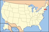
Massachusetts's location in the U.S.Founded 1793 Seat Dedham Largest city Quincy Area
- Total
- Land
- Water
399.58 sq mi (1,035 km²)
44.35 sq mi (115 km²), 10%Population
- (2010)
- Density
670,850
1,677/sq mi (648/km²)Website www.norfolkcounty.org Norfolk County is a county located in the U.S. state of Massachusetts. As of 2010, the population was 670,850. Its county seat is Dedham.[1] It is the 28th highest-income county in the United States with a per capita income of $32,484. It is the wealthiest county in Massachusetts. The county was named after Norfolk, England and means "northern folk."[2]
Contents
History
Norfolk County, Massachusetts was created on March 26, 1793 by legistation signed by Gov. John Hancock. Most of the towns were originally part of Suffolk County, Massachusetts. The towns of Dorchester and Roxbury were part of Norfolk County when it was created but, as Boston gradually annexed them, they returned to be part of Suffolk County. Hingham and Hull were originally part of the Norfolk County legislation but petitioned to remain in Suffolk county and in June 1793 their removal to Norfolk county was repealed. Later in 1803 they were moved into Plymouth County, Massachusetts. The county is also the birthplace of four of the individuals who have held the office of President of the United States (John Adams, John Quincy Adams, John F. Kennedy, and George H.W. Bush), resulting in the moniker "County of Presidents."[3]
Geography
According to the 2000 census, the county has a total area of 443.94 square miles (1,149.8 km2), of which 399.58 square miles (1,034.9 km2) (or 90.01%) is land and 44.35 square miles (114.9 km2) (or 9.99%) is water.[4] The county is not fully contiguous; the towns of Brookline and Cohasset are each part of Norfolk County but are separated from the majority of Norfolk County (and each other) by either water or other counties. At the county's formation, Hingham and Hull were to be part of it, but joined Plymouth County instead, leaving Cohasset as an exclave of Norfolk County and an enclave of Plymouth County. Brookline became an exclave of Norfolk County in 1873 when the neighboring town of West Roxbury was annexed by Boston (thus leaving Norfolk County to join Suffolk County) and Brookline refused to be annexed by Boston after the Brookline-Boston annexation debate of 1873.
Adjacent counties
- Middlesex County (northwest)
- Suffolk County (north)
- Plymouth County (southeast)
- Bristol County (south)
- Providence County, Rhode Island (southwest)
- Worcester County (west)

Middlesex County Suffolk County Massachusetts Bay Worcester County 
 Norfolk County, Massachusetts

Providence County, Rhode Island Bristol County Plymouth County National protected areas
- Adams National Historical Park
- Boston Harbor Islands National Recreation Area (part)
- Frederick Law Olmsted National Historic Site
- John Fitzgerald Kennedy National Historic Site
Demographics
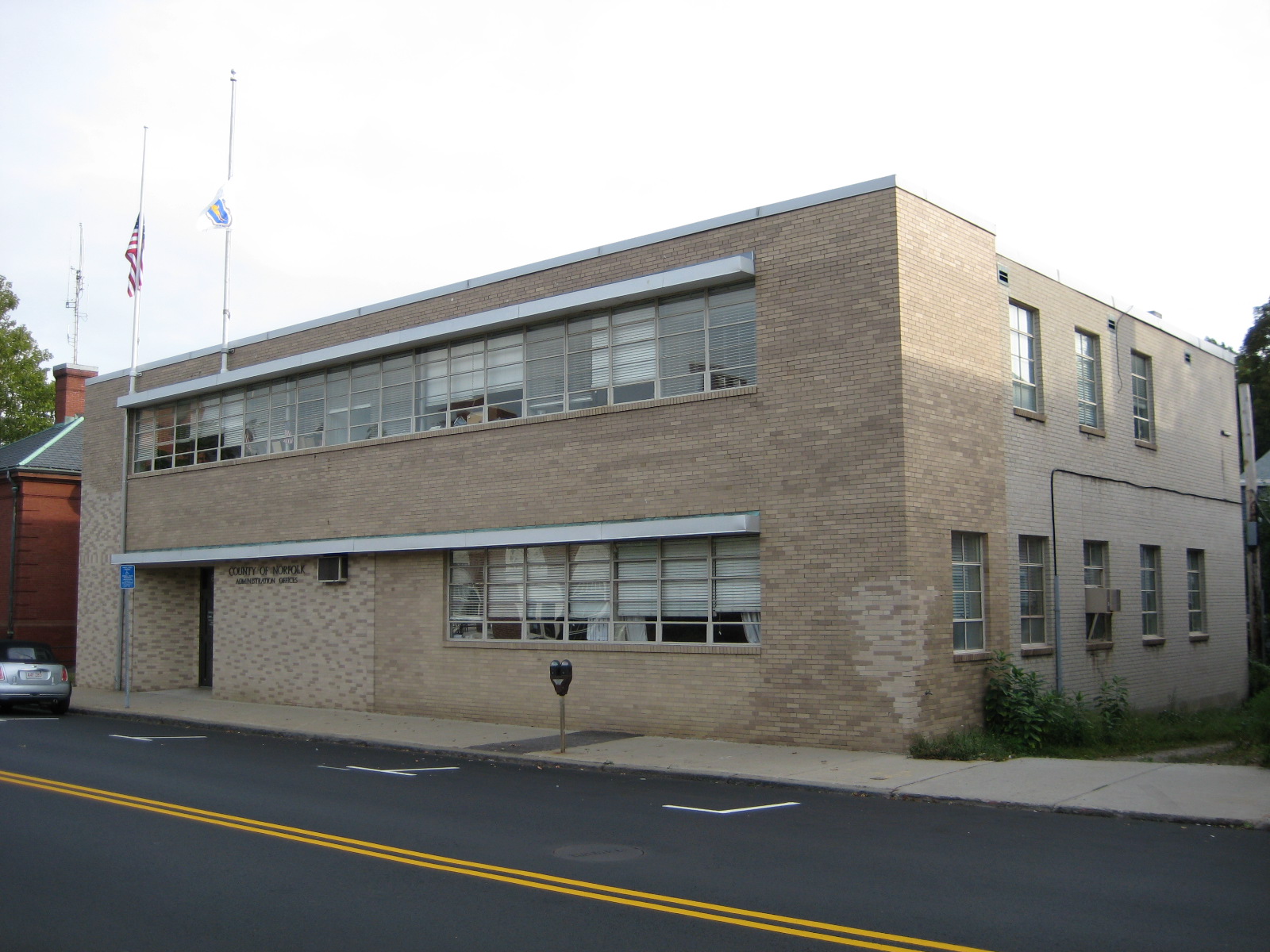
Historical populations Census Pop. %± 1800 27,216 — 1810 31,245 14.8% 1820 36,471 16.7% 1830 41,972 15.1% 1840 53,140 26.6% 1850 78,892 48.5% 1860 109,950 39.4% 1870 89,443 −18.7% 1880 96,507 7.9% 1890 118,950 23.3% 1900 151,539 27.4% 1910 187,506 23.7% 1920 219,081 16.8% 1930 299,426 36.7% 1940 325,180 8.6% 1950 392,308 20.6% 1960 510,256 30.1% 1970 605,051 18.6% 1980 606,587 0.3% 1990 616,087 1.6% 2000 650,308 5.6% 2010 670,850 3.2% [5][6][7] Presidential election results[8] Year Democrat Republican 2008 58.2% 200,675 39.7% 136,841 2004 60.2% 199,392 38.6% 127,763 2000 59.4% 188,450 33.8% 107,033 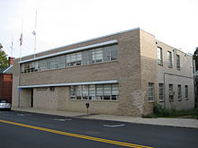 Norfolk County Administration Offices (including the County Commissioners and the County Treasurer) in Dedham.
As of the census[9] of 2000, there were 650,308 people, 248,827 households, and 165,967 families residing in the county. The population density was 1,628 people per square mile (628/km²). There were 255,154 housing units at an average density of 639 per square mile (247/km²). The racial makeup of the county was 89.02% White or European American, 3.18% Black or African American, 0.13% Native American, 5.50% Asian, 0.02% Pacific Islander, 0.78% from other races, and 1.37% from two or more races. 1.84% of the population were Hispanic or Latino of any race. 28.6% were of Irish, 13.4% Italian, 7.7% English and 5.0% descendants of colonists ancestry according to Census 2000. 85.7% spoke English, 2.3% Chinese or Mandarin, 2.0% Spanish, 1.0% Italian and 1.0% French as their first language.
There were 248,827 households out of which 31.20% had children under the age of 18 living with them, 54.20% were married couples living together, 9.50% had a female householder with no husband present, and 33.30% were non-families. 26.80% of all households were made up of individuals and 10.80% had someone living alone who was 65 years of age or older. The average household size was 2.54 and the average family size was 3.14.
In the county the population was spread out with 23.40% under the age of 18, 7.00% from 18 to 24, 31.60% from 25 to 44, 23.50% from 45 to 64, and 14.40% who were 65 years of age or older. The median age was 38 years. For every 100 females there were 91.40 males. For every 100 females age 18 and over, there were 87.60 males.
The median income for a household in the county was $63,432, and the median income for a family was $77,847 (these figures had risen to $77,294 and $95,243 respectively as of a 2007 estimate[10]). Males had a median income of $51,301 versus $37,108 for females. The per capita income for the county was $32,484. About 2.90% of families and 4.60% of the population were below the poverty line, including 4.40% of those under age 18 and 5.70% of those age 65 or over.
Voter Registration and Party Enrollment as of October 15, 2008[11] Party Number of Voters Percentage Democratic 163,231 35.98% Republican 55,220 12.17% Unaffiliated 232,885 51.34% Minor Parties 2,276 0.50% Total 453,612 100% Cities, towns, and villages
- Avon incorporated 1888 from Stoughton.
- Bellingham incorporated 1719 from Dedham.
- Braintree founded 1640.
- Brookline incorporated 1705 from Boston.
- Canton incorporated 1797 from Stoughton.
- Cohasset incorporated 1770 from Hingham.
- Dedham founded 1636. (County seat).
- Dover incorporated 1784 from Dedham.
- Foxborough incorporated 1778 from Wrentham.
- Franklin incorporated 1778.
- Holbrook incorporated 1872.
- Medfield incorporated 1651.
- Medway incorporated 1713 from Medfield.
- Millis incorporated 1885 from Medway.
- Milton incorporated 1662.
- Needham incorporated 1711 from Dedham.
- Norfolk incorporated 1870 from Wrentham.
- Norwood incorporated 1872.
- Plainville incorporated 1905 from Wrentham.
- Quincy incorporated 1792 from Braintree.
- Randolph incorporated 1793 from Braintree.
- Sharon incorporated 1765 from Stoughton.
- Stoughton incorporated 1726 from Dorchester.
- Walpole incorporated 1724 from Dedham.
- Wellesley incorporated 1881 from Needham.
- Westwood incorporated 1897 from Dedham.
- Weymouth founded 1635.
- Wrentham incorporated 1673 from Dedham.
Note: West Roxbury (annexed to Boston 1874), Roxbury (annexed to Boston 1868), Dorchester (founded 1630, annexed to Boston 1870), Hyde Park (incorporated 1868 from Dorchester, Milton, and Dedham, annexed to Boston 1912), and Hingham and Hull were originally part of Norfolk County when the county was incorporated in 1793.
* Villages are census divisions, but have no separate corporate existence from the towns they are in.
File:Norfolk-county-bw-map.gifToday's Norfolk County communities.See also
References
- ^ "Find a County". National Association of Counties. http://www.naco.org/Counties/Pages/FindACounty.aspx. Retrieved 2011-06-07.
- ^ Thomas Cox, Anthony Hall, Robert Morden Magna Britannia Antiqua & Nova: Or, A New, Exact, and Comprehensive Survey of the Ancient and Present State of Great Britain, Volume 5, (Caesar Ward and Richard Chandler: London, 1738), pg. 171 (accessed on Google Book Search, June 22, 2008)
- ^ The County of Norfolk, Massachusetts. Last accessed December 21, 2006.
- ^ "Census 2000 U.S. Gazetteer Files: Counties". United States Census. http://www.census.gov/tiger/tms/gazetteer/county2k.txt. Retrieved 2011-02-13.
- ^ http://www.census.gov/population/www/censusdata/cencounts/files/ma190090.txt
- ^ http://factfinder2.census.gov/faces/tableservices/jsf/pages/productview.xhtml?pid=DEC_10_PL_QTPL&prodType=table
- ^ http://mapserver.lib.virginia.edu/
- ^ "Dave Leip's Atlas of U.S. Presidential Elections". http://uselectionatlas.org/RESULTS/. Retrieved 2011-06-11.
- ^ "American FactFinder". United States Census Bureau. http://factfinder.census.gov. Retrieved 2008-01-31.
- ^ http://factfinder.census.gov/servlet/ACSSAFFFacts?_event=Search&geo_id=05000US25017&_geoContext=01000US%7C04000US25%7C05000US25017&_street=&_county=norfolk&_cityTown=norfolk&_state=04000US25&_zip=&_lang=en&_sse=on&ActiveGeoDiv=geoSelect&_useEV=&pctxt=fph&pgsl=050&_submenuId=factsheet_1&ds_name=ACS_2007_3YR_SAFF&_ci_nbr=null&qr_name=null®=null%3Anull&_keyword=&_industry=
- ^ "Registration and Party Enrollment Statistics as of October 15, 2008" (PDF). Massachusetts Elections Division. http://www.sec.state.ma.us/ele/elepdf/st_county_town_enroll_breakdown_08.pdf. Retrieved 2010-05-08.
- History of Norfolk County, Massachusetts With Biographical Sketches of Many of Its Pioneers and Prominent Men, by Duane Hamilton Hurd. Published by J.W. Lewis & Co., 1884. 1001 pages.
- History of Norfolk County, Massachusetts, 1622-1918 by Louis Atwood Cook. Published by The S.J. Clarke publishing company, 1918. Volume 1.
External links
Municipalities and communities of Norfolk County, Massachusetts Cities 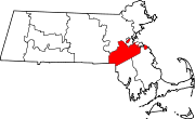
Towns CDPs Bellingham | Dover | Foxborough | Medfield | Millis-Clicquot | Sharon | Walpole
Other
villageCategories:- Massachusetts counties
- Norfolk County, Massachusetts


Wikimedia Foundation. 2010.