- Needham, Massachusetts
-
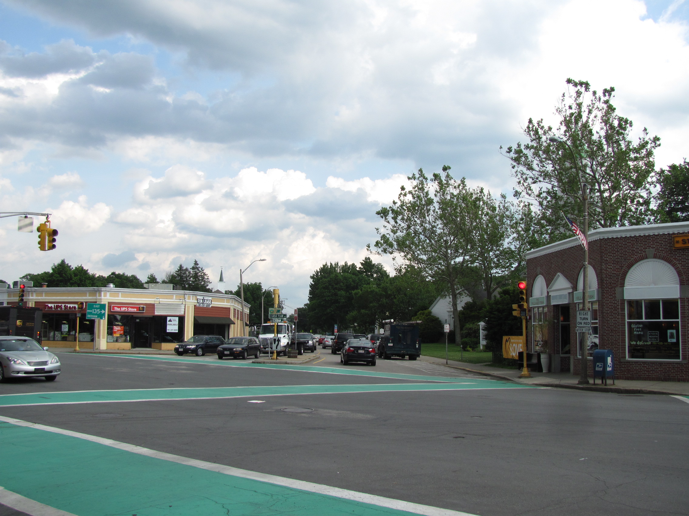
Needham, Massachusetts — Town — Corner of Highland, Great Plain
and Dedham Avenues
Flag
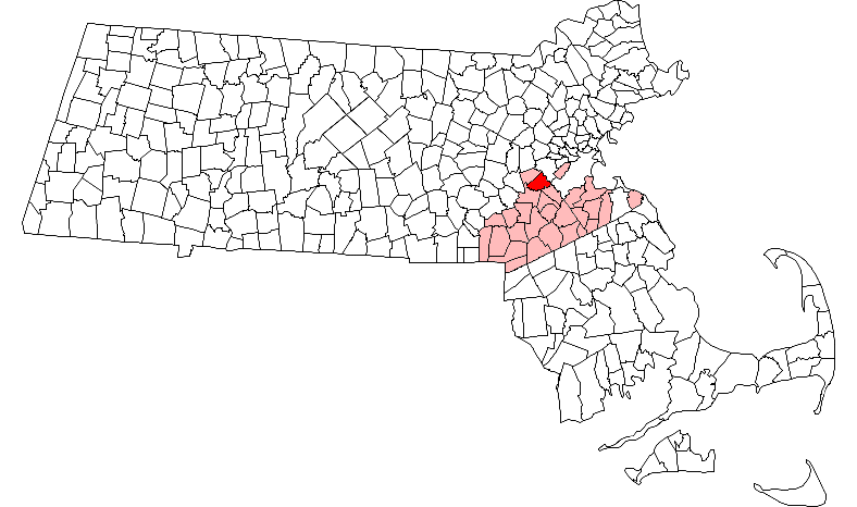
SealLocation in Norfolk County in Massachusetts
Coordinates: 42°17′00″N 71°14′00″W / 42.2833333°N 71.2333333°WCoordinates: 42°17′00″N 71°14′00″W / 42.2833333°N 71.2333333°W Country United States State Massachusetts County Norfolk Settled 1680 Incorporated 1711 Government - Type Representative town meeting Area - Total 12.7 sq mi (32.9 km2) - Land 12.6 sq mi (32.7 km2) - Water 0.1 sq mi (0.2 km2) Elevation 162 ft (49 m) Population (2010) - Total 28,886 - Density 2,292.5/sq mi (883.4/km2) Time zone Eastern (UTC-5) - Summer (DST) Eastern (UTC-4) ZIP code 02492 / 02494 Area code(s) 339 / 781 FIPS code 25-44105 GNIS feature ID 0618325 Website www.needhamma.gov Needham is a town in Norfolk County, Massachusetts, United States. A suburb of Boston, its population was 28,886 at the 2010 census.
Contents
History
Needham was first settled in 1680 with the purchase of a tract of land measuring 4 miles (6.4 km) by 5 miles (8.0 km) from Chief Nehoiden for the sum of 10 pounds, 40 acres (160,000 m2) of land, and 40 shillings worth of corn. It was officially incorporated in 1711. Originally part of the Dedham Grant, Needham split from Dedham and was named after the village of Needham Market in Suffolk, England, a neighbor of the English town of Dedham. By the 1770s settlers in the western part of the town who had to travel a long distance to the meeting house on what is now Central Avenue sought to form a second parish in the town. Opposition to this desire created conflict, and in 1774 a mysterious fire destroyed the extant meeting house. Some time afterwards the West Parish was formed.
In 1857 the City of Boston began a project to fill in the Back Bay with landfill by filling the tidewater flats of the Charles River. The fill to reclaim the bay from the water was obtained from Needham Massachusetts from the area of present day Route 128. The firm of Goss and Munson, railroad contractors, built 6 miles of railroad from Needham and their 35-car trains made 16 trips a day to Back Bay.[1] The filling of present-day Back Bay was completed by 1882; filling reached Kenmore Square in 1890, and finished in the Fens in 1900. The project was the largest of a number of land reclamation projects, beginning in 1820, which, over the course of time, more than doubled the size of the original Boston peninsula. It is frequently observed that this would have been impossible under modern environmental regulations.[citation needed]
In the late 1860s William Emerson Baker moved to Needham. A notably wealthy man due to his having improved the mechanical sewing machine, Baker assembled a parcel of land exceeding 800 acres (3.2 km2) and named it Ridge Hill Farm.[2] He built two man made lakes on his property, including Sabrina lake near present day Locust Lane. Baker turned part of his property into an amusement park with exotic animals, subterranean tunnels, trick floors and mirrors. In 1888 he built a sizable hotel, near the intersection of present day Whitman Road and Charles River Street, called the Hotel Wellesley which had a capacity of over 300 guests. The hotel burned to the ground on 19 December 1891.[2]
In 1881 the West Parish was separately incorporated as the town of Wellesley. The following year, Needham and Wellesley high schools began playing an annual football game on Thanksgiving, now the second-longest running high school football rivalry in the United States[3] (and longest such contest on Thanksgiving).
With the loss of the West Parish to Wellesley, the town lost its town hall and plans to build a new one began in 1902 with the selection of a building committee. The cornerstone was laid by the Grand Lodge of Masons on 2 September 1902 and the building was dedicated on 22 December 1903. The total cost for the hall was $57,500 including furnishings. Because it was located on the town common, the cost did not include land as none was purchased.[4] In 2011, the town hall was extensively refurbished and expanded. In the process, the second-floor meeting hall was restored to its original function and beauty.
Needham's population grew by over 50 percent during the 1920s.[5]
Geography
According to the United States Census Bureau, the town has a total area of 12.7 square miles (32.9 km²), of which 12.6 square miles (32.7 km²) of it is land and 0.1 square miles (0.2 km²) of it is water.
Needham's area is roughly in the shape of an acute, northward-pointing triangle. The Charles River forms nearly all of the southern and northeastern boundaries, the town line with Wellesley forming the third, northwestern one. In addition to Wellesley on the northwest, Needham borders Newton and the West Roxbury section of Boston on the northeast, and Dover, Westwood, and Dedham on the south. The majority of Cutler Park is in Needham and is located along the Charles River and the border with Newton and West Roxbury.
Demographics
Historical populations Year Pop. ±% 1850 1,944 — 1860 2,658 +36.7% 1870 3,607 +35.7% 1880 5,252 +45.6% 1890 3,035 −42.2% 1900 4,016 +32.3% 1910 5,026 +25.1% 1920 7,012 +39.5% 1930 10,845 +54.7% 1940 12,445 +14.8% 1950 16,313 +31.1% 1960 25,793 +58.1% 1970 29,748 +15.3% 1980 27,901 −6.2% 1990 27,557 −1.2% 2000 28,911 +4.9% 2001* 28,619 −1.0% 2002* 28,610 −0.0% 2003* 28,486 −0.4% 2004* 28,421 −0.2% 2005* 28,368 −0.2% 2006* 28,551 +0.6% 2007* 28,609 +0.2% 2008* 28,859 +0.9% 2009* 29,021 +0.6% 2010 28,886 −0.5% * = population estimate.
Source: United States Census records and Population Estimates Program data.[6][7][8][9][10][11][12][13][14][15]As of the census[16] of 2010, there were 28,886 people, 10,341 households, and 7,792 families residing in the town. The population density was 2,292.7 people per square mile (885.2/km²). There were 10,846 housing units at an average density of 860.1 per square mile (332.1/km²). The racial makeup of the town was 92.3% White, 1.4% Black or African American, 0.2% Native American, 7.1% Asian, 0.6% from other races, and 1.6% from two or more races. Hispanic or Latino of any race were 2.1% of the population.
There were 10,341 households out of which 37.0% had children under the age of 18 living with them, 64.9% were married couples living together, 6.9% have a female householder with no husband present and 26.7% were non-families. 23.4% of all households were made up of individuals and 13.9% had someone living alone who was 65 years of age or older. The average household size was 2.63 and the average family size was 3.20.
In the town the population was spread out with 26.2% under the age of 18, 5.3% from 18 to 24, 25.8% from 25 to 44, 24.7% from 45 to 64, and 18.0% who were 65 years of age or older. The median age was 41 years. For every 100 females there were 90.1 males. For every 100 females age 18 and over, there were 83.9 males.
According to a 2007 estimate,[17] the median income for a household in the town was $116,867, and the median income for a family was $144,042. Males had a median income of $76,459 versus $47,092 for females. The per capita income for the town was $56,776. About 1.6% of families and 2.5% of the population were below the poverty line, including 1.2% of those under age 18 and 4.2% of those age 65 or over.
Government
Needham uses the old style Town government with a representative Town Meeting. Also, the populace of Needham elects a Board of Selectmen, which is essentially the executive branch of the town government.
Economy
Needham is primarily a bedroom community and commuter suburb of Boston.
The northern side of town beyond the I-95/Route 128 beltway, however, was developed for light industry shortly after World War II. Some of this industry remains: Needham has been home to a Coca Cola bottling plant since 1986.[18] Trader Joe's also operates a packing plant in Needham. More recently, Needham has begun to attract high technology and Internet firms, such as Parametric Technology Corporation, to this part of town.
Education
The Town of Needham operates one high school, Needham High School, which underwent a $62-million renovation that was completed in 2009,[19] one middle school, William F. Pollard Middle School, for seventh and eighth grade, High Rock School, for sixth grade only, and five elementary schools for grades K-5, which are John Eliot Elementary School, Hillside Elementary School, Mitchell Elementary School, Newman Elementary School and Broadmeadow Elementary School.[20] Needham is also home to private schools such as St. Joseph's Elementary School, St. Sebastian's School, and Monsignor Haddad Middle School.
Franklin W. Olin College of Engineering is located in Needham.


Needham Center MBTA Station Transportation
The I-95/Route 128 circumferential highway that circles Boston passes through Needham, with three exits providing access to the town. Massachusetts Route 135 also passes through the town.
Commuter rail service from Boston's South Station is provided by the MBTA with four stops in Needham on its Needham Line Needham Heights, Needham Center, Needham Junction and Hersey.
Media
Needham is part of the Boston media market.
In addition to the Boston Globe (and its Your Town Needham website) and Boston Herald newspapers, there are two local weekly newspapers, Needham Times (published by Community Newspaper Company) and Needham Hometown Weekly (published by Hometown Publications, LLC), and a website owned by AOL called Needham Patch.
The studios of television stations WCVB (5 Boston, ABC) and WUNI (27 Worcester, Univision) are located in Needham, as are the transmitters of WCVB, WBZ-TV (4 Boston, CBS), WGBH-TV (2 Boston, PBS), WGBX-TV (44 Boston, PBS), WFXT (25 Boston, Fox), WSBK (38 Boston, independent), WLVI (56 Cambridge, CW), and WYDN (48 Worcester, Daystar Television).
The Public-access television cable TV channel, "The Needham Channel" provides local news, such as town meeting information, school announcements, and local high school sports, in addition to eclectic resident produced and sponsored programming. Some examples of these programs include The Real Sports Report, On the Contrary, Healthy Cooking, Needham Channel News, and Inside Talk.
Radio station WEEI (850 Boston) transmits from a three-tower site south of the town dump. Needham has one radio station, 1120 WBNW located at 144 Gould Street, which includes broadcasts such as financial and economy talk shows during the week and high school sports talk on the weekend.
Notable residents
Academics
- Ananda Coomaraswamy, art historian, philosopher, and Indologist, died in Needham
- Nelson Goodman, philosopher, died in Needham
- Thomas Huckle Weller, virologist, Nobel Prize winner, died in Needham
Actors
- Harold Russell, actor, lived in Needham
- Sarah Saltzberg, actress/singer, star of Broadway's The 25th Annual Putnam County Spelling Bee, is originally from Needham
- Zach Weinstein, Actor and Ambassador to The Christopher & Dana Reeve Foundation , grew up in Needham.
Artists
- Edmund H. Garrett, prolific 19th- and 20th-century book illustrator
- Pietro Pezzati, portrait artist, lived in Needham for about thirty years
- Michael John Straub, artist, was born in Needham
- N.C. Wyeth, artist, was born in Needham
Business
- Charlie Baker, President and Chief Executive Officer of Harvard Pilgrim Health Care and 2010 candidate for Governor of Massachusetts was raised in Needham on Coolidge Avenue.
- William Carter, founder of Carters children's wear. Born 1830, Alfreton, Derbyshire, England, emigrated to America in 1856. Settled in Needham Heights, where Carters first factory was built. Died 1918.
- The Jacobs brothers, creators of the Life Is Good clothing company, grew up in Needham
- Jeff Taylor, founder of Monster.com, attended Needham High School
Music
- Niia Bertino, Columbia recording artist featured on Wyclef Jean's Sweetest Girl single, grew up in Needham
- Donald Yetter Gardner, writer of the song All I Want for Christmas Is My Two Front Teeth, lived the end of his life in Needham
- Joey McIntyre, singer-songwriter and actor, was born in Needham
- Marissa Nadler, singer, grew up in Needham
- John Boecklin, drummer/guitarist/songwriter for the metal band Devildriver, grew up in Needham
- Mia Matsumiya, violinist of the avant-rock band Kayo Dot, grew up in Needham
- Richard Patrick, Founder of industrial band Filter and former member of Nine Inch Nails was born in Needham
- Tiger Okoshi, jazz trumpet musician, currently resides in Needham.
Sports
- Edward T. Barry, ice hockey player and coach, lives in Needham
- Dave Cadigan, offensive lineman in the NFL, was born in Needham
- Robbie Ftorek, NHL coach, was born and raised in Needham. He attended Needham High School.
- Eric Johnson, New Orleans Saints tight end, was born and raised in Needham and played football, basketball, and volleyball for Needham High School
- Frank Malzone, former third baseman for the Boston Red Sox, lives in Needham.
- Rachel Mayer, US Olympic figure skater
- Mike Milbury, former player of Boston Bruins and now Sportscaster, lives in Needham
- Karl Ravech, ESPN Baseball Tonight anchor, was born and raised in Needham and attended Needham High School
- Tom O'Regan, former forward for the Boston University Terriers and the Pittsburgh Penguins currently resides in Needham
- Derek Sanderson, former player of Boston Bruins lives in Needham
- Cole Steiger, long-time English Premier League goalkeeper, called by many the greatest player in the history of the sport, grew up in Needham
- Kristine Lilly, former U.S women's soccer player currently lives in needham
- Alexandra Raisman, U.S women's artistic gymnast currently lives in Needham and attends Needham High School
Television
- Marsha Bemko, executive producer of "Antiques Roadshow," is a lifelong resident of Needham
- John Discepolo, Weekend News Anchor at KOMO 4 in Seattle, WA
- Lee Eisenberg, writer for The Office was born in Needham
- Steve Hely, writer of American Dad!, is a native of Needham
- Ben Karlin, executive producer of The Daily Show with Jon Stewart and The Colbert Report, grew up in Needham
- Scott Rosenberg, screenwriter, was born and raised in Needham
- Adam Saltzberg, Casting Staff, Beauty and the Geek & Producer,"Is She Really Going Out with Him?" Was born in Needham
- John Slattery, actor on Mad Men, went to high school at Saint Sebastian's School in Needham[21]
Literature
- Janet Tashjian, the author of The Gospel According to Larry, lives with her family in Needham
Other
- Khassan Baiev, a Chechen surgeon who treated Russian soldiers and Chechen rebels, most notably Shamil Basayev and Salman Raduyev, author of The Oath: A surgeon under fire, lives in Needham
- Peter DeFazio, a United States Congressman from Oregon, was born in Needham
- James S. Gracey, Commandant of the Coast Guard, lived in Needham and attended the high school
- Jen Kirkman, stand-up comedian, television writer and actress, grew up in Needham
- Sunita Williams, NASA Astronaut, considers Needham to be her home
- Chester Nimitz, Jr., a retired United States Navy Rear Admiral, World War II submarine hero, and son of Fleet Admiral Chester W. Nimitz, lived in a retirement home in Needham with his wife, Joan, until their deaths in January 2002
References
- ^ Antony, Mark; Howe, DeWolfe (1903). Boston: The Place and the People. New York: MacMillan. p. 359. http://books.google.com/books?id=YToOAAAAYAAJ&printsec=toc#PPA360,M1.
- ^ Clarke, George Kuhn (1912). History of Needham, Massachusetts, 1711-1911. Cambridge, MA: University Press. pp. 138–139. http://books.google.com/books?id=YDriJEQN4CwC&pg=PA138&dq=%22william+emerson+baker%22#PPA139,M1.
- ^ The oldest rivalry is that of New London, Connecticut vs. Norwich Free Academy, dating to 1875.[1]
- ^ Clarke p. 192
- ^ Schaeffer, K. H. and Elliott Sclar. Access for All: Transportation and Urban Growth. Columbia University Press, 1980. Accessed on Google Books. 86. Retrieved on January 16, 2010. ISBN 0-231-05165-4, 9780231051651.
- ^ "TOTAL POPULATION (P1), 2010 Census Summary File 1, All County Subdivisions within Massachusetts". United States Census Bureau. http://factfinder2.census.gov/bkmk/table/1.0/en/DEC/10_SF1/P1/0400000US25.06000. Retrieved September 13, 2011.
- ^ "Massachusetts by Place and County Subdivision - GCT-T1. Population Estimates". United States Census Bureau. http://factfinder.census.gov/servlet/GCTTable?_bm=y&-geo_id=04000US25&-_box_head_nbr=GCT-T1&-ds_name=PEP_2009_EST&-_lang=en&-format=ST-9&-_sse=on. Retrieved July 12, 2011.
- ^ "1990 Census of Population, General Population Characteristics: Massachusetts". US Census Bureau. December 1990. Table 76: General Characteristics of Persons, Households, and Families: 1990. 1990 CP-1-23. http://www.census.gov/prod/cen1990/cp1/cp-1-23.pdf. Retrieved July 12, 2011.
- ^ "1980 Census of the Population, Number of Inhabitants: Massachusetts". US Census Bureau. December 1981. Table 4. Populations of County Subdivisions: 1960 to 1980. PC80-1-A23. http://www2.census.gov/prod2/decennial/documents/1980a_maABC-01.pdf. Retrieved July 12, 2011.
- ^ "1950 Census of Population". Bureau of the Census. 1952. Section 6, Pages 21-10 and 21-11, Massachusetts Table 6. Population of Counties by Minor Civil Divisions: 1930 to 1950. http://www2.census.gov/prod2/decennial/documents/23761117v1ch06.pdf. Retrieved July 12, 2011.
- ^ "1920 Census of Population". Bureau of the Census. Number of Inhabitants, by Counties and Minor Civil Divisions. Pages 21-5 through 21-7. Massachusetts Table 2. Population of Counties by Minor Civil Divisions: 1920, 1910, and 1920. http://www2.census.gov/prod2/decennial/documents/41084506no553ch2.pdf. Retrieved July 12, 2011.
- ^ "1890 Census of the Population". Department of the Interior, Census Office. Pages 179 through 182. Massachusetts Table 5. Population of States and Territories by Minor Civil Divisions: 1880 and 1890. http://www2.census.gov/prod2/decennial/documents/41084506no553ch2.pdf. Retrieved July 12, 2011.
- ^ "1870 Census of the Population". Department of the Interior, Census Office. 1872. Pages 217 through 220. Table IX. Population of Minor Civil Divisions, &c. Massachusetts. http://www2.census.gov/prod2/decennial/documents/1870e-05.pdf. Retrieved July 12, 2011.
- ^ "1860 Census". Department of the Interior, Census Office. 1864. Pages 220 through 226. State of Massachusetts Table No. 3. Populations of Cities, Towns, &c.. http://www2.census.gov/prod2/decennial/documents/1860a-08.pdf. Retrieved July 12, 2011.
- ^ "1850 Census". Department of the Interior, Census Office. 1854. Pages 338 through 393. Populations of Cities, Towns, &c.. http://www2.census.gov/prod2/decennial/documents/1850c-11.pdf. Retrieved July 12, 2011.
- ^ "American FactFinder". United States Census Bureau. http://factfinder.census.gov. Retrieved 2008-01-31.
- ^ http://factfinder.census.gov/servlet/ACSSAFFFacts?_event=ChangeGeoContext&geo_id=06000US2502144105&_geoContext=01000US%7C04000US25%7C05000US25017%7C06000US2501743895&_street=&_county=needham&_cityTown=needham&_state=04000US25&_zip=&_lang=en&_sse=on&ActiveGeoDiv=geoSelect&_useEV=&pctxt=fph&pgsl=010&_submenuId=factsheet_1&ds_name=ACS_2007_3YR_SAFF&_ci_nbr=null&qr_name=null®=null%3Anull&_keyword=&_industry=
- ^ Many companies food and restaurant companies call Needham home http://www.wickedlocal.com/needham/news/business/x1944245277
- ^ "Needham celebrates high school dedication". The Boston Globe. 1 June 2009. http://www.boston.com/yourtown/news/needham/2009/06/needham_celebrates_high_school.html.
- ^ Needham Public Schools
- ^ "Accent on Humor", Boston Globe, November 13, 2010.
External links
- Town of Needham
- Needham Online
- Needham Times
- Needham Free Public Library
- Needham Historical Society
- History of Sports in Wellesley: Football
- 11-Man Football Miscellaneous Team Records, from NFLHS.com
- Needham Your Town website
Municipalities and communities of Norfolk County, Massachusetts County seat: Dedham Cities 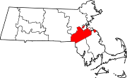
Towns CDPs Bellingham | Dover | Foxborough | Medfield | Millis-Clicquot | Sharon | Walpole
Other
villageCategories:- 1711 establishments in the Thirteen Colonies
- Towns in Norfolk County, Massachusetts
- Populated places established in 1680


Wikimedia Foundation. 2010.