- Dover, Massachusetts
-
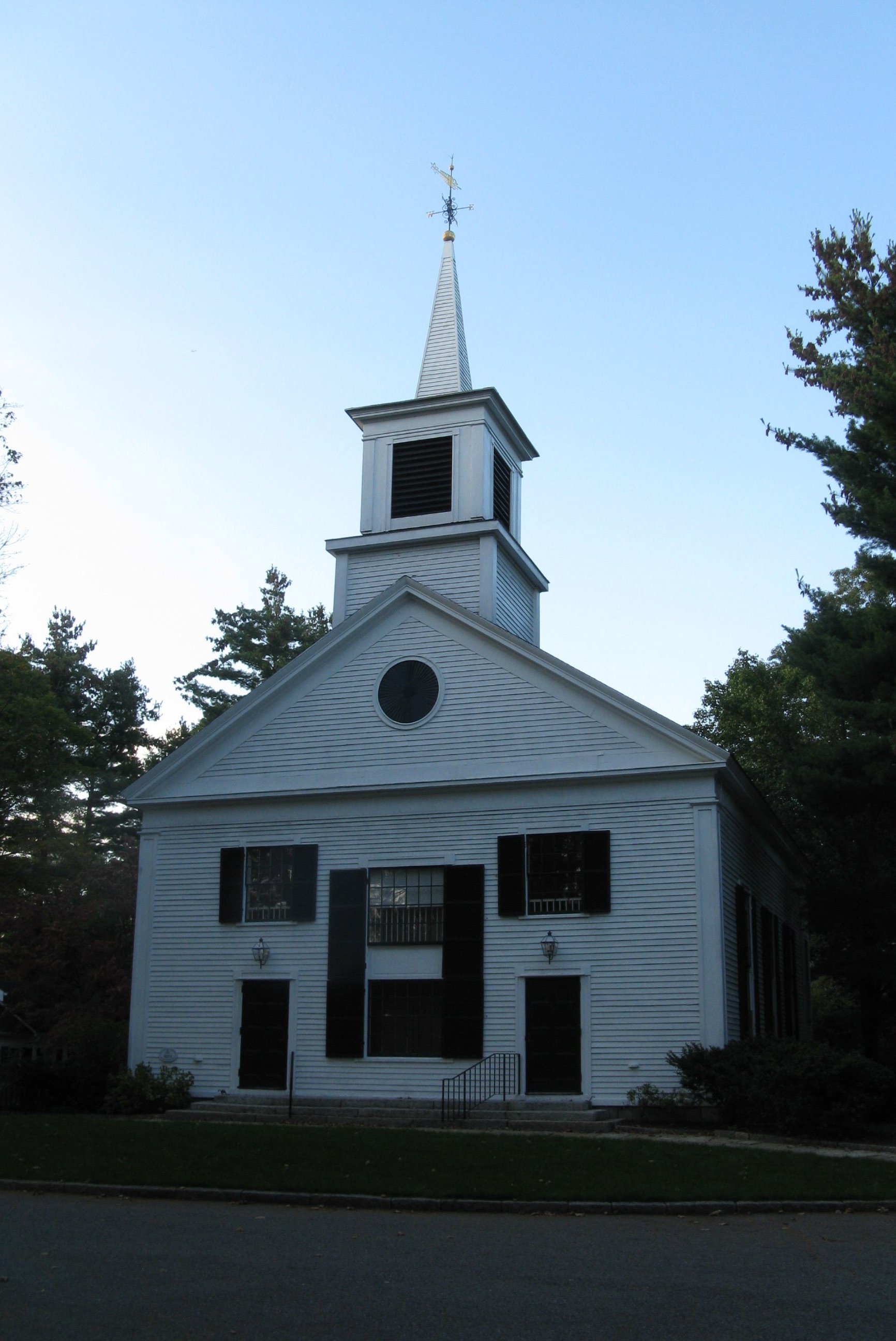
Dover, Massachusetts — Town — The Dover Church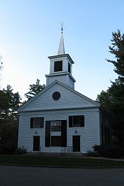
SealNickname(s): Town of Friendship Location in Massachusetts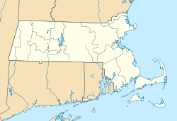
 Dover
DoverCoordinates: 42°14′45″N 71°17′00″W / 42.24583°N 71.2833333°WCoordinates: 42°14′45″N 71°17′00″W / 42.24583°N 71.2833333°W Country United States State Massachusetts County Norfolk Settled 1635 Incorporated 1836 Government – Type Open town meeting Area – Total 15.4 sq mi (39.9 km2) – Land 15.3 sq mi (39.7 km2) – Water 0.1 sq mi (0.2 km2) Elevation 150 ft (46 m) Population (2010)[1] – Total 5,589 – Density 362.9/sq mi (140.1/km2) Time zone Eastern (UTC-5) – Summer (DST) Eastern (UTC-4) ZIP code 02030 Area code(s) 508 / 774 FIPS code 25-17405 GNIS feature ID 0618319 Website www.doverma.org Dover is a town in Norfolk County, Massachusetts, United States. The population was 5,589 at the 2010 census.
Located about 15 miles (24 km) southwest of downtown Boston, Dover is a residential town nestled on the south banks of the Charles River. Almost all of the residential zoning requires 1-acre (4,000 m2) or larger. As recently as the early 1960s, 75% of its annual town budget was allocated to snow removal, as only a mile and a half of the town's roads are state highway. The nickname of Dover is the Town of Friendship.[citation needed]
For geographic and demographic information on the census-designated place Dover, please see the article Dover (CDP), Massachusetts.
Contents
History
The first recorded settlement of Dover was in 1640. It was later established as the Springfield Parish of Dedham in 1748, and incorporated as District Dedham in 1784. Dover was officially incorporated as a town in 1836.
The Caryl House at 107 Dedham St. dates from about 1777 and was home to Dover's first minister, Benjamin Caryl, his son George, who was the town's first doctor, and their descendants until 1897. It has been owned by the town and operated by the Historical Society since 1920. The house retains its architectural integrity and has been carefully restored to reflect life in the 1790s when the first two Caryl families lived and worked there together.
The Sawin Building has been a home for thousands of Dover relics, books, photographs and artifacts since the beginning of the 20th century. Benjamin and Eudora Sawin willed land and funds to the Dover Historical Society along with their old household goods so that the building could be erected, and it was dedicated on May 14, 1907 by members and friends of the Dover Historical Society.In the early years it was used for meetings and to house Dover's historical memorabilia, but eventually members became disenchanted with the Society and the building was seldom opened. In the 1960s there was a renewed interest in the Historical Society which led to the general overhaul and refurbishing of the building. The Sawin Museum, located at the corner of Centre and Dedham Streets in Dover Center, is owned and operated by the Dover Historical Society and is open to the public free of charge.
Geography
According to the United States Census Bureau, the town has a total area of 15.4 square miles (39.9 km²), of which, 15.3 square miles (39.7 km²) of it is land and 0.1 square miles (0.2 km²) of it (0.52%) is water. It is bordered by the towns of Natick, Wellesley, Needham, Dedham, Westwood, Sherborn, Walpole, and Medfield.
Demographics
Historical populations Year Pop. ±% 1850 631 — 1860 679 +7.6% 1870 645 −5.0% 1880 653 +1.2% 1890 727 +11.3% 1900 656 −9.8% 1910 798 +21.6% 1920 867 +8.6% 1930 1,195 +37.8% 1940 1,374 +15.0% 1950 1,722 +25.3% 1960 2,846 +65.3% 1970 4,529 +59.1% 1980 4,703 +3.8% 1990 4,915 +4.5% 2000 5,558 +13.1% 2001* 5,623 +1.2% 2002* 5,640 +0.3% 2003* 5,638 −0.0% 2004* 5,610 −0.5% 2005* 5,597 −0.2% 2006* 5,612 +0.3% 2007* 5,634 +0.4% 2008* 5,681 +0.8% 2009* 5,730 +0.9% 2010 5,589 −2.5% * = population estimate.
Source: United States Census records and Population Estimates Program data.[2][3][4][5][6][7][8][9][10][11]As of the census[12] of 2000, there were 5,558 people, 1,849 households, and 1,567 families residing in the town. The population density was 362.6 people per square mile (140.0/km²). There were 1,884 housing units at an average density of 122.9 per square mile (47.5/km²). The racial makeup of the town was 95.18% White, 0.41% Black or African American, 0.04% Native American (2 people), 3.63% Asian, 0.02% Pacific Islander, 0.05% from other races, and 0.67% from two or more races. Hispanic or Latino of any race were 1.19% of the population (approximately 105 people).
There were 1,849 households out of which 46.0% had children under the age of 18 living with them, 77.0% were married couples living together, 5.5% had a female householder with no husband present, and 15.2% were non-families. 12.8% of all households were made up of individuals and 5.9% had someone living alone who was 65 years of age or older. The average household size was 3.01 and the average family size was 3.29.
In the town the population was spread out with 31.6% under the age of 18, 3.7% from 18 to 24, 23.9% from 25 to 44, 29.6% from 45 to 64, and 11.2% who were 65 years of age or older. The median age was 40 years. For every 100 females there were 95.2 males. For every 100 females age 18 and over, there were 92.8 males.
The median income for a household in the town was $141,818, and the median income for a family was $157,168. Males had a median income of $100,000 versus $56,473 for females. The per capita income for the town was $64,899. About 2.3% of families and 3.0% of the population were below the poverty line, including 2.5% of those under age 18 and 7.1% of those age 65 or over.[citation needed]
Politics
Dover is one of the few communities in metro Boston to have more registered Republicans than Democrats.[13]
Education
Dover's public schools are well regarded and score well on standardized tests [1]. It has three schools—Chickering Elementary School (grades K-5), Dover-Sherborn Middle School (6-8), and Dover-Sherborn High School (9-12). Located near Caryl Park and the entrance to Noanet Woodlands (also known as Miss. Peabody's Woods), Chickering School is under the elected Dover School Committee, while the two secondary schools are the responsibility of the regional school system, under the elected Dover-Sherborn Regional School Committee, with costs and governance shared with the neighboring town of Sherborn. The Regional schools share a campus on Farm Street in Dover, near the borders with Sherborn and Medfield.
Dover Sherborn High School ranked 3rd in Cost Efficiency and 7th in Academic Performance by Boston Magazine. US News and World Report named Dover-Sherborn High School a Gold Medal School, ranking them 65th in the nation.
Dover used to have two elementary schools, Chickering for grades K to 3, and Caryl Elementary School for grades 4 to 8. In 1970, Caryl School was gutted by fire.[14] It was rebuilt and remained open until finally being closed in 1999 after the expansion of Chickering.[15]
The private, independent Charles River School is located in the town's center.
Notable residents
- Mark Albion, author, professor, and social entrepreneur
- Bob Cutler, rower who competed in the 1936 Summer Olympics
- Katherine Doherty, child actress
- Kenny Florian, UFC Fighter
- Carl J. Gilbert, United States Trade Representative from 1969 to 1971
- Jeffrey Harrison, poet
- E. F. Hodgson, founder of the E. F. Hodgson Co
- Mark Hollingsworth, Bishop of the Episcopal Diocese of Ohio
- Melinda McGraw, actress
- John "Moo" May, Xavier University Pope
- Amelia Peabody, artist and philanthropist, donated Noanet Woodlands (also known as Miss Peabody's Woods)
- Matthew A. Reynolds, Assistant Secretary of State for Legislative Affairs
- Leverett Saltonstall, U.S. Senator
- Francis W. Sargent, Governor
- Ronald B. Scott, current resident, journalist, biographer of former Massachusetts governor and presidential candidate W. Mitt Romney, and author of the novel "Closing Circles: Trapped in the Everlasting Mormon Moment."
- John Smith, American football placekicker
- Bob Lobel, Local news sportscaster
- Don MacTavish, Stock Car Driver and winner of the 1966 NASCAR Sportsman Series Championship
- Chris Murray, minor league hockey player
- Bohdan Pomahač, plastic surgeon who led the team that performed the first full face transplant in the United States.
- George P. Sanger, lawyer, editor, judge, and businessman
- Sverre Sears, minor league hockey player
- Jeff Serowik, former player of the Boston Bruins
Historic Places
- Benjamin Caryl House (1777)
- Elm Bank Horticulture Center (1876)
References
- ^ "Population and Housing Occupancy Status: 2010 - State -- County Subdivision, 2010 Census Redistricting Data (Public Law 94-171) Summary File". U.S. Census Bureau. http://factfinder2.census.gov/faces/tableservices/jsf/pages/productview.xhtml?pid=DEC_10_PL_GCTPL2.ST16&prodType=table. Retrieved 2011-07-10.
- ^ "TOTAL POPULATION (P1), 2010 Census Summary File 1, All County Subdivisions within Massachusetts". United States Census Bureau. http://factfinder2.census.gov/bkmk/table/1.0/en/DEC/10_SF1/P1/0400000US25.06000. Retrieved September 13, 2011.
- ^ "Massachusetts by Place and County Subdivision - GCT-T1. Population Estimates". United States Census Bureau. http://factfinder.census.gov/servlet/GCTTable?_bm=y&-geo_id=04000US25&-_box_head_nbr=GCT-T1&-ds_name=PEP_2009_EST&-_lang=en&-format=ST-9&-_sse=on. Retrieved July 12, 2011.
- ^ "1990 Census of Population, General Population Characteristics: Massachusetts". US Census Bureau. December 1990. Table 76: General Characteristics of Persons, Households, and Families: 1990. 1990 CP-1-23. http://www.census.gov/prod/cen1990/cp1/cp-1-23.pdf. Retrieved July 12, 2011.
- ^ "1980 Census of the Population, Number of Inhabitants: Massachusetts". US Census Bureau. December 1981. Table 4. Populations of County Subdivisions: 1960 to 1980. PC80-1-A23. http://www2.census.gov/prod2/decennial/documents/1980a_maABC-01.pdf. Retrieved July 12, 2011.
- ^ "1950 Census of Population". Bureau of the Census. 1952. Section 6, Pages 21-10 and 21-11, Massachusetts Table 6. Population of Counties by Minor Civil Divisions: 1930 to 1950. http://www2.census.gov/prod2/decennial/documents/23761117v1ch06.pdf. Retrieved July 12, 2011.
- ^ "1920 Census of Population". Bureau of the Census. Number of Inhabitants, by Counties and Minor Civil Divisions. Pages 21-5 through 21-7. Massachusetts Table 2. Population of Counties by Minor Civil Divisions: 1920, 1910, and 1920. http://www2.census.gov/prod2/decennial/documents/41084506no553ch2.pdf. Retrieved July 12, 2011.
- ^ "1890 Census of the Population". Department of the Interior, Census Office. Pages 179 through 182. Massachusetts Table 5. Population of States and Territories by Minor Civil Divisions: 1880 and 1890. http://www2.census.gov/prod2/decennial/documents/41084506no553ch2.pdf. Retrieved July 12, 2011.
- ^ "1870 Census of the Population". Department of the Interior, Census Office. 1872. Pages 217 through 220. Table IX. Population of Minor Civil Divisions, &c. Massachusetts. http://www2.census.gov/prod2/decennial/documents/1870e-05.pdf. Retrieved July 12, 2011.
- ^ "1860 Census". Department of the Interior, Census Office. 1864. Pages 220 through 226. State of Massachusetts Table No. 3. Populations of Cities, Towns, &c.. http://www2.census.gov/prod2/decennial/documents/1860a-08.pdf. Retrieved July 12, 2011.
- ^ "1850 Census". Department of the Interior, Census Office. 1854. Pages 338 through 393. Populations of Cities, Towns, &c.. http://www2.census.gov/prod2/decennial/documents/1850c-11.pdf. Retrieved July 12, 2011.
- ^ "American FactFinder". United States Census Bureau. http://factfinder.census.gov. Retrieved 2008-01-31.
- ^ http://www.sec.state.ma.us/ele/elepdf/st_county_town_enroll_breakdown_08.pdf
- ^ "History Of Chickering and Caryl Schools". Chickering Reports. http://chickeringreports.edublogs.org/tag/chickering-school/. Retrieved 17 February 2011.
- ^ "History Of Chickering and Caryl Schools". Chickering Reports. http://chickeringreports.edublogs.org/tag/chickering-school/. Retrieved 17 February 2011.
Boston Globe article re: top-scoring schools in 10th-grade MCAS exam [2]
External links
- Town of Dover
- Dover Days Gone By: The Cyber-Millenium Edition history collection
- Dover Historical Society
- Dover Town Library
Municipalities and communities of Norfolk County, Massachusetts Cities 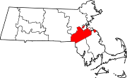
Towns CDPs Bellingham | Dover | Foxborough | Medfield | Millis-Clicquot | Sharon | Walpole
Other
villageCategories:- Towns in Norfolk County, Massachusetts


Wikimedia Foundation. 2010.