- Dover-Foxcroft, Maine
-
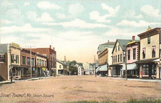
Dover-Foxcroft, Maine — Town — Union Square c. 1906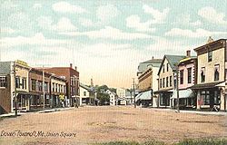

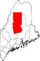
SealLocation within the state of Maine
 Dover-Foxcroft, Maine
Coordinates: 45°11′10″N 69°13′13″W / 45.18611°N 69.22028°WCoordinates: 45°11′10″N 69°13′13″W / 45.18611°N 69.22028°W Country United States State Maine County Piscataquis Incorporated 1812 (Foxcroft)
1822 (Dover)Merger March 11, 1922 Area – Total 71.2 sq mi (184.5 km2) – Land 68.2 sq mi (176.7 km2) – Water 3.0 sq mi (7.7 km2) Elevation 371 ft (113 m) Population (2000) – Total 4,211 – Density 61.7/sq mi (23.8/km2) Time zone Eastern (EST) (UTC-5) – Summer (DST) EDT (UTC-4) ZIP code 04426 Area code(s) 207 FIPS code 23-18195 GNIS feature ID 0582445 Dover-Foxcroft is a town in Piscataquis County, Maine, United States,[1] and the county's largest town and county seat. As of the 2000 census, the population was 4,211.
Contents
History
It was originally two towns, Dover and Foxcroft, separated by the Piscataquis River (Dover is on the south side, Foxcroft on the north).
Dover was purchased from Massachusetts by Boston merchants Charles Vaughan and John Merrick, both of whom had emigrated from England. It was first permanently settled in 1803 by Eli Towne from Temple, New Hampshire, then incorporated on January 19, 1822. Agriculture was the principal early occupation, producing potatoes, corn and grain.[2]
Originally known as T5 R7 NWP, Foxcroft was one of five towns conveyed by Massachusetts in 1796 to Bowdoin College. It was purchased from the college in 1800 by Joseph E. Foxcroft of New Gloucester and settled by John, Eleazer and Seth Spaulding in 1806, when they built the first mill. It was dubbed Spauldingtown until February 29, 1812, when it was incorporated as Foxcroft, taking its proprietor's name.[3]
The Piscataquis River offered water power sites for mills. In 1859, when the population was about 2,500, industries included four sawmills, shingle and clapboard manufacturers, one gristmill, two tanneries, two carriage makers, and a woolen factory.[4]
By 1859, when the population was 1,045, industries included two sawmills, one shingle mill, one carding machine, one carriage builder, one chair manufacturer, one tannery, one fork maker, two pail makers, one machinist, and a sash, door and blind factory.[5]
On March 1, 1922, the two towns merged into a single town.
-
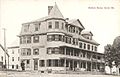
Blethen House c. 1910
-
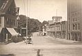
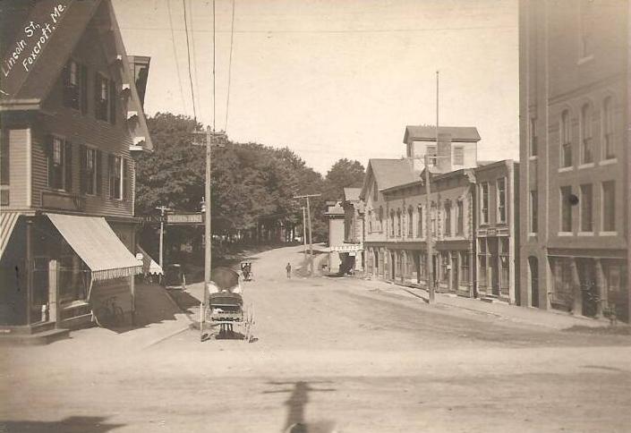
Lincoln Street c. 1905
-

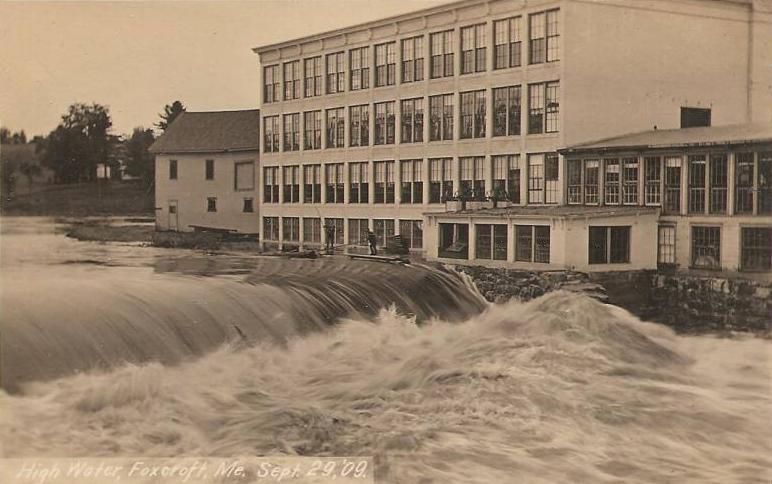
High water in 1909
Geography
According to the United States Census Bureau, the town has a total area of 71.2 square miles (184.5 km²), of which, 68.2 square miles (176.7 km²) of it is land and 3.0 square miles (7.7 km²) of it (4.18%) is water. Dover-Foxcroft is drained by the Piscataquis River.
The town is crossed by state routes 6, 7, 15, 16 and 153; and is the commercial center of the county.
Demographics
As of the census[6] of 2000, there were 4,211 people, 1,658 households, and 1,152 families residing in the town. The population density was 61.7 people per square mile (23.8/km²). There were 2,200 housing units at an average density of 32.2 per square mile (12.4/km²). The racial makeup of the town was 96.91% Caucasian, 0.21% Black or African American, 0.52% Native American, 0.52% Asian, 0.02% Pacific Islander, 0.19% from other races and 1.61% from two or more races. Hispanic or Latino of any race were 0.95% of the population.
There were 1,658 households out of which 32.4% had children under the age of 18 living with them, 54.6% were married couples living together, 10.3% had a female householder with no husband present, and 30.5% were non-families. 25.4% of all households were made up of individuals and 11.8% had someone living alone who was 65 years of age or older. The average household size was 2.45 and the average family size was 2.91.
In the town the population was spread out with 36.9% under the age of 18, 5.8% from 18 to 24, 25.7% from 25 to 44, 25.7% from 45 to 64, and 17.8% who were 65 years of age or older. The median age was 41 years. For every 100 females there were 93.2 males. For every 100 females age 18 and over, there were 90.6 males.
The median income for a household in the town was $30,164, and the median income for a family was $36,287. Males had a median income of $30,000 versus $20,613 for females. The per capita income for the town was $14,544. About 13.6% of families and 15.8% of the population were below the poverty line, including 21.3% of those under age 18 and 8.8% of those age 65 or over.
Education
Dover-Foxcroft is a part of Maine School Administrative District 68 (MSAD68).
MSAD68 provides primary schooling for the town and several surrounding communities at three schools in Dover-Foxcroft: SeDoMoCha Elementary School provides for K-4th grades and SeDoMoCha Middle School (named for four of the communities that attend: Sebec, Dover-Foxcroft, Monson and Charleston) provides for grades 5-8.
Foxcroft Academy is a private secondary school that accepts all students from MSAD68 as well as others from across the state. The Academy is governed independently by a board of trustees and is among the oldest private schools in the state.[citation needed]
Notable people
- Corey Beaulieu, guitarist[citation needed]
- Clarence Blethen, baseball pitcher
- Alfred Eliab Buck, congressman from Alabama
- Stephen Decatur Carpenter, military officer
- Lisa Rowe Fraustino, children's author
- Frank E. Guernsey, congressman
- David Mallett, singer and songwriter[citation needed]
- Henry Otis Pratt, minister, congressman from Iowa
- Dave Schwep, photographer, director
- Lillian M. N. Stevens, temperance worker
- Amasa Tracy, military officer
References
- ^ "Find a County". National Association of Counties. http://www.naco.org/Counties/Pages/FindACounty.aspx. Retrieved 2011-06-07.
- ^ Varney, George J. (1886), Gazetteer of the state of Maine. Dover, Boston: Russell, http://history.rays-place.com/me/dover-me.htm
- ^ Varney, George J. (1886), Gazetteer of the state of Maine. Foxcroft, Boston: Russell, http://history.rays-place.com/me/foxcroft-me.htm
- ^ Coolidge, Austin J.; John B. Mansfield (1859). A History and Description of New England. Boston, Massachusetts. pp. 109–110. http://books.google.com/books?id=OcoMAAAAYAAJ&lpg=PA9&dq=coolidge%20mansfield%20history%20description%20new%20england%201859&pg=PA109#v=onepage&q=&f=false.
- ^ Coolidge, Austin J.; John B. Mansfield (1859). A History and Description of New England. Boston, Massachusetts. p. 126. http://books.google.com/books?id=OcoMAAAAYAAJ&lpg=PA9&dq=coolidge%20mansfield%20history%20description%20new%20england%201859&pg=PA126#v=onepage&q=&f=false.
- ^ "American FactFinder". United States Census Bureau. http://factfinder.census.gov. Retrieved 2008-01-31.
External links
- Town of Dover-Foxcroft, Maine
- Thompson Free Library
- Dover-Foxcroft Historical Society & Museum
- Center Theater for the Performing Arts
- Katahdin Regional Wiki: Dover-Foxcroft
Municipalities and communities of Piscataquis County, Maine Towns Abbot | Atkinson | Beaver Cove | Bowerbank | Brownville | Dover-Foxcroft | Greenville | Guilford | Medford | Milo | Monson | Parkman | Sangerville | Sebec | Shirley | Wellington | Willimantic
Plantations Unorganized
territoriesCDPs Dover-Foxcroft | Greenville | Guilford | Milo
Categories:- Dover-Foxcroft, Maine
- County seats in Maine
-


Wikimedia Foundation. 2010.